![[The Mississippi-Missouri: A Geographical Blunder -- An Illustrated Argument For Renaming The Lower Mississippi River Put Forth By A Prominent American Educator To The Author of a Best Selling American School Geography]](/map/small/56241.jpg)
"The Geographer who shall first have the boldness to teach the truth . . . will be opposed for a time by interested book publishers and conservative pedagogues, but will triumph as Galileo did in the end." The Mississippi-Missouri: A Geographical...
Detailed map of the United States, shortly after the conclusion of the American Civil War. Montana, Wyoming and Idaho are now clearly and accurately delineated as counties, with only Dakota Territory not yet in its final configuration. The map...
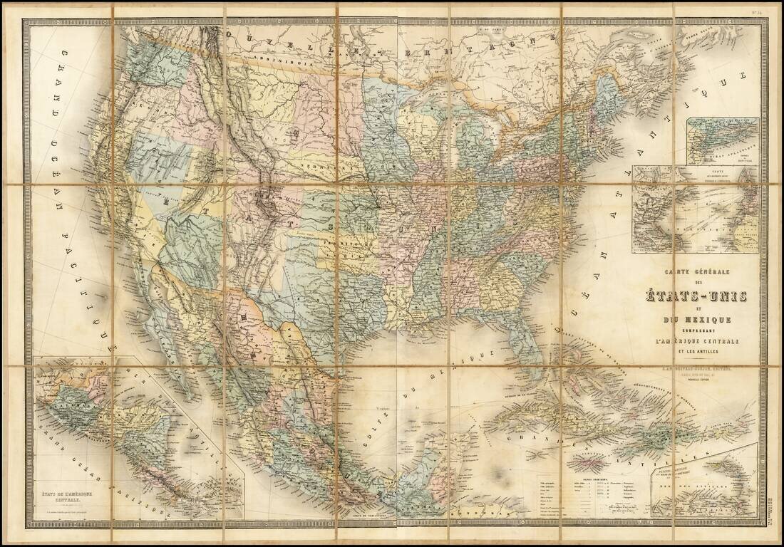
Stunning full color example of Andriveau-Goujon's 2-sheet map of the United States. The map shows the nearly finished territorial changes in the west in fine detail.
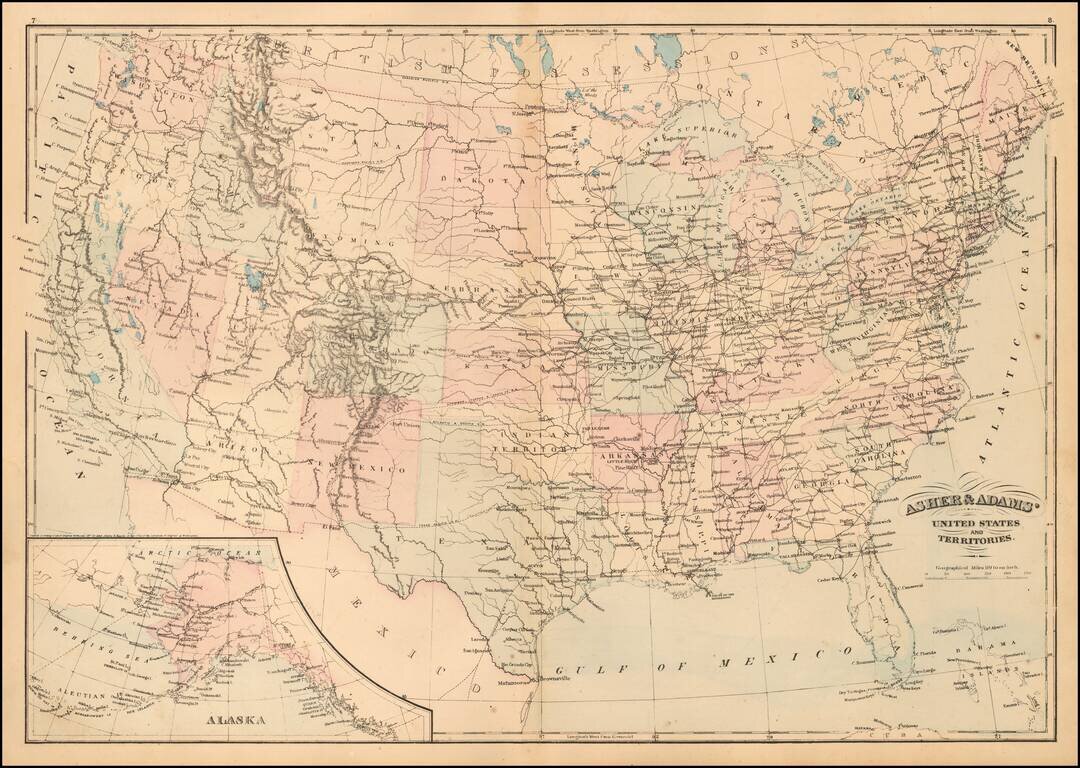
Detailed map of the United States, published by Asher & Adams. The map focuses on railroad routes and proposed railroad routes in the United States. One Dakota is shown as is Indian Territory.
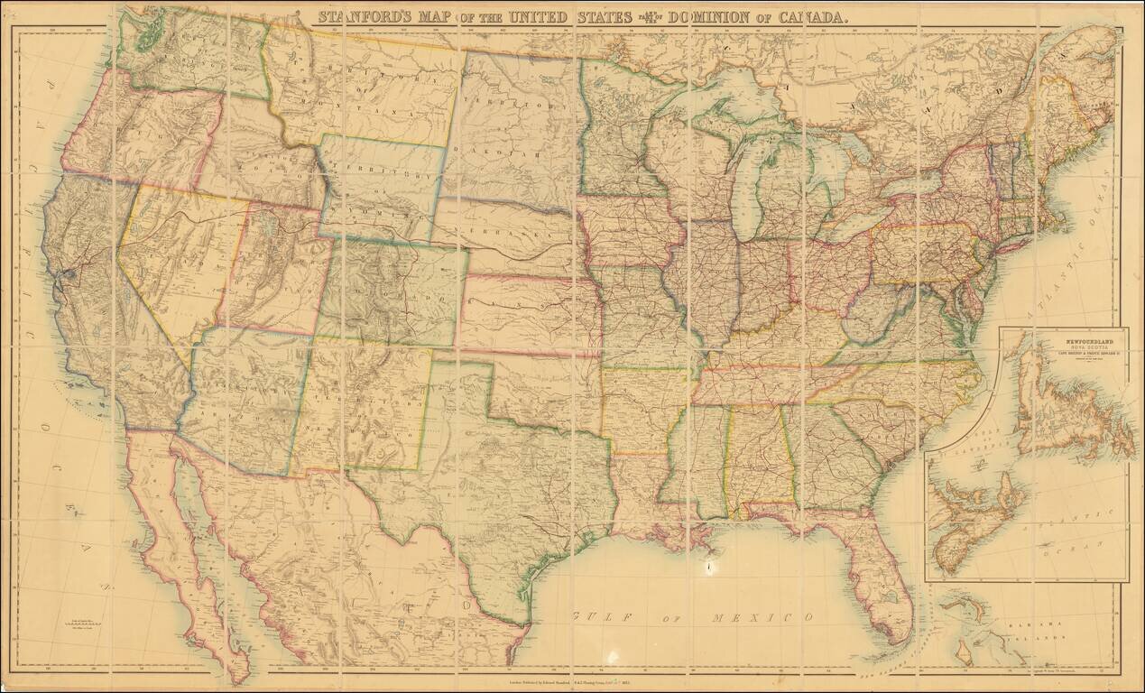
Remarkable large format map of the United States, showing the US immediately after the completion of the first transcontinental railroad. Stanford's map of the United States has a long and interesting history. First published by Rogers & Johnston...
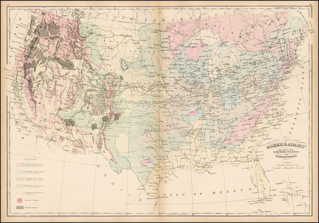
Striking geological map of the United States exhibiting geological regions including Eozoic, Paleozoic, Carboniferous, Mesozoic, Cenozoic, and volcanic regions.
Detailed map of the United States, extending west to just before the Rocky Mountains. Includes an excellent overview of the railroads then in operation.
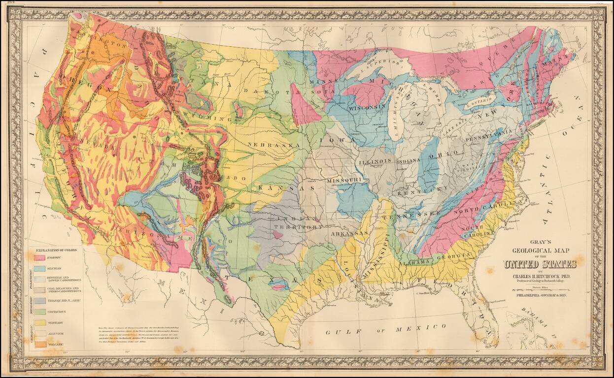
Colorful map of the United States, exhibiting the geological regions, including Ecozoic, Silurian, Devonian and Lower Carboniferous, Coal Measures and Permo-Carboniferous, Triassic and Jurassic, Cretaceous, Tertiary, Alluvium and Volcanic, each coded...
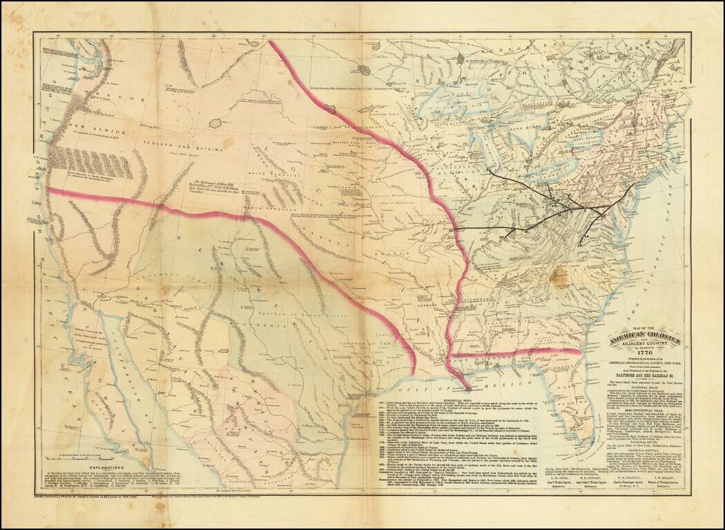
A Wonderful Centennial Map. The United States as it was known in 1776 - from the perspective of 1876. Very scarce hand-colored lithographed map of the United States, prepared by Asher & Adams for the Baltimore & Ohio Railroad, presumably for...
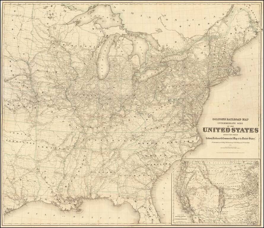
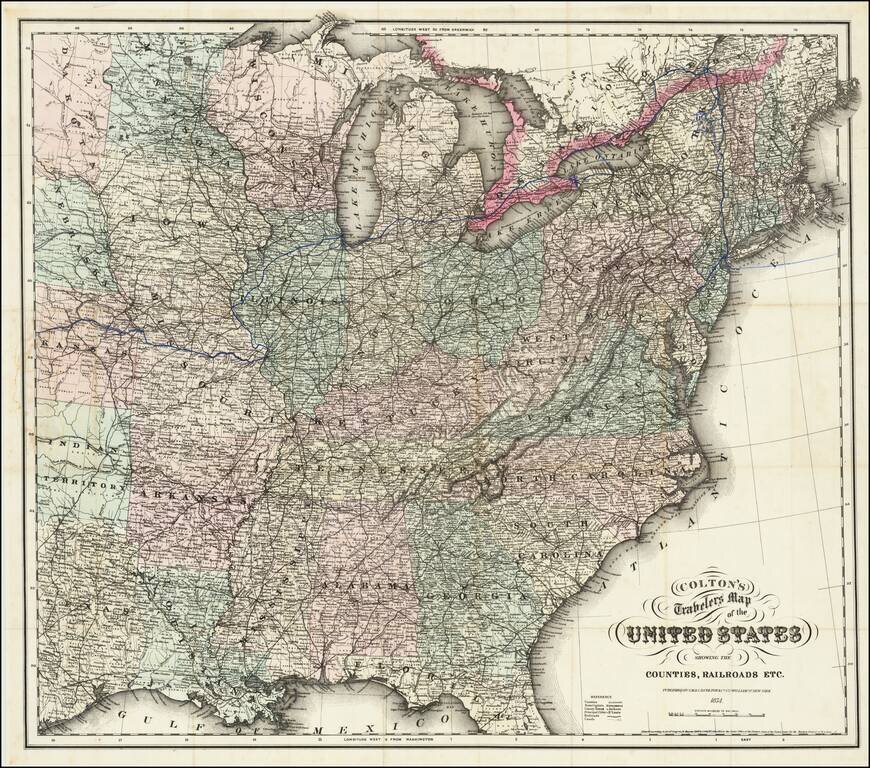
Rare Colton Railroad Map of the United States Highly detailed railroad map of the United States, issued by GW & CB Colton. The main map extends to Texas, Dakota, Nebraska, Kansas and Indian Territory. Completed railroad lines are shown with...
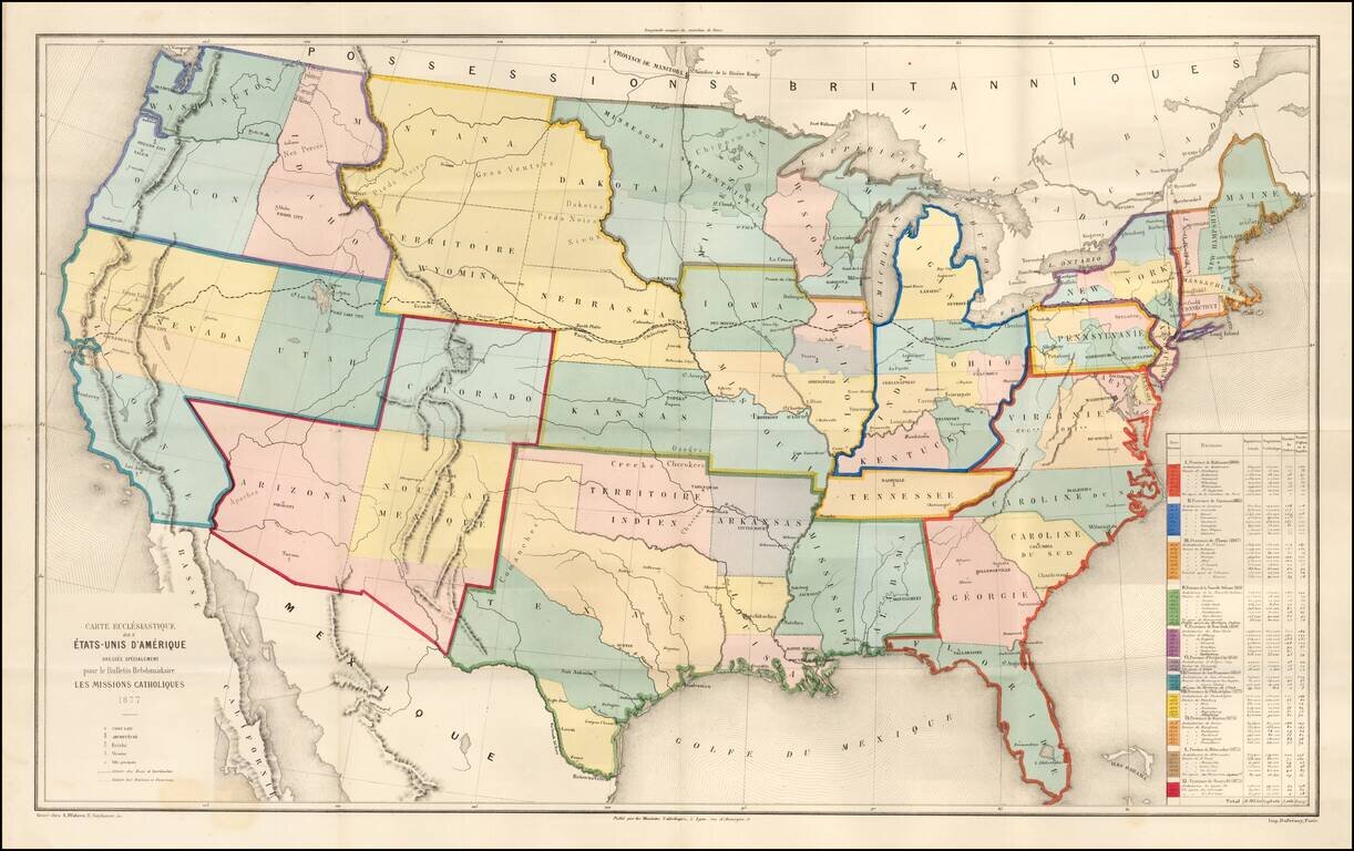
Rare large ecclesiastical map of the United States, focusing on the 11 Catholic Provinces in the United States. Includes an extensive statistical table at the right side of the map. The map shows the Catholic dioceses and bishops' residences, but not...
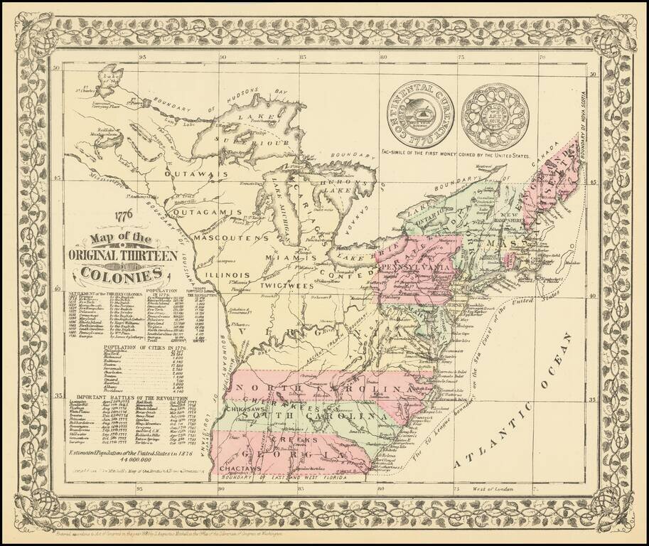
A charming historical map, showing the 13 colonies, Indian Tribes, and details dating to 1776, along with other important historical facts, populations, and Revolutionary War battle dates. A marvelous little map produced on the 100 year anniversary of...
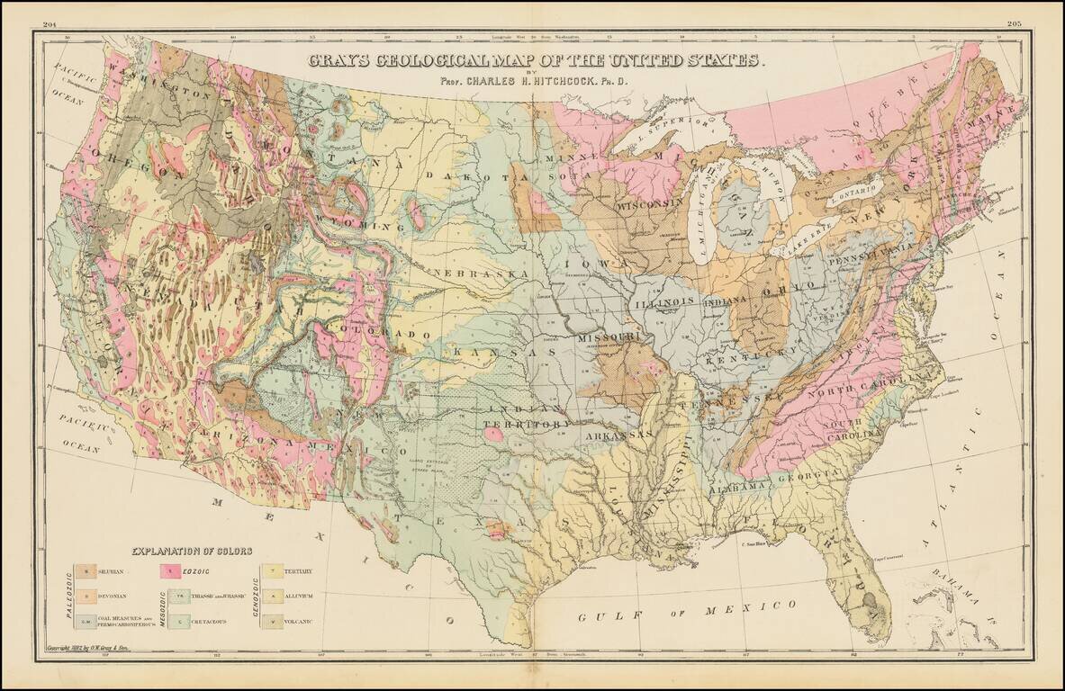
Geological map of the United States, published by O.W. Gray. The map exhibits the geological regions, including Eozoic, Silurian, Deonian and Lower Carboniferous, Coal Measures and Permo-Carboniferous, Triassic and Jurassic, Cretaceous, Tertiary,...
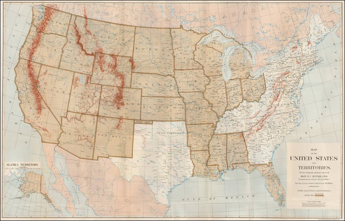
Large Map Illustrating the Public Land States and Territories Highly detailed map of the United States, issued to accompany the annual report of N.C. MacFarland, Commissioner, General Land Office for fiscal year which ended June 30, 1884. The map...
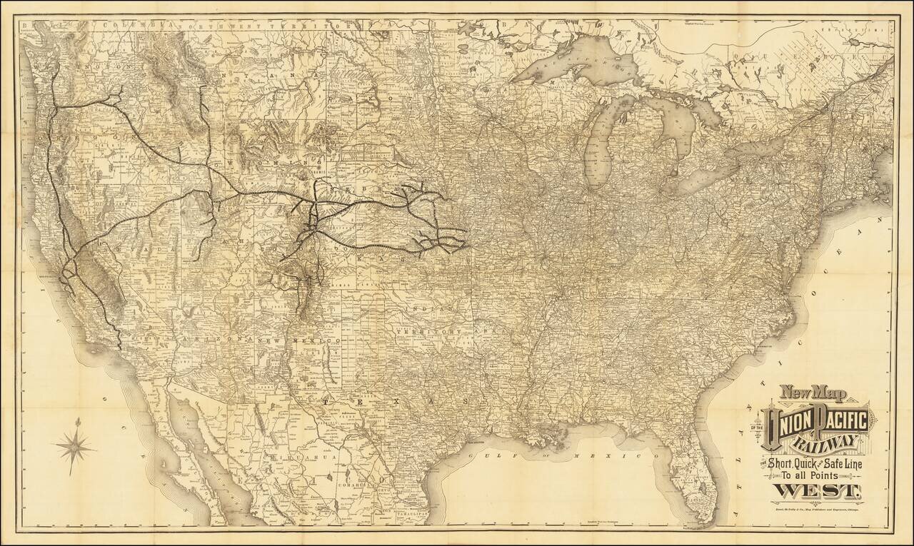
Unrecorded Edition of Map Issued For The Exclusive Use of the Union Pacific Railroad Company Rare case map of the United States, tracking the growth of the Union Pacific Railroad across America. The map shows the whole of the United States...
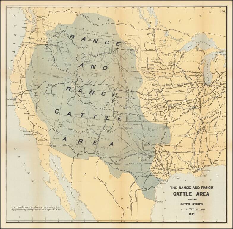
Rare map of the US, focusing on the Ranch and Cattle Industry. From Nimmo's Report on the Internal Commerce of the United States. Nimmo's book is held to be perhaps the most important of the cattle books. Nimmo's essay on the range and ranch cattle...