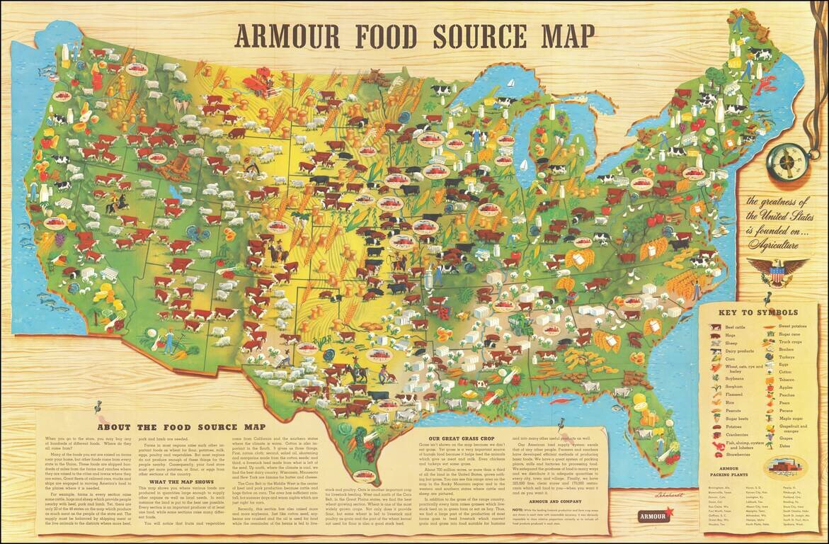
Scarce promotional map published by Armour & Company, displaying and illustrating the agricultural regions of the United States. This is the second of Armour's food maps, updated from the 1922 edition. It includes a lengthy text explanation of...
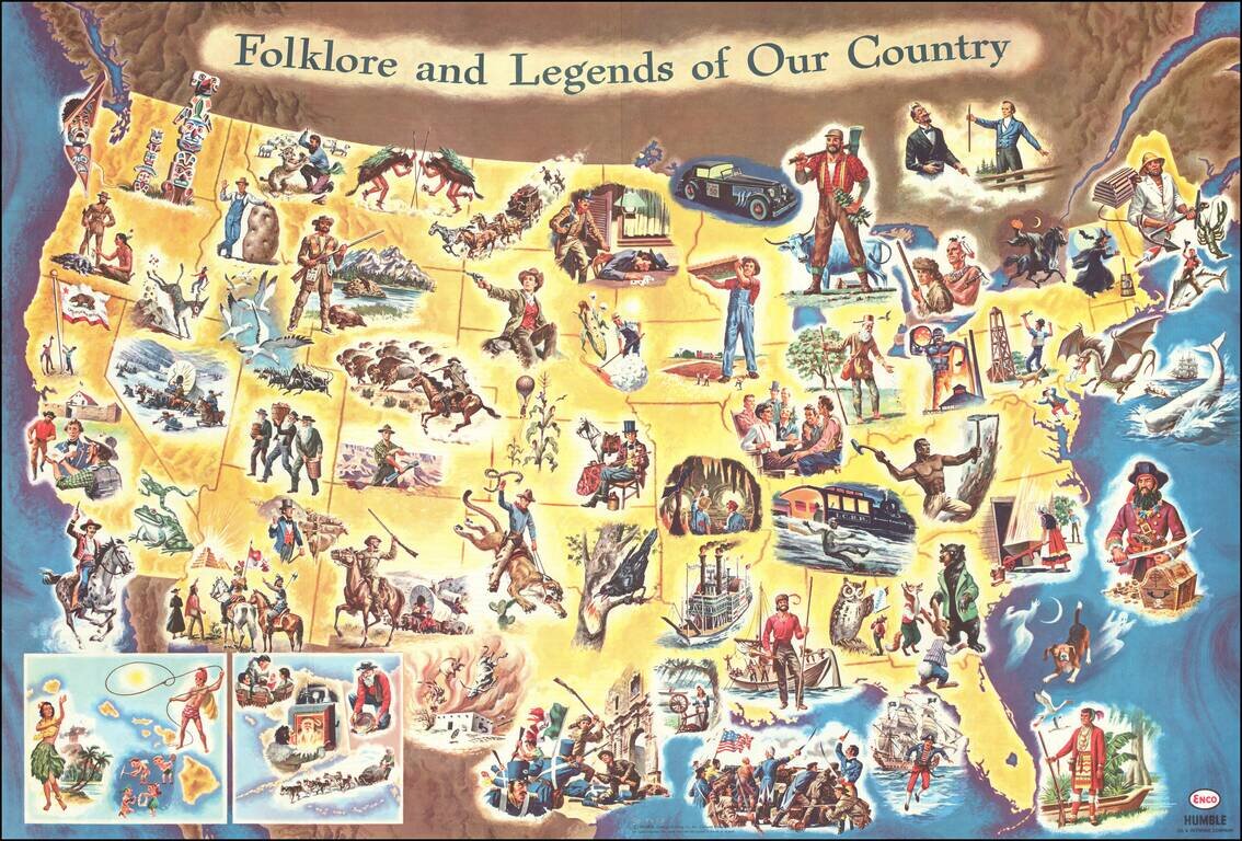
Interesting pictorial / gasoline map of the United States, illustrating on a state by state basis great events in American History. The map is geared toward children, providing a lively and sometimes politically off-color look at America's history....
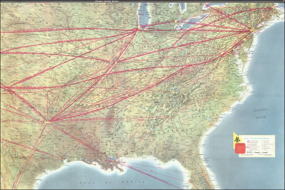
Striking example of this American Airlines promotional map, introducing the upcoming launch of Stage II of the 707 Astrojet. First introduced in 1959, the Boeing 707 "Astrojet" would become the backbone of commercial aviation. The present map was...
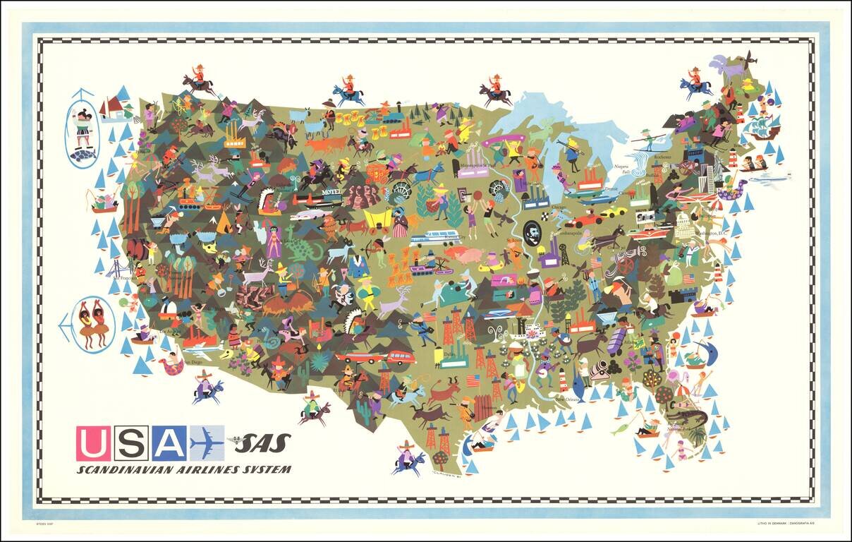
Decorative vintage pictorial map of the United States, published by Scandinavian Airlines System. An interesting and attractive pictorial map with some quaint and politically incorrect imagery, when viewed from a modern perspective. Signed "-CLAUSEN 61"
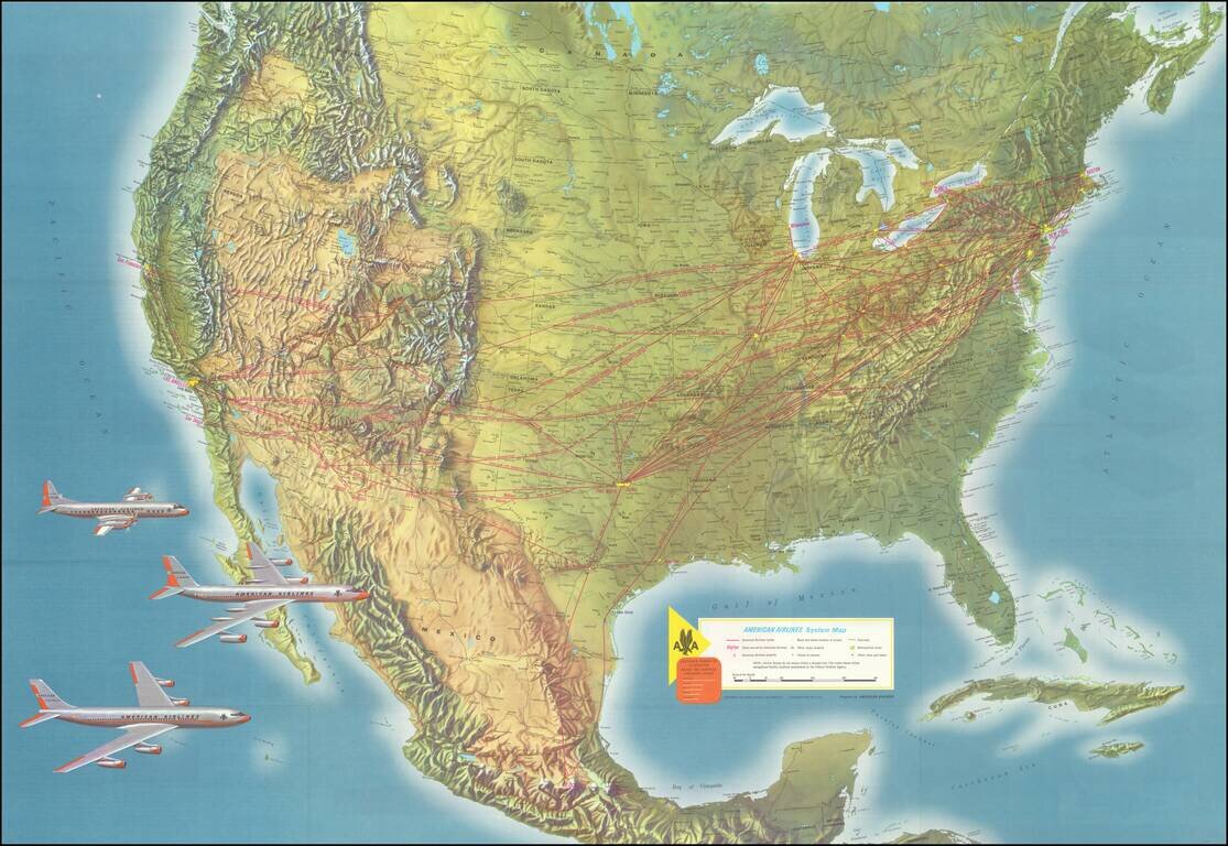
Striking example of this American Airlines promotional map, introducing the upcoming launch of Stage II of the 707 Astrojet. First introduced in 1959, the Boeing 707 "Astrojet" would become the backbone of commercial aviation. The present map was...
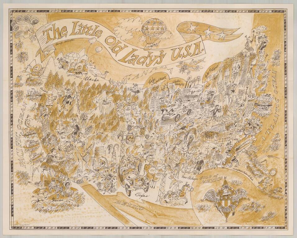
Marvelous whimsical map of the United States. Includes a charming and equally whimsical colored folder. The maps were part of the original publications of the Pisani Press of San Francisco (a division of Pisani Printing Company, then of 485 Brannan...
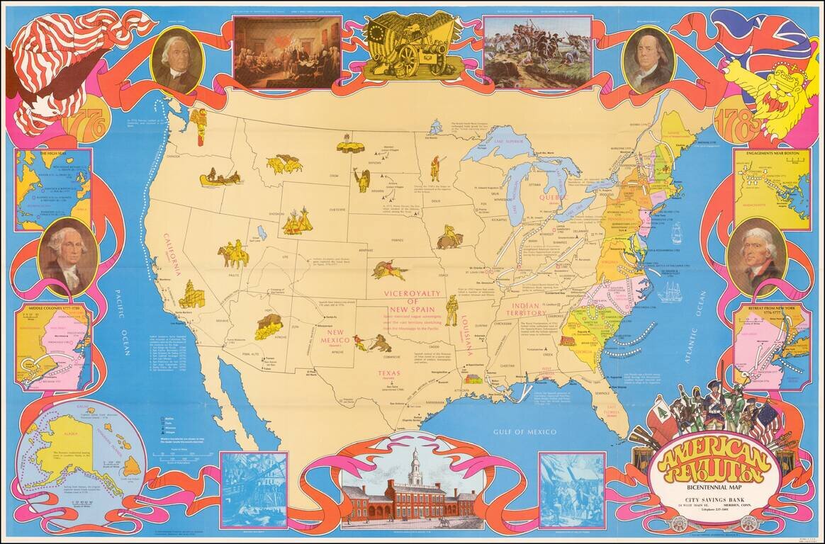
Fine large format map of the United States, featuring vignettes of historical events during the American Revolution and a 1970s style art motif. In addition to Revolutionary War related facts, the map shows information on the California Missions, the...
![[The United States in the Late 19th and Early 20th Centuries] Соединенные Штат Америки в Конце XIХ-Начале ХХ в [Imperialist Aggression of the United States at the End of the 19th - Beginning of the 20th centuries] Империалистическая Агрессия Сша в Конце Х](/map/small/63800.jpg)
Anti-America Historical School Map, Issued in the Final Year of the Soviet Union. A fascinating school wall map of the United States, focusing on controversial aspects of American history in the 19th and early 20th century, published in Moscow in 1991...
Single-Sheet Adams-Onís Treaty Edition of Brué's Important Map of North America Fine example of Brué's impressive map of North America, reduced from four-sheets to one, and published only two months after the signing of the Adams-Onís Treaty in...

Detailed, Early Map of Oregon and Washington Territories Striking early J.H. Colton map of Oregon and Washington Territories published four years before Oregon statehood. The map is dated 1853, but it was first published in 1855. Oregon and...

Detailed, Early Map of Oregon and Washington Territories Striking early J.H. Colton map of Oregon and Washington Territories, published four years before Oregon statehood. The map is dated 1835, but it was first published in 1855. Oregon and...
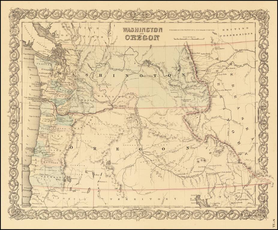
Detailed, Early Map of Oregon and Washington Territories Striking early J.H. Colton map of Oregon and Washington Territories, published four years before Oregon statehood. The map is dated 1835, but it was first published in 1855. Oregon and...
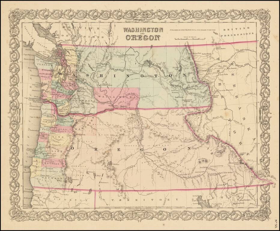
Detailed, Early Map of Oregon and Washington Territories Striking early J.H. Colton map of Oregon and Washington Territories published four years before Oregon statehood. The map is dated 1853, but it was first published in 1855. Oregon and...
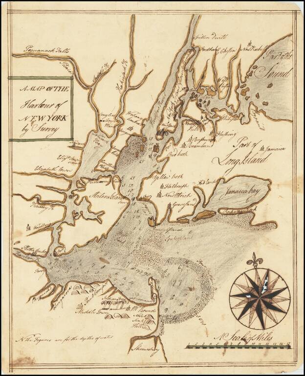
An Early Manuscript Map of Present-Day New York City. With Provenance to One of The U.S. Navy's First Frigate Captains. An early manuscript map of what is now New York City, based closely on William Bradford's New Map of the Harbour of New York, one...
![(American Revolution) [Manuscript Map of New York City and Northern New Jersey]](/map/small/69609.jpg)
An American Revolutionary War Manuscript Map -- From the Collection of One of the First U.S. Frigate Captains Manuscript map in pen and ink on laid paper of New York City and northern New Jersey, "the cockpit of the American Revolution". The map was...

The magnificent capstone of British mapping of northeastern North America. A rare, monumental and momentous general chart of northeastern North America, representing the capstone of British efforts to map the region after the end of the French and...