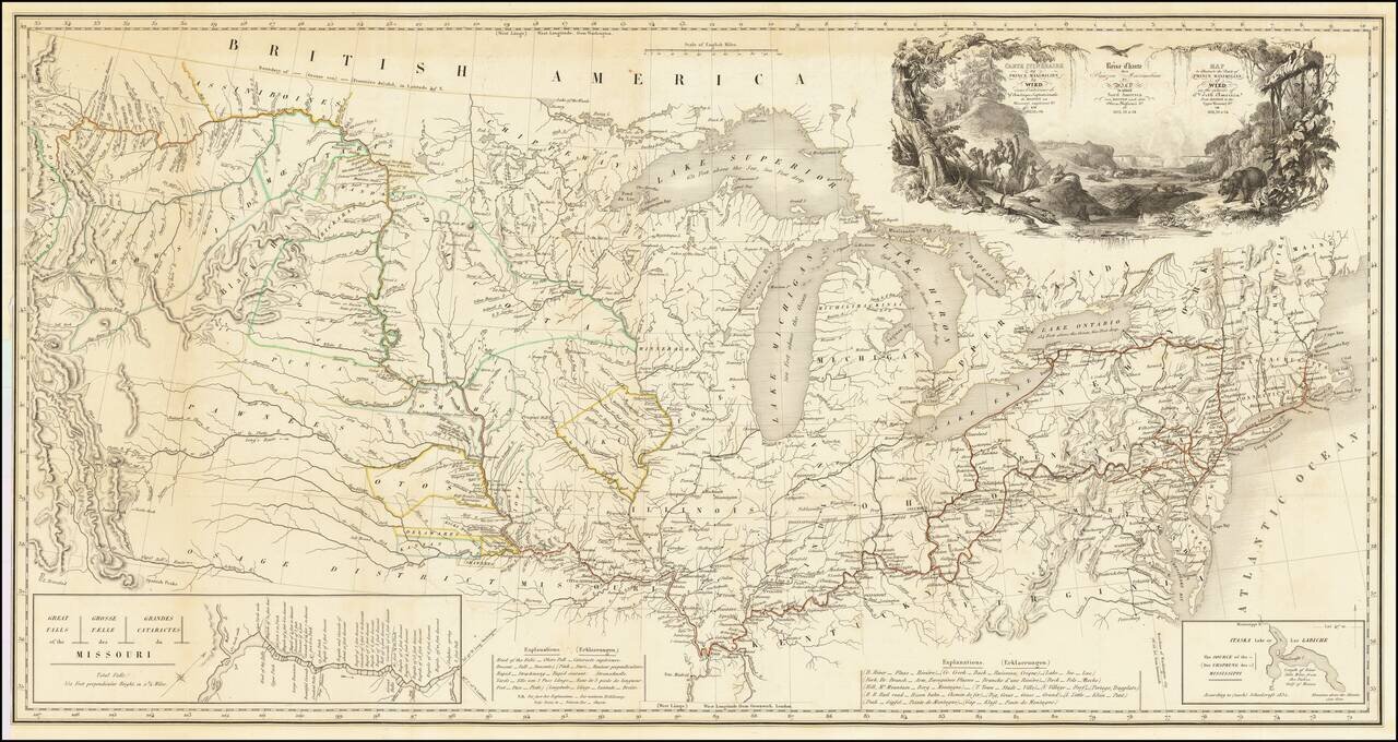
One of the Finest Early Maps of The Missouri Valley & American Plains Nice example of this remarkable map illustrating the account of the travels of Prince Alexander Phillip Maximilian, of Wied's, in the Plains and Rocky Mountain regions, in the...
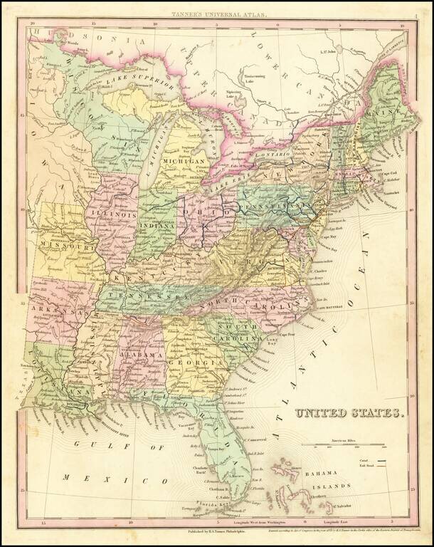
Tanner's scarce map of the United States, including massive unnamed region west of Lake Michigan and oddly shaped Michigan. Shows towns, roads, rivers, lakes, forts, etc.
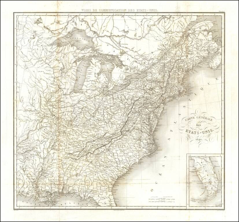
Detailed map of the United States, engraved by Tardieu for Michael Chevalier's Historie et description des voies de Communication aux Etats-Unis. The map focuses on the early railroad lines throughout the United States as of 1840.
Republic of Texas Fine dark impression of this early coast to coast map of the United States, issued just after the declaration of Independence for the Republic of Texas in 1836. Marvelous large format map of the United States and the Republic of...
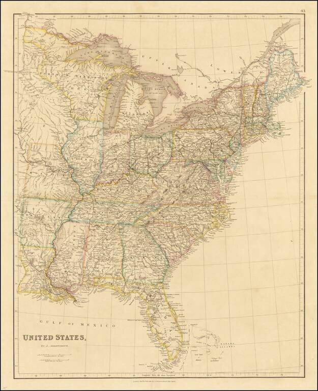
Striking and highly detailed map of the Eastern United States, by one of England's foremost mapmakers of the period. Includes a massive territory named Northwest Territory or Huron and even larger Sioux region. Excellent detail in Florida, including...
![Etats-Unis par Th. Duvotenay…1843 [Republic of Texas]](/map/small/67926.jpg)
The United States & Republic of Texas on the Eve of the Mexican War Charming map of the United States and the Republic of Texas. Includes a fascinating depiction of the United States' Western Territories, including Oregon District, Mandanes...
![Vereinigte Staaten von Nord-Amerika [Views of New York City and Back Country Scenes]](/map/small/25442.jpg)
Decorative set of illustrations, including a view of the State House in New York, and views of Niagara Falls, Saratoga, the Mississippi Valley, a wagon train headed west, a buffalo hunt and a series of indigenous Indian scenes.
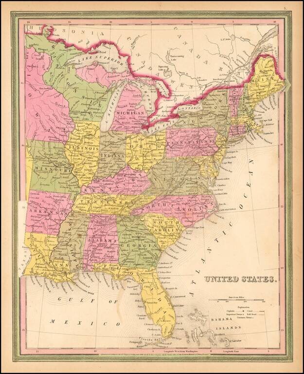
Fine example of Mitchell's scarce 1846 map of the US, including massive and curiously colored Wisconsin and oddly shaped Michigan. Shows towns, roads, rivers, lakes, forts, etc. Nice ephemeral treatment of the Northwest, immediately before the...
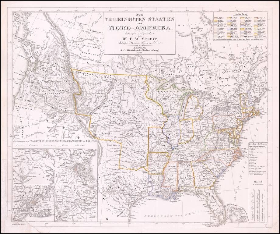
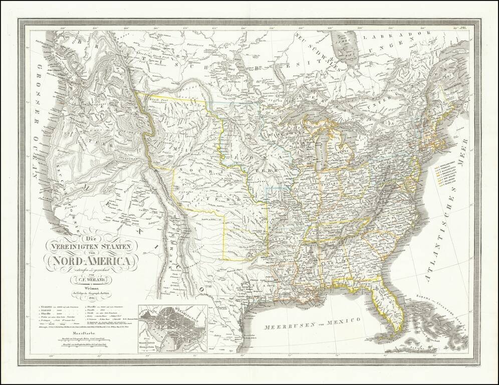
Rare late edition of Streit's fascinating map of the United States with inset maps of the region around Washington DC, Boston, Philadelphia and New York. Very nice detail along the Upper Missouri River and in Oregon Territory. The west is configured...
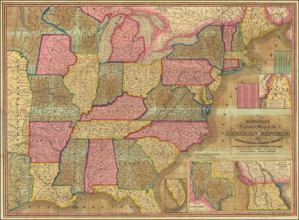
Including Unusual Territorial Representations of Iowa and Wisconsin / New State of Texas / Upper California Good example of Mitchell's most popular map of the United States of the period. The map extends west to Texas, Indian Territory and a...
![[United States, Texas & Upper California] Central America](/map/small/69646.jpg)
Scarce coast to coast map of the United States, showing a massive Texas and Upper California, both recently part of the United States, published in London in 1848. Texas is shown 2 years prior to statehood, with a massive oversized northwestern...
![[Mormonen-Stat Deseret] Post-Kanal-und Eisenbahnkarte der Vereinigten Staaten von Nord-Amerika. Nach Smith, Tanner, Mitchell und der Berichten des General-Postamts bearberitet vom Traugott Bromme in Stahl gestochenv. J.A. Buhler . . . 1850](/map/small/48102.jpg)
The Only Printed Map To Name "The Mormon State of Deseret." Fine example of one of Traugott Bromme's travel maps of the United States, with an inset map naming the " Mormonen-Stat Deseret". Loosely modeled after the maps of Smith, Mitchell and...
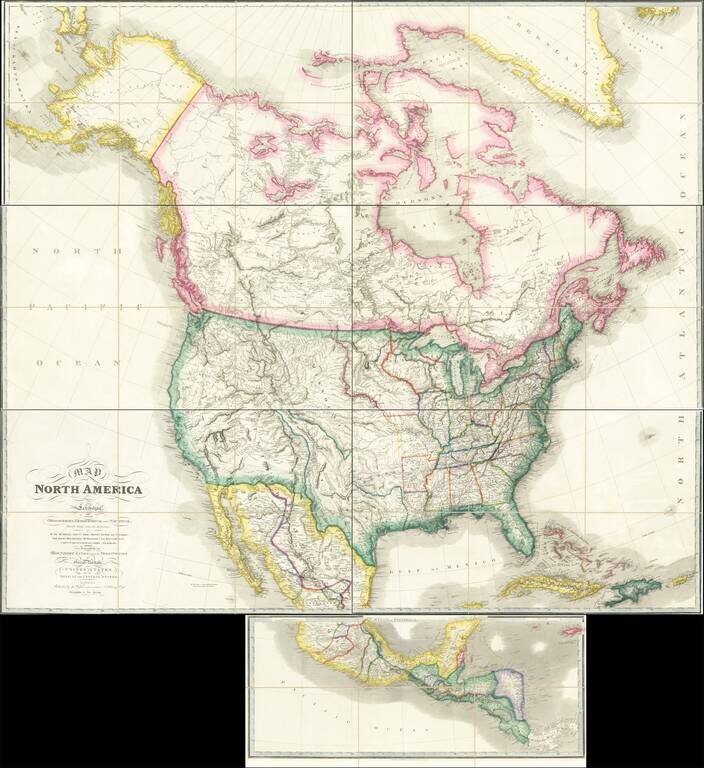
Rare Large Map of North America from a Royal Library Fine example of the circa 1850 (our dating) edition of Wyld's massive map of North America, which includes the extra panel at the bottom, adding Central America, first issued in 1824. John Wyld was...

Rare Early Depiction of the "Minesota" Territory A decorative map of the United States, published during the Mexican-American War designed to stir patriotic sentiments and celebrate the newly conquered territory. Of particular note, the map is one of...
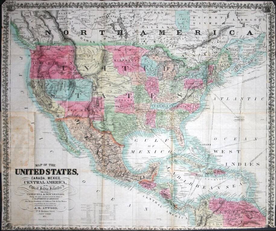
Rare pocket map of the United States, published by J.M. Atwood. Rumsey notes that the map "shows the Gold Regions in California. Atwood made important maps of the Gold Rush for Colton and Ensign & Thayer in 1849. In this map, he publishes his own...
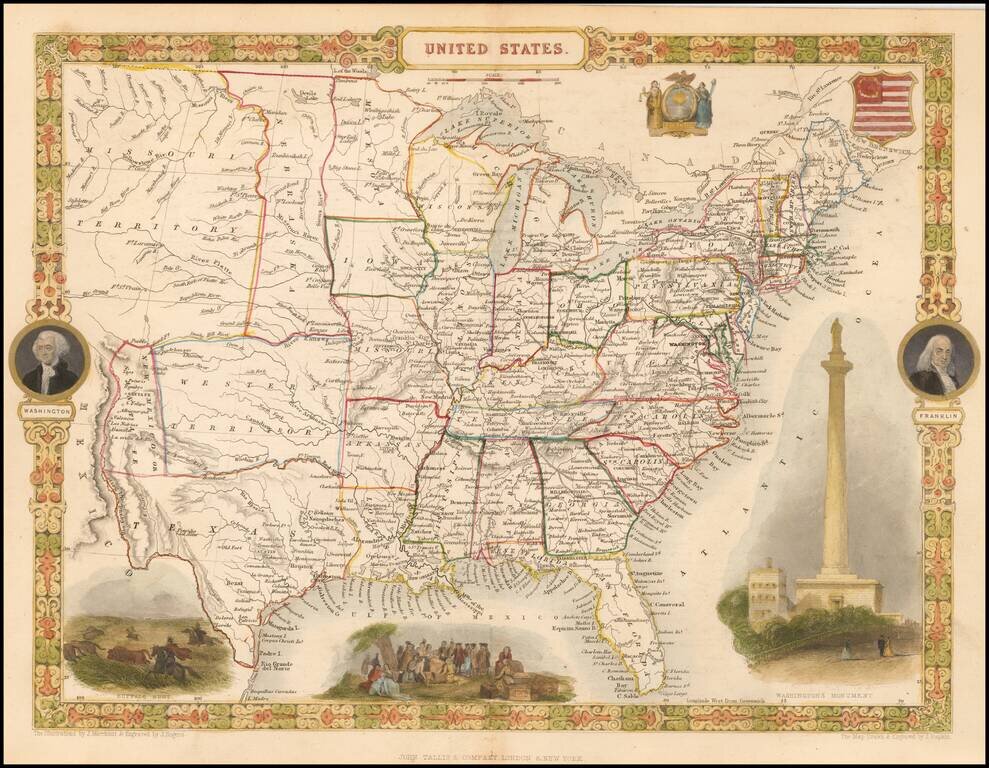
Attractive full color example of Tallis' map of the United States. The map shows an oddly configured Texas and New Mexico, pre-Indian Territory region called Western Territory, massive Missouri Territory, odd elongated Nebraska Territory extending to...