
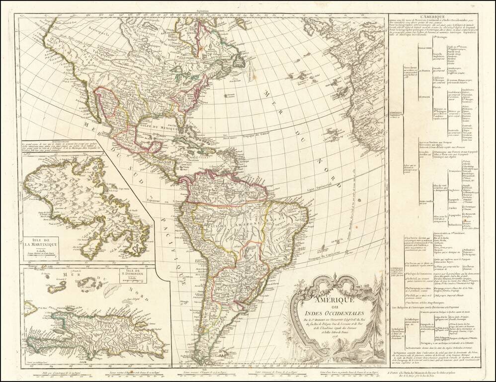
The Great River of the West and Lahontan's Longue River Scarce second state of De Vaugondy's map of America, pre-dating information from any of the Cook Voyages. The Northwest Coast of America is shown wildly distorted to the west, with a number of...
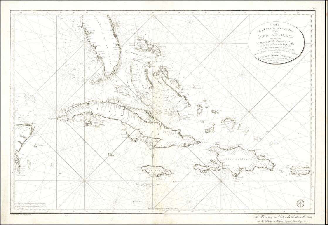
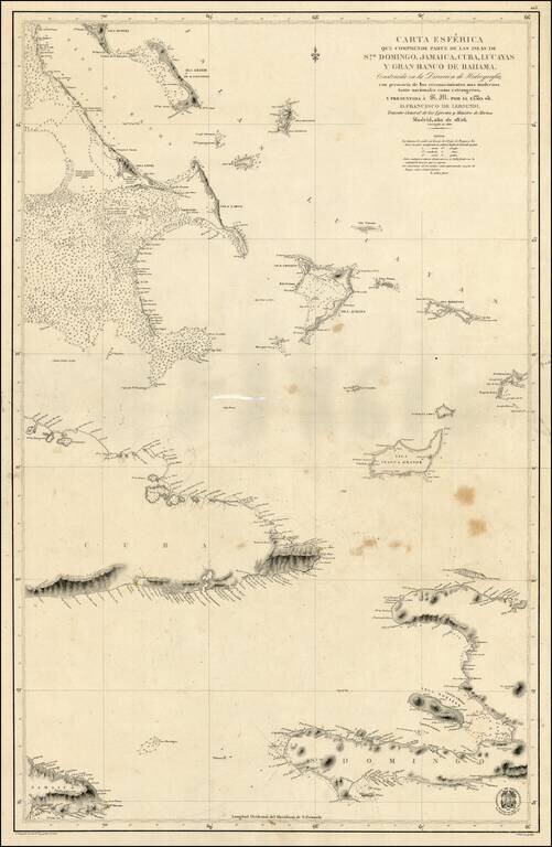
Detailed sea chart of South Florida, the Bahamas, Cuba, Jamaica, Cayman Islands, Puerto Rico, Santa Domingo and the part of the Yucatan Peninsula, published by the Depot De La Marine 1801. The chart is one of the most detailed maps of the region and...
![Cuba Insula [with] Hispaniola Insula [with] Insula Jamaica [with] Ins. S. Ioannis [with] I.S. Margareta Cum Confiniis](/map/small/70194.jpg)
Nice old color example of the Mercator-Hondius maps of Cuba, Puerto Rico, Hispaniola and Jamaica, with inset of Havana. A highly decorative map of the islands, embellished with sea monsters and sailing ships.
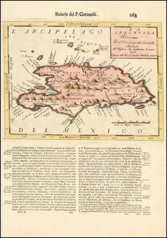
Detailed map of Hispaniola and neighboring Islands, from Coronelli's Isolario. Includes fine topographical details. The Turks and Caicos Islands are also shown, among others.
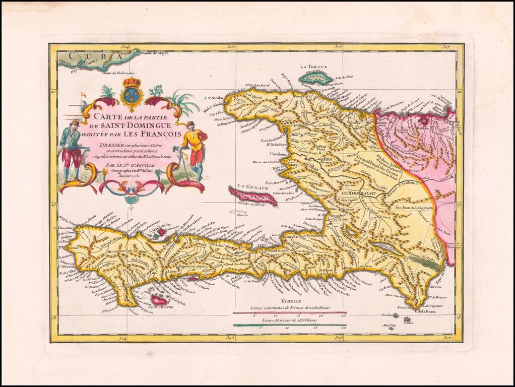
Exceptional Original Color Example of this Separately-Issued Map of Saint Domingue Based on Jesuit Manuscript Sources Finely detailed map of Saint Domingue by the renowned French mapmaker Jean-Baptiste Bourguignon d’Anville. This is a...
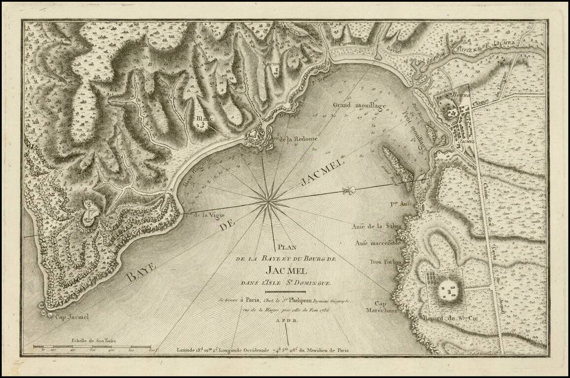
Fine example of this scarce chart of the bay and town of Jacmel, on the south coast of Haiti's southwestern peninsula, with multiple depth soundings and the topography of the surrounding countryside rendered in great detail. The map appeared in the...
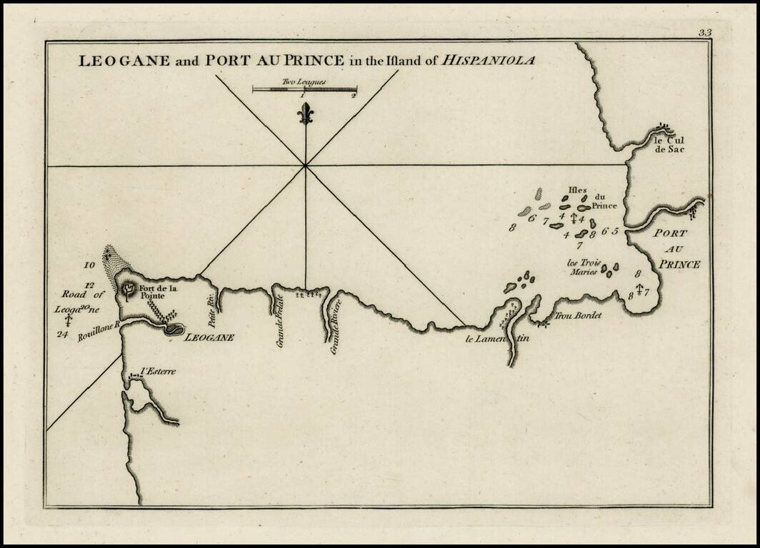
Rare plan of the coast of Haiti, from Port Au Prince to Leogane first published by Sayer & Bennett. Includes a detailed charting of the harbor, with soundings and anchorages, forts, islands and other details. One of the earliest obtainable...
Scarce Spanish Sea Chart of the southern part of Haiti, the Caicos and neighboring Islands.
![[Hispaniola, Cuba, Martinique and Guadalupe] Carte de S.Domingue . . . / Carte de Cuba . . . / Carte de Martinique . . . / Carte de Guadalupe et des Isles de Saintes . .](/map/small/70543.jpg)
Fine, Detailed French Map of Prominent Caribbean Islands Rare, separately-published map illustrating Hispaniola, Cuba, Martinique and Guadaluope. Each inset map is nicely detailed and includes a description in the title block. This text offers a...
![[Jamaica, Grenada, Dominica and St. Vincent) Carte de L'Isle de la Dominique . . . [and] Carte de L'Isle de la Grenade . . . [and] Carte de L'Isle St. Vincent . . . [ and] Carte De L'Ise de la Jamaique . . .](/map/small/66139.jpg)
Caribbean Theater During the Anglo-French War Rare separately published broadside set of 4 maps of British Colonial islands in the Caribbean, published during Anglo-French Wars in the Carbbean. Invasion of Dominica The Invasion of Dominica on...
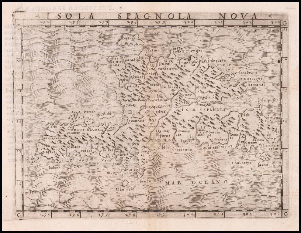
One of the earliest separately published maps of Hispaniola, which first appeared in the 1548 edition of Gastaldi's edition of Ptolemy's Geografia. The map is one of the "modern" maps to appear in Giacomo Gastaldi's La Geografia. Gastaldi was the most...
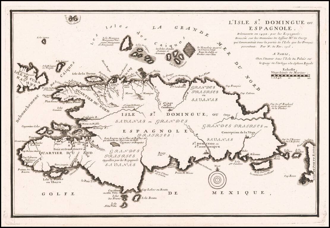
Antique Map of Haiti & Santa Domingo Detailed separate map of Hispaniola, from Nicolas De Fer's Atlas Curieux.
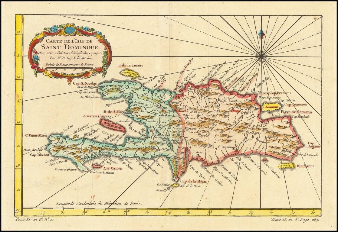
Detailed map of the Island of Saint Domingue. Remarkable detail for the period. Includes a large decorative title cartouche. One of the maps produced by Nichlas Bellin for Prevost d'Exiles influential travel book, L'Histoire Generale des Voyages.
![[Fort-Liberte Bay] Baye et Ville de Bayaha ou Port-Dauphin dans L'Isle S. Domingue](/map/small/59662.jpg)
Detailed map of the Bay of Fort-Liberte Santa Domingo, published in Nicholas Bellin's Petit Atlas Maritime. The chart is oriented with east at the top. Bellin was the first Ingenieur Hydrographe de la Marine, and also Official Hydrographer to the...
![[Port au Prince] Environs de Leogane et du Port au Prince dans L'Isle S. Domingue](/map/small/59730.jpg)
Detailed map of area around Port au Prince Bay in Haiti, published in Nicholas Bellin's Petit Atlas Maritime. The chart is oriented with southwest at the top. The plan shows the town, fortifications, anchorages, soundings, buildings, topographical...
![[Port au Prince] Le Port au Prince dans L'Isle S. Domingue](/map/small/59753.jpg)
Detailed map of Port au Prince Bay in Haiti, published in Nicholas Bellin's Petit Atlas Maritime. The chart is oriented with west at the top. The plan shows the town, fortifications, anchorages, soundings, buildings, topographical details, etc....