
![[Sinai Peninsula] (Ottoman Turkish Language Sinai and Palestine Campaign Map)](/map/small/54465.jpg)
Ottoman Map Showing A Portion of the Sinai and Palestine Campain and Battle for the Suez Canal During the World War I Rare separately published Ottoman Turkish map of the Sinai Peninsula, illustrating the battles fought during the Sinai Campaign....
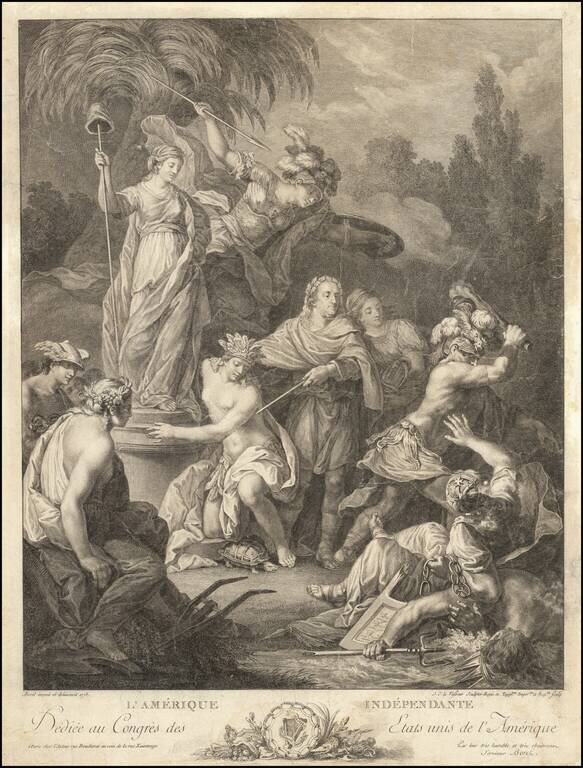
A Tribute To Benjamin Franklin and an Independent America: dedicated to the Congress of the United States of America Second state of this fine engraved allegorical image of an Independent United States of America, engraved by Jean Charles Le Vasseur...
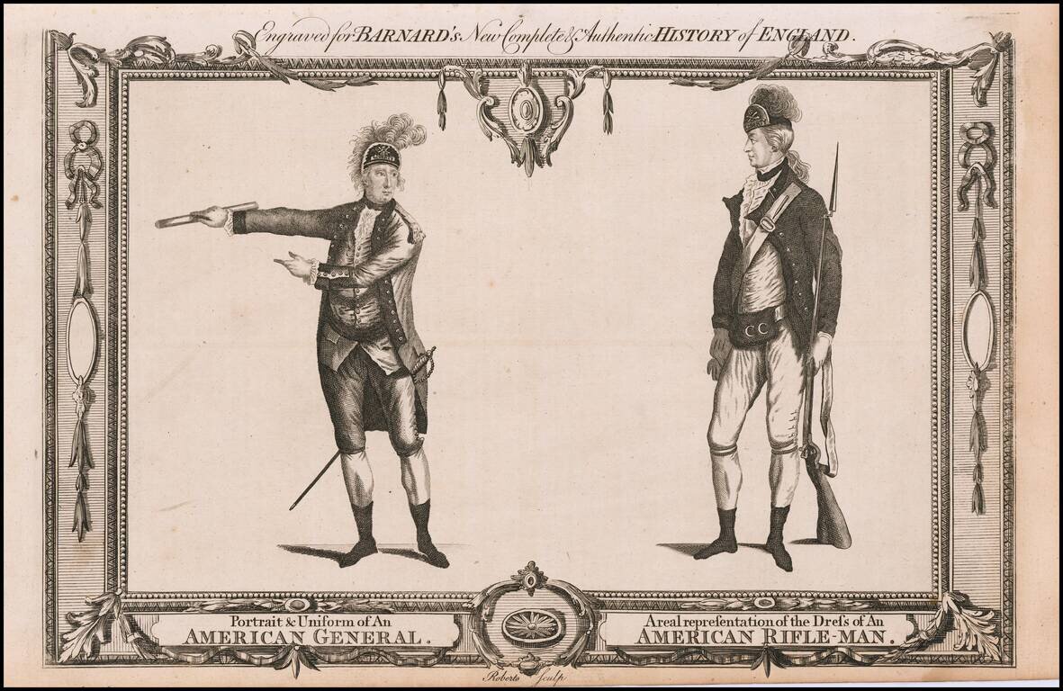
A contemporary depiction of American Revolutionary War figures set within a decorative border, engraved by Roberts. From "Barnard's New Complete & Authentic History of England."
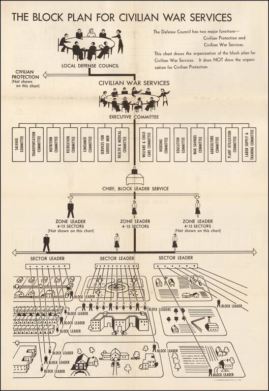
World War II Civilian War Services Organizational Chart Unusual organizational chart showing the means for organizing civilians during World War II. As the chart notes, this is the Civilian War Services chart, NOT the chart for Civilian Protection....
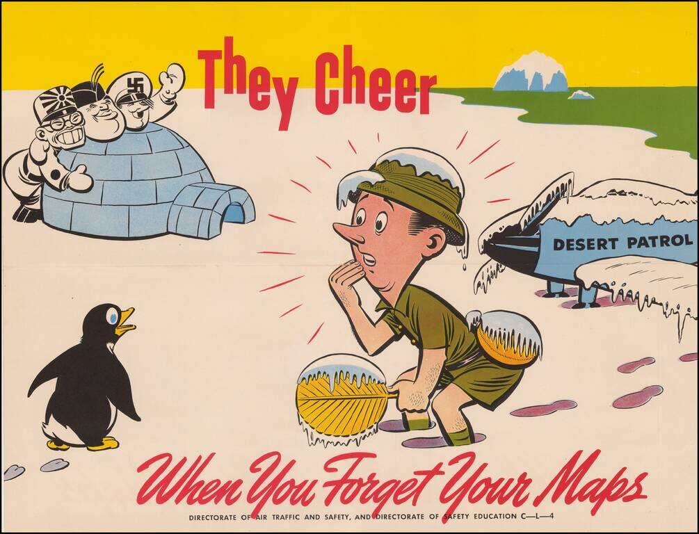
Whimsical World War II propaganda tool, published by the British Military services. The image is from the "They Cheer" series published by the "Directorate of Air Traffic and Safety" during the War. Tojo, Mussolini and Hitler are shown behind the...
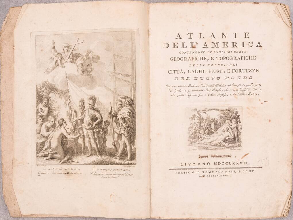
First Separate Edition of this Atlas of the Americas, issued on the Advent of the American Revolution. The maps and text in this atlas were first published during the French and Indian War, in Il Gazzettiere Americano, published by M. Coltenllini in...
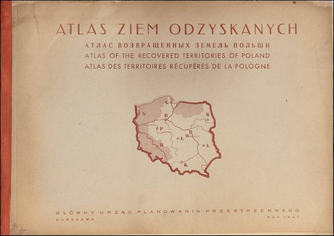
Rare Atlas of the Regions Recovered by Poland After World War II A rare and graphically sophisticated atlas that provides a multi-dimensional picture of the regions of Poland--then called the Recovered Territories--which were ceded back to Poland at...
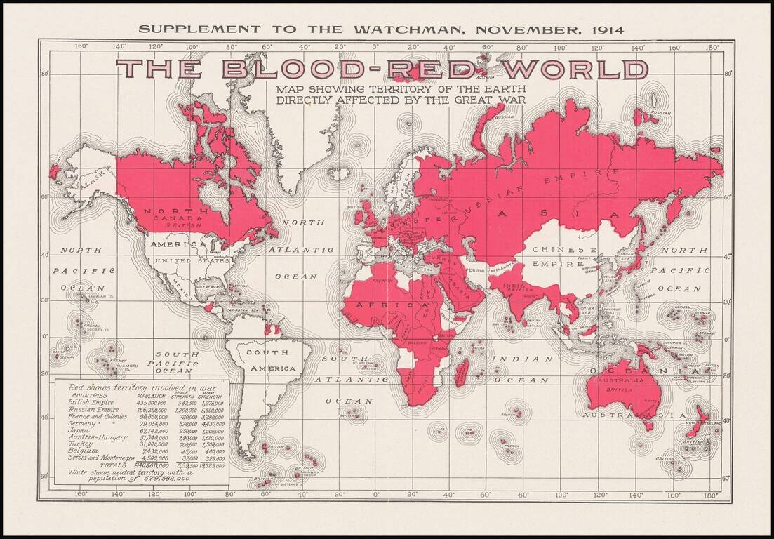
Interesting, small map issued as a supplement to the magazine The Watchmen magazine, which was published by the Southern Publishing Association of Nashville, Tenn. The map shows that 940,568,000 people were somehow affected by the war through living...
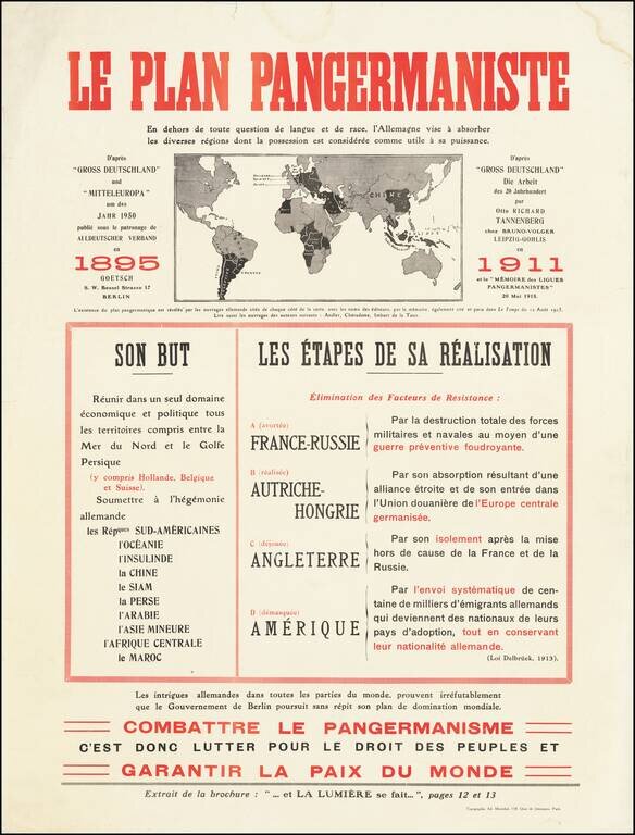
Fantastic anti-German polemic broadside map, issued in France during World War I, published by Adrien Maréchal. The map focuses on the so-called "Pan-Germanic Plan" of world domination. It rallies the French against the ever-expanding influence of...
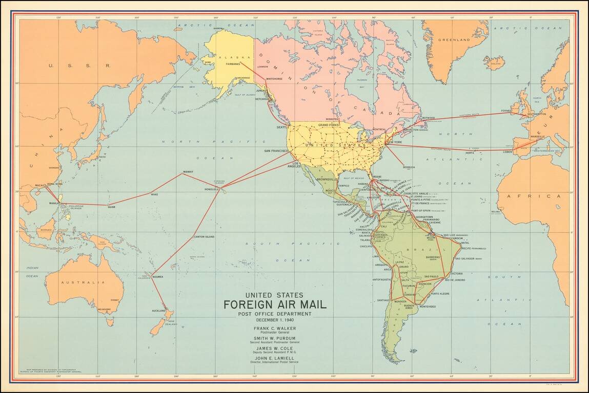
America's Foreign Air Mail Routes in the Year Before it Entered World War II. Attractive vintage map of the foreign routes of the US airmail service relevant to the United States, in December of 1940. At the time of creation, there were only a few...
![[Musselini Celebrates Pearl Harbor] Grande Carta Del Pacifico](/map/small/64895.jpg)
Musselini Celebrates The Japanese Attack on Pearl Harbor -- Provoked by A Democratic Despot Issued 4 days after the Japanese attack on Pearl Harbor, this message from Musselini, celebrates the attack and speaking in fiery nationalistic rhetoric in...
![[WWII Propaganda Map] Newsmap -- Monday, September 14, 1942](/map/small/66662.jpg)
American Occupation of Galapagos -- Nazis Closing on Stalingrad -- 234 US Vessels Launched Labor Day (1942) Fine large format WWII "Newsmap", providing up to date coverage of World War II to the American public. The base map is surrounded by news...
![[WWII Propaganda Map] Newsmap -- Monday, October 26, 1942](/map/small/66710.jpg)
More Than 530 Enemy Subs Reported Sunk or Damaged Fine large format WWII "Newsmap", providing up to date coverage of World War II to the American public. The base map is surrounded by news style articles, images, photographs and other information...
![[World Map - Pearl Harbor] World News of the Week, Monday December 10, 1945](/map/small/59643.jpg)
Detailed map of the world, with a large inset map of Oahu, illustrating the Japanese attack on Pearl Harbor. The map was issued on the fourth anniversary of Pearl Harbor, with a discussion of the details of the attack and ancillary facts related...
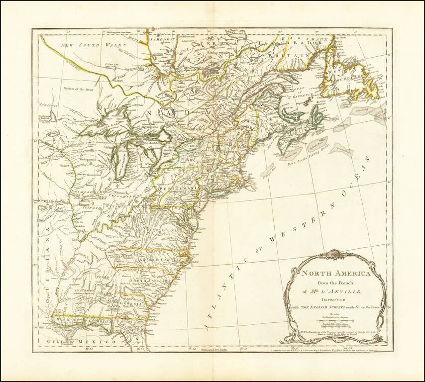
The third state of Jefferys map of the British Colonies, based upon D'Anville's map. This third state was issued after the conclusion of the French and Indian War. The map shows the Colonies on the eve of the American Revolutionary War. A note in the...
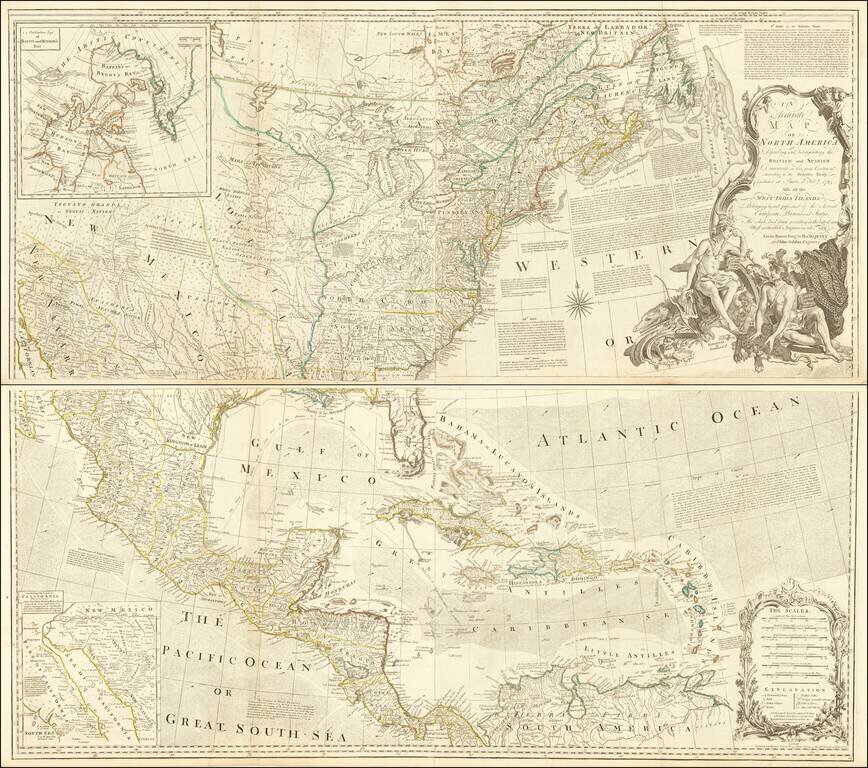
Striking 4-sheet map of North America on the eve of the American Revolution. The map is one of the best large format representations of the British Colonies, from a British perspective, on the eve of the Revolution. The claims of the Carolinas,...