

A rare map of the North Sea (Atlantic Ocean) from the Polar Circle to the Equator, showing much of North America, the Caribbean, and parts of Europe and Africa. The detail in the British Colonies in North America includes Carolina, Virginia, Maryland,...

Rare Contemporary-Colored Example of Linschoten's Map of South America Striking example of this spectacular map of South America, the Caribbean, Florida and the Gulf Coast, along with a marvelous treatment of the unknown southern continent. Engraved...
![[Wall Map] West-Indische Paskaert waer in de graden der breedde over weder zyden vande middelyn wassende so vergrooten dat die geproportioneert syn tegen hunne nevenstaende graden de lengde.](/map/small/60169.jpg)
A Remarkable Dutch Sea Chart Used For Navigation Between Africa and America Rare Johannes Van Keulen issue of Pieter Goos's sea chart of the Atlantic Ocean, America and Africa, first published circa 1680. This chart was created for use at sea by...

"A scientific and artistic document of the first order" -- One of the most important sea charts of the 17th century. Exceptionally rare Johannes Loots issue of Guillaume Blaeu's landmark sea chart of the Atlantic Ocean, America and Africa, printed on...
![Map of Mexico, Central America, and the West Indies [Insets of Bermuda, Sandwich Islands, Jamaica and Panama Railroad]](/map/small/69133.jpg)
Attractive map of Mexico, the Caribbean and the Gulf Coast, published by SA Mitchell Jr. Includes large insets of Cuba, Bermuda, Jamaica, and the Isthmus of Panama and a small inset of Jamaica. Shows shipping routes from New Orleans to points...

The Rare and Classic Rogers & Johnston Atlas. With its Famous Maps of Utah and Nebraska Territories, Among Many Other Good American Maps. This is an example of one of the most important atlases of North America published just before the start of...

An important and very rare early Dutch Sea Chart, focusing on Canada, New England, the Eastern Caribbean, Brazil, Guyana and Venezuela. This attractive sea chart assumes the perspective of the westward direction facing upwards and embraces the Western...
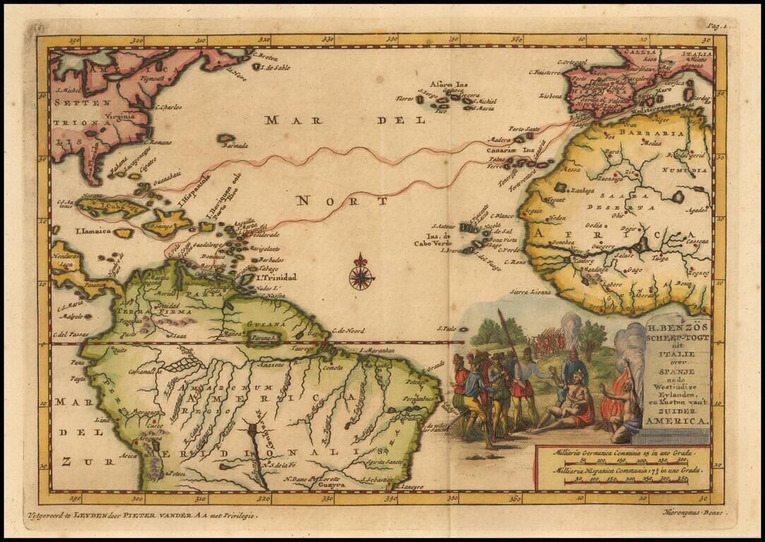
Detailed map of the Atlantic and contiguous coastlines, which was prepared to illustrate the Dutch Account of Girolamo Benzoni's voyage to America in 1541. Benzoni (born Milan ca 1519) travelled to America in 1541, visiting the Caribbean, Isthmus of...

Fine Chart of the Atlantic from an Influential Atlas Scarce sea chart of the Atlantic Ocean from the important Atlas Maritimus et Commercialis, published in London in 1727. The map provides a detailed treatment of the East Coast of North America,...
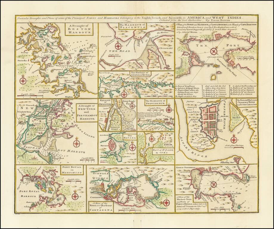
Nice set of harbor and town plans, showing the major trading cities and ports in North America and the Caribbean. The maps include: Boston New York Charleston Martinico Placentia Anapolis St. Augustine Havana St. Jago (San Juan) Providence...
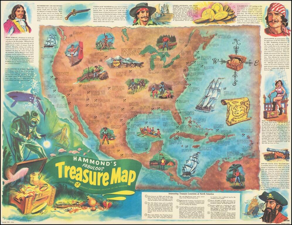
Pirates and Treasure! Lively pictorial map of North America, providing the locations of famous treasures, real and mythical, disbursed throughout the region. From the Lost Dutchman mine to John Dillinger's stash near Mercer Wisconsin, The map details...

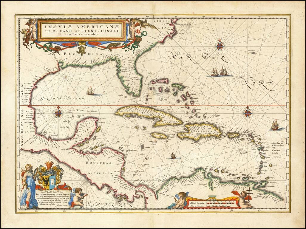
A highly decorative and important sea chart showing Florida, the Gulf Coast, Caribbean, Central America and the region from south of the mouth of the Delaware River. This fine separately published map was first engraved around 1650, but is based...
Forlani’s Map of South America—The Only Lafreri School Map of The Continent Rare map of South America by Paolo Forlani. It was the first map of South America to show the interior in considerable detail and is the only map of the continent produced...

Jacques Le Moyne's Landmark Map of Florida & The Southeast, Based On The Expedition of Laudonniere to Florida in 1564 Jacques Le Moyne's map of Florida and the Southeastern portion of the United States is one of the most important 16th Century...

Nice example of the second edition of Herrera's map of Florida and the Caribbean, which first appeared in Herrera's Descripcion de las Indias Ocidentales, first published in Madrid in 1601. In describing the map, Burden notes: Of interest to us on...
Blaeu's Chart of the Caribbean Nice example of Blaeu's chart of the Caribbean, based on a section of Blaeu's own West Indische Paskaert (ca. 1630) and Hessel Gerritsz' rare chart of 1631. The chart was the most accurate for its time and was used...