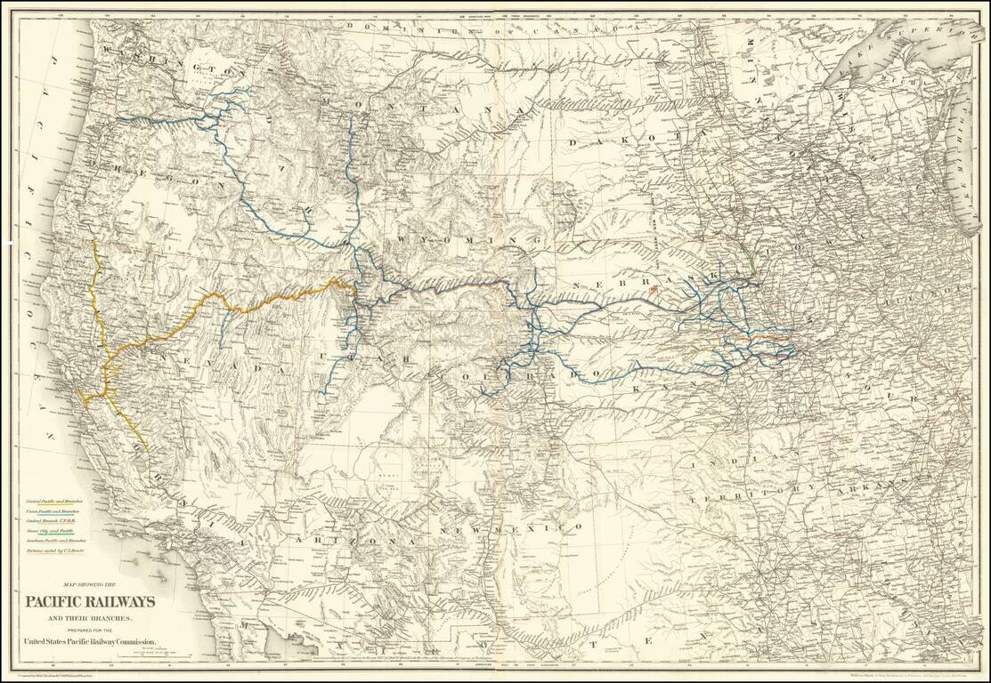
Mapping the Railroads of the Transmississippi West. Highly detailed map of the Western United States, illustrating the railroads in operation and under construction west of the Mississippi River. The key at the lower left identifies the Central...
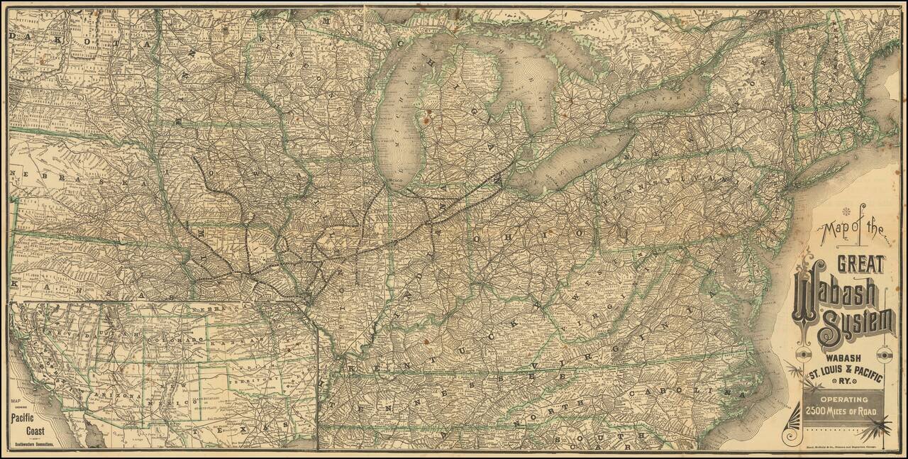
Mapping The Wabash Lines in 1887 Scarce Railroad Timetable Map of the Wabash System, published for the Wabash, St. Louis and Pacific Railway in 1887. The map shows the company railroad lines, extending from Lake Michigan to Kansas City, Council...
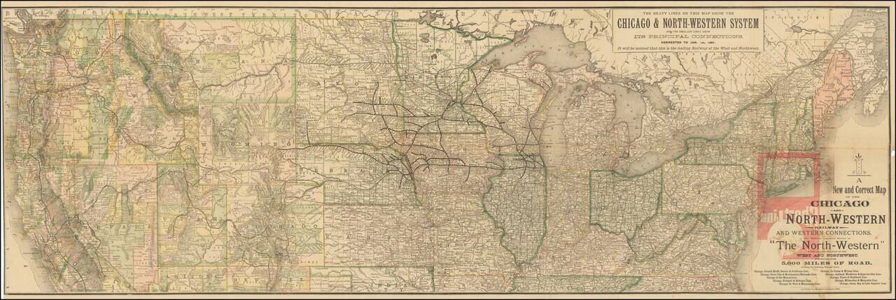
Mapping The Chicago & Northwestern System and Its Principal Connections in 1887 Scarce Railroad Timetable Map of the Chicago & Northwestern System, published for the Chicago and North-Western Railway in 1887. The map shows a fine images of...
![[Map of the United States, illustrating the routes of the Candian Pacific Railway and the Seattle, Lake Shore and Eastern Railway]](/map/small/71080.jpg)
Interesting lithographed map of the United States and southern Canada illustrating the main railways emanating from Seattle, as well as the length of the Canadian Pacific. The map was issued in the 1888 Report on Washington Territory, along with a...
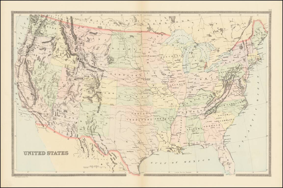
Large Map of the United States, published by William Bradley for a late edition of Mitchell's General Atlas. Includes a single Dakota and Indian Territory.
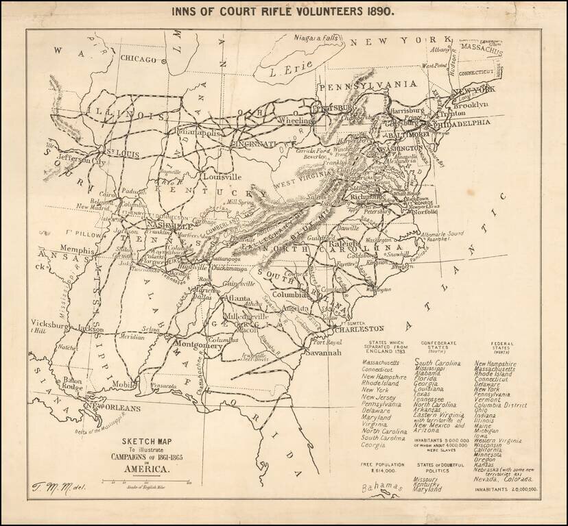
Published for the Inns of Court Regiment--Fighting Lawyers & Judges--By A Future Military Science Expert Unusual separately published map of the United States, illustrating the "Campaigns of 1861-1865 in America," published by the Court of Rifle...
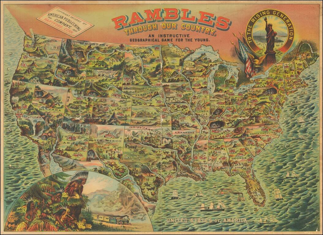
A bright, whimsical chromolithographed map of the United States, designed for a children's game, but wonderful in its own right. The principal cities of the US are depicted, as are natural resources or landmarks. Texas is shown with Indians chasing a...

Traversing The Great Fertile Belt of Canada Detailed map of Canada, promoting the Canadian Pacific Railway's lands in Northern Alberta. The lower map includes two elaborate farming scenes.
![[United States] Across the Continent](/map/small/63859.jpg)
Fine example of this early example of Parker Brothers game board, "Across the Continent." This is one of a few color lithographic game boards produced in the 1880s and early 1890s. Includes several railroad routes illustrating the major railroad...
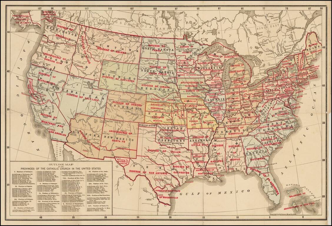
Rare separately issued map of the United States, apparently the earliest printed map to identify the various Catholic Church Provinces and Dioceses within the United States. Each of the Provinces are divided by Dioceses. Nearly 100 Dioceses are shown....
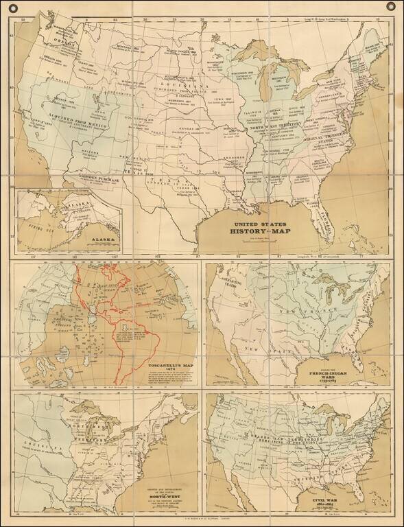
Rare teaching map of the history of the United States, advertised for sale by Bacon in 1899. The map was part of Bacon's Excelsior School-Map series and specifically the "Excelsior Wall-Atlases For Secondary Schools" The present set of 5 maps on a...
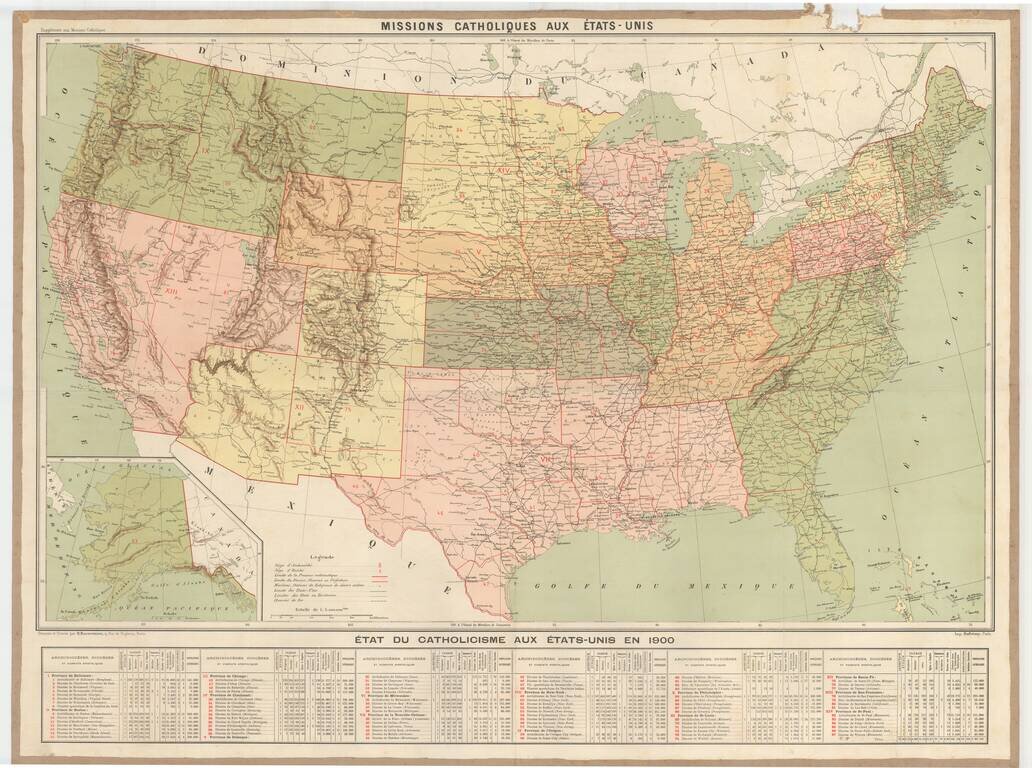
Rare large format map showing the Catholic Missions in the United States, with an extensive table below. The map includes topographical details, locations of Missionaries, Archdiocese, Diocese, Vicariates and Prefectures. There is an extensive...
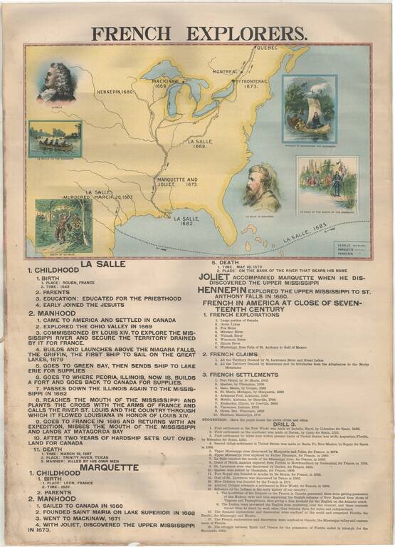
Rare Large Educational Map, With Pictorial Map Illustrating French Exploration of America and Illustrated Historical Chart of the United States. Decorative large format image, printed in color on both sides, almost certainly for educational purposes....
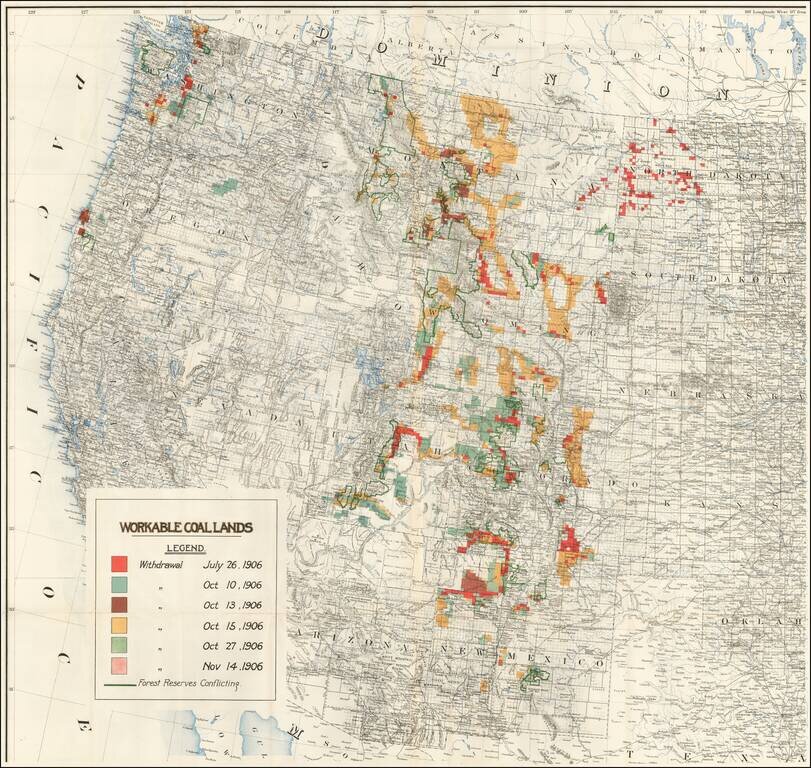
Rare separately published map of the Western United States focusing on coal production. While the map at first appears to be 1 sheet of a larger map, our research suggests that this map is in fact a re-use of the western sheet of a US Government...
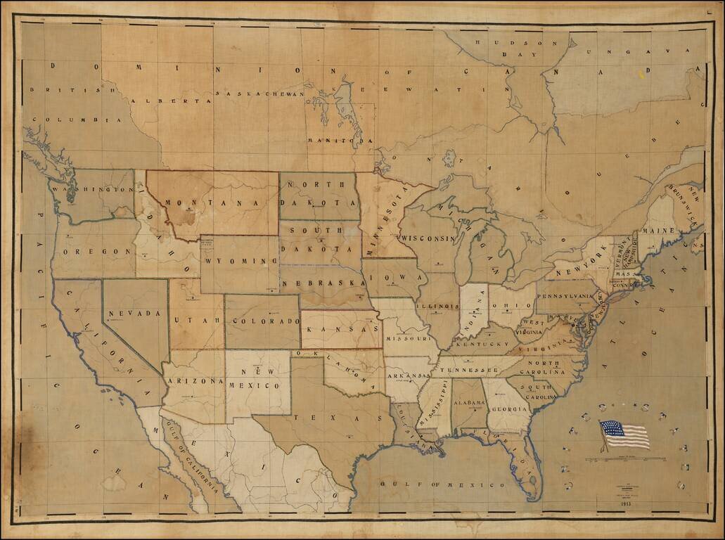
A Profound Statement of An Armenian Immigrant's Love for the United States A mammoth hand-drawn and –painted map of the United States produced in 1913 by a recent ethnic-Armenian immigrant from Turkey for presentation to his high school in Chelsea,...
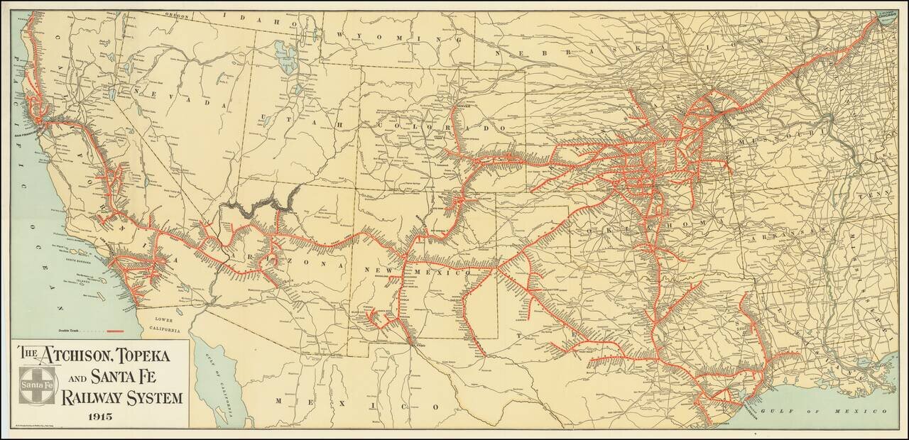
Fine example of The Atchison, Topeka and Santa Fe Railroad's general promotional map for 1915. Includes all the routes and train stations along the route in fine detail.