logo

1870. Carte Generale Des Etats-Unis Et Du Mexique . . .

  • Carte Generale Des Etats-Unis Et Du Mexique . . .

Carte Generale Des Etats-Unis Et Du Mexique . . . information:

Year of creation: 
Resolution size (pixels): 
 11484x8016 px
Disk Size: 
 25021500B
Number of pages: 
 1
Place: 
 Paris

Print information. Print size (Width x height in inches):
Printing at 72 dpi 
  159.5 х 111.33
Printing at 150 dpi 
 76.56 х 53.44
Printing at 300 dpi 
 38.28 х 26.72

An example of detailing the file of this map of in a printable high-resolution:

Click to open in high resolution (open in new tab).
Attention! this is just the central piece (central area 960x960 px) of the map file!
This is an example, so that you can see and study the level of detail of a given map. The entire Map will be fully available after payment!

Carte Generale Des Etats-Unis Et Du Mexique . . .

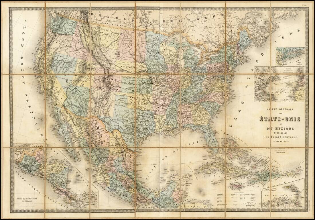
Stunning full color example of Andriveau-Goujon's 2-sheet map of the United States.

The map shows the nearly finished territorial changes in the west in fine detail.


Special conditions for students!

If you are a student, write to us in telegram: @antiquemaps and indicate what material you need and for what work you need a map in high detail. We are ready to provide material on special terms. For students only!

Item information:

Year of creation:
Size:
11484x8016 px
Disk:
25021500B
Number of pages:
1
Place:
Paris
Author:
Eugène Andriveau-Goujon.
$14.99

Related item