Map size in jpg-format: 2.6941MiB
Click to open in high resolution (open in new tab).
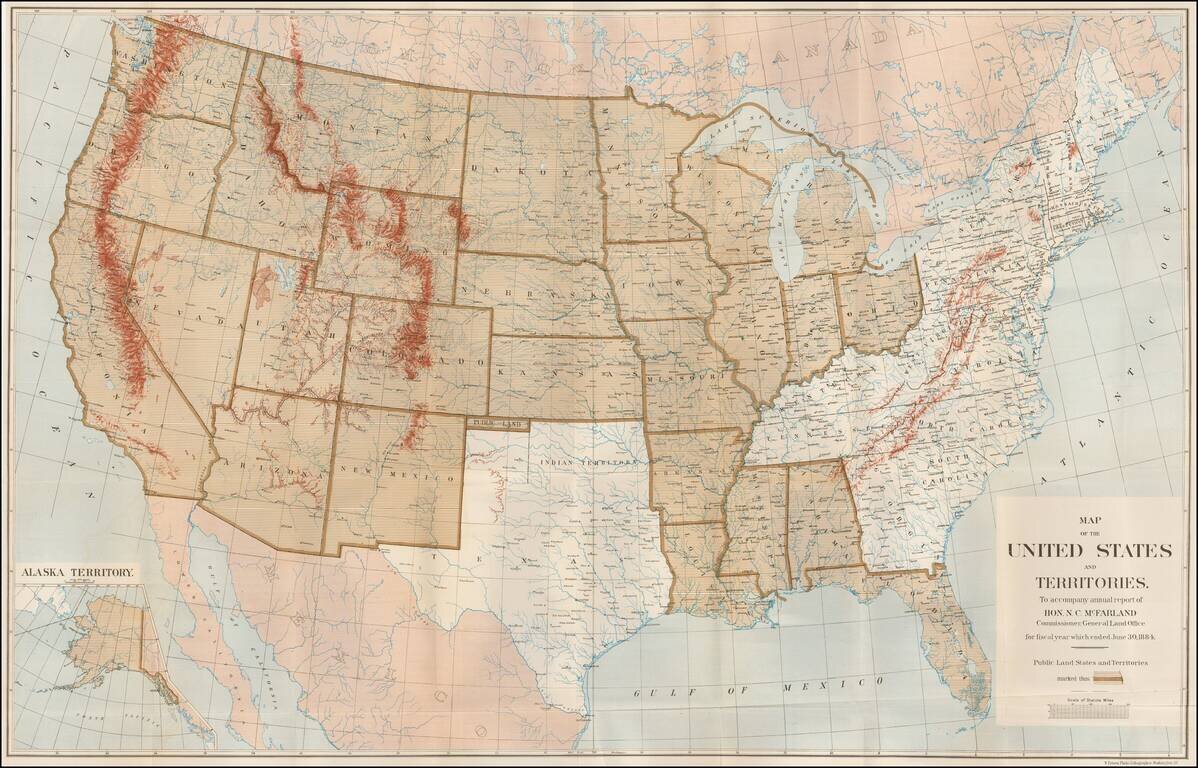
Large Map Illustrating the Public Land States and Territories
Highly detailed map of the United States, issued to accompany the annual report of N.C. MacFarland, Commissioner, General Land Office for fiscal year which ended June 30, 1884.
The map is shaded to illustrate the regions in which the General Land Office's jurisdiction applied--these being the Public Land States and Territories.
Texas is omitted, as by agreement with the Republic of Texas, at the time of its annexation, the lands were retained by the State of Texas and did not transfer to the Federal Government.
If you are a student, write to us in telegram: @antiquemaps and indicate what material you need and for what work you need a map in high detail. We are ready to provide material on special terms. For students only!

![[Signed Political Satire Artwork] Vietnam ... Vietnam ... Vietnam ...](/map/small/68726.jpg)
