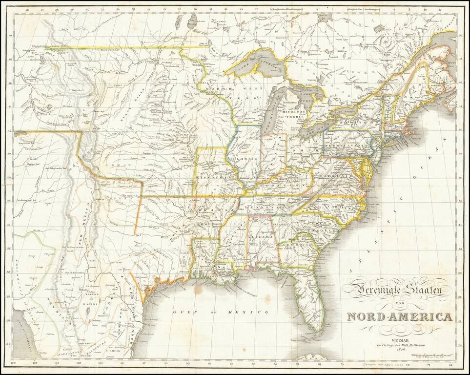
With Text in English! Rare German edition of Melish's map of the United States, extending west to include all of Texas, the Rocky Mountains, the Columbia River, Salt Lake and the Colorado River, considerably farther west than Melish's map. The map...
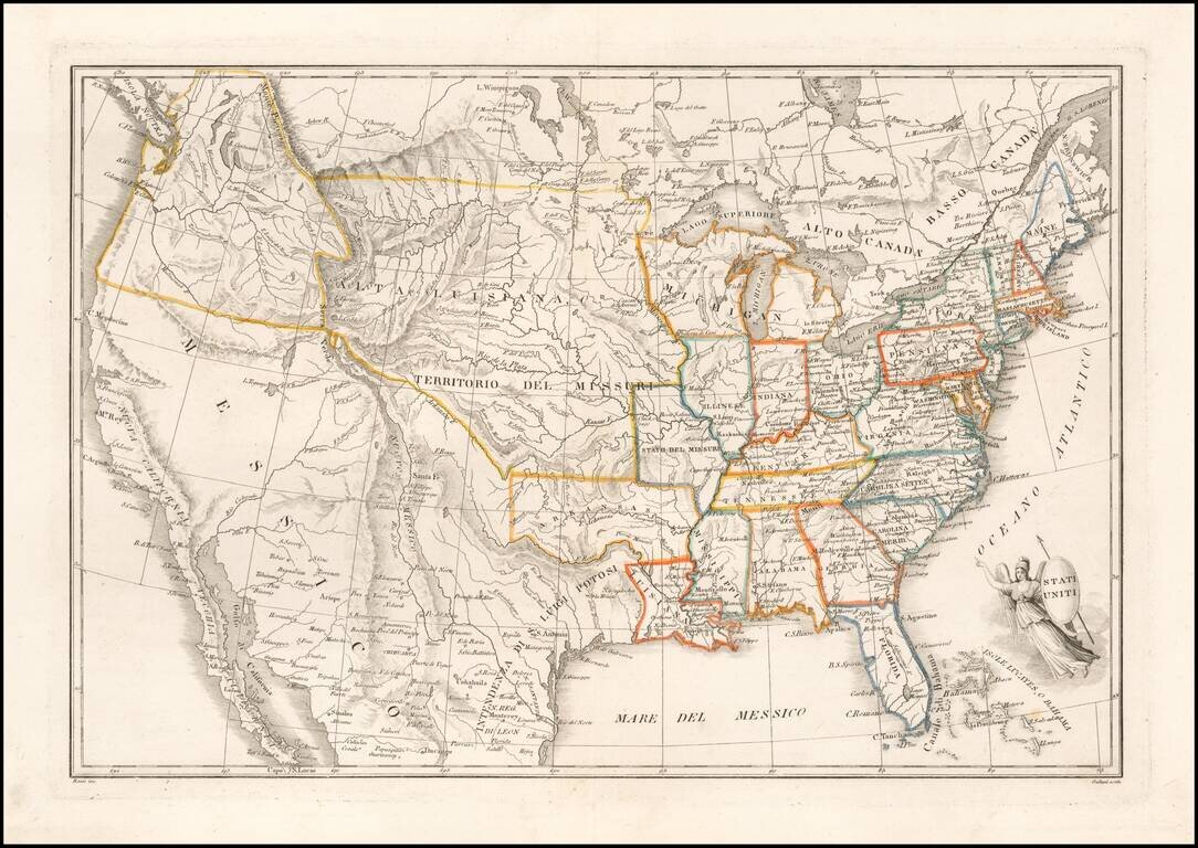
Rare Italian Map of the United States Detailed map of the United States from coast to coast, published in Italy. The map combines good early post-Lewis & Clark details with Italian place names, such as Alta Luisiana, Territorio del Missuri,...
![[School Girl Map] United States by Betsey C. Converse](/map/small/66109.jpg)
Interesting large school girl map of the United States, drawn by Betsey C. Converse (?). The main information provided in the south and west are the locations (and in some cases sizes) of Indian Tribes and American Forts. Dating The Map and...
![[Hand Drawn School Girl Map] United States](/map/small/67904.jpg)
Rare School Girl Map of the United States From Coast to Coast Finely executed school girl map of the United States, drawn by Mary S. Messinger. The map would seem to have been drawn from a map printed by F.J. Huntington in 1830, from an Atlas,...
Highly detailed map of the United States from coast to coast. Includes an excellent 54-40 or fight Oregon Territorial Border, terrific post-Lewis & Clark, post-Zebulon Pike view of the Rocky Mountains and excellent treatment of the Southwest and...
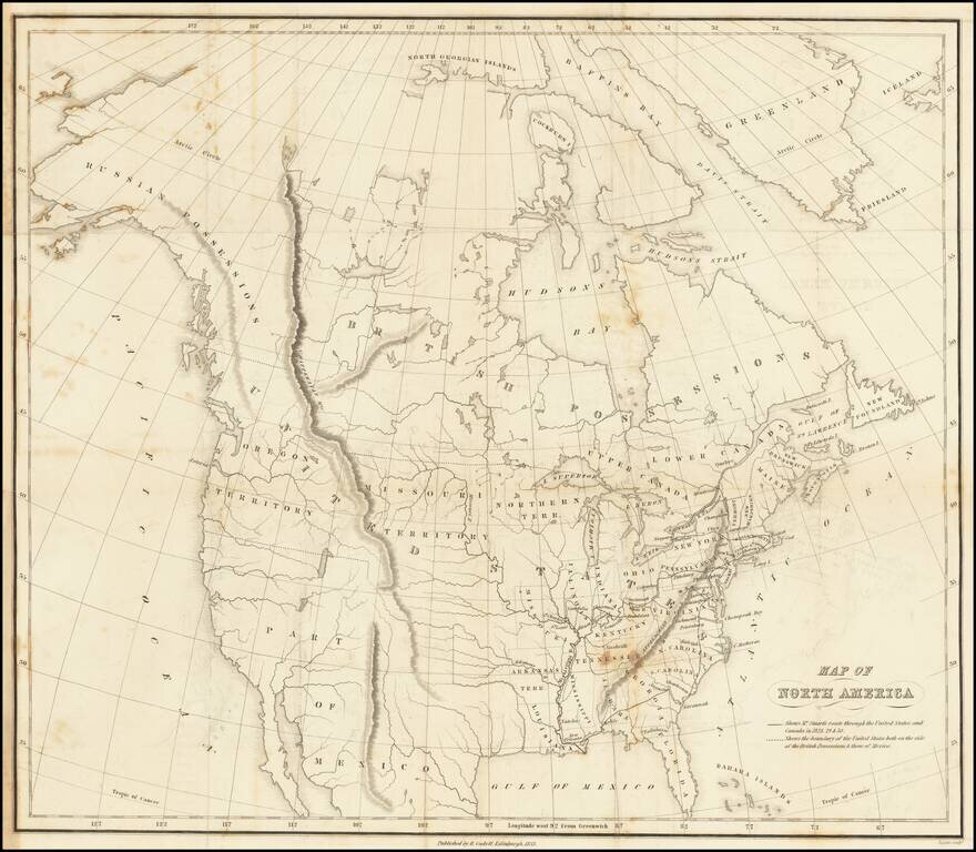
Detailed map of North America, illustrating Scotish politician James Stuart's travels through the United States. The map notes "Mr. Stuart's route through the United States, and Canada in 1828, 29 & 30" and "the boundary of the United States,...
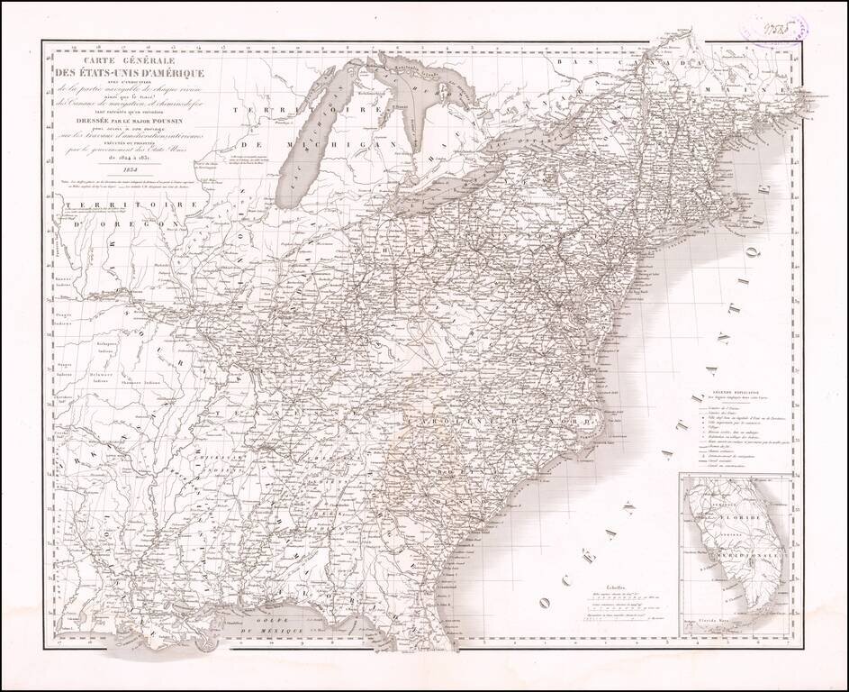
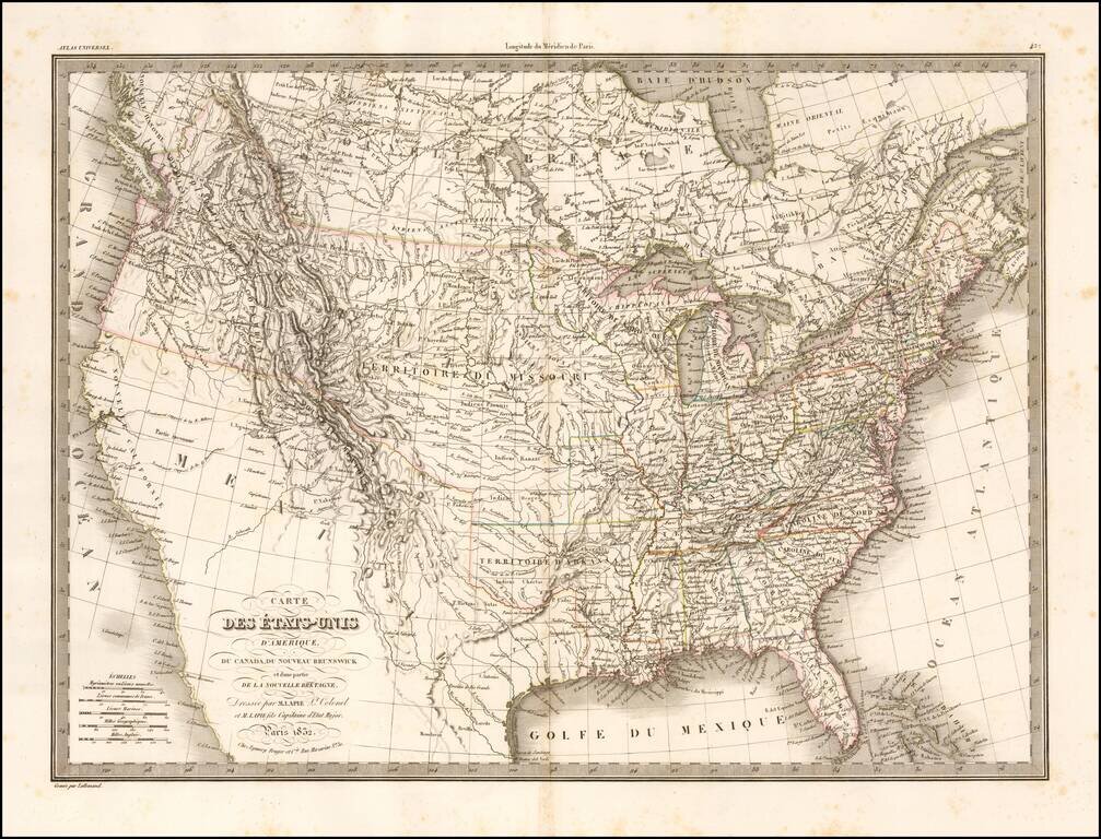
General map of the United States, illustrating the nation at the time the French Engineer Guillaume Tell-Poussin was working in America as one of its leading canal engineers. The map appeared in the Travaux d'ameliorations interieures projetes ou...
Nice example Bradford's map of the United States, covering the United States from Coast to Coast on the eve of the Independence of Texas. The map shows a massive Oregon Territory, along with a number of Indian Districts (Huron, Sioux, Mandan, Osage...

Alexis de Tocqueville's map of the American Democracy Nice example of the first edition of Alexis De Tocqueville's map of North America. The map provides a simplified picture of the United States, showing the existing states, populations and the...
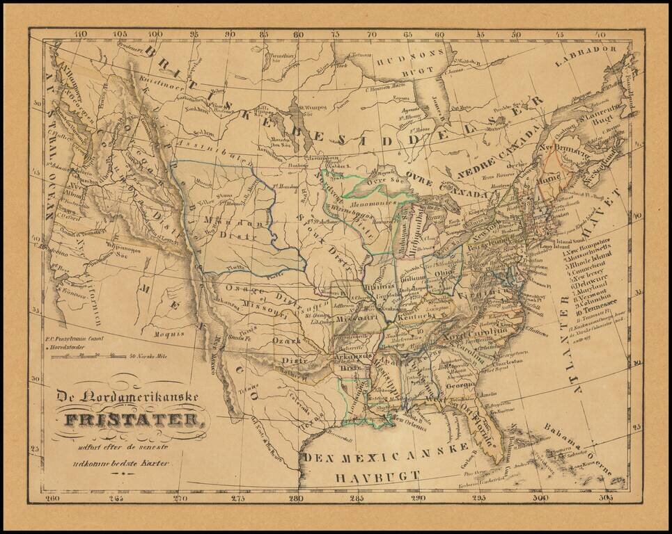
Illustrating Norwegian Settlements In Illinois Rare Norwegian map of the United States from Coast to Coast, published in the first part of the 19th Century. The map almost certainly relates to the promotion of Norwegian settlement near Kaskassias...
Shows Huron Territory -- The Future Wisconsin Territory Scarce map of the United States, showing a massive Missouri Territory, Huron Territory and Texas. The map provides fine details in the Northwestern part of the map, corresponding to the old...
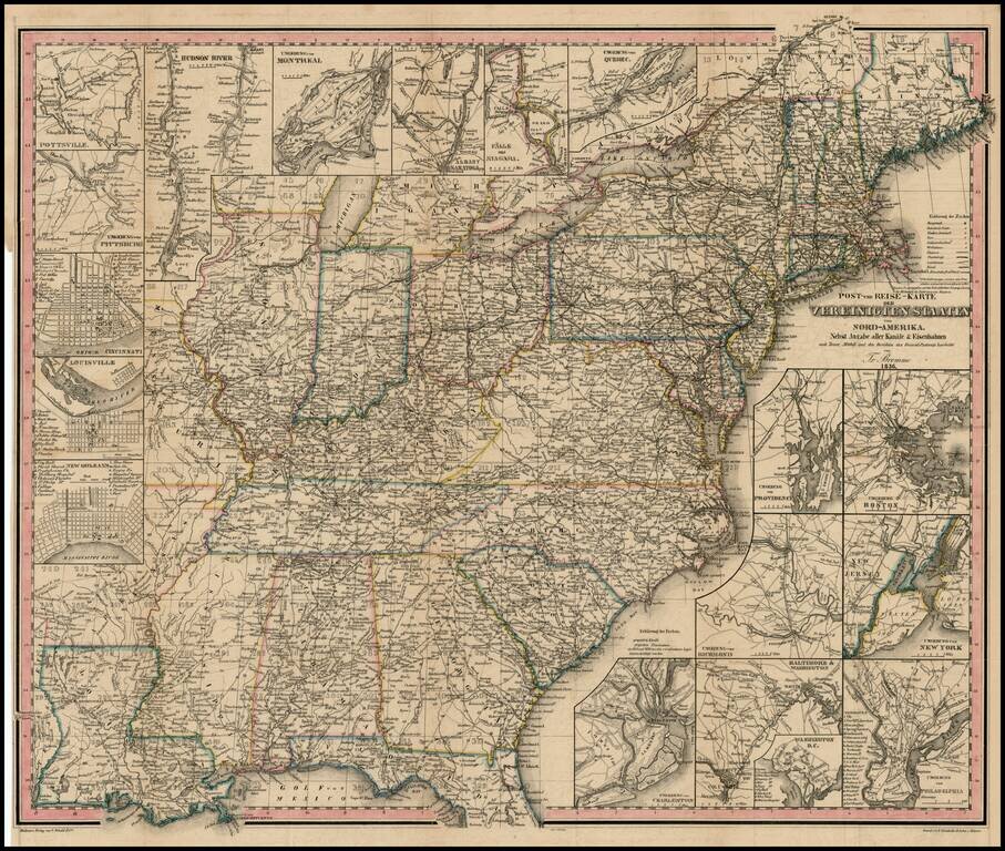
A very early example of one of Traugott Bromme's travel maps of the US. Early map and scarce U.S.-published item from the most prolific German travel writer on America. The inclusion of railroads, postal routes and canals makes the map of particular...
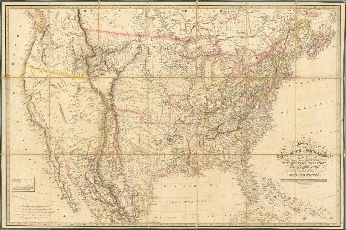
Rare 1836 edition of Laurie's Fredonia, which has been substantially updated in Texas and the West. First issued in 1830, the map faithfully incorporates information from all important early explorations, including Lewis & Clark, Stephen Long, and...
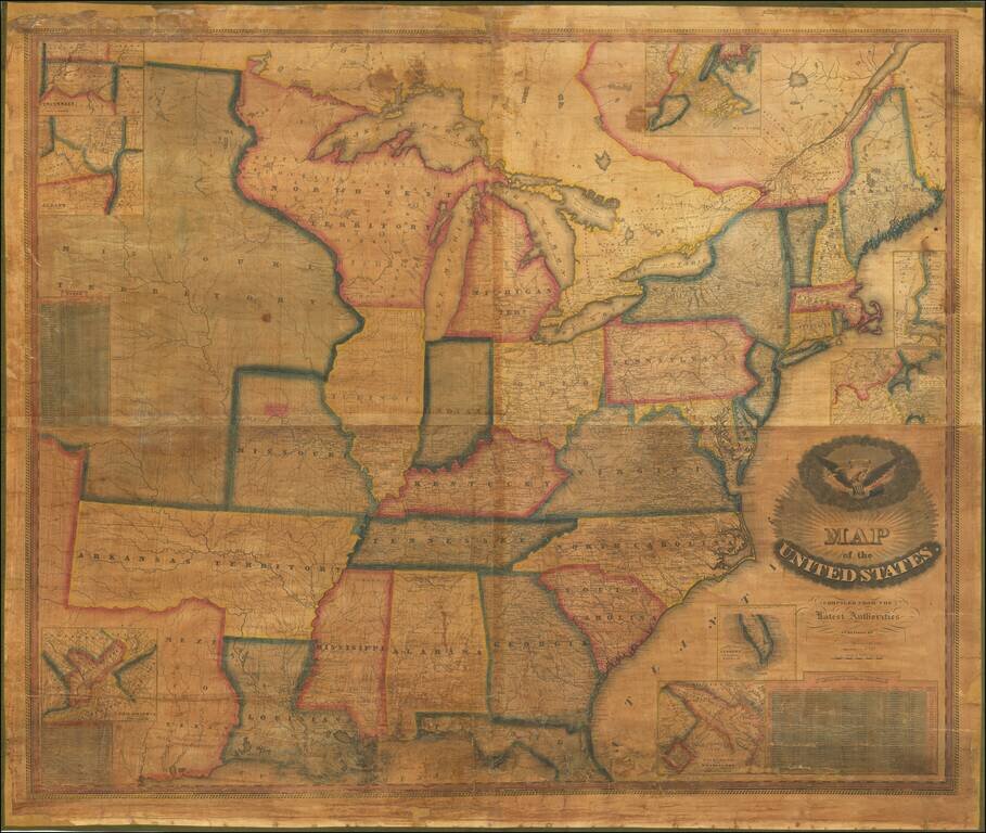
Very rare map of the United States by Vermont mapmaker Lewis Robinson. Historically important wall map of the United States and a portion of the Republic of Texas, extending from Texas and the Missouri Territory to the East Coast, including parts of...
Fascinating map of the United States and Texas, published about the time Texas became a Republic. The map names "Wisconsan", suggesting the map was published about the time Wisconsin was becoming a Territory. In Texas, the Houston and Austin are...
![[Republic of Texas] Carte Des Etats-Unis D'Amerique. . . .1838](/map/small/70864.jpg)
An Early Coast To Coast Map of the United States -- Republic of Texas Fine map of the United States from Coast to Coast, also showing the Republic of Texas just two years after its declaration of independence in 1836. During the 1820s to 1840s, the...