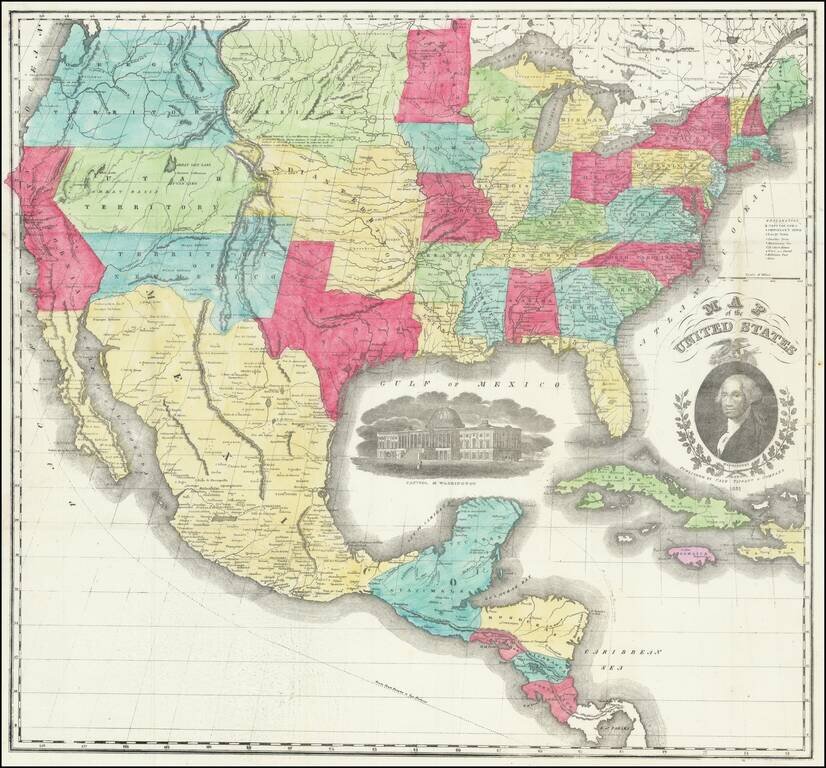
Second edition of this decorative map of the United States, with portrait of President Washington; view of the Capitol. The map provides a fantastic large format picture of the evolving Western territories and states, significantly revised from the...
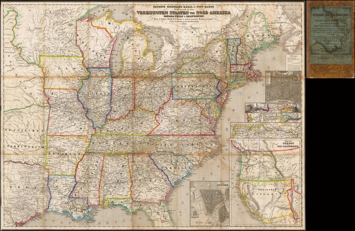
Rare Early of the Bamberg Emigrant Maps Rare Bamberg published Railroad, Canal and Post Route map of the United States, published in 1852. While later versions of the map are recorded, this 1852 edition is extremely rare, especially with the...
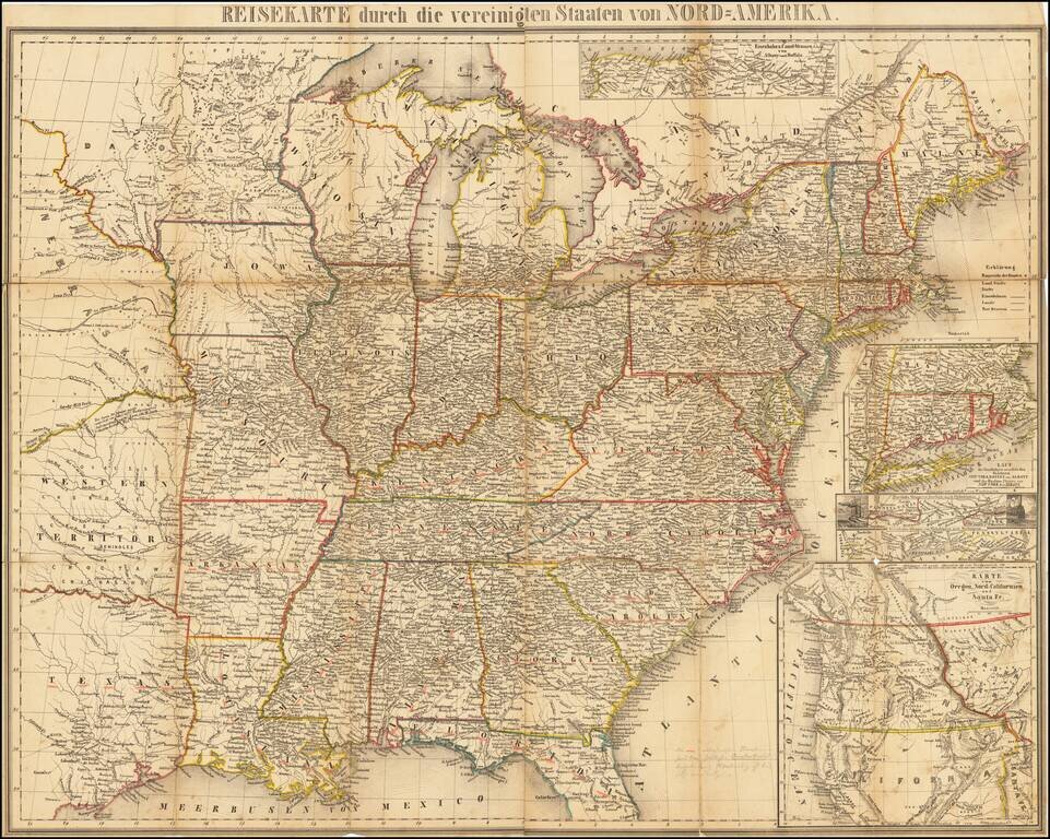
Rare German travelers map of the United States, published in Wesel in 1852. Includes the following inset maps: Karte von Oregon, Nord-Californien und Santa Fe Eisenbahn-Strasse von Philadelphia nach Washington Eisenbahn-Strasse von New York nach...
![[Mormon State of Desert] Die Vereinigten Staaten von Nord America nebst Canada . . . 1852](/map/small/69483.jpg)
A Rare Depiction of Deseret Detailed map of the United States, including the Mormon State of Deseret and an alternative name for Utah Territory, which is also shown newly divided from New Mexico Territory, to the south. Kiepert's map depicts "Alta...
Monumental Wall Map of The United States Excellent example of J Calvin Smith's wall map of the United States, one of the largest regularly published maps of the United States issued in the 19th Century. In the west, a massive Minnesota Territory...
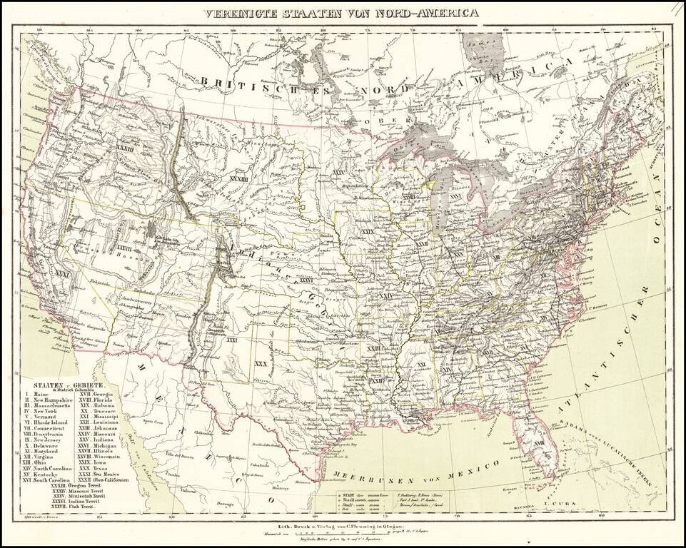
Nice example of Flemming's map of the United States, exhibiting in fabulous detail the early US territorial borders, Indian Districts, Forts, early routes of the Transmississippi explorers and other details. any Indian tribes, forts, missions, roads,...
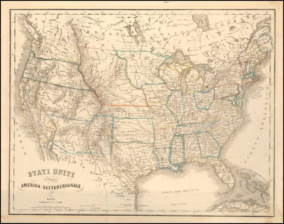
Interesting map of the United States, illustrating the western territories as they appeared from 1854 to 1860. A scarce Italian produced map of the United States during a time of very interesting territorial borders just before the onset of the Civil...
![The United States of America [1st edition]](/map/small/67796.jpg)
First edition of Colton's map of the United States, from Colton's 1855 Atlas. The map is a remarkable compendium of contemporary cartographic information, showing the early Western Territorial configurations. Washington Territory and Oregon Territory...
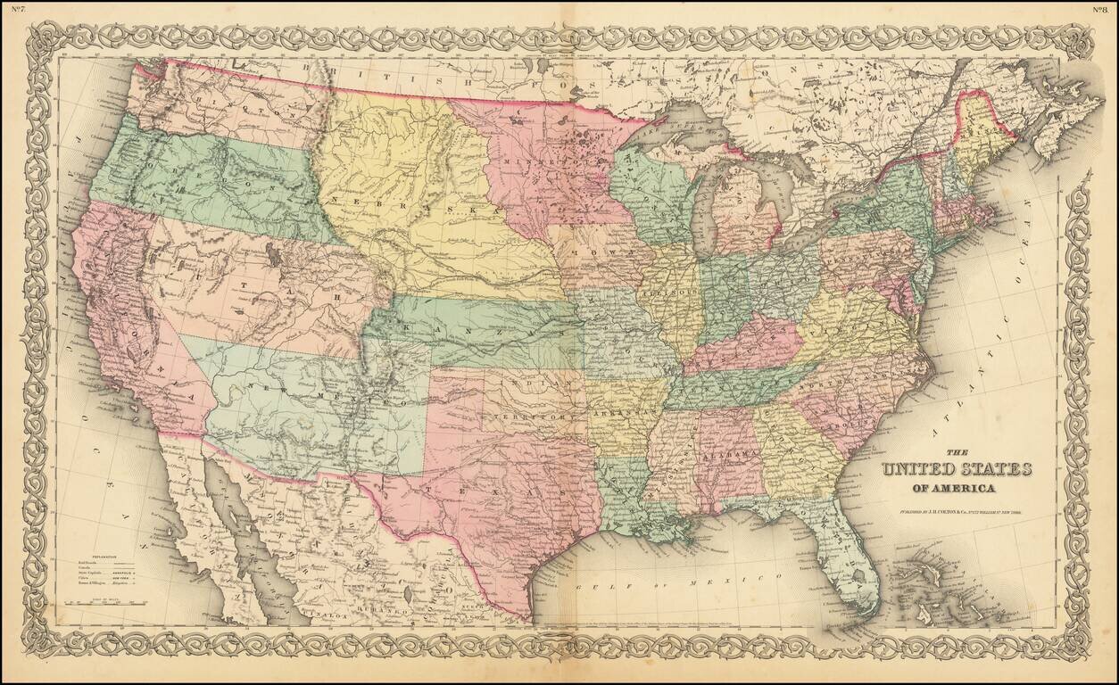
Very early edition of Colton's map of the United States, from 1855 or 1856. The map is a remarkable compendium of contemporary cartographic information, showing the early Western territorial configurations. Washington & Oregon Territories...
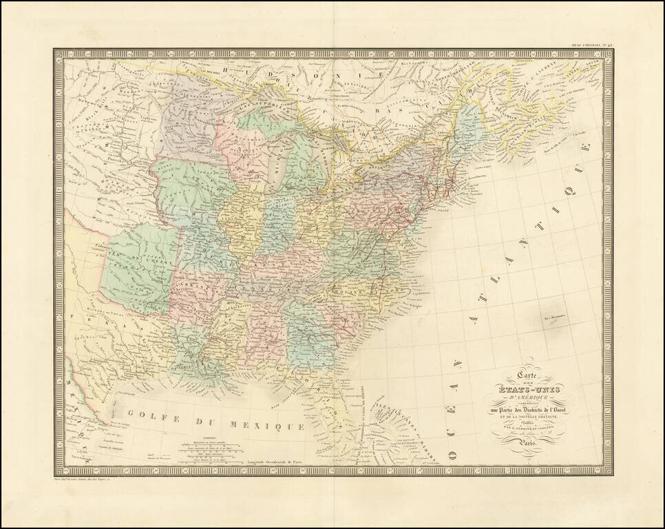
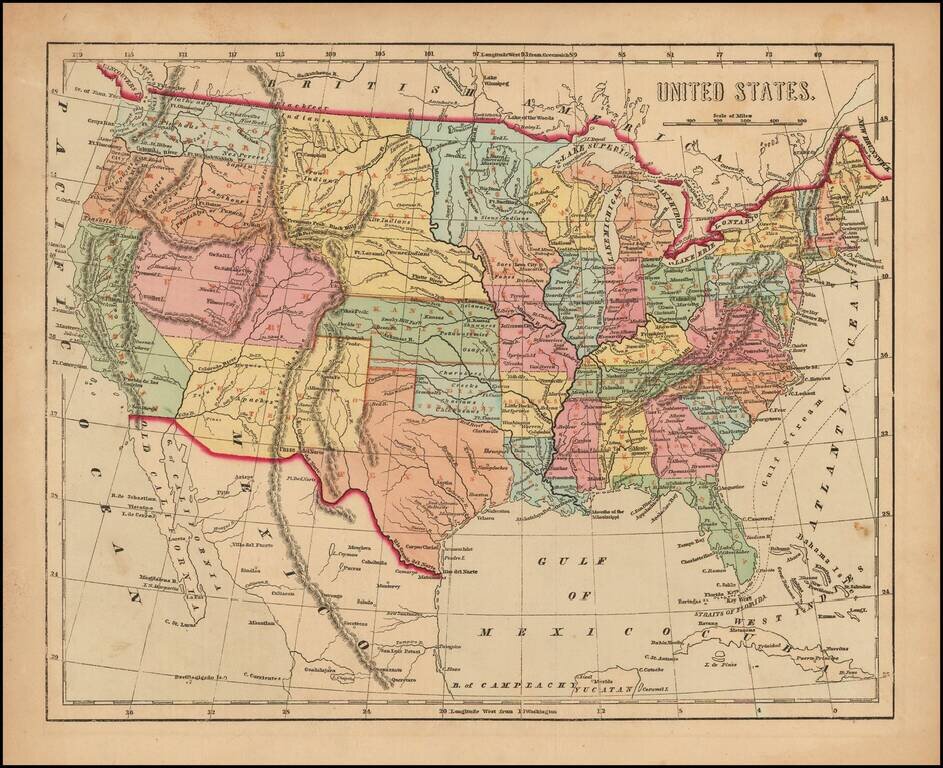
Detailed map of the US, extending west to include a large Texas and the Missouri River Valley. Indian Territory is called "Terre. de l'Ouest". Nice detail throughout the map, including Indian tribes, early railroad information, and other detail. The...
![Colton's Map of the United States of America, The British Provinces, Mexico, The West Indies and Central America . . . 1856 [Folding Map with original slip case]](/map/small/37488hf.jpg)
Fine example of this rare 1856 edition of Colton's map of the United States. This edition includes 2 short-lived western territorial anomalies, the "Uninhabited" lands between New Mexico and Chihuahua and the unincorporated block of land between...
Scarce map of the United States, from Morse's General Atlas of the World. The map captures the Transmississippi West, shortly after the Gadsden Purchase, with many of the large territorial configurations still in evidence, including a very early...
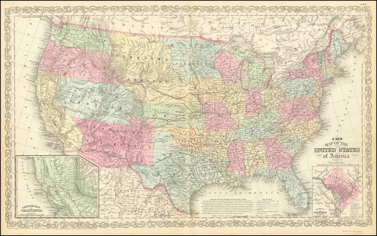
Antique Map of United States with early Western Territorial Borders Nice example of Charles Desilver's map of the United States, illustrating the evolving American West. Oregon and Washington extend to the Rocky Mountains. Massive Nebraska Territory...

Geological map which accompanied William H. Emory's Report on the United States and Mexican Boundary Survey, one of the classic maps of Texas and Western history. "On August 15, 1854," notes William Goetzmann, "Major William H. Emory was ordered by...
![[United States] Index Map](/map/small/67626.jpg)
Key sheet illustrating the general location the maps from Rogers & Johnston's Atlas of the United States.
![Die Vereinigten Staaten von Nord Amerika (Ostlicher Theil) [New York City Inset]](/map/small/62143.jpg)
Highly detailed map of the eastern part of the United States, with a large inset map of New York City.