Map size in jpg-format: 45.0465MiB
Click to open in high resolution (open in new tab).
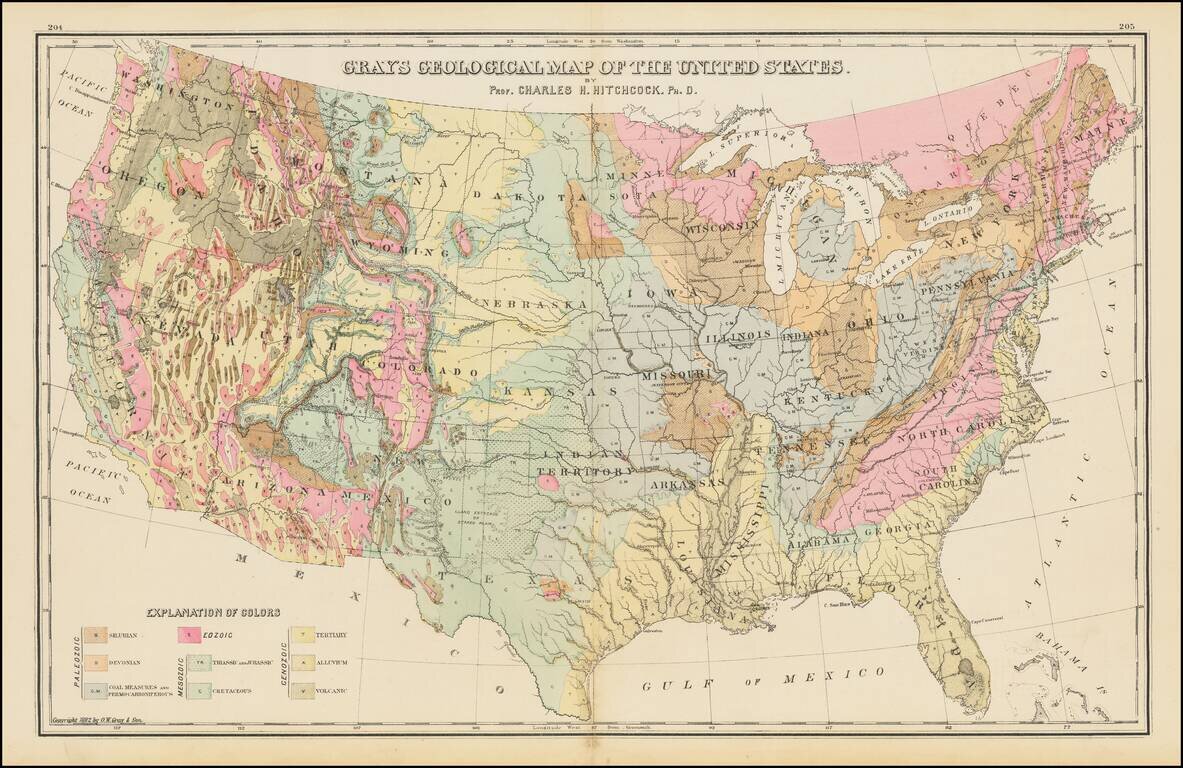
Geological map of the United States, published by O.W. Gray.
The map exhibits the geological regions, including Eozoic, Silurian, Deonian and Lower Carboniferous, Coal Measures and Permo-Carboniferous, Triassic and Jurassic, Cretaceous, Tertiary, Alluvium and Volcanic, each coded by color.
O. W. Gray was a publishing firm based in Philadelphia. Later, they published as O. W. Gray & Son. They published atlases in the late nineteenth century. Gray's National Atlas was one of the most successful commercial ventures of the 1870s and one of the last to employ hand coloring on maps.
If you are a student, write to us in telegram: @antiquemaps and indicate what material you need and for what work you need a map in high detail. We are ready to provide material on special terms. For students only!

![[Signed Political Satire Artwork] Vietnam ... Vietnam ... Vietnam ...](/map/small/68726.jpg)
