
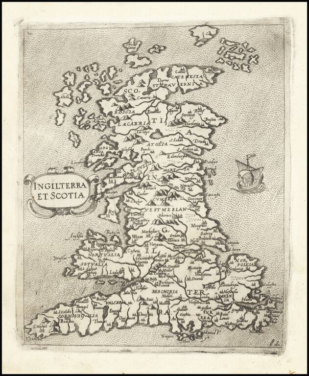
One of the Earliest Modern Maps of England, Wales & Scotland Nice example of Camocio's finely engraved map of England, Wales & Scotland, published in Venice. The map is derived from George Lily. Lily's map is generally considered to be the...
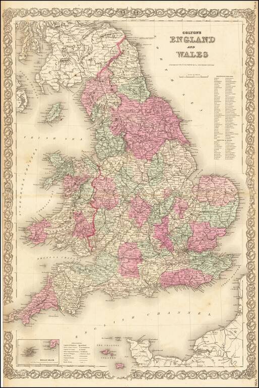
Nice large format map of England & Wales, hand colored by counties.
![[Two Sheet Detailed Agricultural Map] Great Britain](/map/small/68080.jpg)
A fascinating map of Great Britain compiled by the Ministry of Agriculture and Fisheries in June 1939 and printed by the Ordnance Survey in 1944. The map shows the types of agriculture which dominate in each region of the United Kingdom. Approximately...
![[Wales] Cambriae Typus Auctore Humfredo Lhuydo . . .](/map/small/45077.jpg)
Ortelius' map is the first printed map of Wales. The map appeared in Ortelius' Theatrum Orbis Terrarum, the first modern atlas of the world. Ornate cartouche and many sailing ships and sea monster. The map is based upon Mercator's 1564 wall map of the...
![[Wales] Cambriae Typus Auctore Humfredo Lhuydo . . .](/map/small/41983.jpg)
Second state of this finely engraved map of Wales, with new decorative cartouche. The map is derived from the Welsh cartographer Humphrey Lhuyd's 1568 map, the first modern map of Wales. The map was revised and made slightly smaller in...
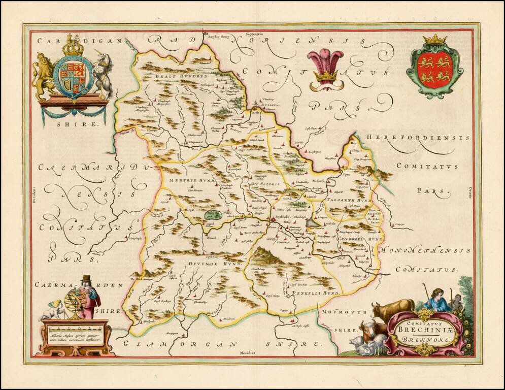
Exceptional old color example of Blaeu's map of the County of Brecknock (Brecon) in Wales, heightened in Gold, from his Atlas Maior. Fine original color, lavishly heighted with gold leaf. A fine example, with wide margins.
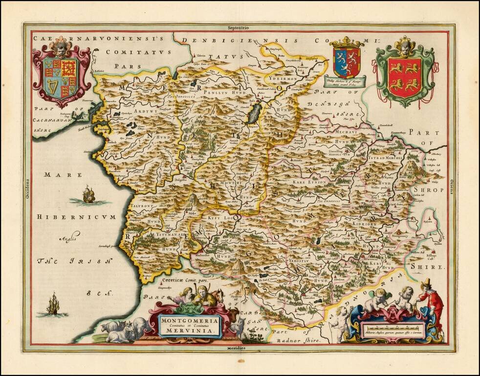
Exceptional old color example of Blaeu's map of Montgomeryshire, heightened in Gold, from his Atlas Maior. The map is decorated with a title cartouche and 3 coats of arms. A fine example, with wide margins.
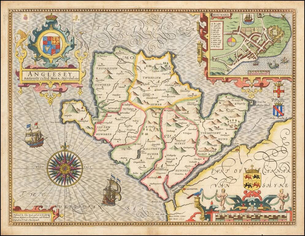
Attractive full color example of Speed's map of the island of Anglesey, off the coast of Wales, published by John Speed. Includes a plan of Beaumaris, the Royal Arms supported by lion and unicorn, the coats of arms of 2 Earls, ships full sail, and an...
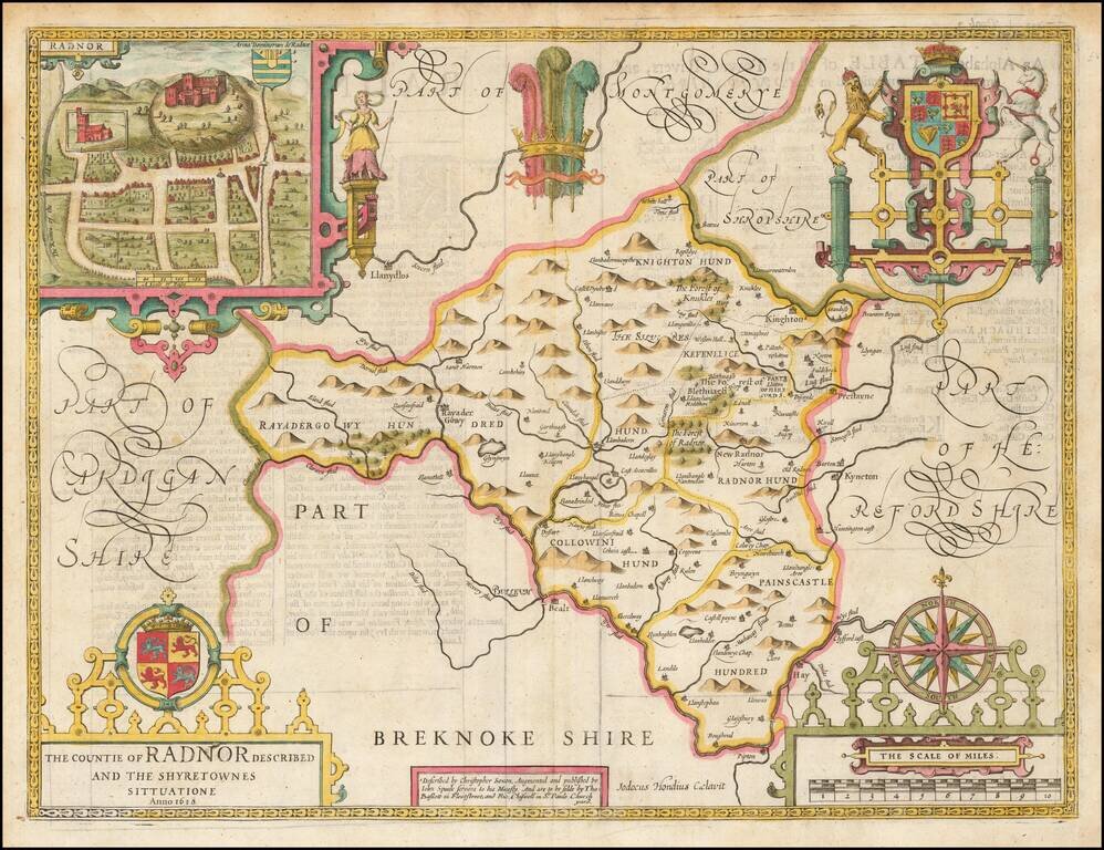
A nice full color example of Speed's map of the County of Radnor, including coats of arms and a detailed town plan of Radnor. Speed's Theatre of the Empire of Great Britain… was first published in 1612, employing maps which Speed began publishing...