Map size in jpg-format: 161.61MiB
Click to open in high resolution (open in new tab).

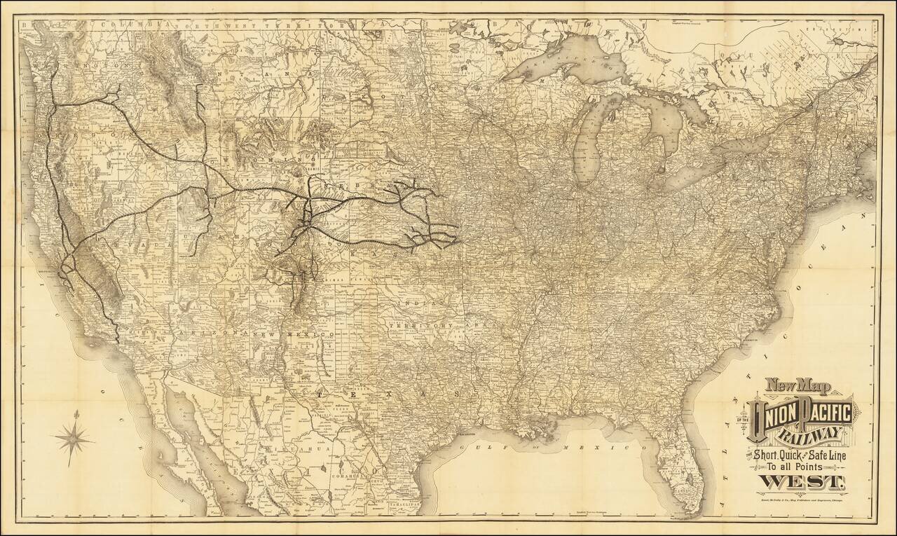
Unrecorded Edition of Map Issued For The Exclusive Use of the Union Pacific Railroad Company
Rare case map of the United States, tracking the growth of the Union Pacific Railroad across America.
The map shows the whole of the United States illustrating routes of the Union Pacific and its many subsidiaries and connecting routes of competing railroads.
The map reflects the Union Pacific's attempt to reach the booming regions of the west, with lines extending to:
This is the second state of the map, which shows the connection between Portland and Seattle not present in the earlier state.
Both states are extremely rare, but the present example, with no color and no vignettes, seems to be a unique survival.
The Newberry Library example (with vignettes) notes that it was "Issued For The Exclusive Use of the Union Pacific Railroad Company."
If you are a student, write to us in telegram: @antiquemaps and indicate what material you need and for what work you need a map in high detail. We are ready to provide material on special terms. For students only!

![[Signed Political Satire Artwork] Vietnam ... Vietnam ... Vietnam ...](/map/small/68726.jpg)
