

Exceptional Full Hand-Colored Example. Beautifully hand-colored four-sheet map centered on America and showing the various trade and exploration routes in the Pacific and Atlantic. Chatelain's "very curious map" is one of the most spectacular...

One of the Most Detailed and Important Map of the Americas made by a Scandalous Geographer This is a nice example of the 1775 edition of this important six sheet chart of North and South America, originally compiled by John Green (a.k.a. Bradock...

The First Printed Map of the Pacific Ocean Old color example of Ortelius' Maris Pacifici . . . , the first printed map of the Pacific Ocean. Ortelius's Maris Pacifici map was first issued in 1590. The map is based upon Mercator's world map of 1569,...
![[English Edition!] Maris Pacifici quod vulgo Mar del Zud](/map/small/71000.jpg)
Rare English Edition of The First Map of the Pacific Ocean from the First Modern Atlas Fine example of the English Edition of Ortelius' “Maris Pacifici”, the first stand-alone map of the Pacific ever printed. It was featured in Theatrum Orbis...

Fine example of Pierre Mortier's map of the Pacific, which appeared in later editions of the famous Neptune Francois This fine map of the Pacific was drawn from previously unpublished manuscript maps collected by the Portuguese crown and secreted away...
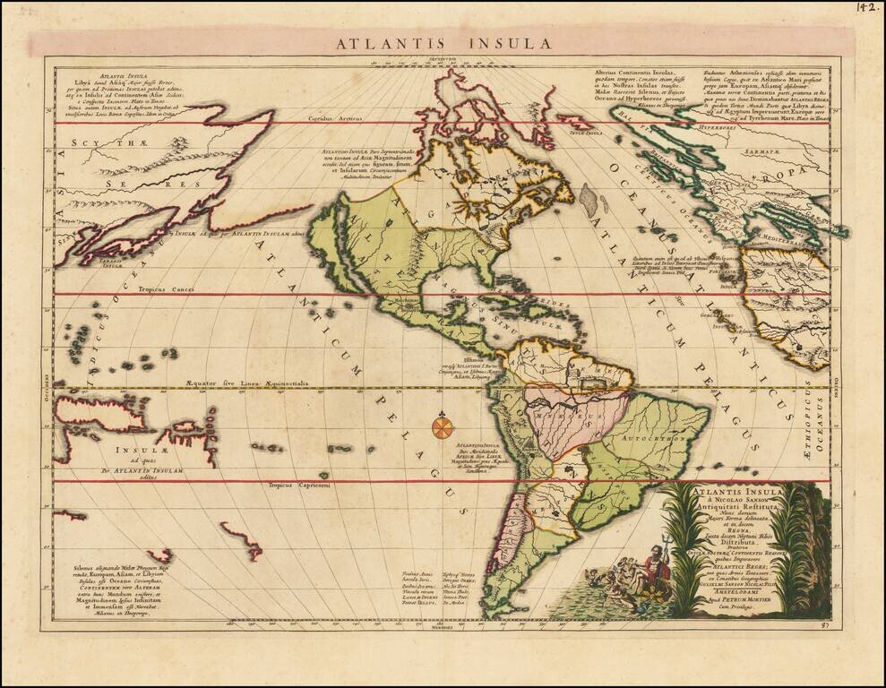
Fascinating map of America, published by Mortier and based upon a map by Nicolas Sanson, purporting to show the Western Hemisphere about 200,000 years ago before the earliest human civilizations. The map reflects the populating of the lost continent...
![Pascaart vertoonende de zeecusten van Chili, Peru, Hispania Nova, Nova Granada, en California…. [Early New Zealand Inset]](/map/small/65168.jpg)
Fine Golden Age Dutch Chart with the Island of California and an Early Mapping of New Zealand Scarce early sea chart by Doncker, showing the West Coast of the Pacific Ocean, which extends from the island of California to Chile, with noteworthy insets...
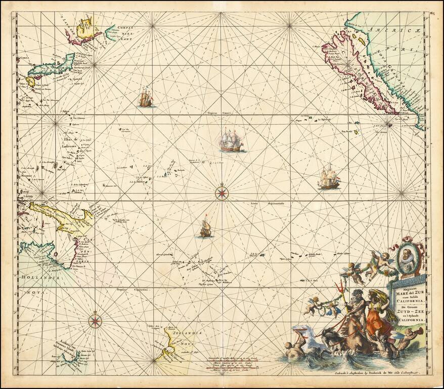
Fine old colored example of first state of De Wit's map of the Pacific Ocean, featuring California as an Island and important early projections of Australia and New Zealand. The finely engraved sea chart was first published in De Wit's Orbis Maritimus...
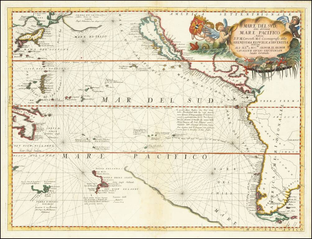
Striking Coronelli Map of the South Seas Showing the Latest Dutch Discoveries Nice example of Coronelli's map of the Pacific Ocean, published in Venice. The map depicts the west-coast of America south to Tierra del Fuego. To the east, it shows...
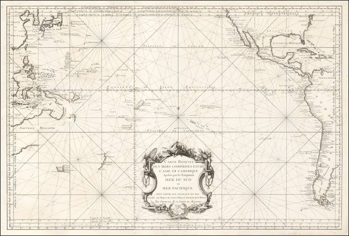
French Chart of the Pacific Ocean on the Eve of the Great Voyages of Discoveries Fascinating sea chart, depicting the Pacific Ocean immediately before the wave of exploration that occurred from the 1760s to the 1790s. This fine chart, issued by the...
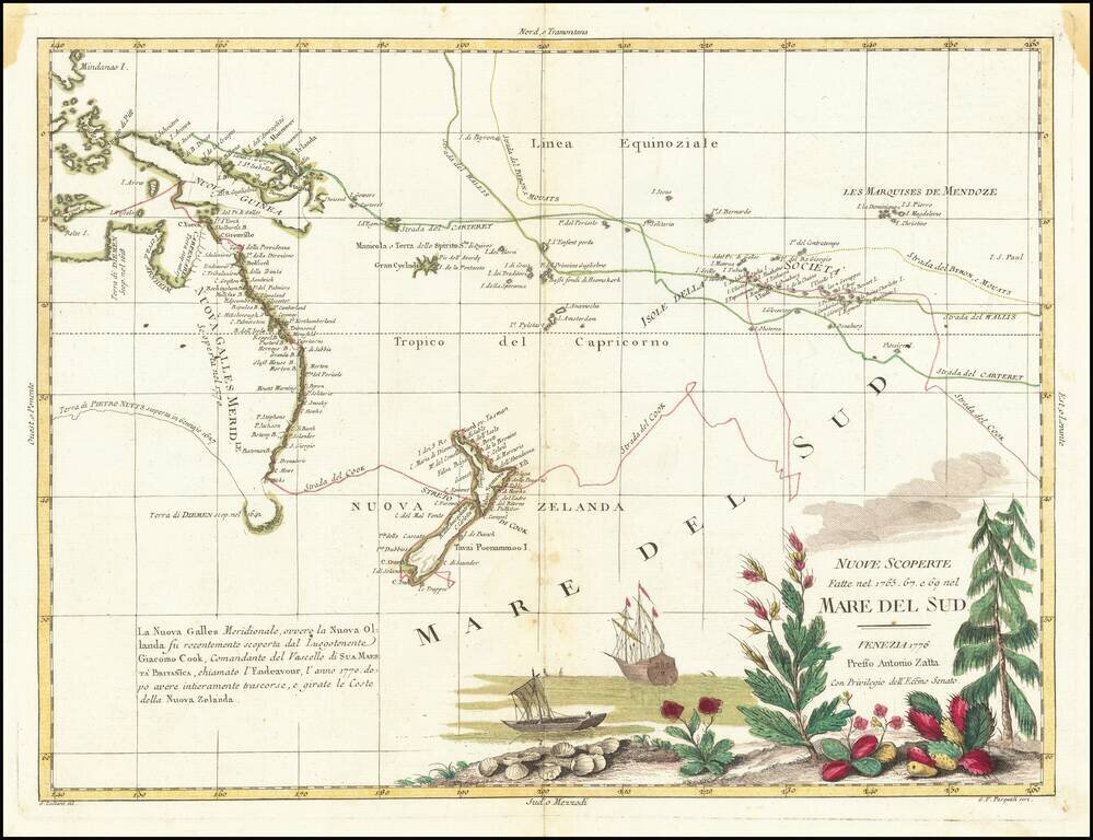
Cook's First Tracks In The South Pacific First edition of the first decorative map to show Cook's tracks in the Pacific, one of the most sought after early maps to depict Cook's Voyage to New Zealand, Australia and the South Pacific. The map records...
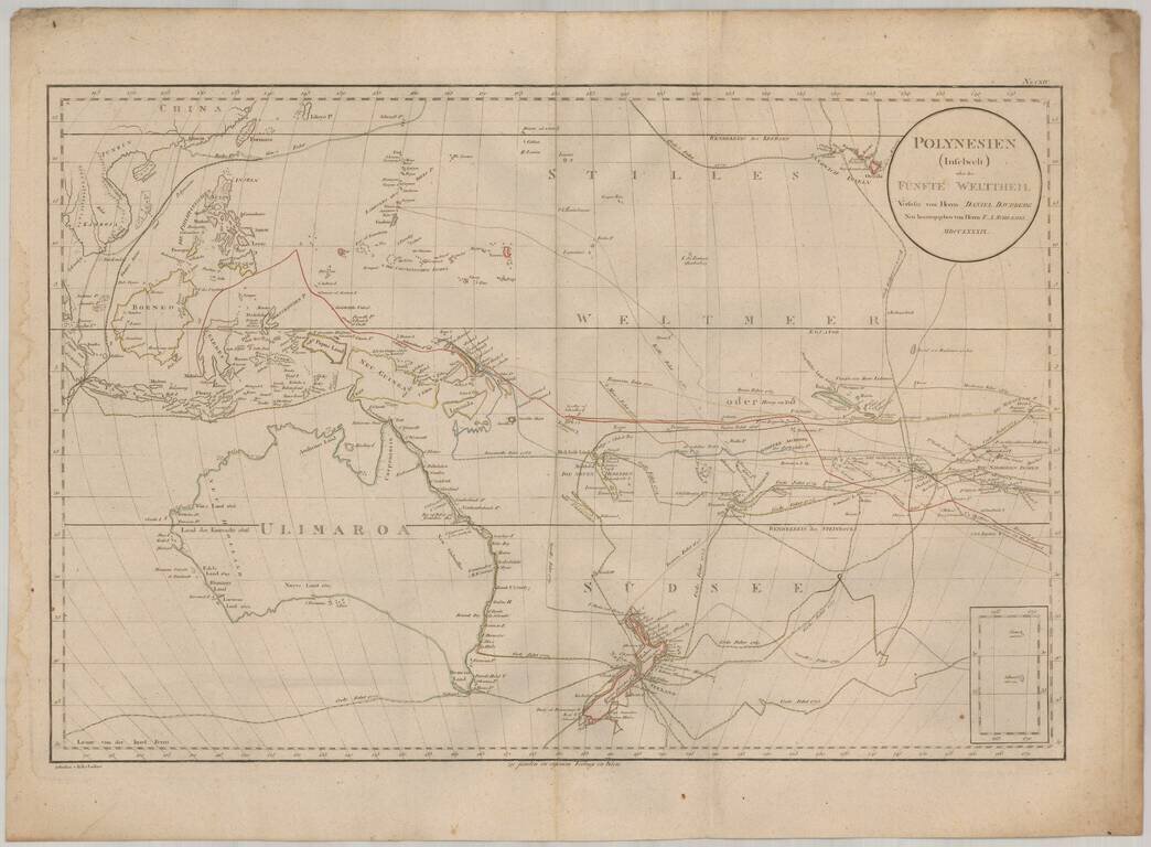
Rare map of the South Pacific, from Australia (Ulimaroa) to Hawaii. The map is one of the only maps to refer to Australia by its native name (Ulimaroa) and is also noteworthy for its fine treatment of New Zealand and extensive depiction of the routes...
Scarce chart of the Western Pacific Ocean, published by Mortier, Covens & Fils. The map is based on Johann Matthias Christoph Reinecke's 1801 map of the region, which was the first German map to depict Tasmania as a separate island. The Mortier...
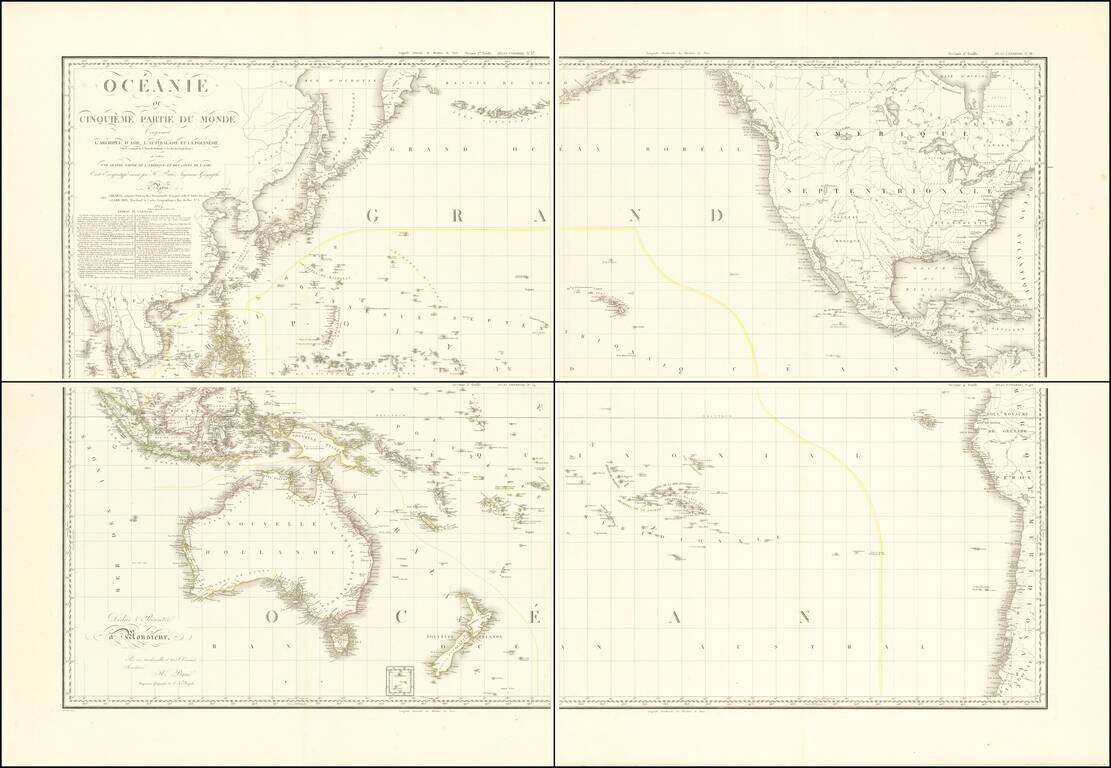
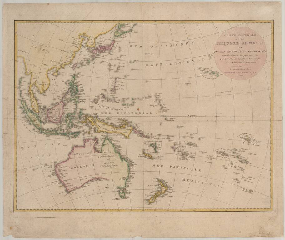
Stunning, Large-Format Map of the Pacific, the Origin of the Toponym Oceania Fine example of A.H. Brué's four-sheet map of the Pacific Ocean, first published in Paris in 1814 and here updated to 1817. The title in the upper left corner indicates...
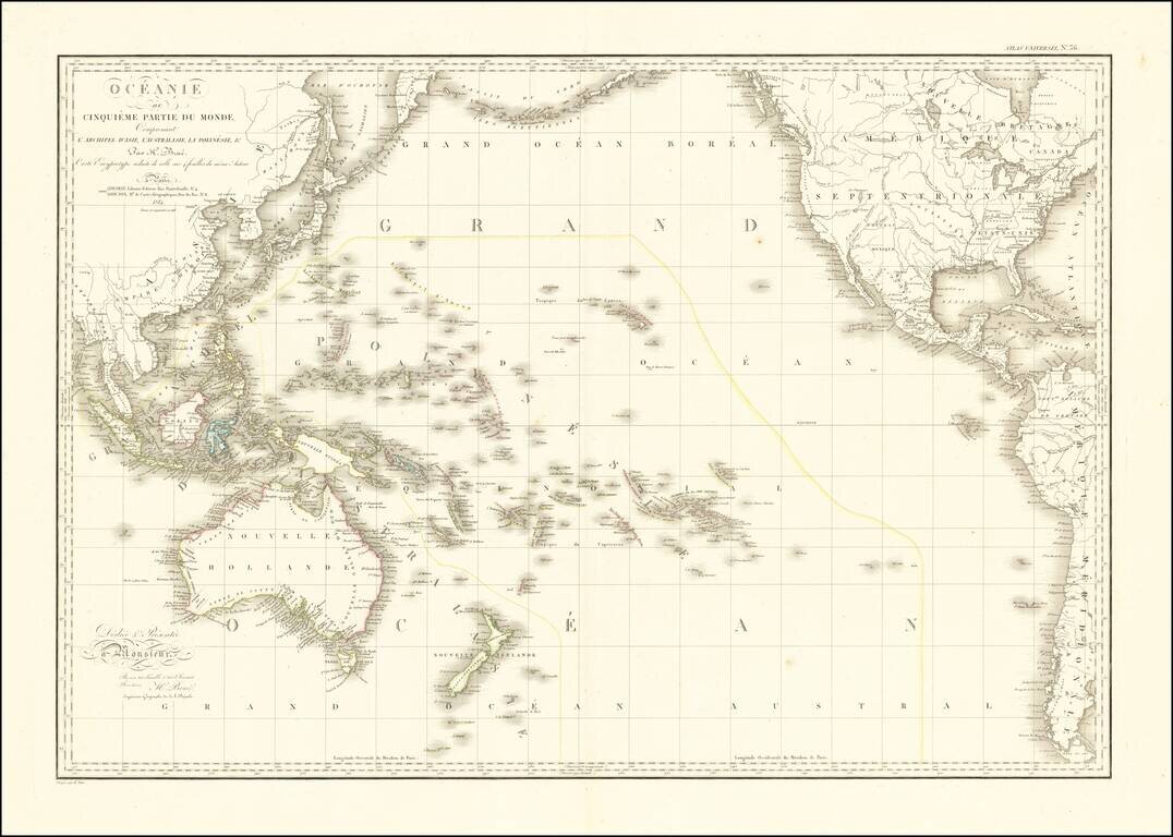
Striking Map of the Pacific, the Origin of the Toponym Oceania Fine example of A.H. Brué's distinctive map of the Pacific Ocean, first published in Paris in 1814 and here updated to 1816. The title in the upper left corner indicates that this map...
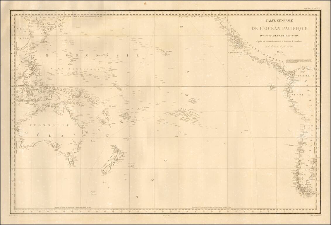
Fine separately published example of Dumont D'Urville's fine map of the Pacific, based upon his explorations. The map details the regions explored by the Astrolabe, under Dumont D'Urville's command. Rear Admiral Jules Sébastien César Dumont...