logo

1874. Asher & Adams' Geological Map United States and its Territories

  • Asher & Adams' Geological Map United States and its Territories

Asher & Adams' Geological Map United States and its Territories information:

Year of creation: 
Resolution size (pixels): 
 2440x1712 px
Disk Size: 
 1.10965MiB
Number of pages: 
 1
Place: 
 New York
Author: 

Print information. Print size (Width x height in inches):
Printing at 72 dpi 
  33.89 х 23.78
Printing at 150 dpi 
 16.27 х 11.41
Printing at 300 dpi 
 8.13 х 5.71

An example of detailing the file of this map of in a printable high-resolution:

Click to open in high resolution (open in new tab).
Attention! this is just the central piece (central area 960x960 px) of the map file!
This is an example, so that you can see and study the level of detail of a given map. The entire Map will be fully available after payment!

Asher & Adams' Geological Map United States and its Territories

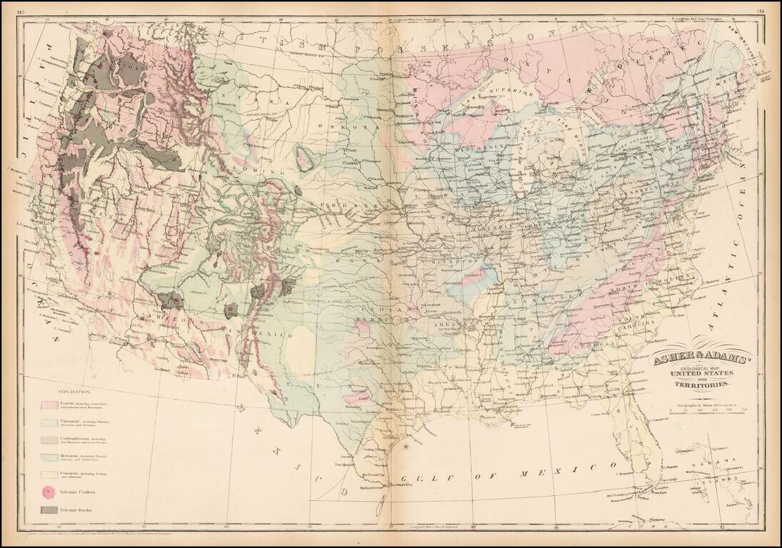
Striking geological map of the United States exhibiting geological regions including Eozoic, Paleozoic, Carboniferous, Mesozoic, Cenozoic, and volcanic regions.

Asher & Adams was a New York publishing firm known for their atlases. Notably, their maps were some of the first to prominently exhibit railroad lines, even if this meant a slight reduction in topographical detail. They specialized especially in state and county maps of the United States.


Special conditions for students!

If you are a student, write to us in telegram: @antiquemaps and indicate what material you need and for what work you need a map in high detail. We are ready to provide material on special terms. For students only!

Item information:

Year of creation:
Size:
2440x1712 px
Disk:
1.10965MiB
Number of pages:
1
Place:
New York
Author:
Asher. Adams.
$9.99

Related item