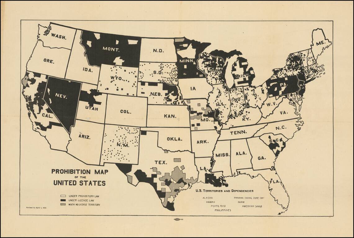
Pre-prohibition map of the United States, illustrating the various local laws that controlled the consumption and sale of liquor in the US. The map illustrates interesting geographical (and underlying cultural) variables in the implementation of...
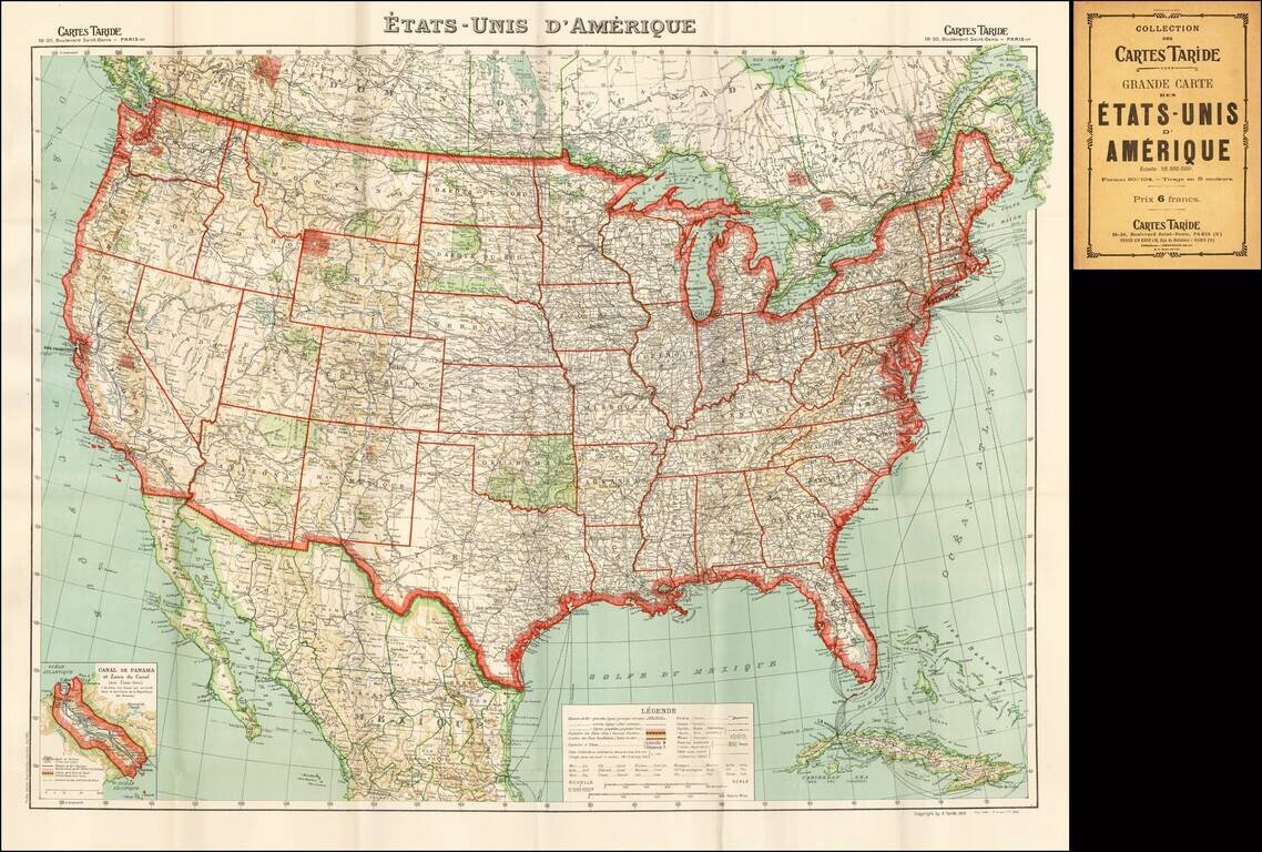
Fine detailed map of the United States, published in Paris by Taride.
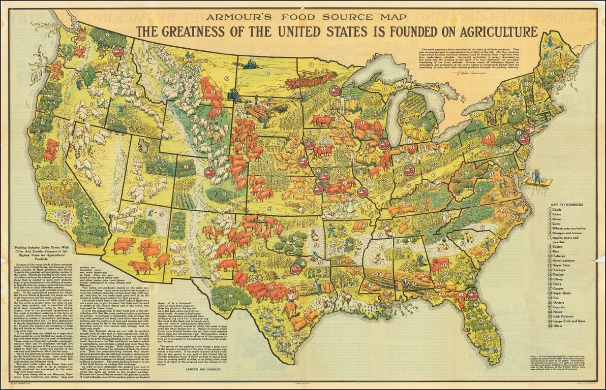
Scarce promotional map published by Armour & Company, displaying and illustrating the agricultural regions of the United States. Includes a marvelous quote from L. Ogden Armour describing the importance of livestock in American Agricultural...
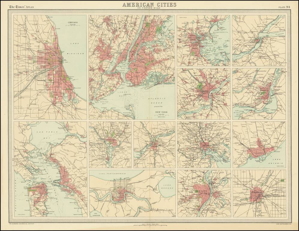
Nice group of city plans of American cities on a single sheet.
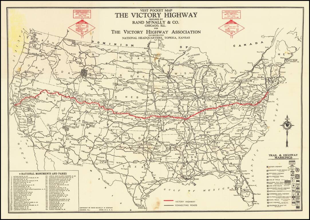
An Early Transcontinental Highway Nice example of this scarce map of the United States published by The Victory Highway Association, with its National Headquarters in Topeka Kansas. The Victory Highway is highlighted in red, differentiating it from...

This is an attractive pictorial map of the United States published by the Ford Motor Company as an advertisement for air routes that were supplied in part by their Ford Trimotor aircraft. The map is fascinating, showing domestic and international air...
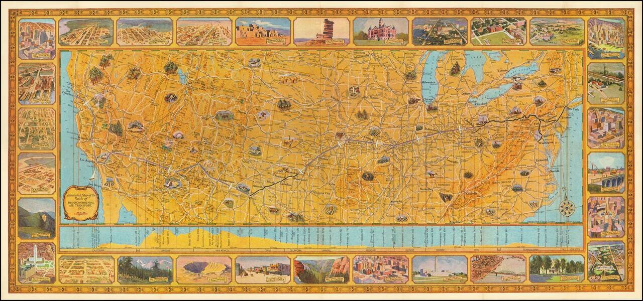
Rare Early Flight Planning Map Finely executed pictorial map of the United States showing the route of Transcontinental Air Transport, embellished by 30 decorative vignettes showing major American cities and points of interest. On the verso is flight...
![[Polish Towns in the United States] Ks. Fr. Bolek Osiedla Zalozone Przez Polakow W. Stanach Zjednoczonych / The Towns and Villages Settled By Poles in the United States](/map/small/63071.jpg)
Interesting map of the United States, drawn by Polish historian Franciszek Bolek and published by the Polski Prezglad Kartograficzny (Polish Cartographic Review) in 1930. Franciszek Bolek (also known as Francis Bolek ) was a Polish historian,...
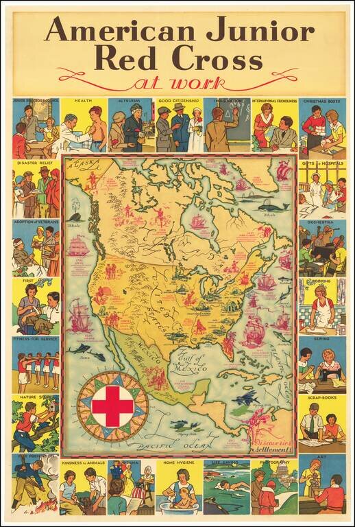
Attractive vintage pictorial map of North America, published by the American Junior Red Cross and with art by H.M. Leslie Rundle. The central map of North America shows early European Settlements (in blue) and Discoveries (in pink) including "Norsemen...

Striking large pictorial map of the United States, produced for the Chicago World's Fair of 1933. The map was executed by Louis Delton Fancher, a well regarded graphic artist for the Great Atlantic & Pacific Tea Company (A & P), as a...
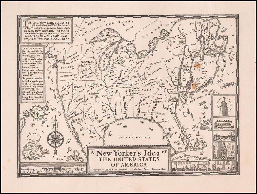
Scarce variant edition of Wallingford's iconic New Yorker's Idea Map. Clever pictorial map of the United States, whimsically depicting a massive New York and Brooklyn area, with a highly distorted and intentionally inaccurate representation of the...
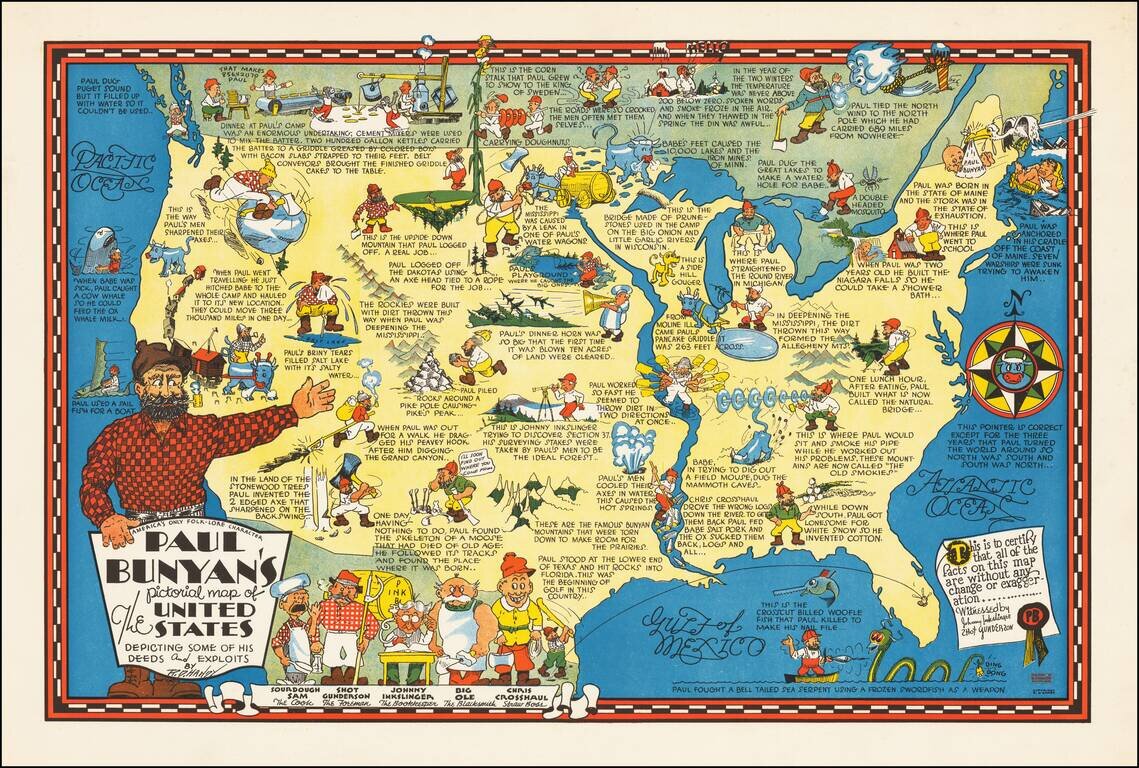
Rare pictorial map of the United States, celebrating the legend of Paul Bunyan. As noted by David Rumsey: Humorous pictorial map by R. D. Handy showing the adventures [of Paul Bunyan] across the United States, with illustrations and descriptive...
![[Come To Dallas] Easy To Reach -- Hard To Leave](/map/small/63387.jpg)
Pictorial map of the United States, focusing on Dallas as the center of the country. The map shows distances from Dallas to many other major cities in the United States. The map was published as part of the centennial of the Republic of Texas...
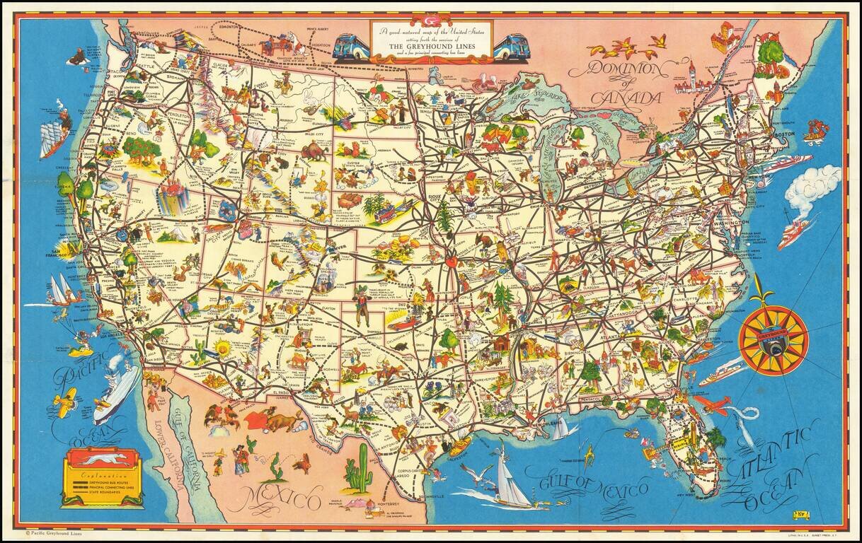
A fine example of this decorative pictorial map of the United States, promoting Greyhound bus lines. The caricatures of the various regions run from charming to very politically incorrect and provide a marvelous look at American's ethnic and regional...
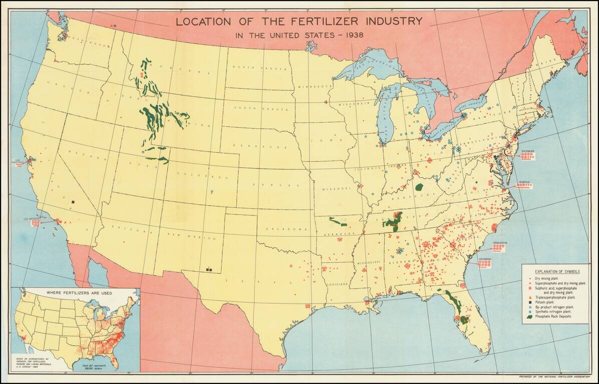
Mapping America's Fertilizer Production and Use During World War II Large map of the United States, illustrating the places and means of production of Fertilizer in the United States. The key locates 8 different important locations of different types...
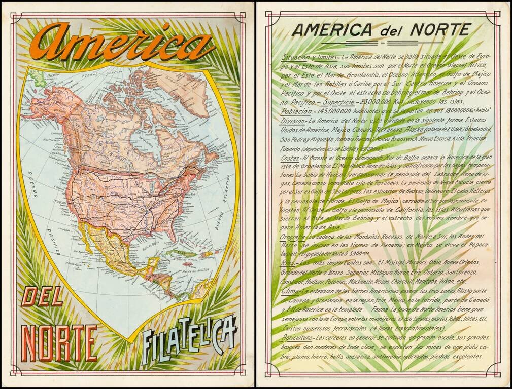
Award winning pair of manuscript cards, prepared by Antonio Raggio for the 11th Congreso de la Union Postal Universal (World Postal Congress) Exposition Filatelica Internacional, held in Buenos Aires, Argentina, in 1939. The map shows a finely...