

This is a fabulous town plan of Rome, including a description and location of many of the important features of the city. This map was accompanied by a Plan of Ancient Rome, which showed the city stripped of much of the development seen here. The map...

Old color map of the Roman Empire from Abraham Ortelius' Theatrum Orbis Terrarum, the first modern atlas of the world. Several decorative cartouches, 2 portraits, sailing ship and a historical tree showing details.

First Edition of Speed's Map of the Roman Empire Striking example of Speed's map of the Roman Empire. The map focuses on the Mediterranean and the regions dominated by Rome at the height of its empire. Includes views of Rome, Venice, Genua,...
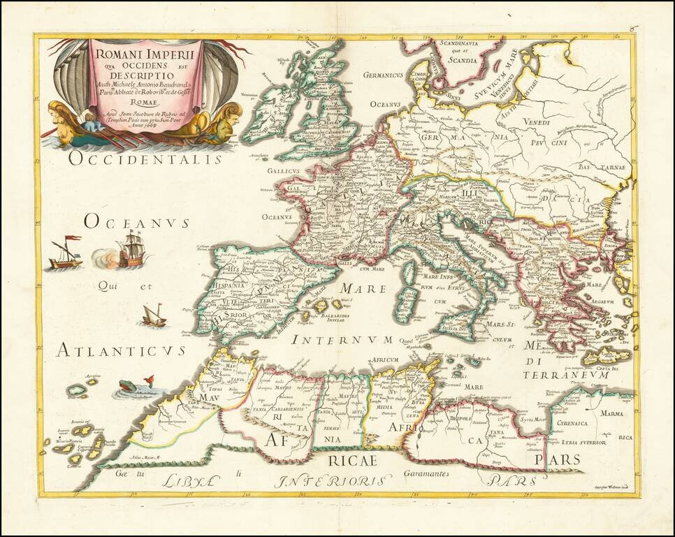
Rare map of the Roman Empire and contiguous regions. This map was originally designed by Michel Antoine Baudrand (1633-1700), a French Historian and Geographer, who served as secretary to Cardinal Francesco Barberini (then Dean of the College of...
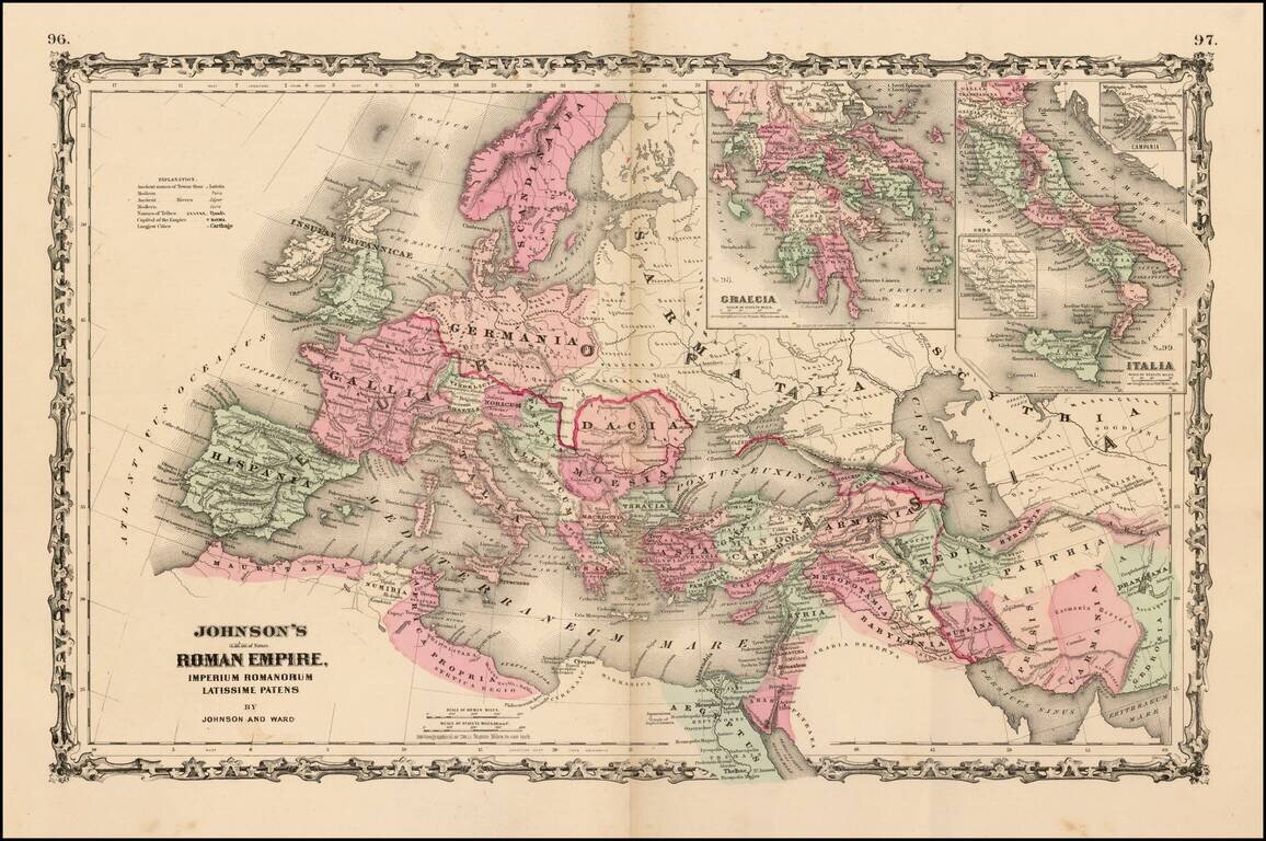
Large format map of the Roman Empire with insets of Roman Greece and Roman Italy. Includes ancient place names, rivers, mountains, etc. Decorative borders. A marvelous historian's map.
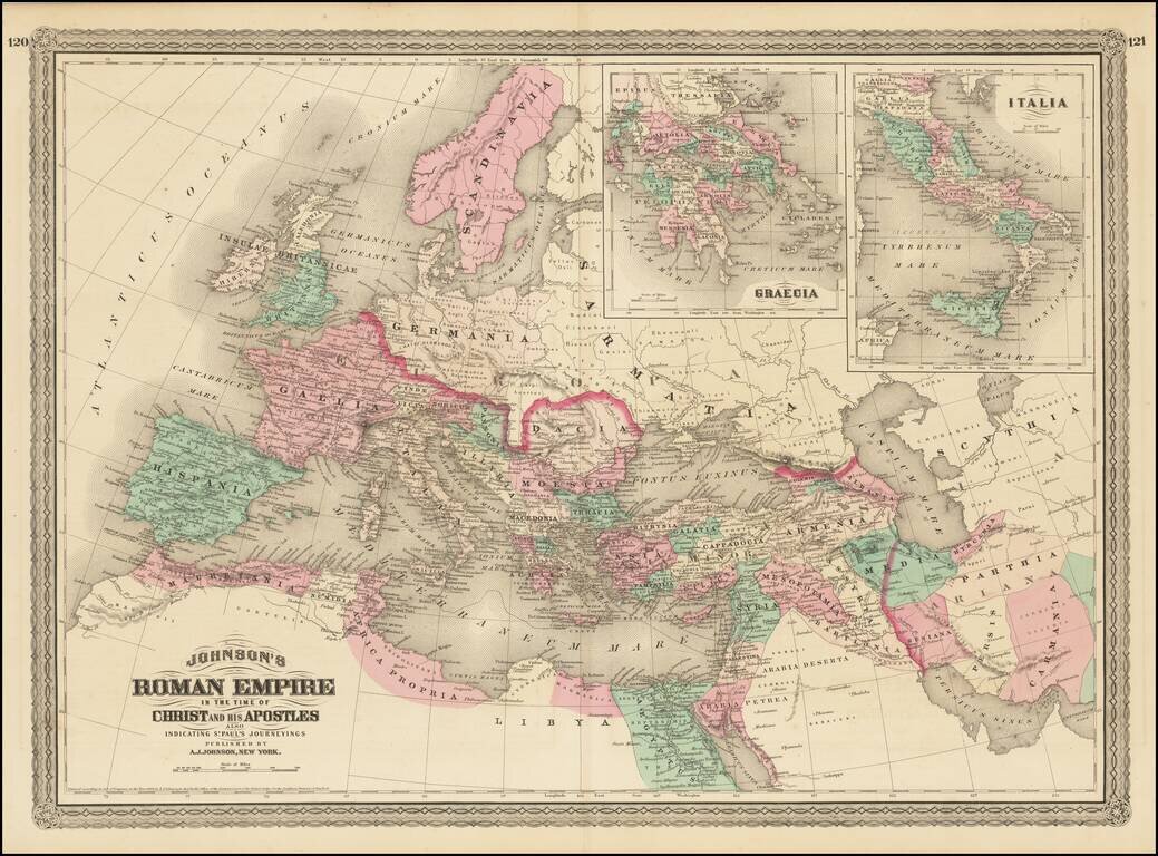
Large format map of the Roman Empire with insets of Roman Greece and Roman Italy. Includes ancient place names, rivers, mountains, etc. Decorative borders. A marvelous historian's map.

Decorative example of this fine map of Northern Italy and contiguous regions, extending from Venice on the Adriatic, to Pisa and Nice on the Mediterranean, to Lake Geneva in the west, and the Alps in the North, from Ortelius' Theatrum Orbis Terrarum,...

Striking regional map, centered on Lake Geneva, based upon a map from Abraham Ortelius's Epitome. The map is oriented with East at the top and extends to Basel and Strasbourg in the North, Turin and Grenoble in the south, and Dijon and Lyon in the...

An exceptional old color example of this scarce map of the Savoye region, topped by Lake Geneva. The color in this example is truly extraordinary. The map is adorned with a title cartouche decorated with a globe crowned with fleurs de lys and two...
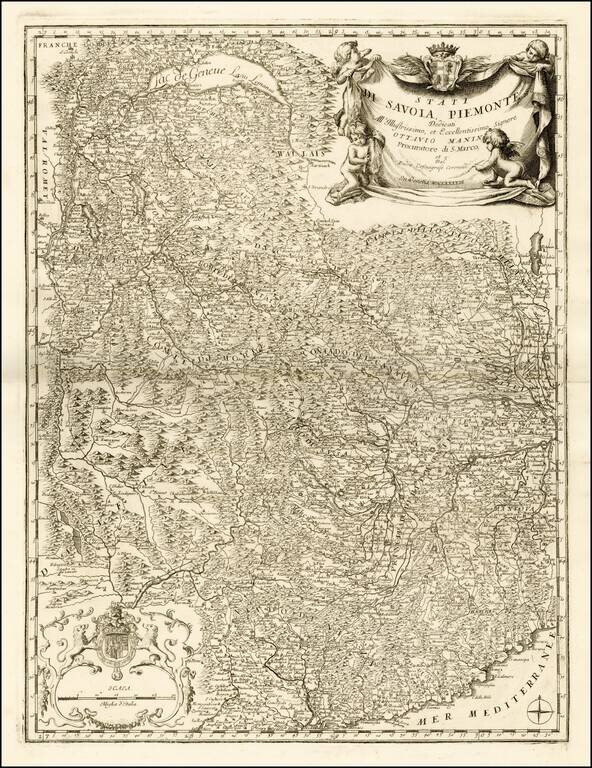
Fine example this striking map of Piemonte and Savoye, from Vincenzo Maria Coronelli's Corso Geographico, published in Venice. The map provides a fantastic image of the topography of the region, naming mountains, rivers, lakes, towns, castles, etc....
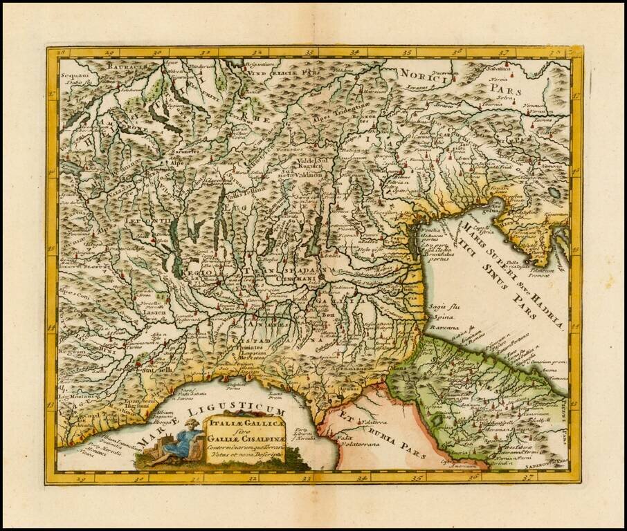
Striking and decorative map of Northern Italy and the Alps, embellished by a decorative cartouche.
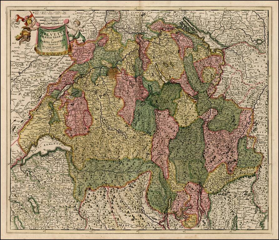
Decorative map of Switzerland, the Lake Geneva area and the areas around Lago Magiore, Lugano and Lago di Como and Bergamo. Includes a decorative title cartouche.
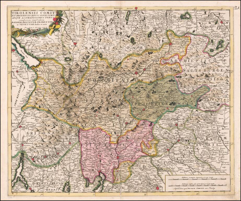
Fine old color example of the Tirolia region, published by Peter Schenk in Amsterdam.
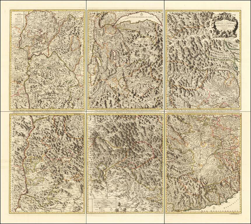
Rare 6-sheet map of the Savoy and Piemonte region, published by Pierre Mortier in Amsterdam. The map provide a highly detailed treatment of the topography of the region. Lake Geneva at the top center, with Monaco and the Italian Riviera at the bottom...
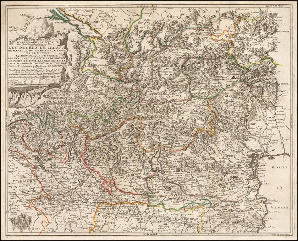
Detailed map of the Theater of War in Northern Italy, published in 1702 by Nicolas De Fer. The map extends from Locarno and Lake Constance to the Gulf of Venice and Saltzurg.
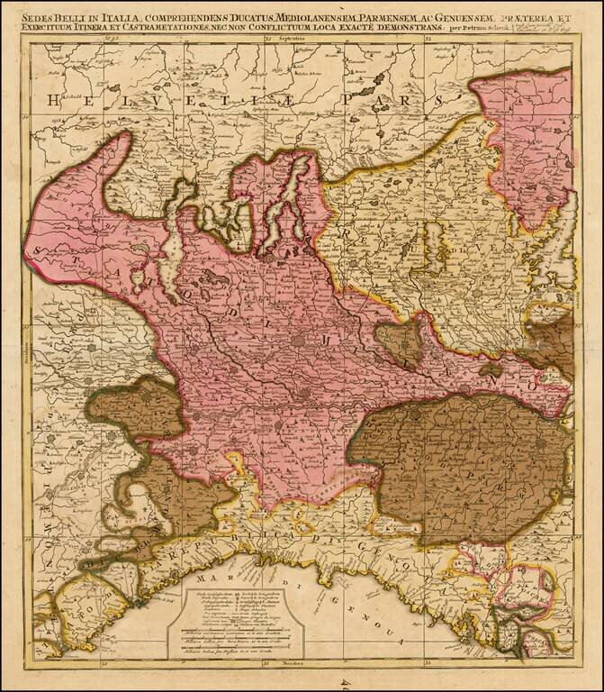
Detailed map of Northern Italy and contiguous parts of Switzerland.