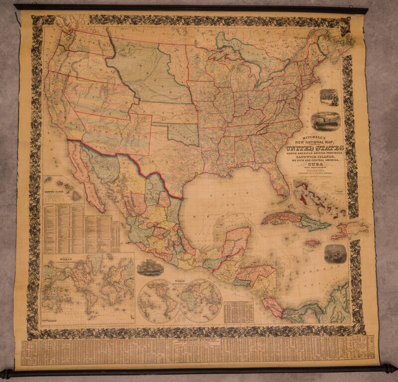
Fine Example of Mitchell's National Map of the United States Fine wall map of the United States, illustrating the transitional western Territorial and State borders, published by S A Mitchell in 1858. First published in 1856, Mitchell's remarkable...
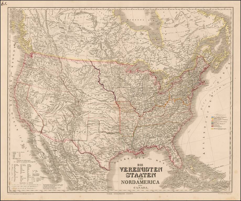
Scarce map of the United States, published in Berlin by Heinrich Kiepert. Perhaps the most noteworthy features is the alternative name given for Great Salt Lake City, "New Jerusalem oder Mormonen" (New Jerusalem of the Mormons). The map shows...
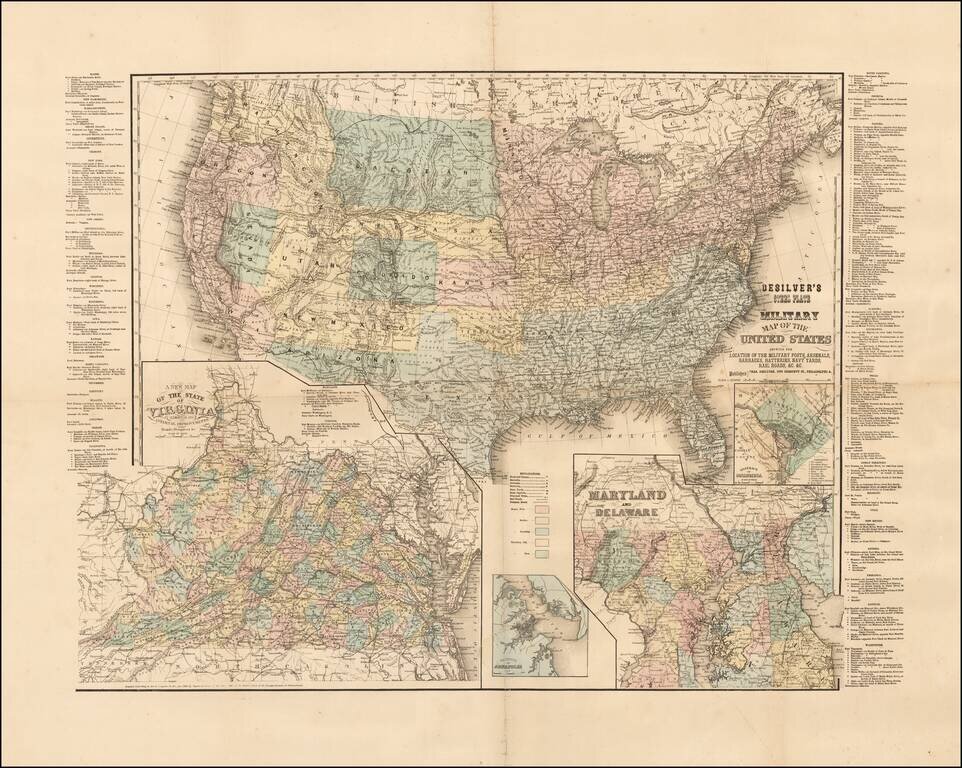
Rare Civil War era map of the United States, published in Philadelphia by Charles Desilver. The map includes inset maps of Washington D.C., Virginia, Maryland and Delaware, and the Vicinity of Annapolis. Includes a list of all the Military Forts and...
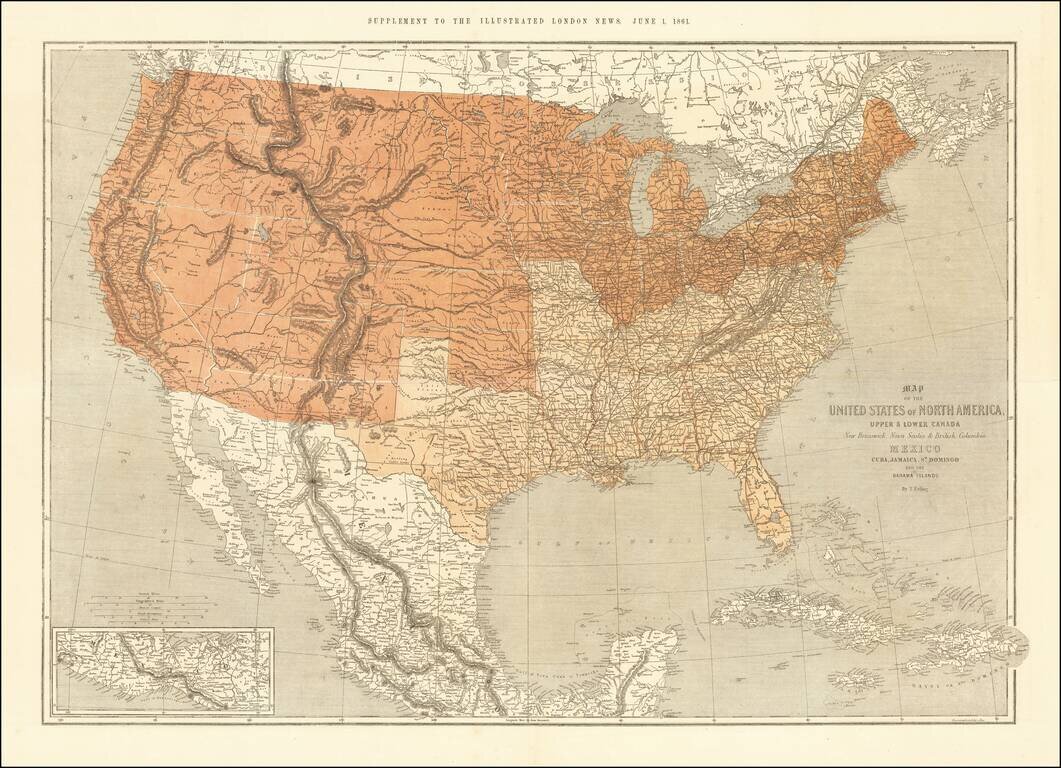
This is a scarce map of the United States, issued as a supplement to the Illustrated London News in 1861. The map is well detailed and shows the US split according to slave and free states. The map was clearly prepared in anticipation of the Civil War,...
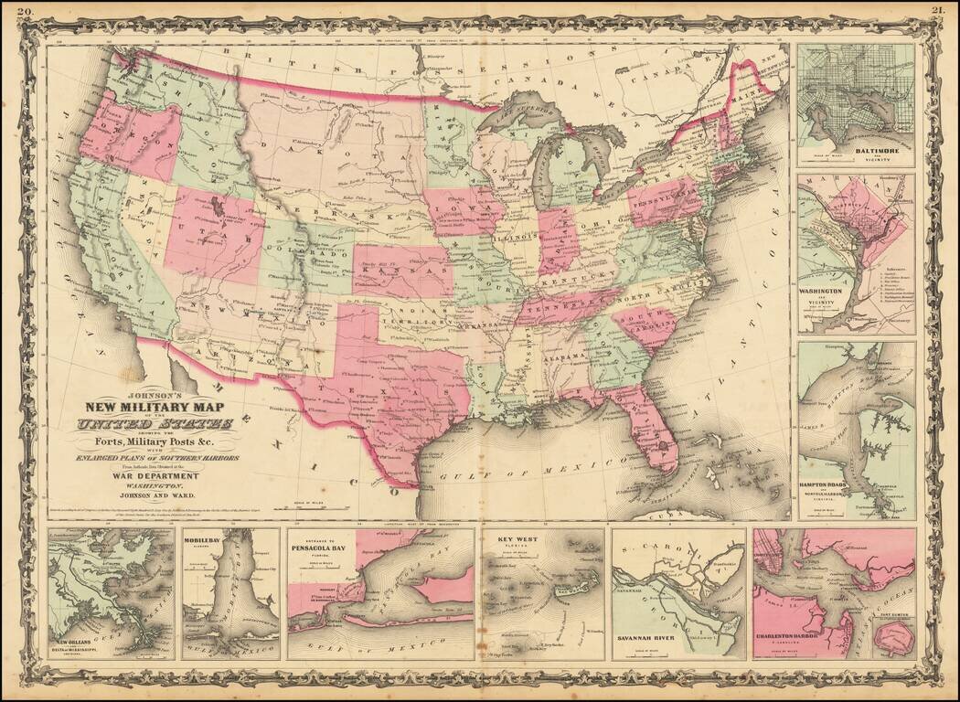
Nice example of Johnson's Military map, , with 9 insets of Baltimore, Washington DC, Hampton Roads, Charleston, Savannah River, Key West, Pensacola, Mobile Bay and New Orleans. Includes a massive Dakota Territory includes all of Montana and Wyoming....
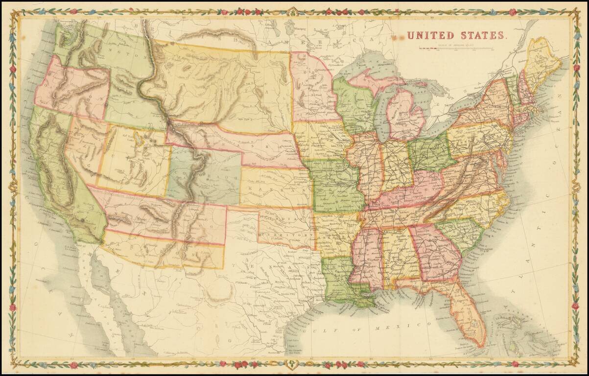
Scarce map of the United States, drawn in the style of John Rapkin. The Missouri Compromise Line of 1820 is referenced along the northern New Mexico territorial border. Washington Territory is depicted in the short-lived inverted 'L' configuration,...
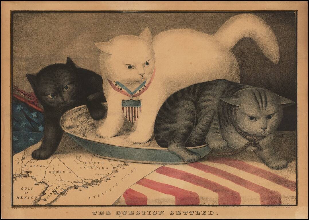
Rare Allegorical Civil War Broadside Fascinating allegorical broadside, showing 3 cats in a milk saucer, superimposed over a map of the South. The center white cat, Old Abe, is a reference to Abraham Lincoln. To the right, the gray cat represents...
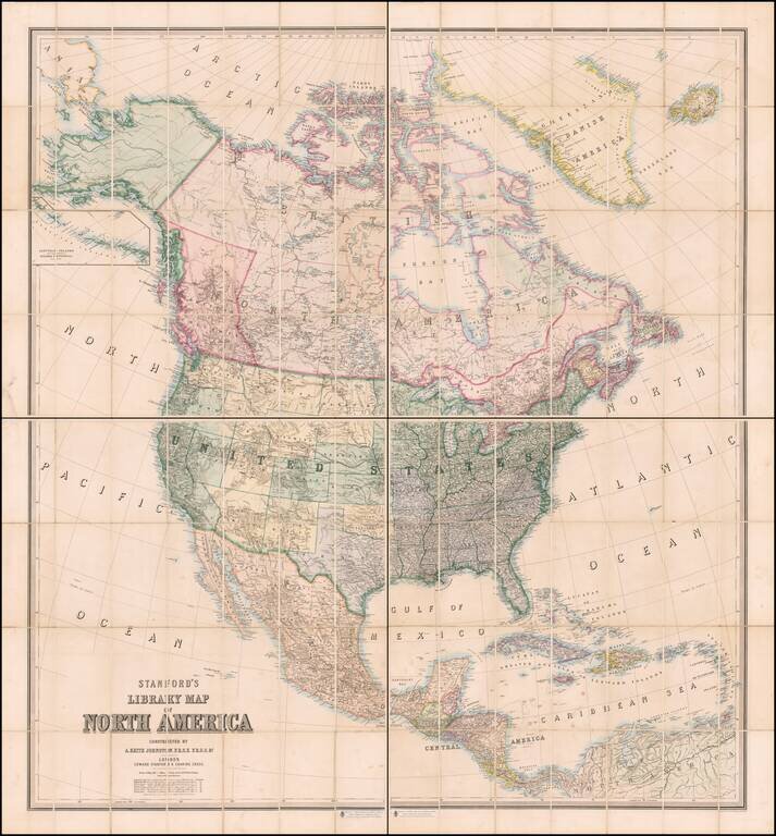
Colored To Show The Slave & Confederate States and Territories Fine 4-sheet map of North America, published in London by Edward Stanford. One of the best large format maps of North America published in London during the Civil War. The map is...
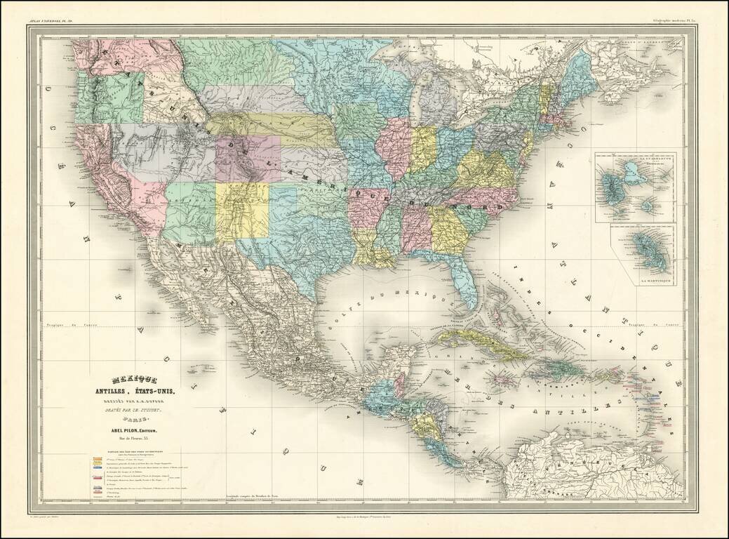
A Fascinating French convolute of Shoshone, Idaho & Montana Territories. Finely colored large format map of the United States, depicting the evolution of the Western Territories, as they were created in the 1860s. Includes marvelous ephemeral...
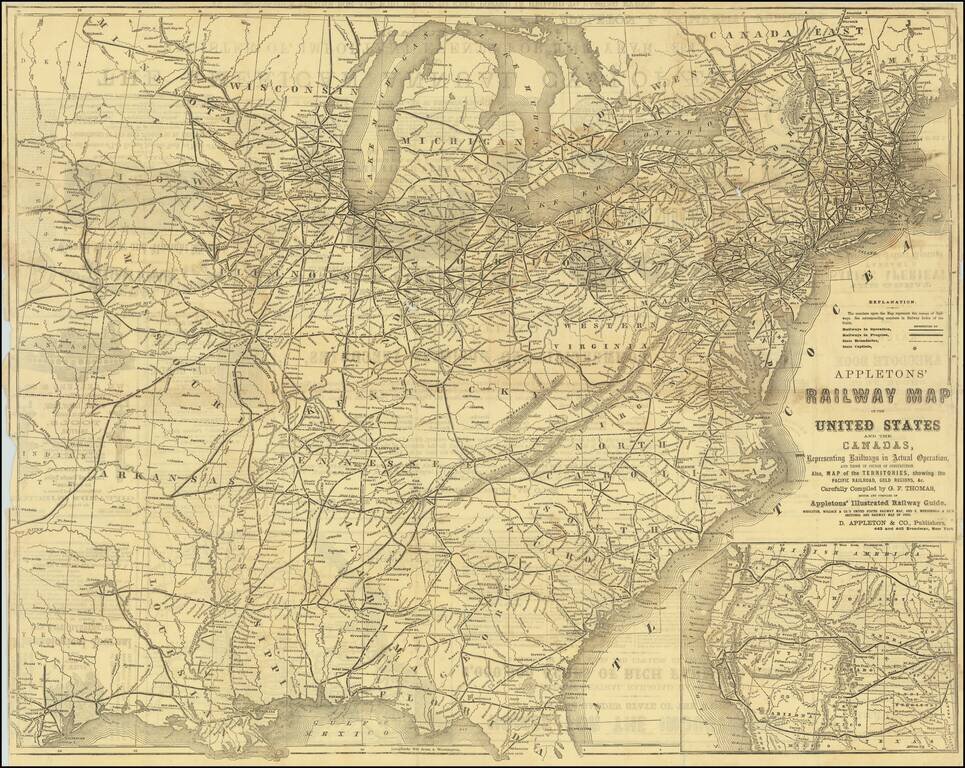
Detailed railroad map of the United States, with an large inset of the Western States. Shows all railways in operation and in progress, as well as stations, etc. The verso includes extensive advertising.
![The United States of America [Wyoming attached to Dakota]](/map/small/53757.jpg)
Rare edition of Colton's map of the United States. The most notable feature is that the map pre-dates the formation of Wyoming, with the area which would become Wyoming attached to Dakota, but unnamed. Includes a curious truncated Nevada, oversized...
An Early Appearance of Wyoming Territory Rare intermediate state of Mitchell's map of the United States, the first map to include the territory of Wyoming, 3 years before it's official creation, based upon a failed 1865 congressional act. The map...
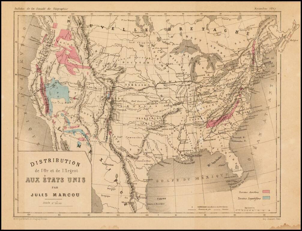
Scarce map of the United States, showing the distribution of Gold (red) and Silver (blue) in the United States. The map appeared in the November 1867 edition of the Bulletin de la Societe de Geographie, published in Paris. Jules Marcou was perhaps...
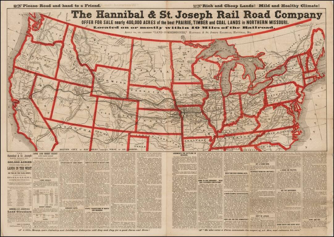
Advertising broadsheet map published by the Hannibal & St. Joseph Railroad, promoting land in Northern Missouri. The map notes the Railroad offering more than 400,000 acres of land for sale along the Hannibal & St. Joseph Railroad in...
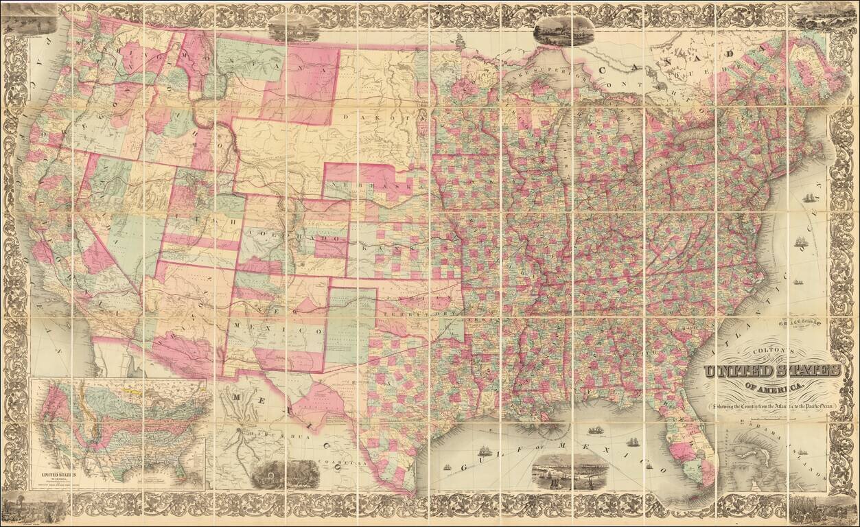
Scarce map of the whole United States following the Civil War, published by G.W. & C.B. Colton. The map includes eight vignette scenes around or within the decorative floral border, and a large inset map at lower left, "United States of America...
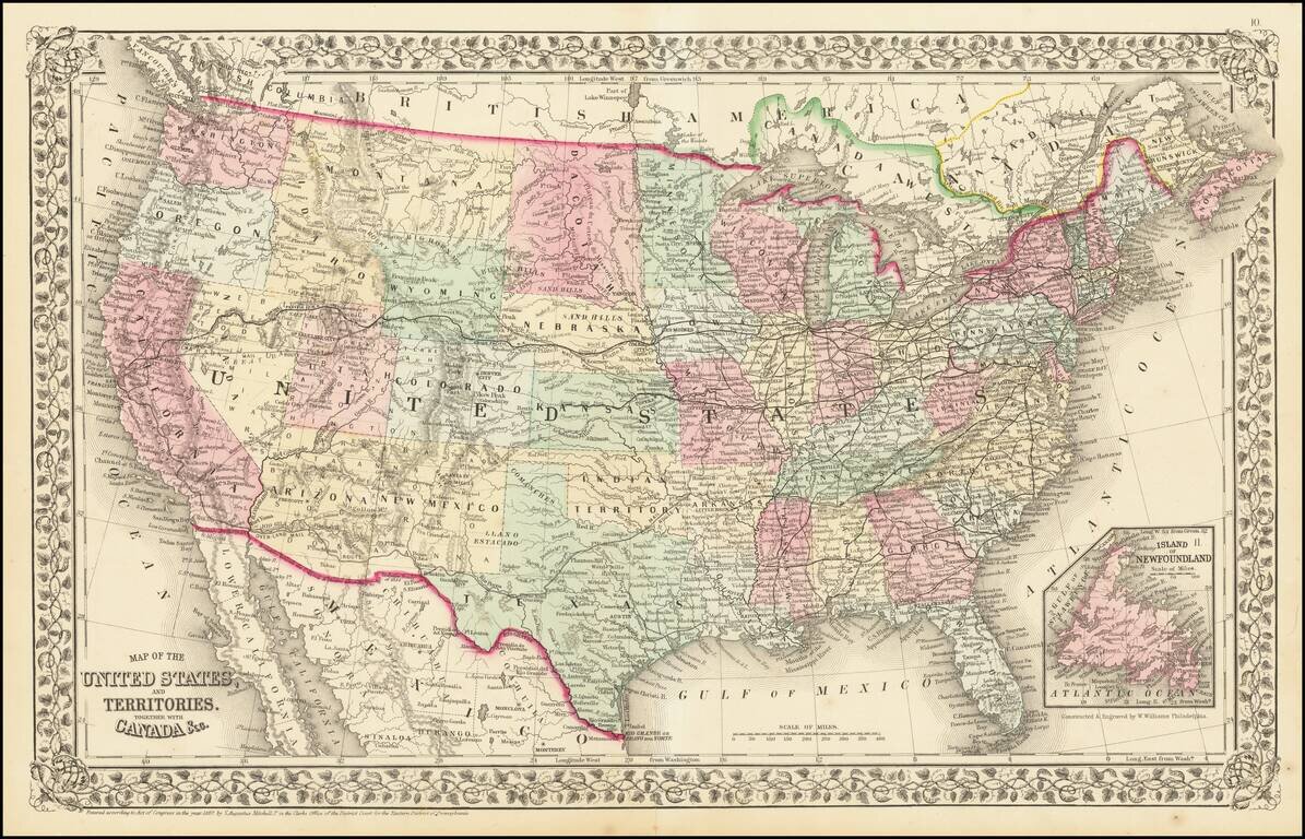
1867 edition of Mitchell's atlas map of the United States. The western Territories are now largely formed, with this being an early appearance of Wyoming Territory.