

"A scientific and artistic document of the first order" -- One of the most important sea charts of the 17th century. Exceptionally rare Johannes Loots issue of Guillaume Blaeu's landmark sea chart of the Atlantic Ocean, America and Africa, printed on...

Rare map of the Kingdom of Prester John, which appeared in Picart's Tresor des carte Geographiques, published in Paris. Picart's map is based upon Jansson's map, published in his Atlas Minor in 1628. The first French version of the map was published...
![The West Part of Barbary... [on sheet with:] The East Part of Barbary...](/map/small/52496.jpg)
A nice example of Herman Moll's 1729 miniature engraved map of North Africa in two images on the same sheet, from his Atlas minor. Hand-colored by kingdom. Includes an inset of the harbor of Oran.
![[Facsimile - 15th Century Portolan Sea Chart] Portolan des Iehuda ben Zara](/map/small/64285.jpg)
Impressive modern facsimile of the Iehuda Ben Zara portolan of the Mediterranean from 1497. The beautiful chart extends from the British Isles in the northwest to the Red Sea in the southeast and depicts all of the Mediterranean with the exception of...
![[Arabian Peninsula, Red Sea, Nile River and Gulf of Aden] L'Afrique . . . 1740](/map/small/59382.jpg)
Title cartouche section of the Le Rouge wall map of Africa, published in Paris in 1740. The map includes a decorative cartouche showing Europeans trading gold and slaves with local African leaders.
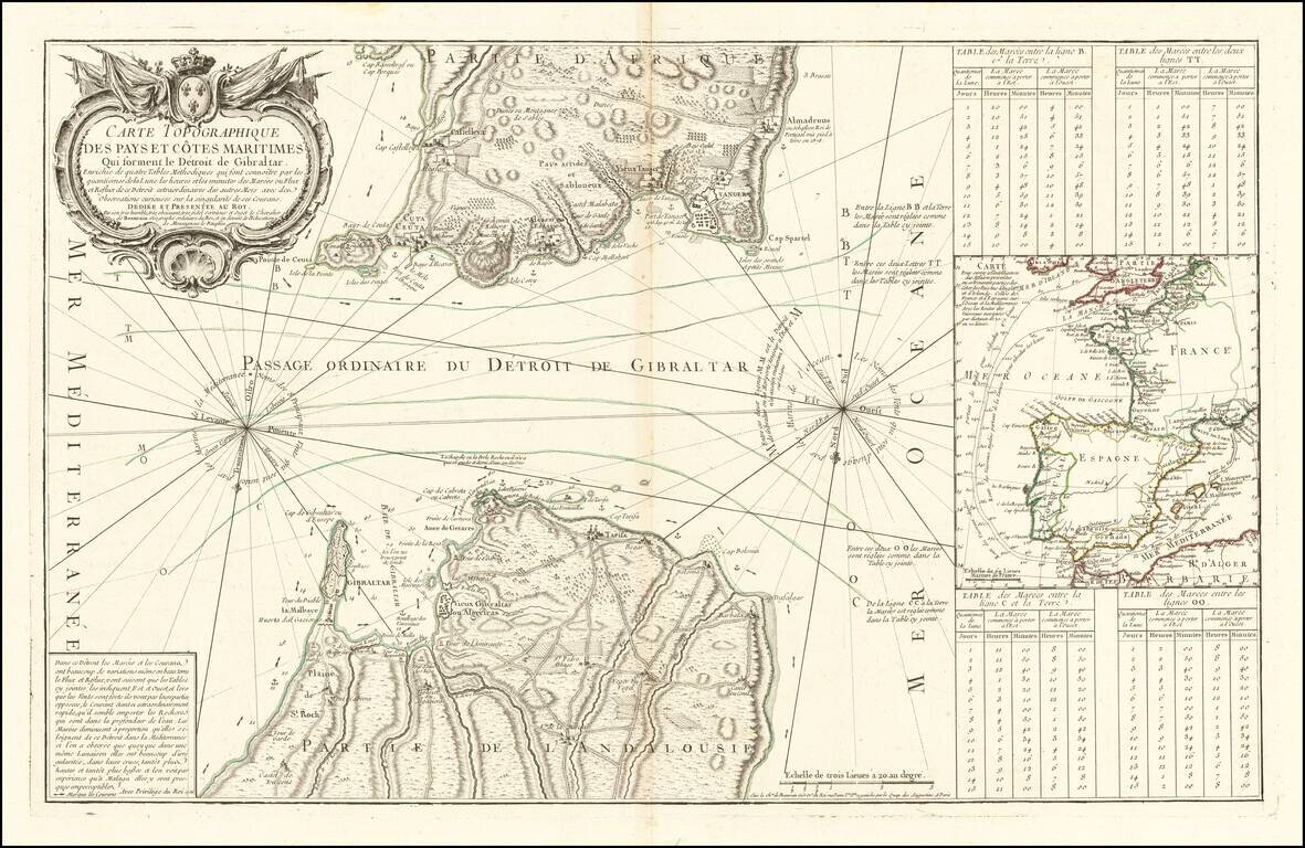
Rare scientific sea chart, oriented with south at the top, showing the entrance to the Mediterranean through the Straits of Gibraltar. The chart illustrates in great detail the fortifications on both the Iberian and African coastlines, as well as the...
![Gibraltar to Berlin. [World War II Broadside Map.]](/map/small/63270.jpg)
Fascinating WWII broadside propaganda map, published in India, in order to keep the local populous informed about the War. The map shows the theater of war in parts of Western Europe and North Africa, with the course of railways, roads, and tracks....
Fascinating map illustrating a voyage from Dieppe to Marseille, via the Straits of Gibralter. Decorative cartouche.
![Turcici Imperii Imago [shows Cyprus]](/map/small/68676.jpg)
Fine Map of the Ottoman Empire from the Mercator-Hondius Atlas Striking example of this map of the Ottoman Empire, showing their territories in the Balkans, Anatolia, the Levant, the Arabian Peninsula, and North Africa. It was published by Henricus...
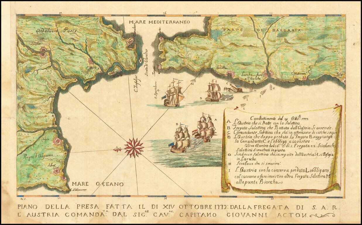
Map illustrating a battle between the Tuscan Navy and the Barbary pirates. The Tuscans, aboard the S.A.R. Austria, were led by Captain Giovanni (John) Acton. The key at the right provides details of the battle. Sir John Francis Edward Acton VI,...
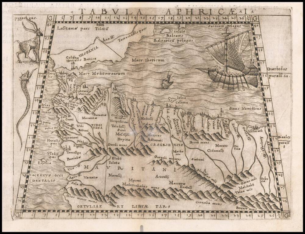
Early map of part of North Africa and Spain, primarily focusing on the region from modern day Morocco and the Balearic Islands to the Pilars of Hercules. Embellished is a saiing ship, sea monster and several curious animals. Gastaldi's atlas was the...
![[Western Mediterranean] Carta Particolare del Mare Mediterranio che Comincia con lo Stretto di Gibilterra e Finisce con il Porto di Cartagena in Ispagna e del Capo Falcone in Barberia](/map/small/53991.jpg)
Robert Dudley's Sea Chart of the Western Mediterranean Detailed map of the western Mediterranean and Straits of Gibraltar, from Dudley's Dell'Arcano del Mare. Shows the Spanish coast from Trafalgar to Capo de Paulas (Murcia) and from Tangier,...
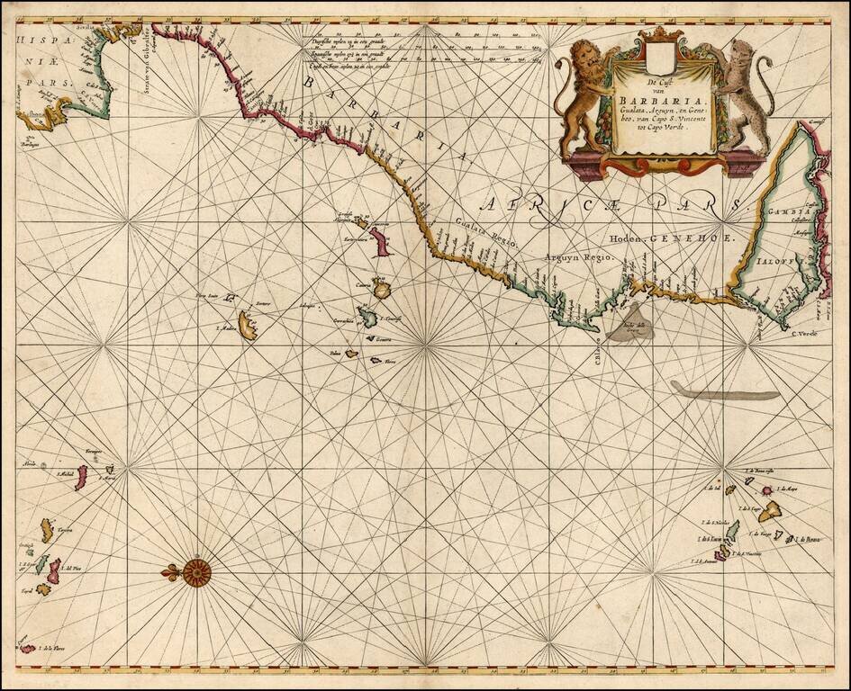
Detailed sea chart of the Iberian Peninsula and the Northwest Coast of Africa, extending to the Cape Verde Island and Gambia. Pieter Goos was one of the leading Dutch chart makers of the period.
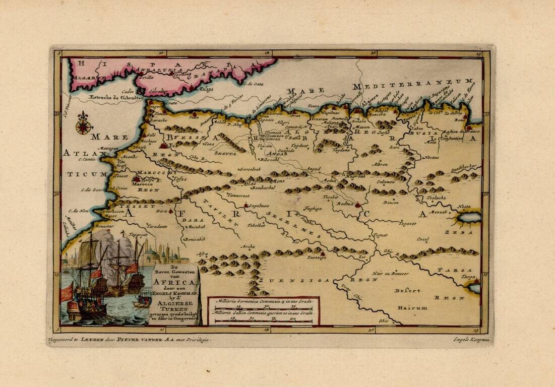
Interesting map of the Western Mediterranean and contiguous parts of Spain and North Africa, showing the tracks of Engels Koopman in 1648. The map offered here was used by Vander Aa to illustrate a Dutch Translation of Koopman's travels in the region...
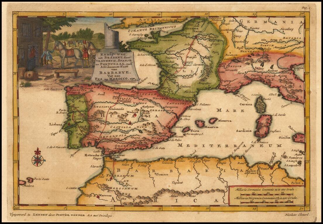
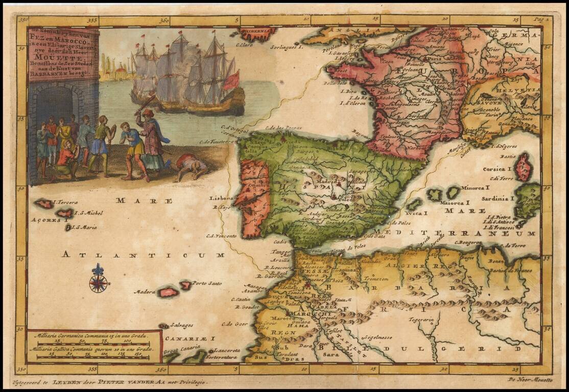
Detailed map of Spain, France and the Western Mediterranean. Francis Brooks was an Englishman who was enslaved by the Moors at the end of the 17th Century. After his escape, he wrote a narrative of his captivity, which detailed the practices of the...
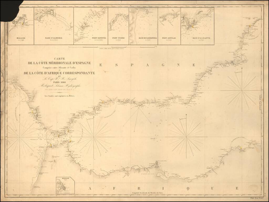
Rare separately published sea chart of the Strait of Gibraltar coast of Southern Spain and the corresponding coast of North Africa, published by Robique. Small inset maps of: Malaga Rade D'Almeria Port Genoves Port Pedro Baie de Carbonera Port...