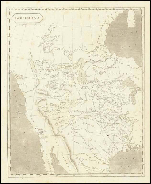
The First American Map of Louisiana Territory Nice example of Arrowsmith & Lewis's map of Louisiana Territory, first published shortly after the completion of the Louisiana Purchase and about the time Lewis & Clark set out to explore the...
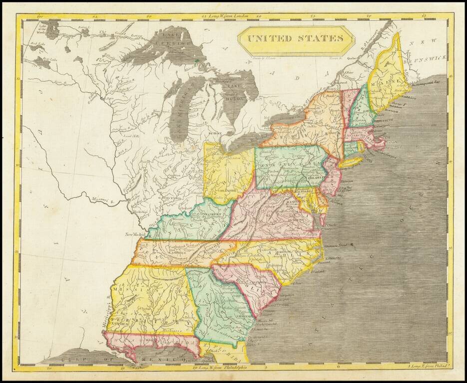
Detailed antique map of the United States, extending to the Mississippi, with a large inset of Florida. Mississippi Territory includes all of Alabama. No sign of Michigan Territory, but Detroit is prominently labeled. The map was featured in...
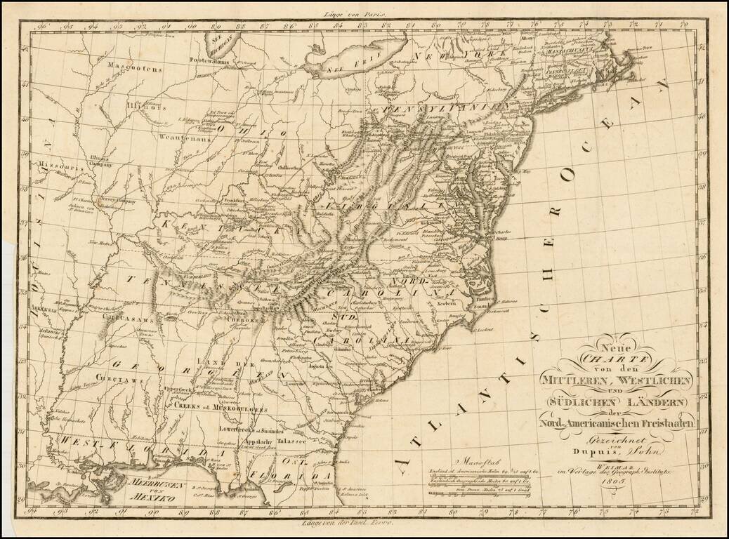
Rare early German map of the United States, in the first decade of the 19th Century. One of the most striking features of the map is the excellent treatment of the major western roads. The map provides and excellent treatment of the Indian Tribes...
![Charte von Den Vereinigten Staaten von Nord-America nebst Louisiana . . . 1805 [Rare 1st State of Gussefeld's Louisiana Purchase Map]](/map/small/63496.jpg)
Rare first state of Gussefeld's map of the United States, published in the same year as the Louisiana Purchase and highlighting Jefferson's United States on the eve of the expedtitions of Lewis & Clark, Zebulon Pike, etc. Following the Louisiana...
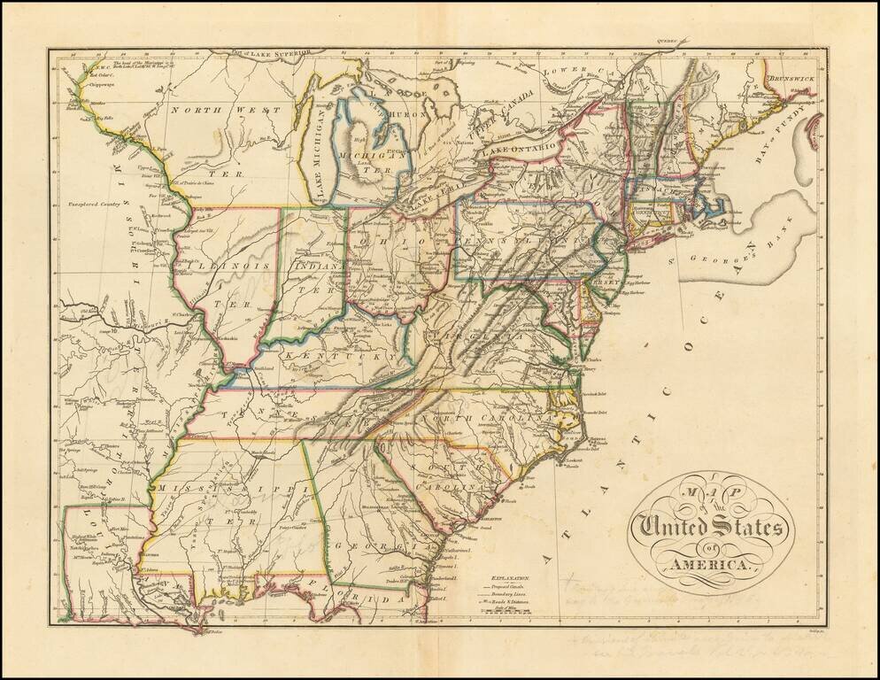
![The United States of America Confirmed By Treaty 1783 [shows Franklinia]](/map/small/70258.jpg)
Highly sought-after map of the United States, featuring the State of Franklin. Includes a massive Georgia, running to the Mississippi River, New Iberia, massive Western Territory and extensive notes along the Mississippi Valley. An important...
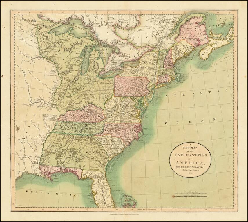
Beautiful Antique Map of the United States from 1806 Full original hand-color example of John Cary's map of the United States, published in London shortly before the War of 1812. Includes a massive Georgia, extending to the Mississippi River, East...
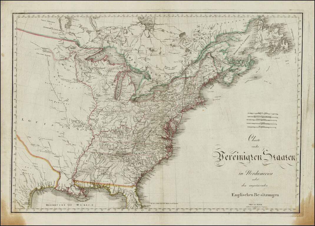
Rare map of the United States, shortly after the Louisiana Purchase, published in Vienna and Budapast. The map provides a fantastic transitional look at the United States, prior to the Adams Onis Treaty. East Florida and West Florida a still shown,...
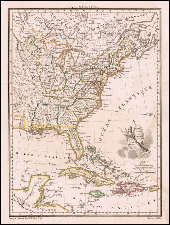
Finely engraved map, embellished with a winged America with shield and javelin. Shows Mississippi Territory including Alabama, Indiana to the Mississippi River, plus nice western Indian information. Malte Brun's Atlas Complet Du Precis De La...
Nice example of Mathew Carey's map of the United States, which first appeared in his 1814 General Atlas, published in Philadelphia. The map reflects a fascinating period in the geo-political evolution of the U.S. Mississippi Territory still appears,...
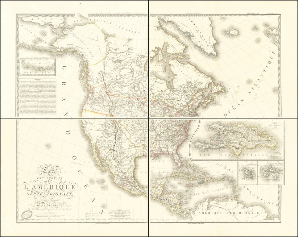
Adams-Onís Treaty Edition of Brué's Important Map of North America Fine example of Brué's impressive four-sheet map of North America, published only two months after the signing of the Adams-Onís Treaty in February 1819 and one of the first...
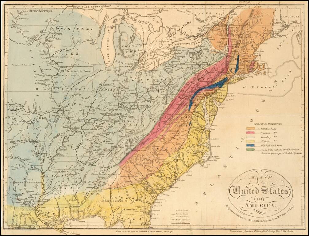
A Geological Map of the United State By The Father of American Geology The Melish-Maclure map of the United States is one of the first geological map of the United States published in America. This scarce map of the United States, was issued in...
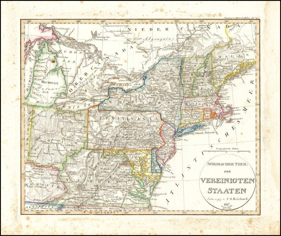
Rare early map of a portion of the Midwest and regions to the East, from Lake Michigan to Kentucky and Virginia to Maine. Early depiction of Michigan Territory.
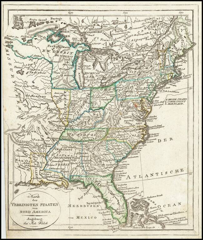
Mississippi Territory ! Rare early state of Walch's map of the United States, showing a number of early and transitional territorial configurations. This map vividly illustrates the fluid nature of American territorial boundaries between the Louisiana...
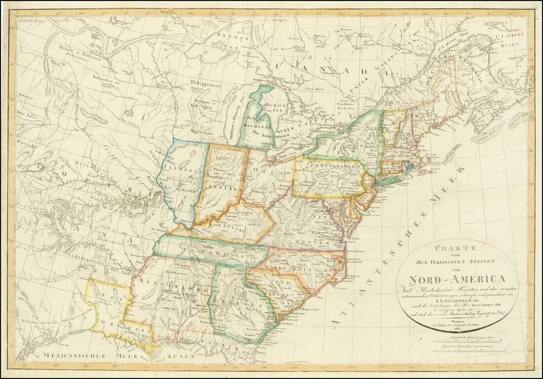
With an unusual appearance of "Neu Orleans" Territory. Rare late state of Gussefeld's map of the United States, published in the same year as the Louisiana Purchase and highlighting Jefferson's United States on the eve of the expeditions of Lewis...
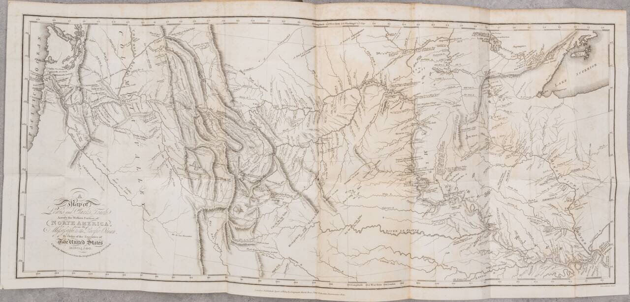
London edition of Lewis & Clark's map of the Northwestern US, based upon William Clark's original manuscript map of the expedition, along with the complete 3 volume text and maps of the 1817 London edition of Lewis & Clark's Travels to the...
![Charte von den Vereinigten Staaten von Nord=America mit Luisiana Prag 1818 [Rare Florida inset]](/map/small/62281.jpg)
Neu Orleans Territory Rare and unusual map of the United States, published in Prague. The map provides a fascinating depiction of Louisiana Territory, with "Neu Orleans" Territory shown as a regional name for the modern State of Louisiana. The map...