Map size in jpg-format: 14.4077MiB
Click to open in high resolution (open in new tab).
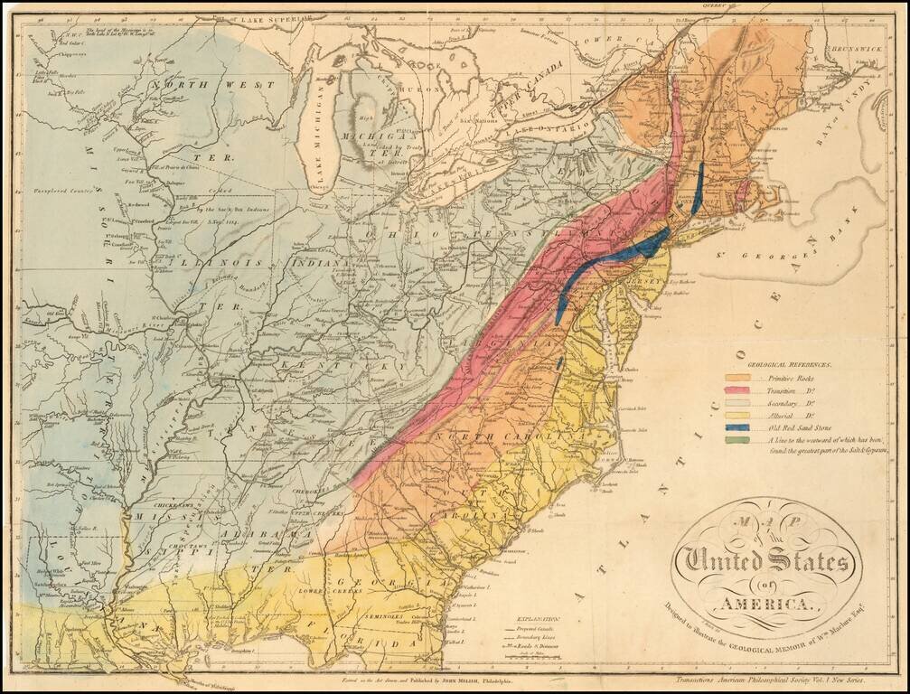
A Geological Map of the United State By The Father of American Geology
The Melish-Maclure map of the United States is one of the first geological map of the United States published in America.
This scarce map of the United States, was issued in William Maclure's report, Observations on the Geology of the United States. Maclure, known as the "father of American geology," published the first widely available geologic map of the United States in 1809. And while this is the third issue of the map (1809 in Philadelphia and 1811 in Paris), it is "generally considered as the starting point for the geology of North America" (Marcou & Marcou).
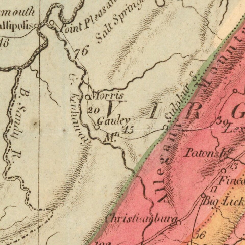
The map is color-coded to indicate the location of Primitive Rocks, Transition Rocks, Secondary Rocks, Alluvial Rocks, and Old Red Sand Stone, based on the Wernerian classification system. Also keyed to the legend is a "line to the westward of which has been found the greatest part of the Salt & Gypsum." The map is filled with information on Indian tribes, forts, roads and early settlements. Illinois Territory is located well away from Lake Michigan and bounded on the north by the large North West Territory. Chicago is correctly located, but is on the border between Indiana and North West Territory. Of particular interest are distance notations along several major roads in miles. A legend locates canals, boundary lines and roads.
The map is one of the earliest maps to show the newly formed Alabama Territory and identifies a massive Missouri Territory, west of the Mississippi River. Indiana is directly below Lake Michigan, with Illinois Territory pushed far to the West off Lake Michigan and Chicago shown in Indiana.
Maclure (d. 1840) was a very important early American scientist and geologist. He was the founder and President of the Academy of Natural Sciences at Philadelphia, and was also the President for some years of the American Geological Society. His Observations. . . is considered the first connected account originally written in English on the geology of the U.S. Maclure became a member of Robert Owen's socialistic community in New Harmony (founded in 1826), became a large land owner in this area, and later started his own splinter group called "Macluria."
If you are a student, write to us in telegram: @antiquemaps and indicate what material you need and for what work you need a map in high detail. We are ready to provide material on special terms. For students only!

![[Signed Political Satire Artwork] Vietnam ... Vietnam ... Vietnam ...](/map/small/68726.jpg)
