Scarce first edition of this fine early map of the British Colonies in North America at the outset of the French & Indian War. The map names and depicts many of the early boundary lines delineating the colonial charters, some with dates. Some of...
Rare, Detailed First Edition of Longchamps’ Map of the North American Colonies—Proof State! Fine example of the first edition of Longchamps’ map of the colonies—Spanish, French, and British—in North America east of the Mississippi River,...
Decorative map of North America, published during the French & Indian War. The map provides a very large inaccurate depiction of the Great Lakes, along with a disembodied river and lake system in the west. There is no northwest coast of America....
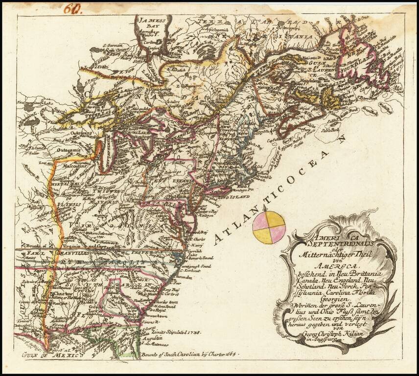
Rare map of the British Colonies at the conclusion of the French & Indian War, originally engraved by Georg Christoph Kilian and included in from Heiden's Americanische urquelle derer innerlichen kriege des bedrängten Teutschlands. . . The map...
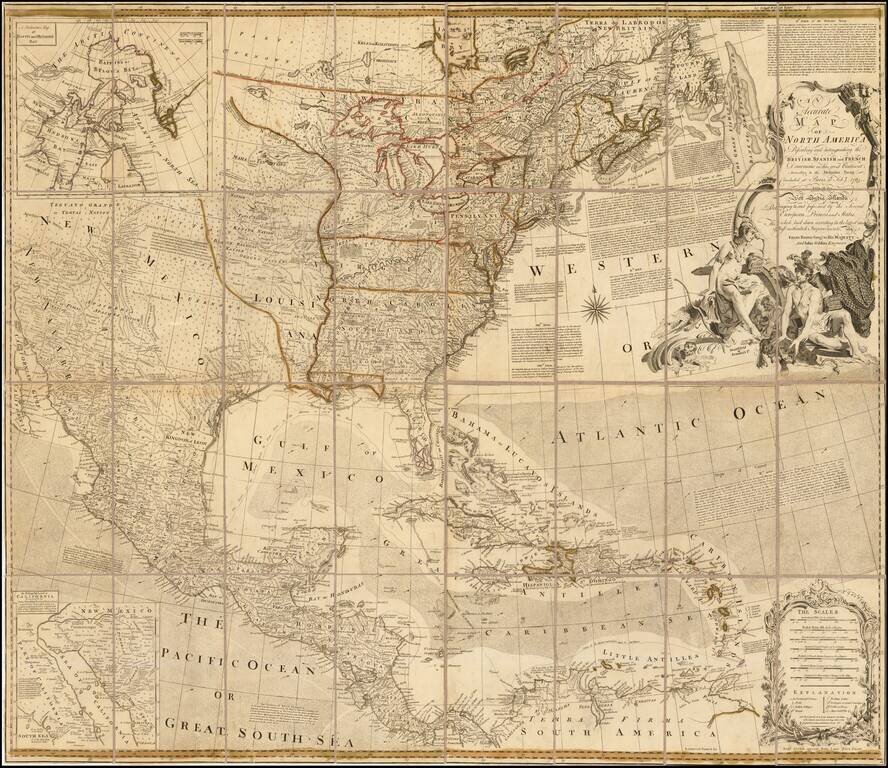
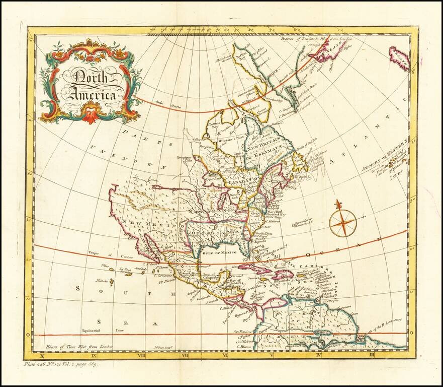
Second State of Bowen & Gibson's Iconic Map of North America Rare separately issued 1763 edition of Bowen & Gibson's important 4-sheet map of North America, one of the most enduring wall maps of North America published in the second half of...
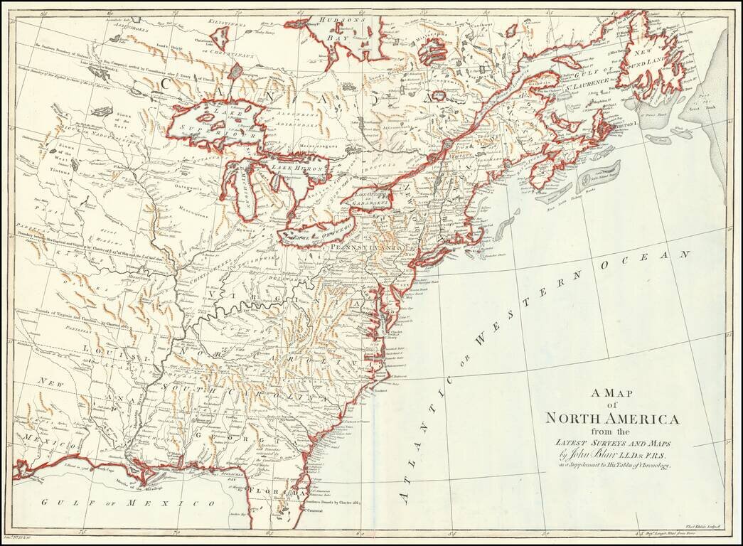
Interesting map of the US and Canada at the end of the French & Indian War, based upon John Mitchell's seminal map of 1755. The map shows the many French and English Forts in the Mississippi and Ohio Valleys, along with numerous Indian Tribes on...
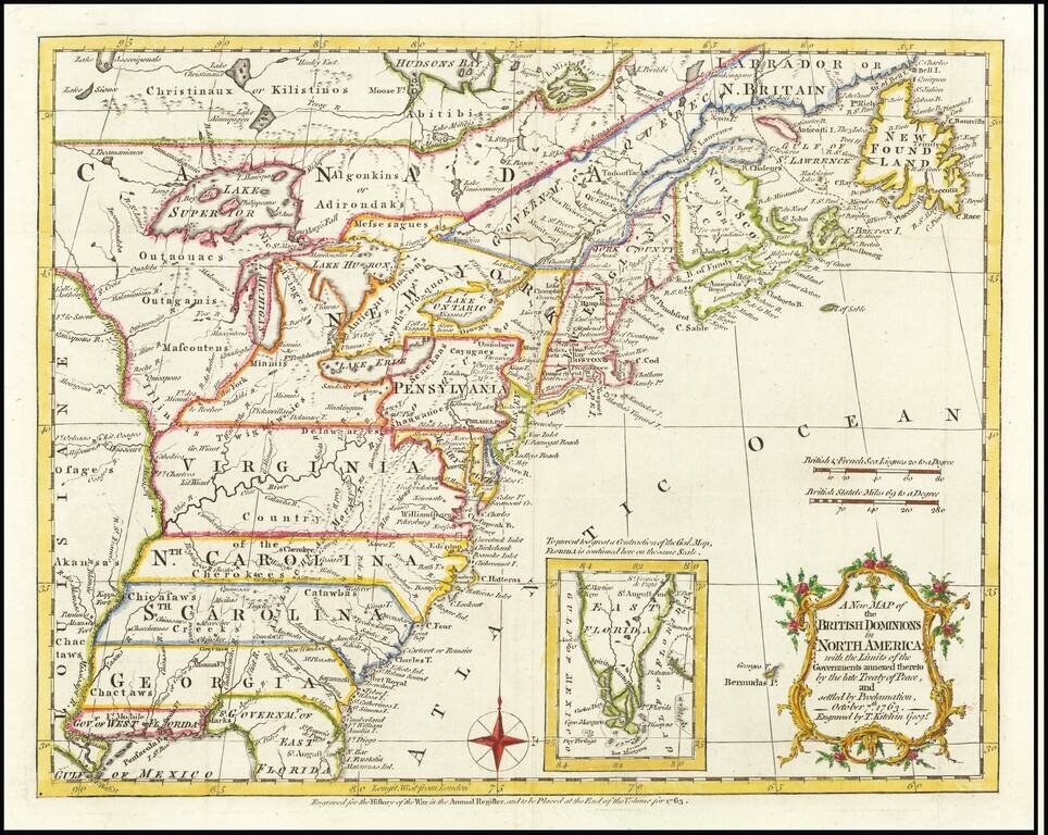
Detailed map of the British Colonies in North America, featuring Georgia, the Carolinas and Virginia with their boundaries extending to the Mississippi River. The map provides a detailed look at the British Colonies, between the French & Indian...
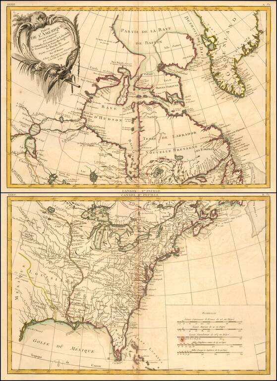
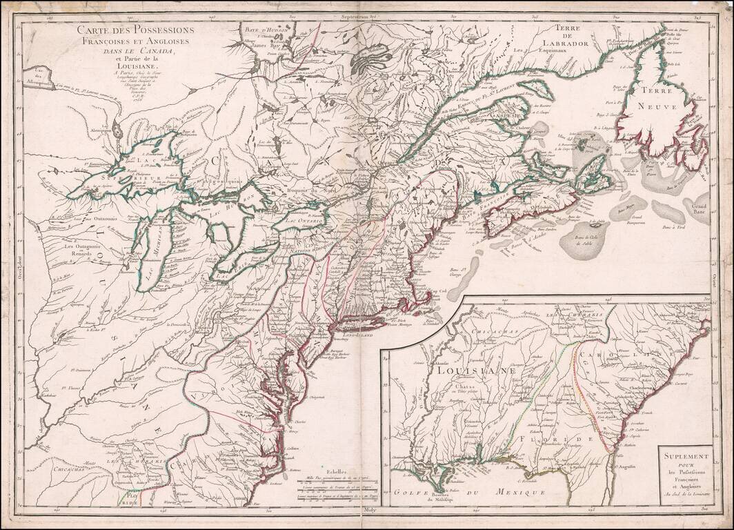
Detailed 2 sheet map of the British and Spanish colonies in North America, which appeared in Lattre's Atlas Moderne, published in Paris. The map extends north to Baffin's Bay and west to Lake Ouinipigon (Winnipeg), the known course of the Missouri...
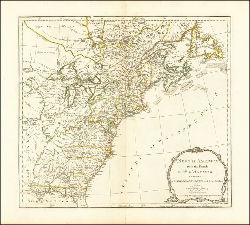
The third state of Jefferys map of the British Colonies, based upon D'Anville's map. This third state was issued after the conclusion of the French and Indian War. The map shows the Colonies on the eve of the American Revolutionary War. A note in the...
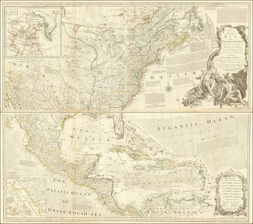
Striking 4-sheet map of North America on the eve of the American Revolution. The map is one of the best large format representations of the British Colonies, from a British perspective, on the eve of the Revolution. The claims of the Carolinas,...
Decorative map of North America with a large title cartouche. The map shows the British Colonies still extending to the Mississippi, although Pennsylvania is now truncated. East and West Florida are shown. The northwest coast of America is still New...
![The Theatre of War in North America, with the Roads and a Table of the Distances [with] A Compendious Account of the British Colonies in North-America.](/map/small/43988.jpg)
Nice example of the rare first state of Sayer & Bennett's Broadside Map and Account of the War in North America, one of the first widely distributed news accounts of the American Revolution in Great Britain. Following a brief peace attempt between...
![[Revolutionary War Broadside Map] Allgemeine Charte von Nord America als den Sitz des Krieges zwischen den Konigl. Engl. Truppen u:den Provinzialen](/map/small/43232.jpg)
Rare, Early German Broadside Map of the North American British Colonies—First State! First state of an remarkably rare German broadside map showing the British colonies in North America, one of the earliest separately-issued broadside maps of the...
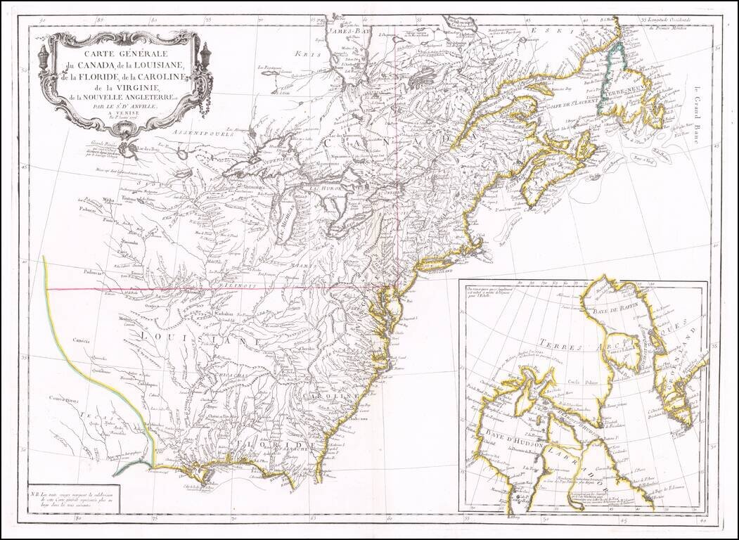
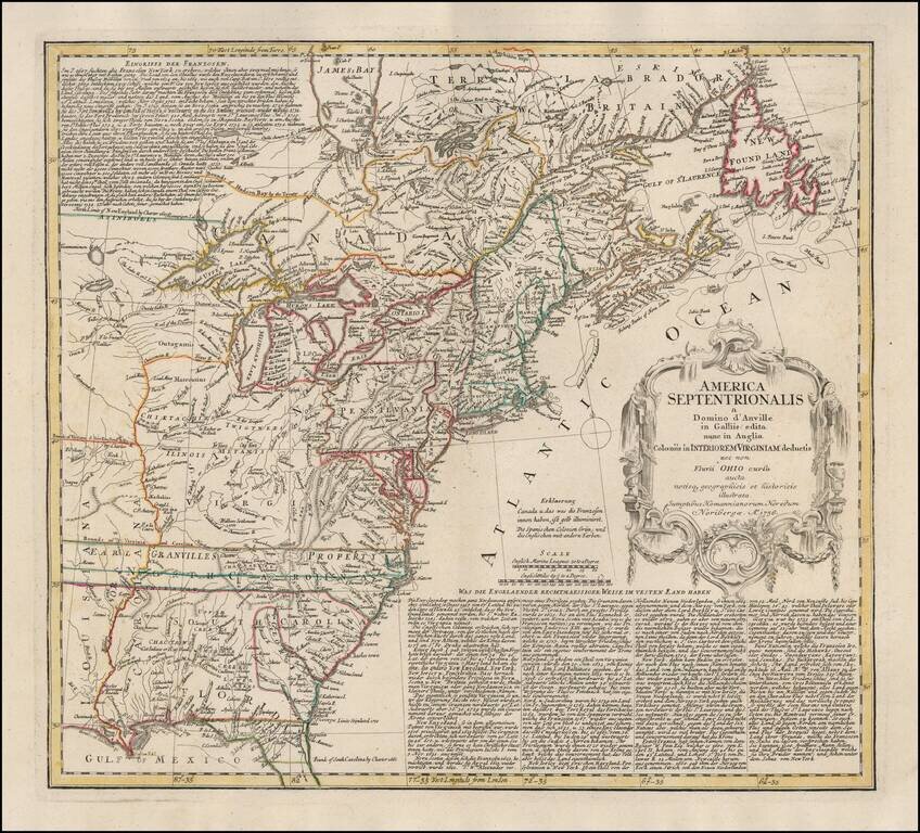
Second edition of Santini's map of the British & French Colonies in North America, based upon D'Anville's seminal map of 1746. The map provides a highy detailed treatment of Great Lakes and Mississippi Valley, on the eve of the American...
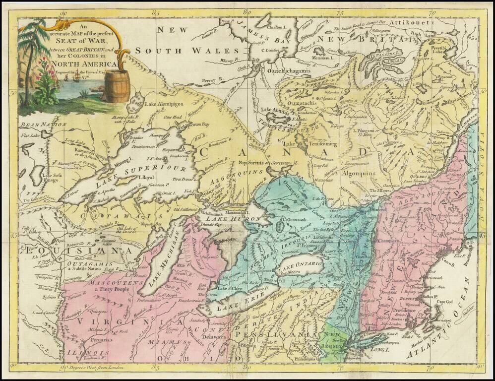
Centered on the Great Lakes Scarce map of the Northern and Western part of the British Colonies in North America, showing the theater of the American Revolutionary War in 1776. The map extends north to James Bay, west to the Mississippi River and...
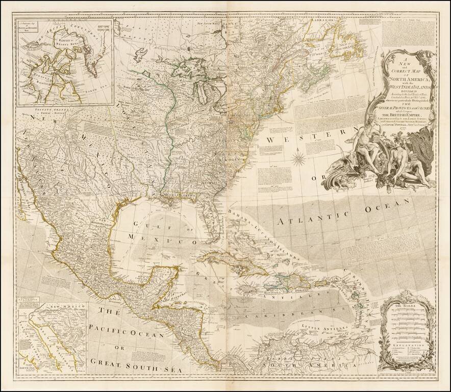
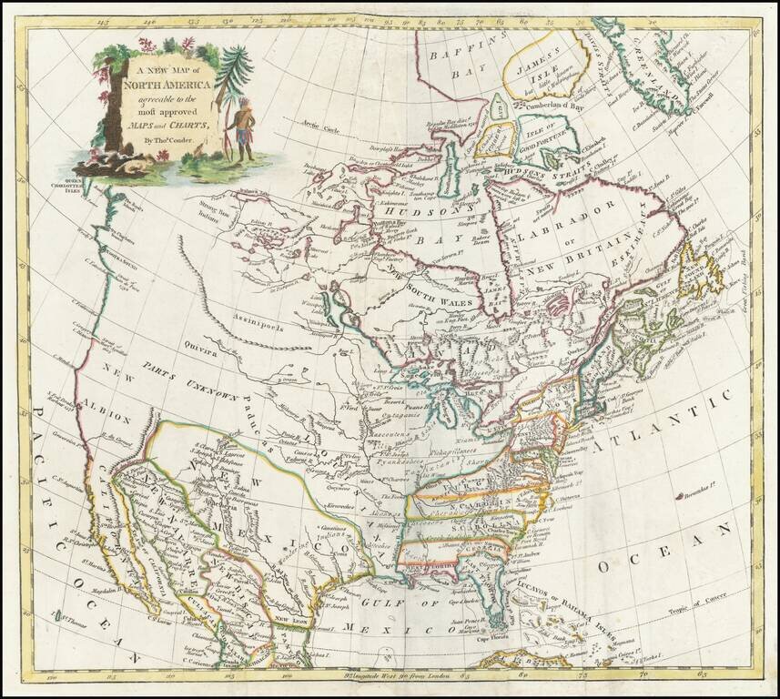
First "Pownall" edition of this influential wall map of North America, issued shortly after the commencement of the Revolutionary War in 1777, and including the revisions compiled by Governor George Pownall. Originally issued separately by Bowen &...