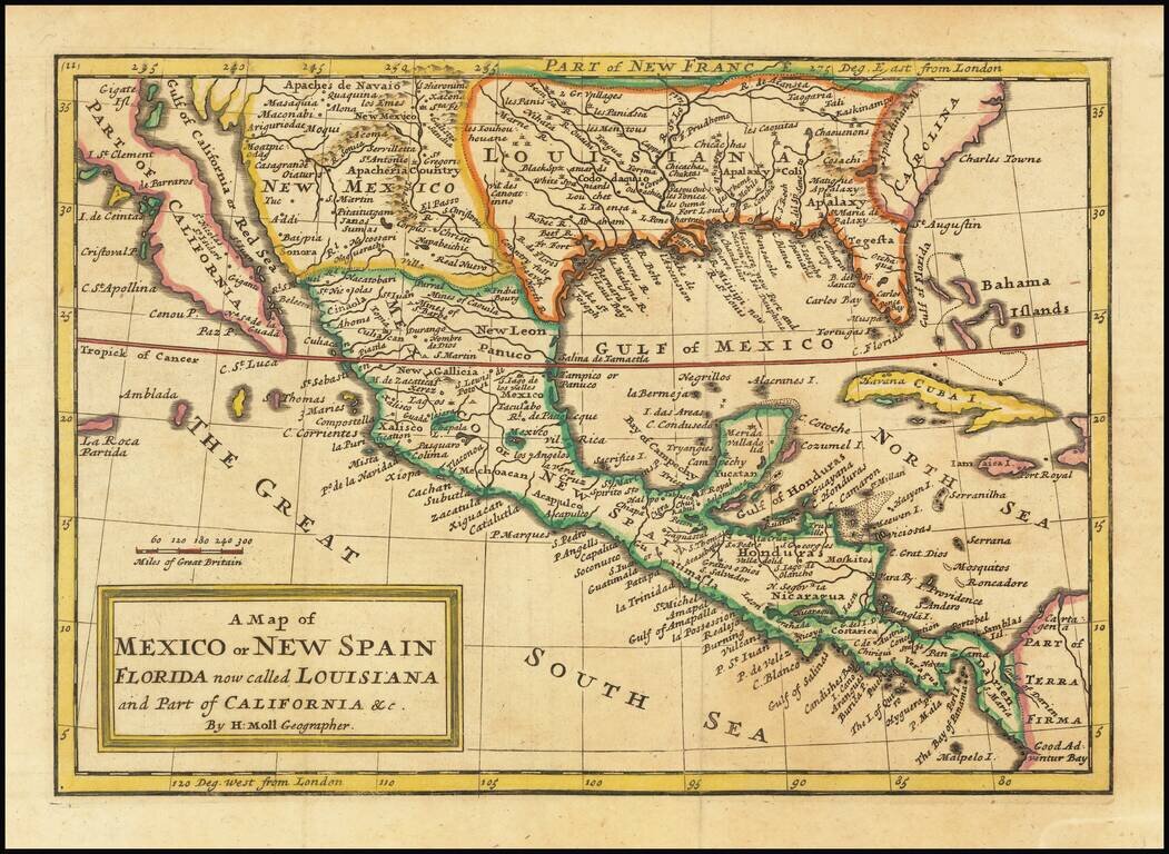
Antique map of the southern half of North America, from the Island of California to Florida by London's most famous cartographer of the early 18th Century. The map shows remarkable detail for a map of its size, including very nice detail in modern-day...
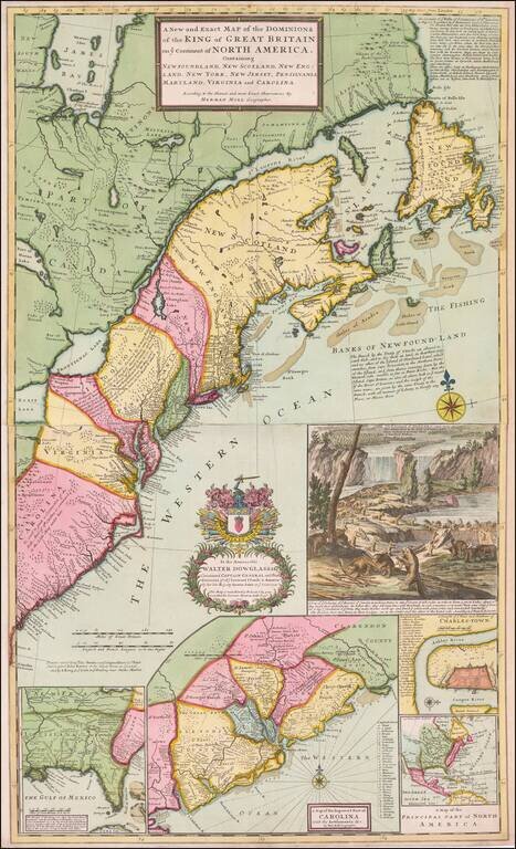
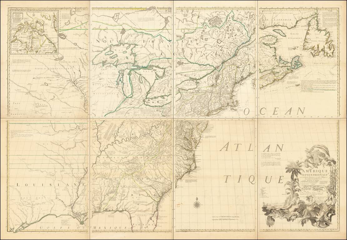
Finely colored example of Moll's seminal map of the British Colonies in America, the first large-scale map to show English developments in North America and the first to show the American postal routes. Moll's map was the first and one of the most...

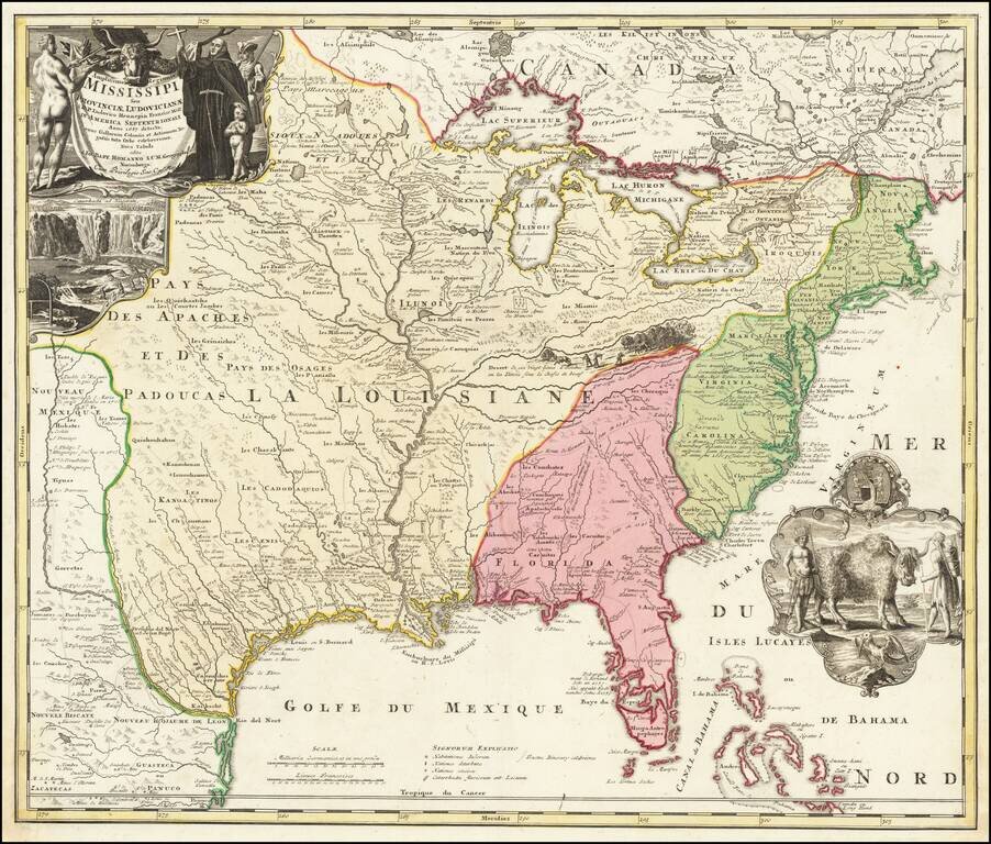
Fine full color example of Henri Chatelain's map of the inhabited parts of North America, based upon Nicholas De Fer's landmark 4 sheet map published in 1718. At the top left of the map is large scale map of the Mississippi Delta and Mobile Bay, based...
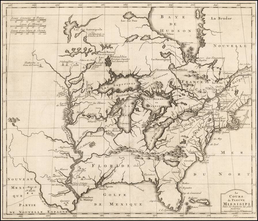
Striking full-color example of Homann's map of the Course of the Mississippi River, based upon the reports of Hennepin, who explored the upper Mississippi and Great Lakes regions as a Jesuit Missionary in the late 1600s. The map follows the work of De...
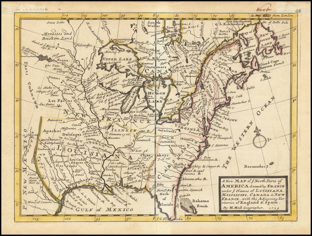
A nice example of Moll's map of the British, French and Spanish regions of North America, reduced from his landmark Sasquehanna Village map. The map, which appeared in Moll's Atlas Minor, is one of the smaller format English maps of the period, with...
Important early derivative of Louis Hennepin's seminal map of North America. Benard's map provides an excellent treatment of the region from the Mississippi River and the Great Lakes eastward to the eastern seaboard. Along the Mississippi, Benard...
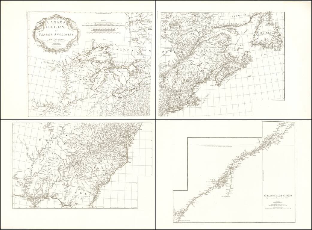
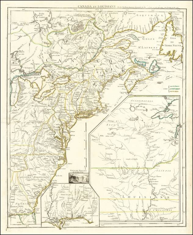
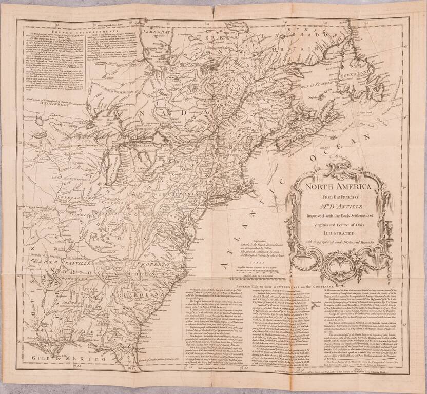
Fine example of this important early four sheet map of North America published by D'Anville. The map extends from James Bay to Florida and as far west as the Mississippi River. Portions of the map are drawn from John Mitchell's seminal map of North...
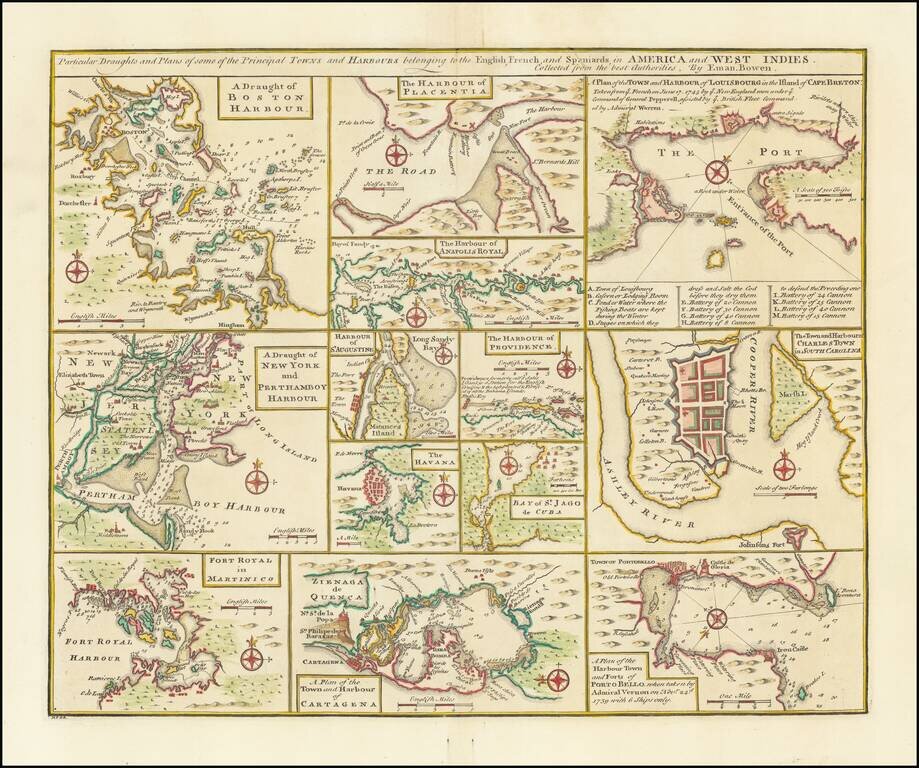
Nice set of harbor and town plans, showing the major trading cities and ports in North America and the Caribbean. The maps include: Boston New York Charleston Martinico Placentia Anapolis St. Augustine Havana St. Jago (San Juan) Providence...
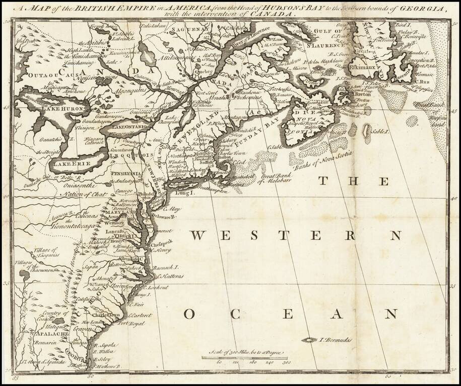
Very rare pre-Mitchell map of the British Colonies in Noth America, published pursuant to Act of Parliament in November 1750, for Owen's Magazine of Magazines. The map shows the northeast from Newfoundland to Georgia and west to just beyond Lake Erie,...
The First French Map of the French and Indian War. A French Reply To Henry Overton's Inflammatory "George Washington" Map. Rare first state of this fascinating broadside map focusing on the recent British and French hostilities in the Ohio Valley,...
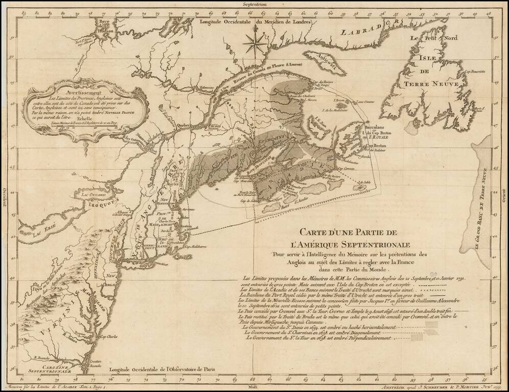
Rare Dutch Edition of Bellin's Controversial and Highly Important Map Illustrating the French and British Historical Claims to the Canadian Maritimes and Maine, published in Paris on the Eve of the Seven Years' War (1756-63) Rare Amsterdam imprint...
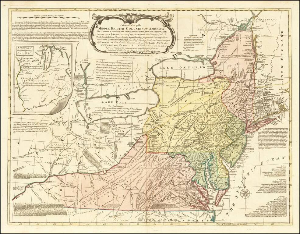
One of the Most Influential 18th Century Maps of America Fine example the Carrington Bowle's edition of Lewis Evans' seminal map of the British Colonies in North America. Along with the maps of Henry Popple and John Mitchell, Lewis Evans' map is...
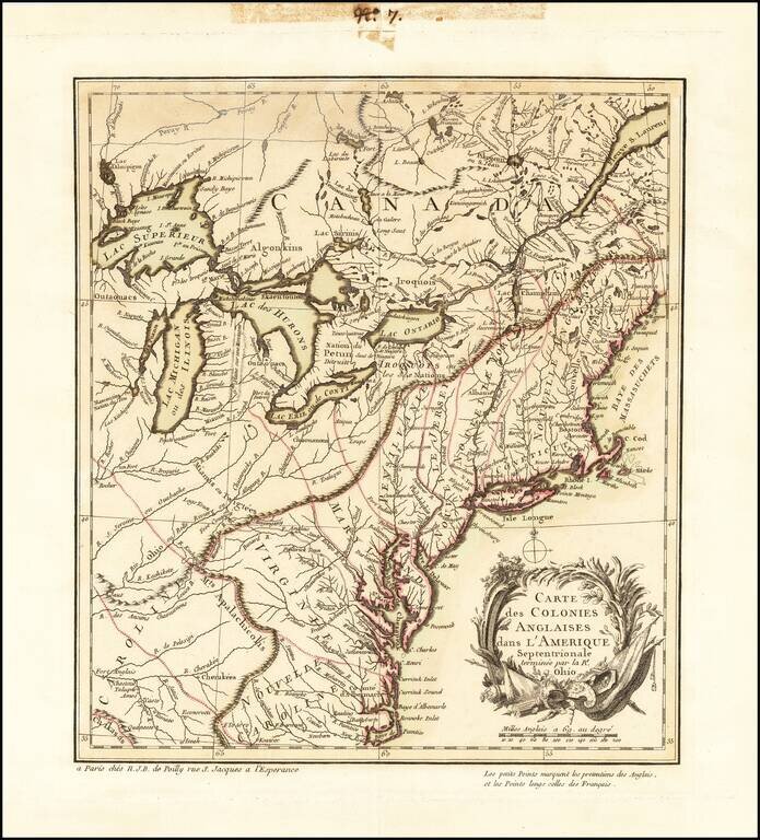
France Claims on the Eve of the French & Indian War Rare French & Indian War map of the British and French Colonies in North America, published by Le Rouge. Fine example of this highly detailed set of maps illustrating the French &...
The Most Important American Map of the 18th Century Fine example of the French edition of Mitchell's seminal map of the Eastern part of North America. Mitchell's is regarded as perhaps the single most important American map of the 18th Century, and...
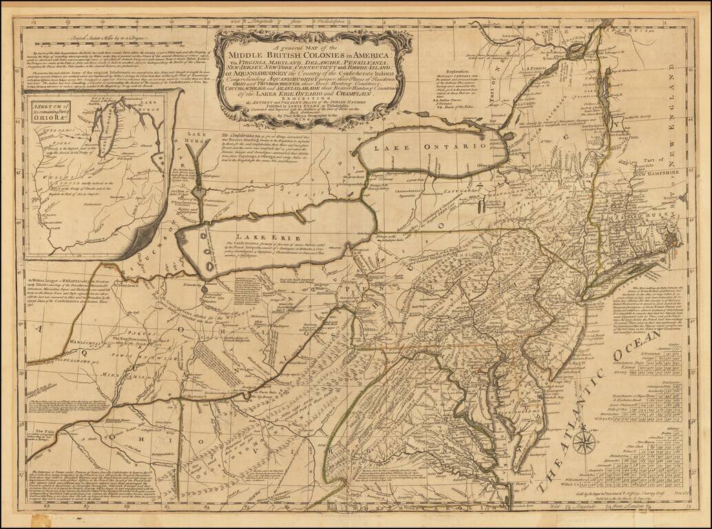
A nice example of the Sayer-Jefferys London issue of Lewis Evans' seminal map of the British Colonies in North America. Along with the maps of Henry Popple and John Mitchell, Lewis Evans' map is considered among the most important and influential...
"The Best Collection of Facts in General, for a Future Historian, that Was Ever Made or Published" -- John Huskey, 1755 This is a fascinating and important Boston-published work from the late-Colonial period, a year into the French and Indian War....