Map size in jpg-format: 14.6601MiB
Click to open in high resolution (open in new tab).
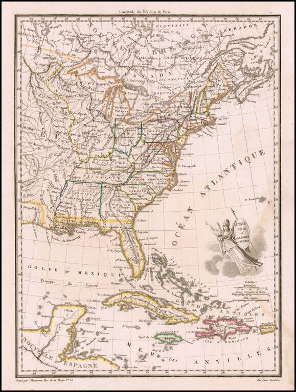
Finely engraved map, embellished with a winged America with shield and javelin.
Shows Mississippi Territory including Alabama, Indiana to the Mississippi River, plus nice western Indian information.
Malte Brun's Atlas Complet Du Precis De La Geographie Universelle… published in Paris in 1812 and after, is an often overlooked gem of contemporary cartography.
If you are a student, write to us in telegram: @antiquemaps and indicate what material you need and for what work you need a map in high detail. We are ready to provide material on special terms. For students only!

![[Signed Political Satire Artwork] Vietnam ... Vietnam ... Vietnam ...](/map/small/68726.jpg)
