Fine example of this highly detailed set of maps illustrating the British Colonies in North America at the conclusion of the American Revolution, published by Soules in his Histoire des Troubles de Amerique Anglaise. The primary map shows the British...
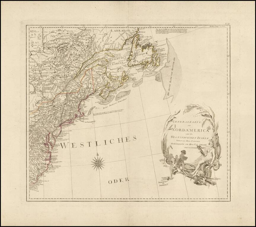
Wide margined example of the northeastern sheet of F.A. Schraebl's 4 sheet wall map of North America, published in 1788. The map extends from Charleston and Hilton Head, South Carolina in the south to Hudson's Bay and Newfoundland, centered on the...
Fine map of the British Colonies, illustrating General Burgoyne's march from Saratoga, New York, to Charlottesville, Virginia, which appeared in the French edition of Thomas Anburey's Voyages dans les parties interieurs de l'Amerique by Thomas Anburey,...
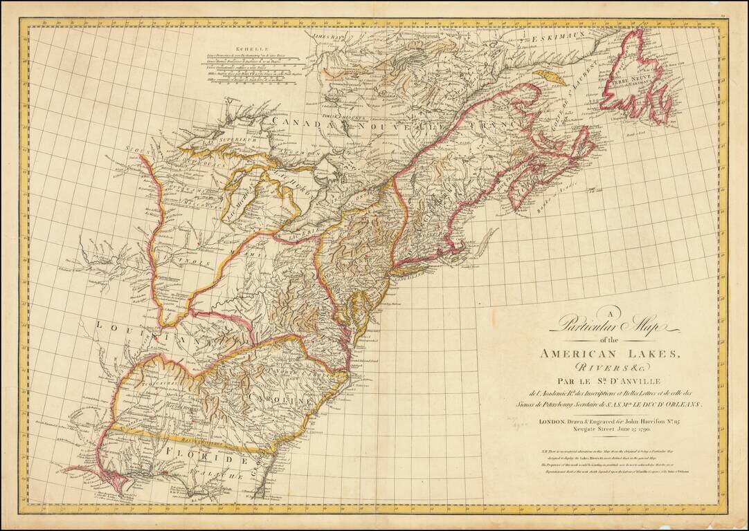
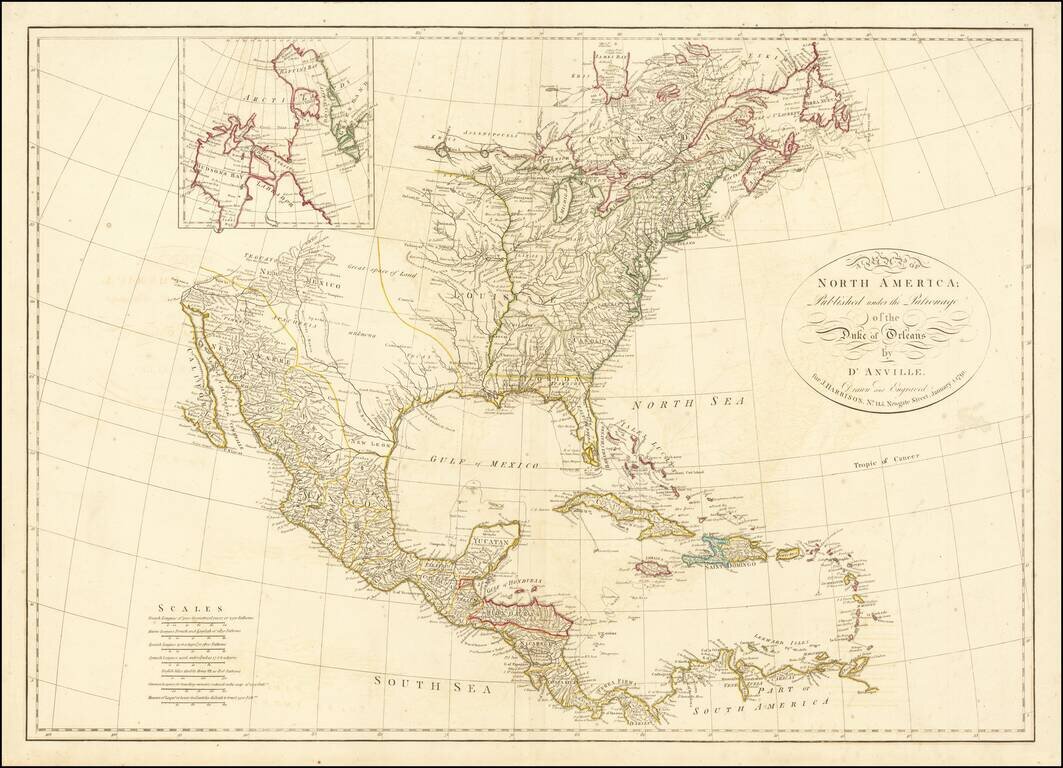
An Rare English Map of the United States and Louisiana Territory Rare English edition of Jean Baptiste Bourguignon D'Anville's important map of the British Colonies in North America, published shortly after the conclusion of the American Revolution...
A marvelous map of North America, based upon D'Anville's 4 sheet map. The map names Tecas, but the entire Northwest is noted as parts unknown. Many place names, Indian tribes, and forts located. Good detail of watershed: the Colorado is here called...
![[Franklinia] A Map of the States of Virginia, North Carolina, South Carolina and Georgia; Comprehending the Spanish Provinces of East and West Florida: Exhibiting the Boundaries as fixed by the late Treaty of Peace . . .](/map/small/67980.jpg)
One of the Earliest Appearances of the State of Franklin (Franklinia) Nice example of Purcell's map of the Southern States (and Midwest), which includes an early reference to the New State of Franklin in the center part of North Carolina. This map...
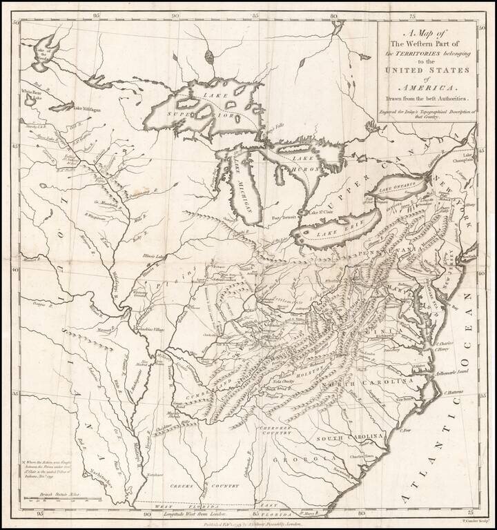
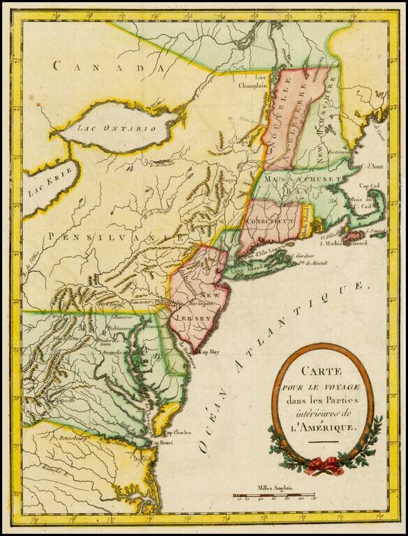
Nice example of this scarce regional map of the United States, which appeared in A Topographical Description of the Western Territory of North America ... by Gilbert Imlay. The map covers the region from the Great Lakes through Georgia and from the...
![The United States of North America with the British Territories And Those of Spain, according to the Treaty of 1784 . . . 1793 [shows Franklinia!]](/map/small/64978.jpg)
Rare First State of Franklin's United States Showing The State of Franklin! Scarce map of the United States, which includes the State of Franklinia in Western North Carolina. One of the first and finest English maps to display the boundaries of the...
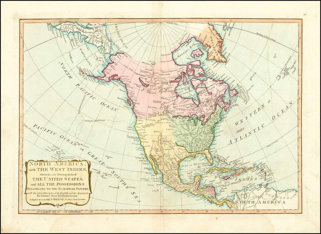
The River of the West According to Some 1794 edition of Samuel Dunn's map of North America. The map provides an interesting depiction of North America, shortly after the close of the American Revolution. The US is colored in Green. To the west, the...
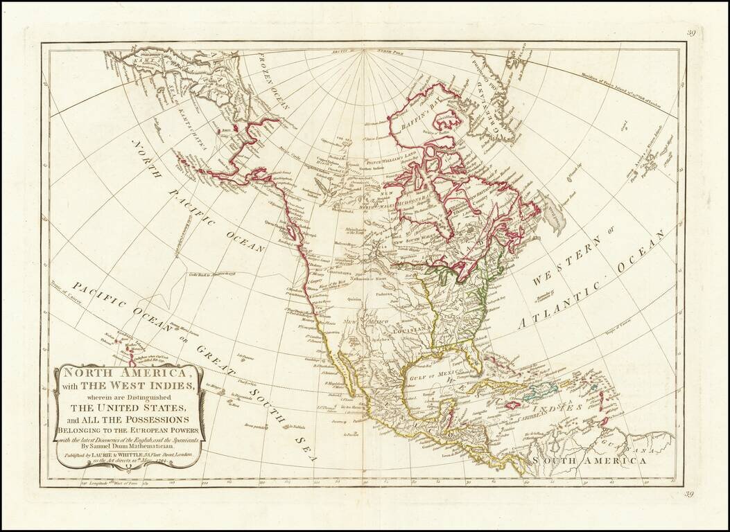
Striking example Samuel Dunn's map of North America. The map provides an interesting depiction of North America, shortly after the close of the American Revolution. The US is colored in Green. To the west, the vast unknown regions of Louisiana, New...
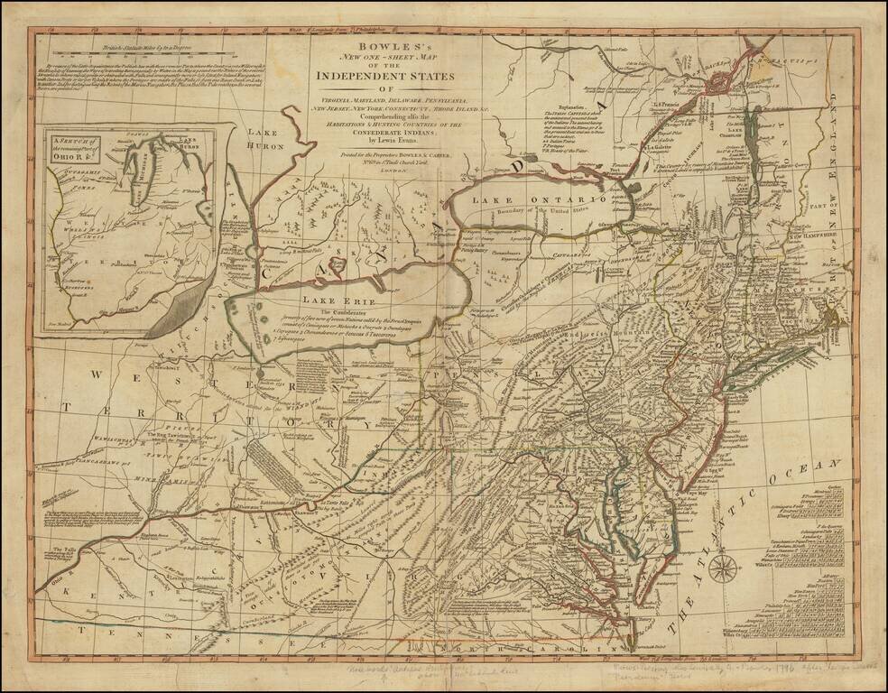
Rare Map of the Mid-Atlantic Issued Shortly After The 1783 Treaty of Peace. A nice example of the Bowles & Carver post-Revolutionary War edition of Lewis Evans' seminal map of the British Colonies in North America, including early references to...
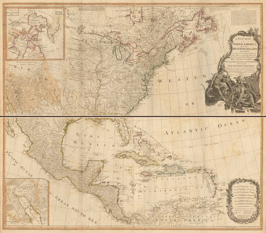
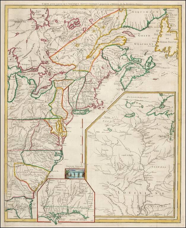
Striking example of this monumental 4-sheet map of North America, issued shortly after the conclusion of the Revolutionary War. Originally issued separately by Bowen & Gibson in 1755, this map was periodically updated following the conclusion of...
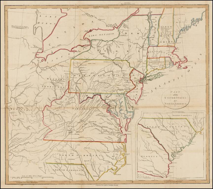
Interesting map of the United States with large inset of South Carolina and Georgia. The map extends east to include the confluence of the Kentucky and Ohio Rivers and names Kentucky, but not Ohio or Tennessee. Includes nice detail in the...
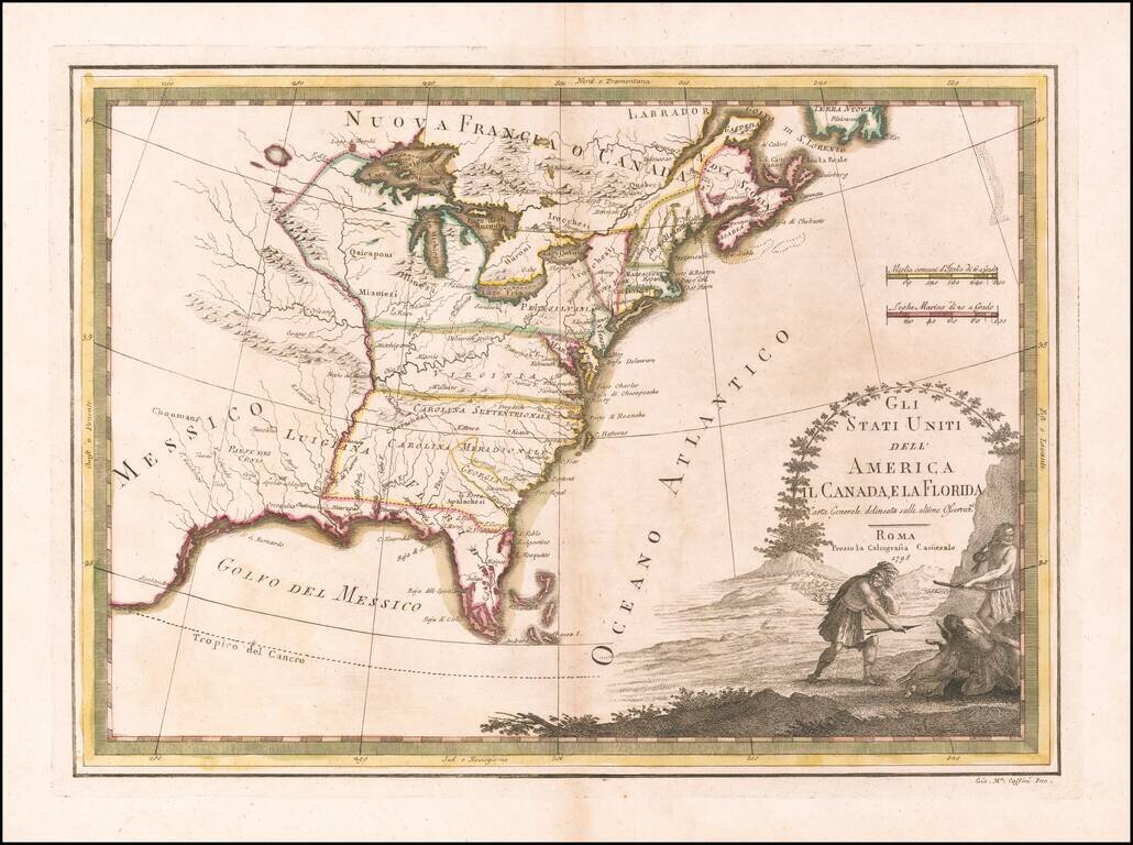
Scarce map of the United States, published in Rome by Giovanni Maria Cassini. Virginia and the Carolinas extend to the Mississippi River. Florida is shown as an archipelago.
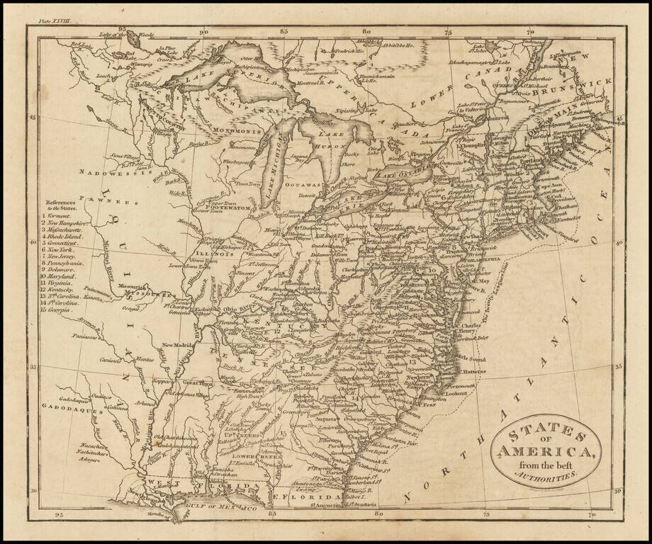
Detailed and fascinating map detailing states and Indian lands east of the Mississippi River from northern Florida to Canada. The map pre-dates Ohio and Mississippi Territory. Louisiana is shown, but the map would seem to predate Louisiana Territory.
Rare separately issued map of the United States by Daniel Freidrich Sotzmann, engraved for Christoph Daniel Ebeling's Beschreibung. The present example has wide uncut deckled edges, similar to Sotzmann's individual maps of the states. The words "No....