Map size in jpg-format: 10.8712MiB
Click to open in high resolution (open in new tab).

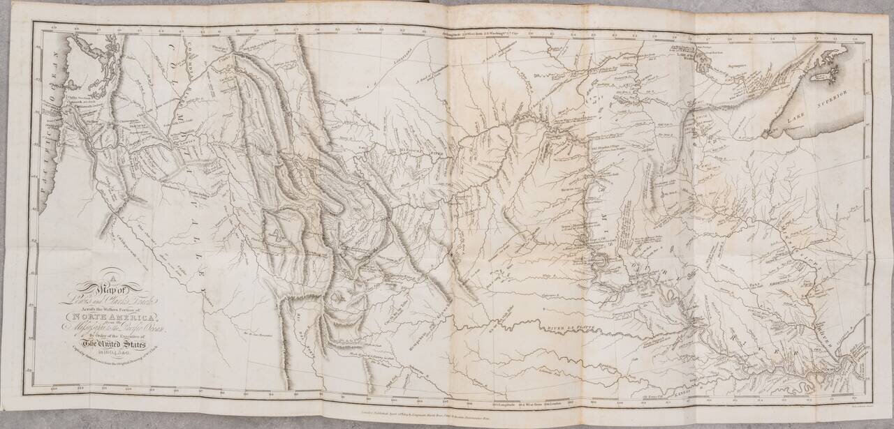
London edition of Lewis & Clark's map of the Northwestern US, based upon William Clark's original manuscript map of the expedition, along with the complete 3 volume text and maps of the 1817 London edition of Lewis & Clark's Travels to the Source of the Missouri River and across the American Continent to the Pacific Ocean. Performed by the Government of the United States, in the years 1804, 1805, and 1806. . . .
Lewis & Clark's map and the written account of the expedition changed American mapping of the northwest by giving the first accurate depiction of the relationship of the sources of the Missouri, the sources of the Columbia, and the Rocky Mountains.
Lewis & Clark's official account of the expedition is a cornerstone of any collection of Western Americana. This map, which is intended to illustrate the sum total of the expedition, is perhaps the single most important American exploration and discovery map of the 19th Century. Wheat states:
As for showing the route of the explorers themselves, too much [about the map] cannot be said. This is the way across North America, and the way is made plain for all to see. At last the youthful United States had been heard from, in a tour de force. The fact that many years would pass before any men of the new nation other than Lewis and Clark (and the Astorians) would appear to add force to their country's claim to the land that lay westward made it all the more impressive that the young captains had successfully crossed to the waters of the Pacific. This 1814 map was the progenitor of many later maps and one of the most influential ever drawn. . . . [it is] a map of towering significance . . . a milestone of mapping in its time, and countless placenames it gave to the face of America remains today as an ineradicable cultural heritage.Lewis & Clark's work is without question the most famous of all western travel narratives, describing the expedition to explore the newly acquired Louisiana Purchase, undertaken from 1804 to 1806, by ascending the Missouri River to its source, crossing the Rocky Mountains, and reaching the Pacific Ocean. In total, the expedition covered some eight thousand miles in slightly more than twenty-eight months. The expedition resulted in the first reliable information about much of the area which Lewis & Clark traversed, made contact with the Indian inhabitants as a prelude to the expansion of the fur trade, and advanced by a quantum leap the geographical knowledge of the continent.
This example of the map appeared in the London edition of Lewis & Clark's official account of the expedition, published by Longman, Hurst, Rees, Orme & Brown, in 1814, 1815 and 1817. The present example is dated April 28th, 1814, which Wagner identifies as being the date of printing on all 3 of the English editions. This is the English re-engraving and publication of the map issued in 1814, to accompany the first American edition of Lewis & Clark's History Of The Expedition Under The Command Of Captains Lewis And Clark, To The Sources Of The Missouri . . . , published in Philadelphia, by Bradford & Inskeep. The Philadelphia edition of the map was copied by Samuel Lewis from William Clark's original drawing, and was engraved by Samuel Harrison.
While intended as an exact duplicate, there are some minor differences between the London and Philadelphia editions of the map. The London edition is a bit larger than the Philadelphia edition (per measurements in Wagner-Camp 13:1, 13: 2 and 13:3) . The London edition omits the inverted "V" symbols showing Indian settlements into the western portion of the map. Also the old Route eastward from the Mahar Village area on the Missouri River toward Spirit Lake and the Portage to the Lake, are omitted from the English edition. Biddle Lake is noted as Riddle Lake in this edition. There are no doubt other minor differences in spellings, etc. Rumsey notes: " The map faithfully copies Samuel Lewis' map, except in the area of the "Southern Pass" where the pass itself is not named and the "Liah tan Bands" of Indians are not named."
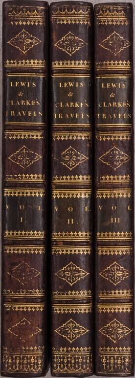
The map is accompanied by a complete set of the original 3 volume text, including the remaining maps, with only the large map detached from the book, but otherwise in very nice condition.
If you are a student, write to us in telegram: @antiquemaps and indicate what material you need and for what work you need a map in high detail. We are ready to provide material on special terms. For students only!

![[Signed Political Satire Artwork] Vietnam ... Vietnam ... Vietnam ...](/map/small/68726.jpg)
