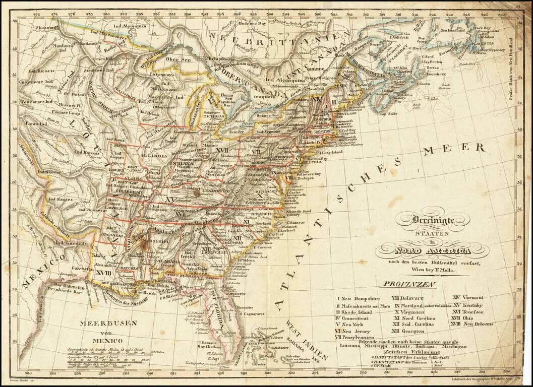
Scarce & interesting map of the United States, published in the decade following the Louisiana purchase. Among the more notable features of the map are the many interesting mountain ranges in the Plains regions, the early appearance of Michigan...
An Early American Travel Directory By America's Most Important Early Mapmaker Rare early travel directory, published by John Melish in 1819. This is one of the earliest American Travel guides, produced by America's most important mapmaker in the...
Interesting map of the United States, from A Year's Residence in the United States of America , by William Cobbett. The map shows the United States shortly after the creation of Michigan Territory, Illinois Territory and Alabama Territory. The...
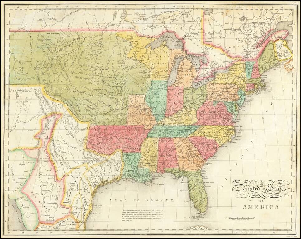
Showing The Discoveries of Lewis & Clark Very early coast to coast map of the United States, engraved in New Haven, Connecticut by Alfred Daggett, exhibiting the fulfillment of Thomas Jefferson's image of American Manifest Destiny. Issued shortly...
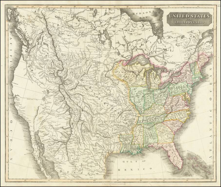
A Manifest Destiny Map - One of the Earliest Maps of The United States Extending To The Pacific Ocean Fine example of John Thomson's coast to coast map of the United States, published in Edinburgh in 1820. Thomson's map of the US is one of the...
![[Missouri named Jefferson] Etats-Unis par A.M. Perrot](/map/small/69488.jpg)
Missouri as the state of Jefferson Fascinating early map of the United States, which names the present state of Missouri as Jefferson. The outline color clearly delineates Missouri, as formed in 1821. Other features include a 54-40 or fight boundary...
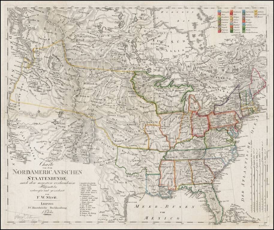
Scarce early coast to coast map of the United States, issued by F.W. Streit, in Leipzig, featuring excellent post-Lewis & Clark details. The map is study in the cartographic details of the Western United States following the expeditions of Lewis...
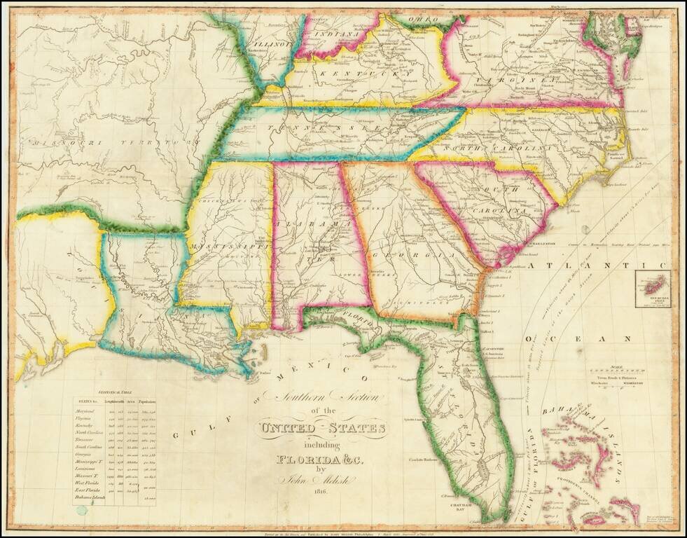
Nice example of Melish's map of the United States, which appeared in the Carey & Lea American Atlas. The map extends westward to depict the northwest, Missouri and "Arkansa" territories, and the province of Mexico, including Texas. The map draws...
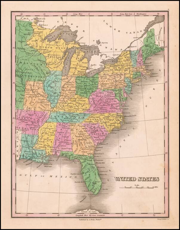
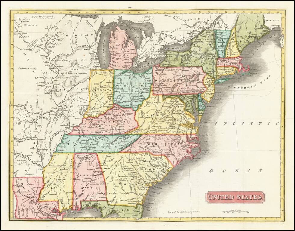
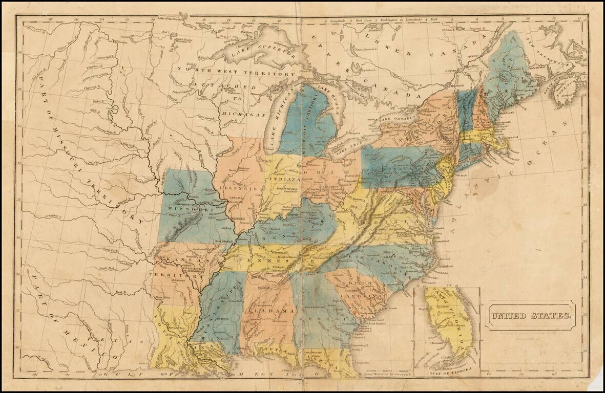
Interesting map of the Eastern United States, extending west to show a massive Missouri Territory. Shows an oversized Northwest Territory, double wide Arkansas Territory and naming Michigan Territory, within its approximate current borders but lacking...
![A Map of North America, Constructed According To The Latest Information: by H.S. Tanner. Improved to 1825 [Case Map]](/map/small/33554.jpg)
The First Map To Name Oregon Territory and The Finest Map of North America Published in America in the First Half of the 19th Century Tanner's landmark map of North America, first issued in 1822, is perhaps the most important North American map of the...
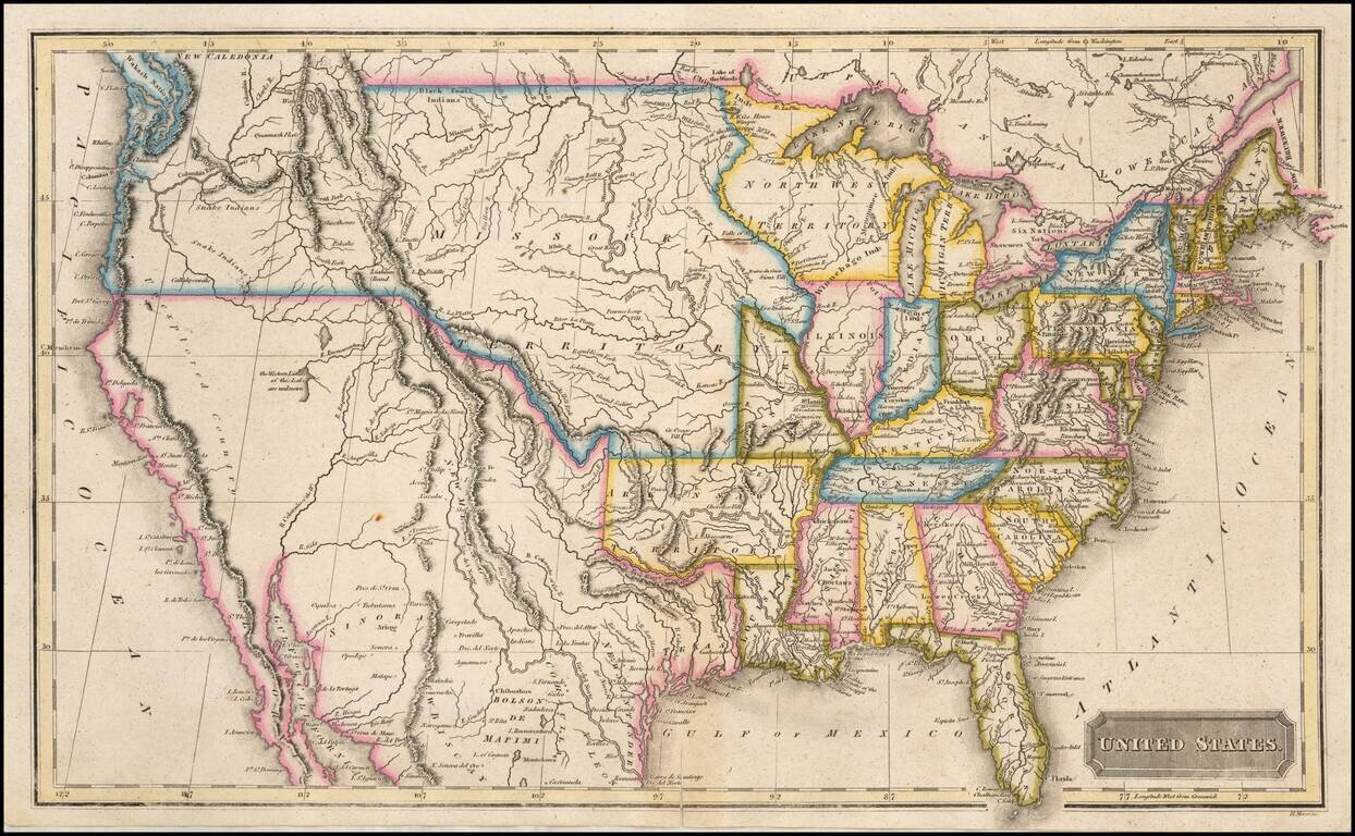
Rare early map of the United States, published in Boston by Annin & Smith. The map shows a large region west of Lake Michigan entitled North West Territory Attached to Michigan. The massive area now known as Missorui Territory is identified, then...
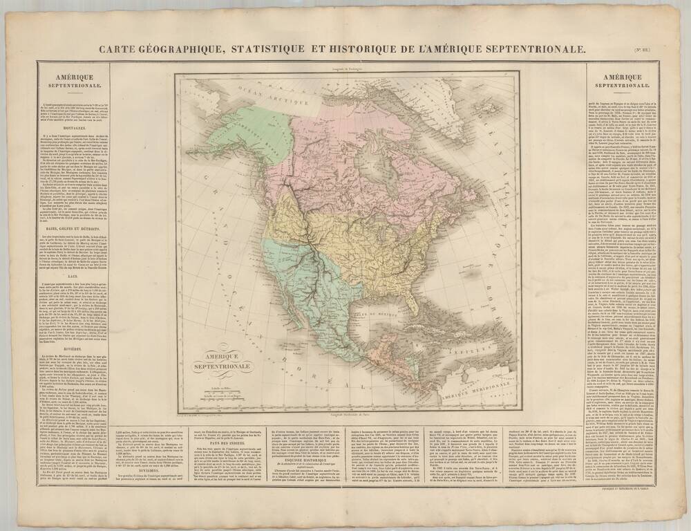
Striking large map of North America in attractive full wash colors, from the French edition of Carey & Lea's Atlas of America, one of the most important American Atlases of the early 19th Century. The map includes a 54-40 or fight border with...
Fascinating map of the United States, colored to delineate the states and territories. In California, the map shows the mythical river flowing to an unnamed lake (Teguayo) to San Francisco Bay, crossing a region entitled "Parties encore inconnues"...
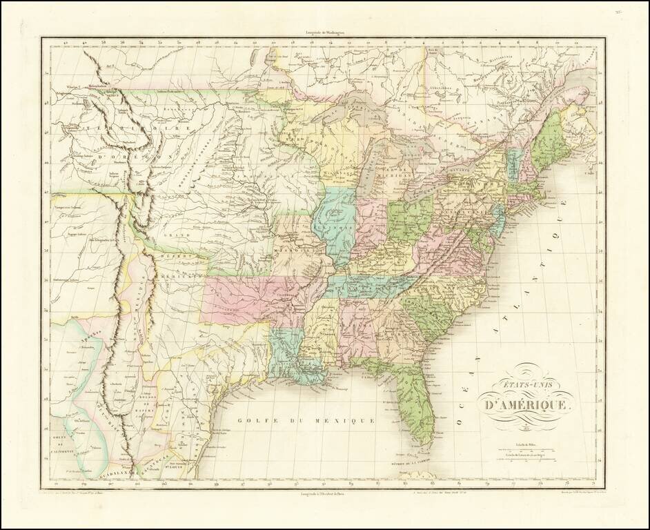
Buchon's edition of John Melish's map of the United States. Fine example of Jean Alexandre Buchon's map of the United States, intended to be included in his Atlas geographique, statistique, historique et chronologique des deux Ameriques (Paris,...
![Map of the United States and the Provinces of Upper & Lower Canada, New Brunswick, and Nova Scotia. Compiled from the latest Surveys . . . 1827 [Case Map in 4 sheets]](/map/small/43908bm.jpg)
One of the best large format maps of the United States published in the 1820s, including the location of several short-lived forts and Fur Trading houses between the Missouri and Mississippi River Valleys. Walker's case map of the United States is one...
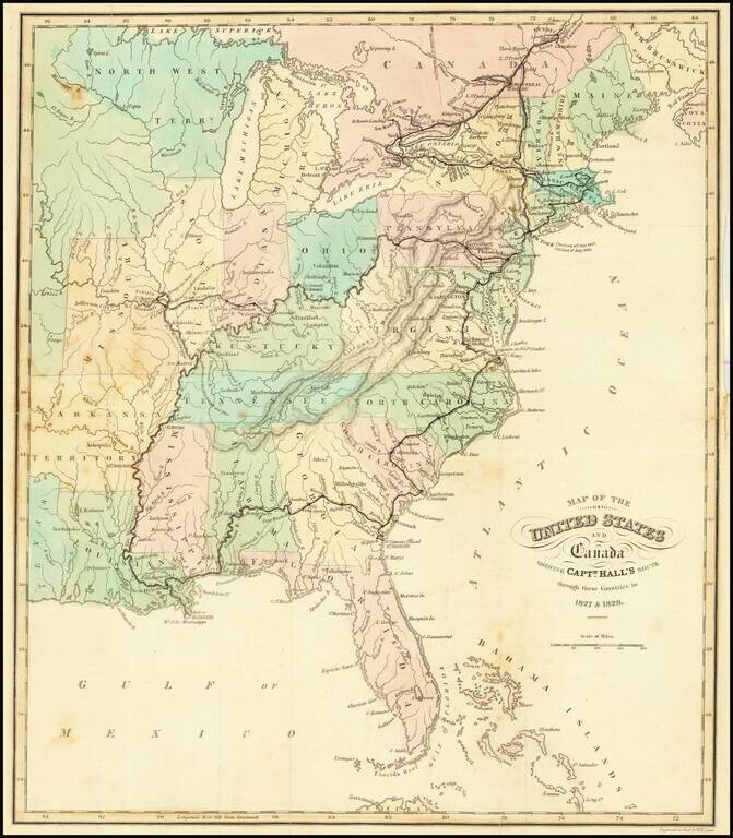
Attractive and detailed map of the United States, colored by states. Shows towns, islands, rivers, mountain ranges, great lakes, etc. Detailed record of Hall's route in bold print.