Map size in jpg-format: 6.58496MiB
Click to open in high resolution (open in new tab).

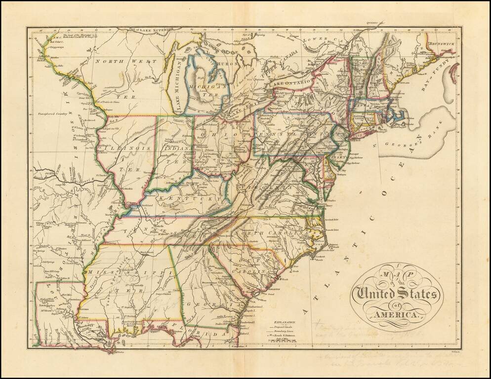
Nice example of Mathew Carey's map of the United States, which first appeared in his 1814 General Atlas, published in Philadelphia.
The map reflects a fascinating period in the geo-political evolution of the U.S. Mississippi Territory still appears, including all of the future State of Alabama. Michigan Territory has recently been created, but does not yet include the Upper Peninsula. Illinois Territory and Indiana Territory are shown, but the boundaries are pushed considerably west of their true location by an oversized Ohio, such that Illinois does not touch any part of Lake Michigan and Chicago is left in the Northwest Territory.
West of the Mississippi, a massive Missouri Territory appears, stretching from Louisiana to Canada. Along the Mississippi River, many forts and Indian Villages are shown, along with several notes on the source of the Mississippi, trading houses, etc. St. Louis is shown at the confluence of the Mississippi and Missouri, with several Indian villages and forts shown to the West on the Missouri. To the south of the Missouri, there are a number of early settlements shown in what would become Missouri and Arkansas, including Williams, Flees, Futenans, and Hackerton's Settlements and the Post of Arkansas.
The map also shows many early roads, distances, proposed canals, Forts and many other places of interest.
A scarce and informative map of the United States, published by one of America's most important early mapmakers.
If you are a student, write to us in telegram: @antiquemaps and indicate what material you need and for what work you need a map in high detail. We are ready to provide material on special terms. For students only!

![[Signed Political Satire Artwork] Vietnam ... Vietnam ... Vietnam ...](/map/small/68726.jpg)
