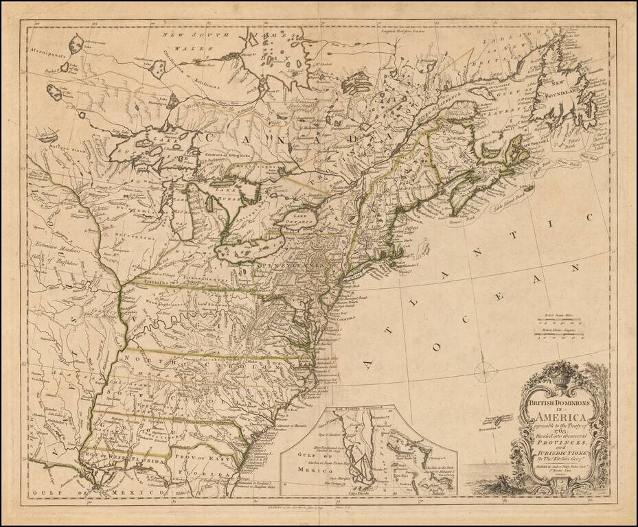
Rare Revolutionary War Era Map of the American Colonies. Andrew Dury's rare double-page engraved map of the American colonies, published during the Revolutionary War. This example in subtle, but pleasing, old outline hand-color. Dury's British...
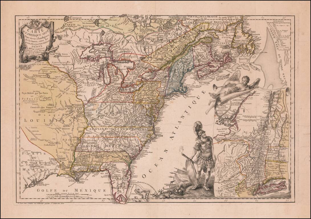
Mars, the God of War, Witnessing Fame's Proclamation of the Birth of the United States Fine example of Beaurain's important map of The 13 Colonies and the contiguous part of French Louisiana and Florida, one of the earliest maps published in Europe to...
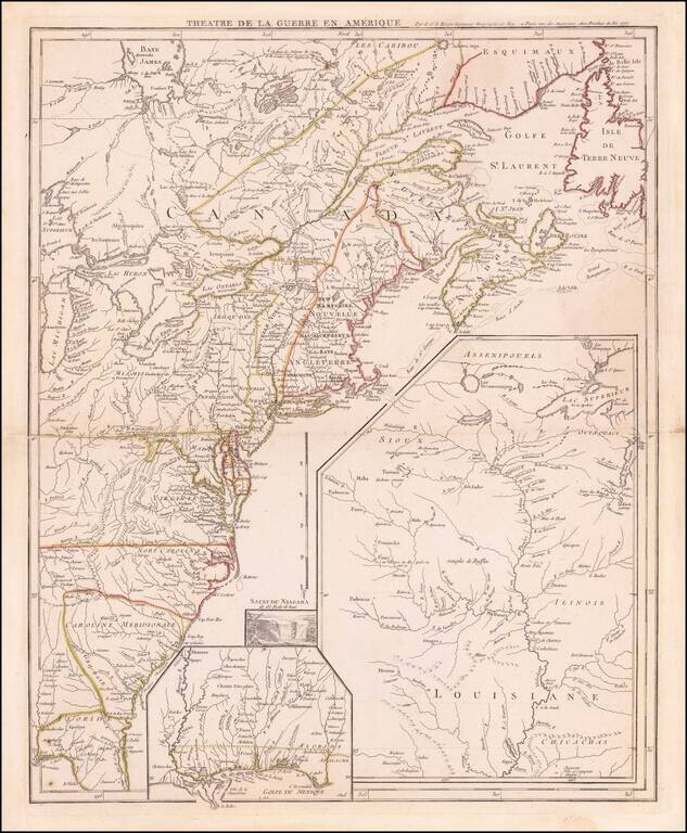
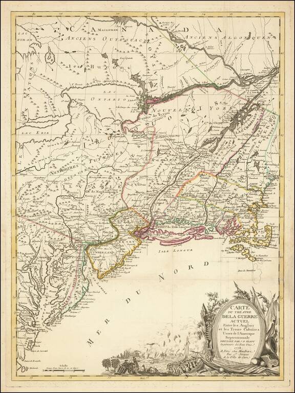
Antique Map of The Theater of The American Revolution on the Eve of the French Joining the War Coming the year after the creation of the United States and signing of the Declaration of Independence, this antique map illustrates the British Colonies...
Nice example of the first edition of this scarce separately issued broadside Revolutionary War Map of the British Colonies. The map includes a remarkable amount of historical, topographical and military notes and details concerning the British...
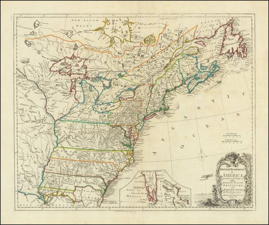
Rare Revolutionary War Era Map of the American Colonies. Andrew Dury's rare double-page engraved map of the American colonies, published during the Revolutionary War. This example in subtle, but pleasing, old outline hand-color. Dury's British...
Nice example of J. B. Eliot's map of the United States, generally regarded as the earliest map to include the title "United States'' on a printed map. Eliot's map, which is drawn from American sources not previously utilized on any printed map, is...
![[United States] Il Canada Le Colonie Inglesi Con La Luigiana E Florida di nuova Projezione . . . 1778](/map/small/65888.jpg)
Striking map of the United States and Canada, which includes references to the Upper and Lower English Colonies of Louisiana. One of the very few maps we have seen from the period which treat the regions east of the Mississippi as being Upper or...
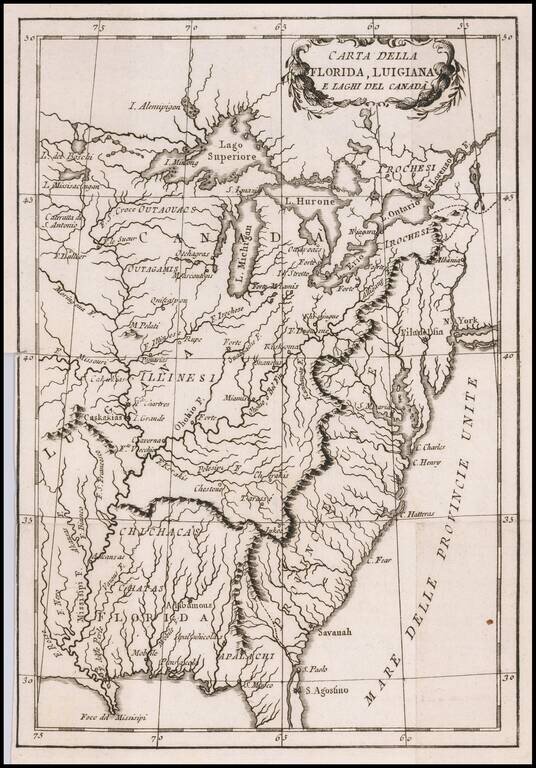
Albany called Albania! Rare Italian map of the United States, Florida, Louisiana and Canada, which appears to have been issued during the American Revolutionary War. The US is called Province Unite, with Albany, New York called Albania. The city (or...
Scarce late state of De Vaugondy's map of North America, published in Paris. First issued in the 1750s, this edition has been updated to include the newly formed United States. Florida is shown as an archipelago and the coastline of California is...
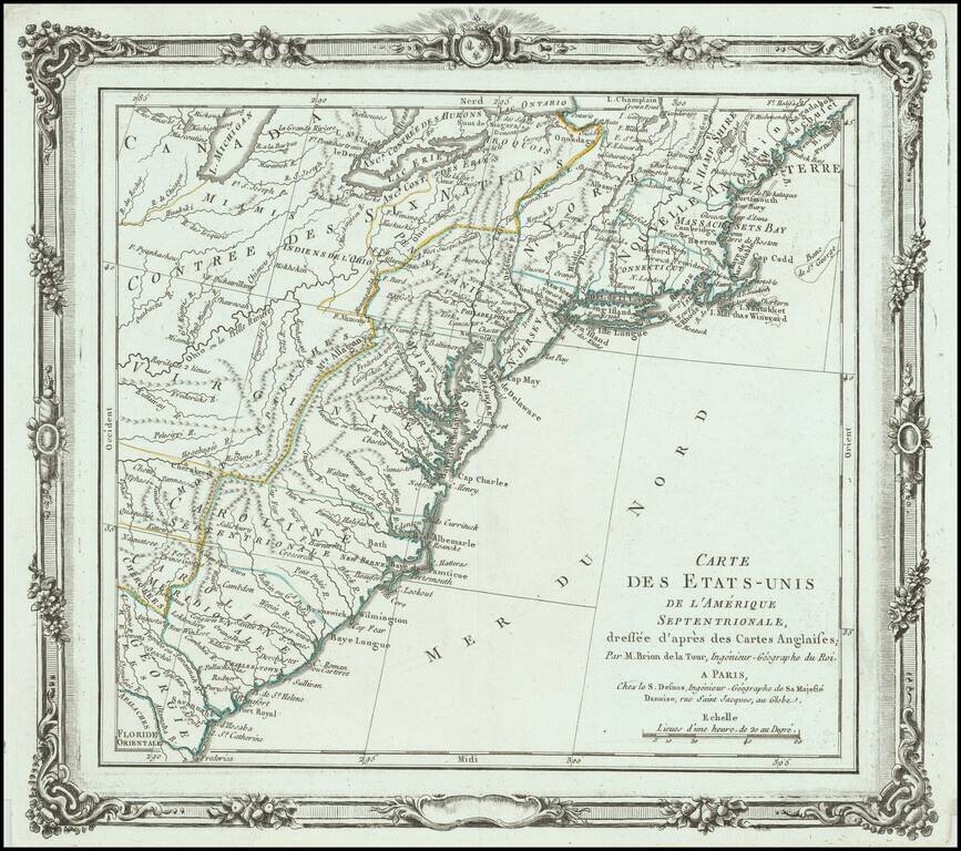
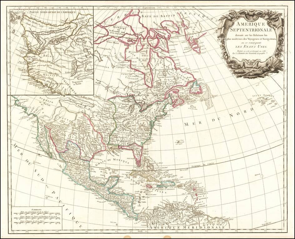
One of the Earliest Maps to Name the United States Brion de La Tour's map is one of the earliest obtainable maps to name the United States (Etats Unis de L'Amerique Septentrionale). The map shows the 13 Colonies, pre-dating the appearance of Vermont....
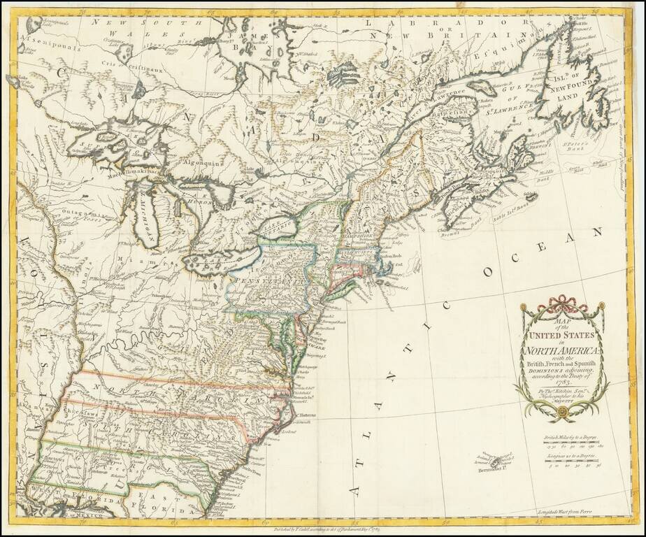
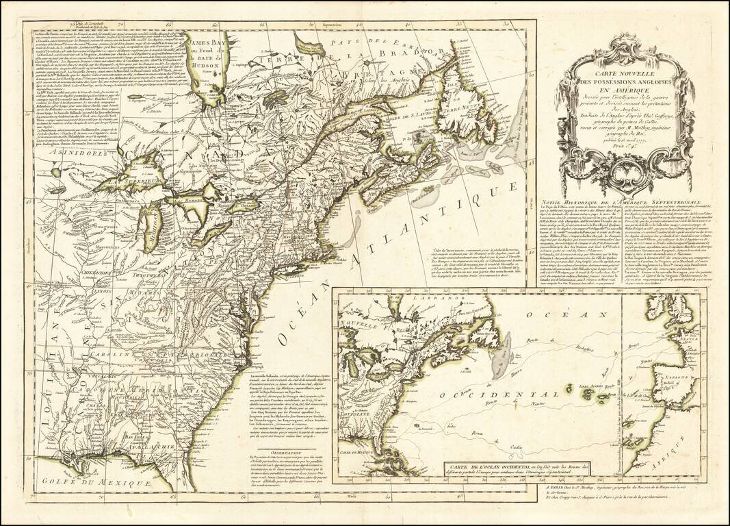
One of the earliest obtainable English Maps to name (and recognize) the newly independent United States of America. The map shows the United States extending to the Mississippi River, with the former colonial claims now Independent States. The states...
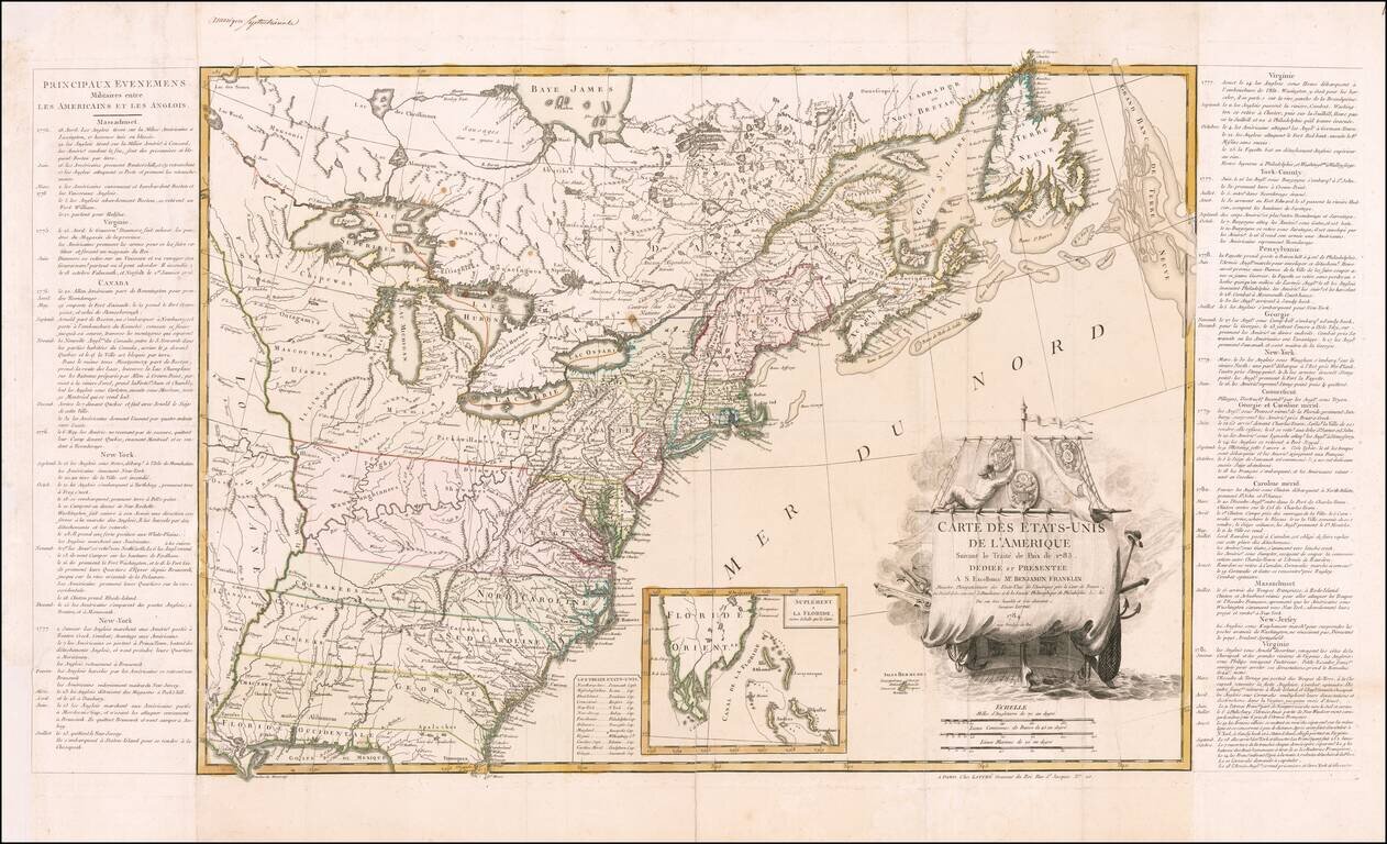
Dedicated to Benjamin Franklin -- The First Map of The United States Published After Ratification of the Treaty of Paris Lattre's map of the United States appeared in June 1784, just two months after the United States gained official independence...
Fine example of Lotter's four-sheet map of the newly formed United States, based upon a map originally published by Bowen & Gibson and later by Jefferys, and Sayer & Bennett. The map is a completely different engraving and includes a striking...
![[Untitled Map of the United States] Canada IIe Feuille](/map/small/61191.jpg)
Detailed map of the United States and French Louisiana, west to the region of the Padouca Indians along the Upper Missouri and covering most of Texas. Nice detail in the Missouri and Mississippi River Valleys, indicative of the French activity in the...
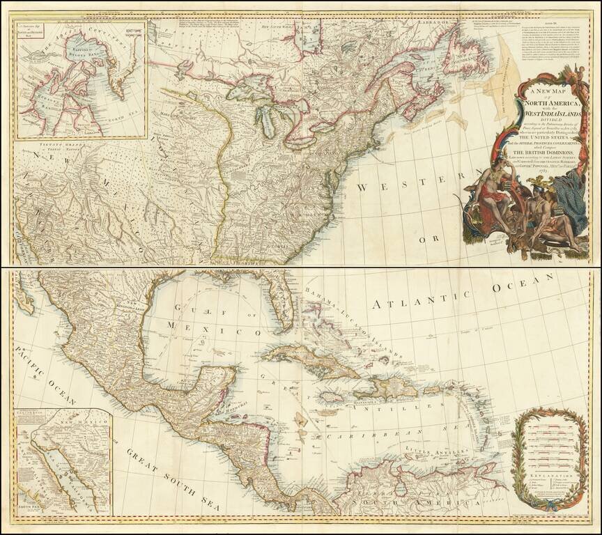
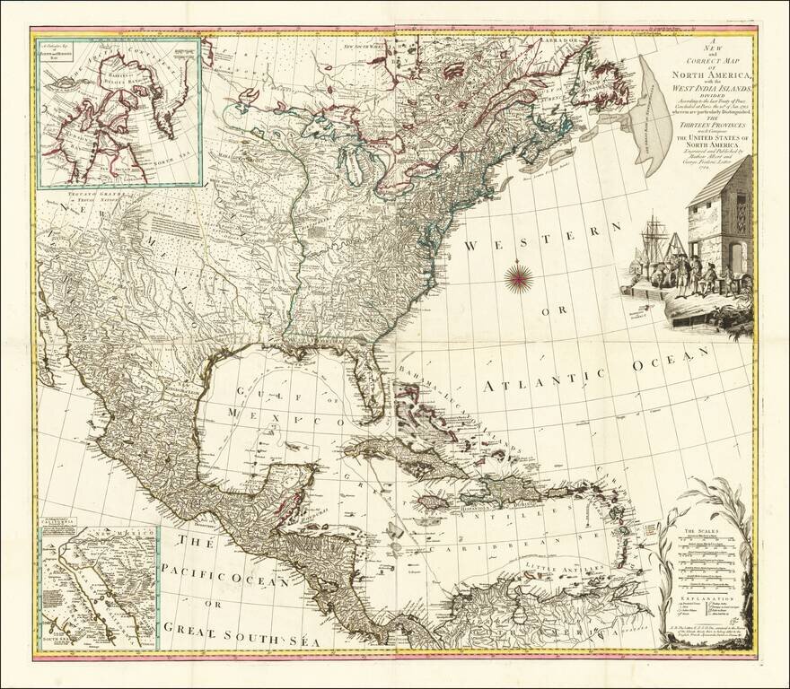
Striking example of this monumental 4-sheet map of North America, issued shortly after the conclusion of the Revolutionary War. Originally issued separately by Bowen & Gibson in 1755, this map was periodically updated following the conclusion of...
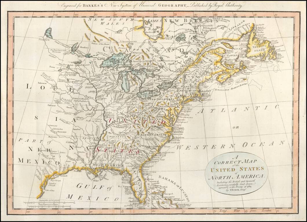
Early map of the United States, colored by regions and Colonies. The map was published shortly after independence, and prior to the admission of Kentucky, Tennessee or Vermont as states, although Vermont is named quite curiously, appearing above...