Map size in jpg-format: 2.33748MiB
Click to open in high resolution (open in new tab).

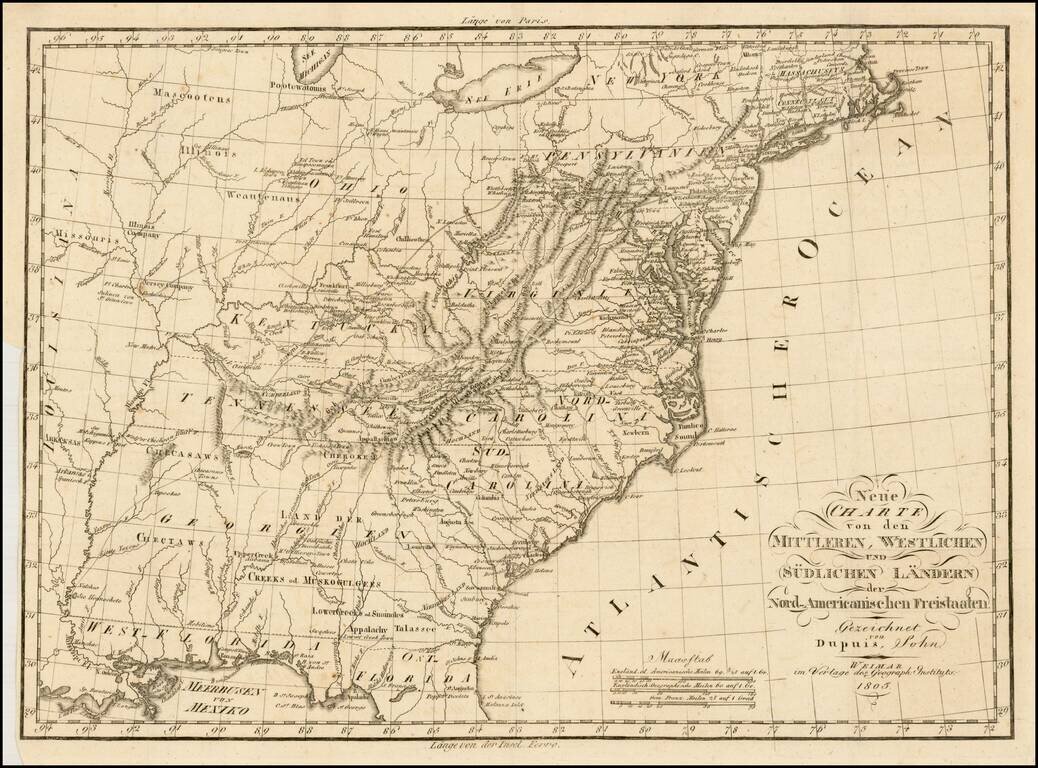
Rare early German map of the United States, in the first decade of the 19th Century.
One of the most striking features of the map is the excellent treatment of the major western roads.
The map provides and excellent treatment of the Indian Tribes west of the Appalachian and Alleghany Mountains. A number of Western Military Forts are shown, as are the lands of the Jersey Company and Illinois Company in Illinois.
Ohio is shown. Georgia still extends to the Mississippi River, pre-dating Alabama and Mississippi Territories. East and West Florida also appear on the map.
The map was published during the time period when East Florida and West Florida were not yet part of the United States.
The map appeared in a very rare German travel book, entitled Reise in das innere Nordamerikanischen Freistaaten, westwärts der Alleghany=Gebirge. Aus dem Französischen. Mit einigen Zusätzen und Anmerkungen herausgegeben von T.F. Ehrmann. Mit einer Charte.
If you are a student, write to us in telegram: @antiquemaps and indicate what material you need and for what work you need a map in high detail. We are ready to provide material on special terms. For students only!

![[Signed Political Satire Artwork] Vietnam ... Vietnam ... Vietnam ...](/map/small/68726.jpg)
