logo

1768. A Map of North America from the Latest Surveys and Maps . . .

  • A Map of North America from the Latest Surveys and Maps . . .

A Map of North America from the Latest Surveys and Maps . . . information:

Year of creation: 
Resolution size (pixels): 
 13777x10123 px
Disk Size: 
 31.066MiB
Number of pages: 
 1
Place: 
 London
Author: 

Print information. Print size (Width x height in inches):
Printing at 72 dpi 
  191.35 х 140.6
Printing at 150 dpi 
 91.85 х 67.49
Printing at 300 dpi 
 45.92 х 33.74

An example of detailing the file of this map of in a printable high-resolution:

Click to open in high resolution (open in new tab).
Attention! this is just the central piece (central area 960x960 px) of the map file!
This is an example, so that you can see and study the level of detail of a given map. The entire Map will be fully available after payment!

A Map of North America from the Latest Surveys and Maps . . .

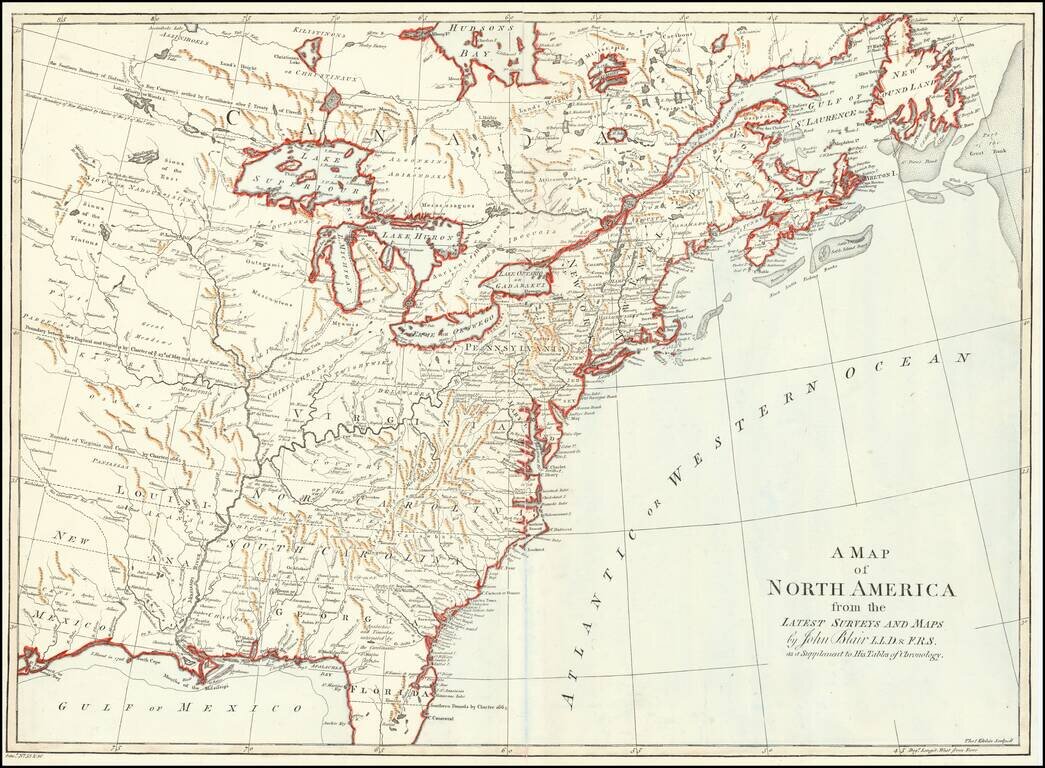
Detailed map of the British Colonies in North America, featuring Georgia, the Carolinas and Virginia with their boundaries extending to the Mississippi River.

The map provides a detailed look at the British Colonies, between the French & Indian War and the American Revolution. The map also notes the boundaries established by the Treaty of Utrecht and 3 different English Colonial Charters.


Special conditions for students!

If you are a student, write to us in telegram: @antiquemaps and indicate what material you need and for what work you need a map in high detail. We are ready to provide material on special terms. For students only!

Item information:

Year of creation:
Size:
13777x10123 px
Disk:
31.066MiB
Number of pages:
1
Place:
London
Author:
John Blair.
$14.99

Related item