logo

1776. An accurate Map of the present Seat of War, between Great Britain and her Colonies in North America . . . 1776

  • An accurate Map of the present Seat of War, between Great Britain and her Colonies in North America . . . 1776

An accurate Map of the present Seat of War, between Great Britain and her Colonies in North America . . . 1776 information:

Year of creation: 
Resolution size (pixels): 
 8458x6507 px
Disk Size: 
 15.3292MiB
Number of pages: 
 1
Place: 
 London
Author: 

Print information. Print size (Width x height in inches):
Printing at 72 dpi 
  117.47 х 90.38
Printing at 150 dpi 
 56.39 х 43.38
Printing at 300 dpi 
 28.19 х 21.69

An example of detailing the file of this map of in a printable high-resolution:

Click to open in high resolution (open in new tab).
Attention! this is just the central piece (central area 960x960 px) of the map file!
This is an example, so that you can see and study the level of detail of a given map. The entire Map will be fully available after payment!

An accurate Map of the present Seat of War, between Great Britain and her Colonies in North America . . . 1776

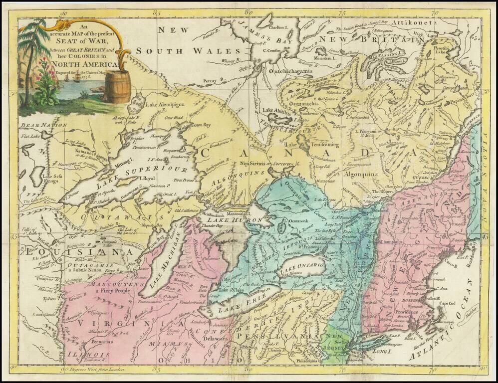
Centered on the Great Lakes

Scarce map of the Northern and Western part of the British Colonies in North America, showing the theater of the American Revolutionary War in 1776.

The map extends north to James Bay, west to the Mississippi River and south to Philadelphia and Pittsburg.

The map notes the region of "Confederate Indians" south of the Lake Erie and Lake Ontario, along with a number of other Indian Tribes.


Special conditions for students!

If you are a student, write to us in telegram: @antiquemaps and indicate what material you need and for what work you need a map in high detail. We are ready to provide material on special terms. For students only!

Item information:

Year of creation:
Size:
8458x6507 px
Disk:
15.3292MiB
Number of pages:
1
Place:
London
Author:
Universal Magazine.
$14.99

Related item