Map size in jpg-format: 12.9613MiB
Click to open in high resolution (open in new tab).
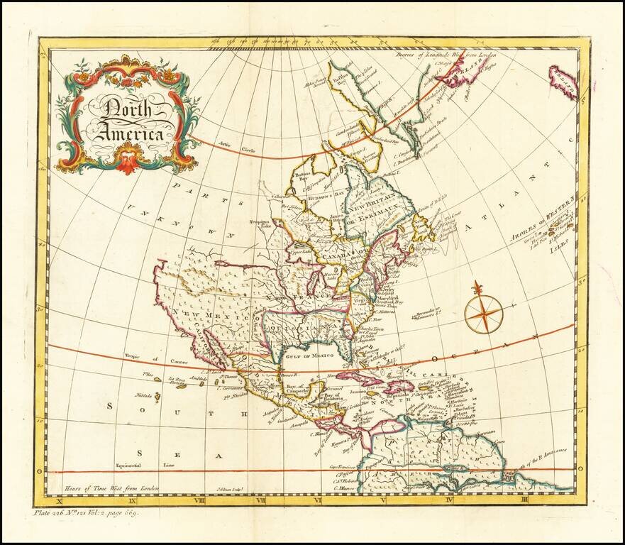
Decorative map of North America, published during the French & Indian War.
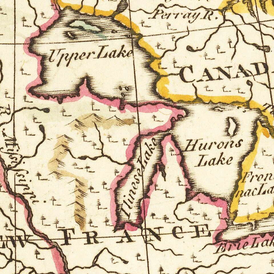
The map provides a very large inaccurate depiction of the Great Lakes, along with a disembodied river and lake system in the west. There is no northwest coast of America. There is a hint of a Northwest Passage near Cape Churchill.
John Gibson flourished in London from 1748 to 1773. He was most likely born ca. 1724. As a young man he was apprenticed to John Blunbell of the Stationers Company, and then to John Pine. He was made free of the Company in 1748. Gibson proved a talented geographer and engraver who produced numerous maps, especially for books and magazines. He worked in collaboration with other map sellers such as Emanuel Bowen and John Roque. His best-known work was the pocket atlas, The Atlas Minimus (1758). Although little is known about his life beyond his publications, he was imprisoned for debt in King’s Bench from May to June of 1765.
If you are a student, write to us in telegram: @antiquemaps and indicate what material you need and for what work you need a map in high detail. We are ready to provide material on special terms. For students only!

![[Signed Political Satire Artwork] Vietnam ... Vietnam ... Vietnam ...](/map/small/68726.jpg)
