Map size in jpg-format: 1.45315MiB
Click to open in high resolution (open in new tab).
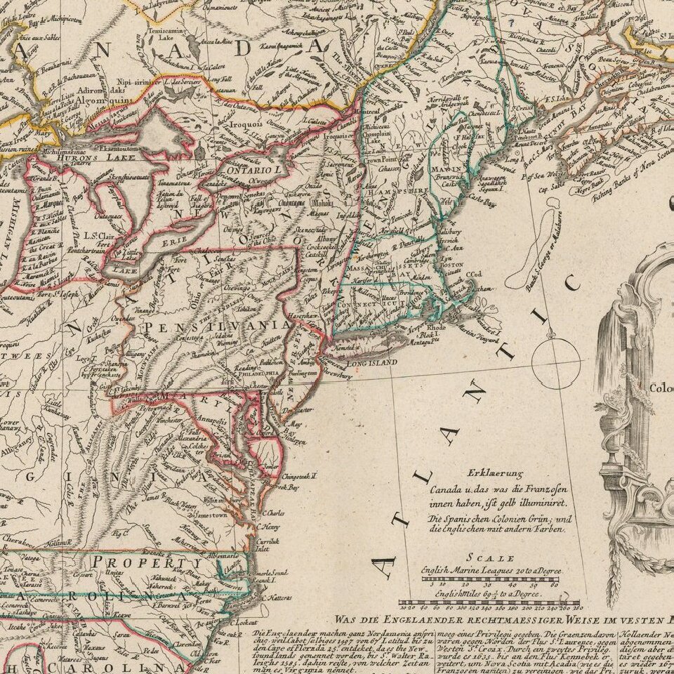
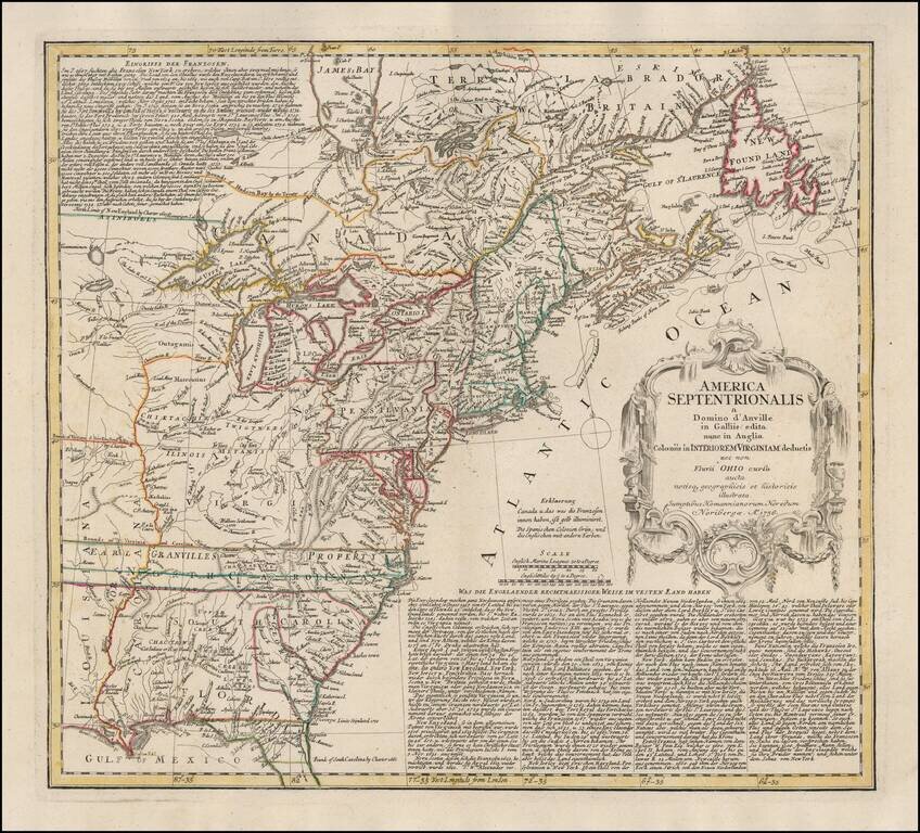
Scarce first edition of this fine early map of the British Colonies in North America at the outset of the French & Indian War.
The map names and depicts many of the early boundary lines delineating the colonial charters, some with dates.
Some of the interesting features include a truncated Pennsylvania and oversized Virginia, as well as the massive stretch of land in North Carolina designated as Earl Granville's property, which extends to the Mississippi. An early appearance of Georgia. Nice detail in the Great Lakes region and Canada.
Extensive annotations in German, give details on the various American Colonies.
Homann Heirs was a German publishing firm that enjoyed a major place in the European map market throughout the eighteenth century. Founded in 1702 by Johann Baptist Homann, the business passed to his son, Christoph, upon Johann’s death in 1724. Christoph died in 1730, aged only 27, and the firm was inherited by subsequent Homann heirs. This altered the name of the company, which was known as Homann Erben, or Homann heirs. The firm continued in business until 1848.
If you are a student, write to us in telegram: @antiquemaps and indicate what material you need and for what work you need a map in high detail. We are ready to provide material on special terms. For students only!

![[Signed Political Satire Artwork] Vietnam ... Vietnam ... Vietnam ...](/map/small/68726.jpg)
