Map size in jpg-format: 31.5789MiB
Click to open in high resolution (open in new tab).
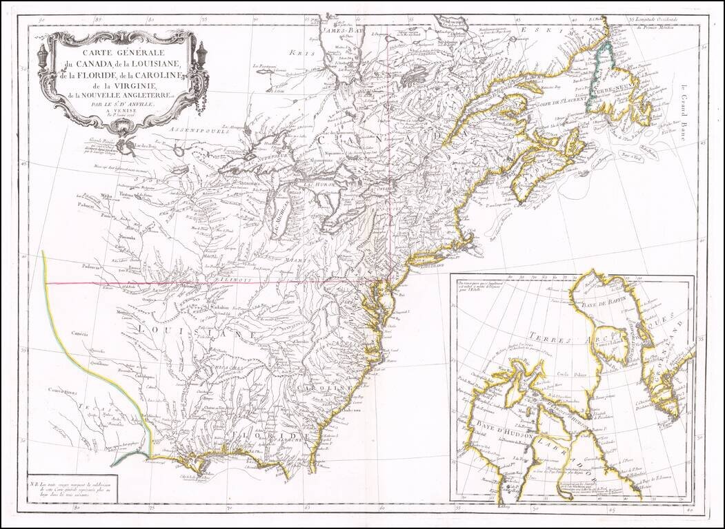
Second edition of Santini's map of the British & French Colonies in North America, based upon D'Anville's seminal map of 1746.
The map provides a highy detailed treatment of Great Lakes and Mississippi Valley, on the eve of the American Revolution.
The map shows numerous French forts throughout, along with substantial Indian detail, along with a massive Tecas and Louisiana.. One of the best large format maps of the region during the latter part of the 18th Century, based upon D'Anville's map of North America.
The map was first issued in 1775, with this example bearing the new date of 1776.
If you are a student, write to us in telegram: @antiquemaps and indicate what material you need and for what work you need a map in high detail. We are ready to provide material on special terms. For students only!

![[Signed Political Satire Artwork] Vietnam ... Vietnam ... Vietnam ...](/map/small/68726.jpg)
