logo

1775. A New Map of North America, agreeable to the most approved Maps and Charts.

  • A New Map of North America, agreeable to the most approved Maps and Charts.

A New Map of North America, agreeable to the most approved Maps and Charts. information:

Year of creation: 
Resolution size (pixels): 
 9359x8388 px
Disk Size: 
 18.6601MiB
Number of pages: 
 1
Place: 
 London
Author: 

Print information. Print size (Width x height in inches):
Printing at 72 dpi 
  129.99 х 116.5
Printing at 150 dpi 
 62.39 х 55.92
Printing at 300 dpi 
 31.2 х 27.96

An example of detailing the file of this map of in a printable high-resolution:

Click to open in high resolution (open in new tab).
Attention! this is just the central piece (central area 960x960 px) of the map file!
This is an example, so that you can see and study the level of detail of a given map. The entire Map will be fully available after payment!

A New Map of North America, agreeable to the most approved Maps and Charts.

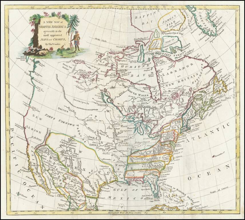
Decorative map of North America with a large title cartouche.

The map shows the British Colonies still extending to the Mississippi, although Pennsylvania is now truncated. East and West Florida are shown.

The northwest coast of America is still New Albion, with the Straits of Martin Aguilar shown, as is the Straits of Juan De Fuca. Pre-dates MacKenzie's explorations in northwest Canada.


Special conditions for students!

If you are a student, write to us in telegram: @antiquemaps and indicate what material you need and for what work you need a map in high detail. We are ready to provide material on special terms. For students only!

Item information:

Year of creation:
Size:
9359x8388 px
Disk:
18.6601MiB
Number of pages:
1
Place:
London
Author:
Thomas Conder.
$14.99

Related item