![Amerique Septentrionale divisee en Ses Principales parties . . . . 1692 [California as an Island]](/map/small/69862.jpg)
Jaillot’s Impressive Map of North America, with California as an Island Fine, dark impression of Jaillot's striking, large-format map of North America, showing California as an island. The map, printed in a wide-format, shows all that was then...
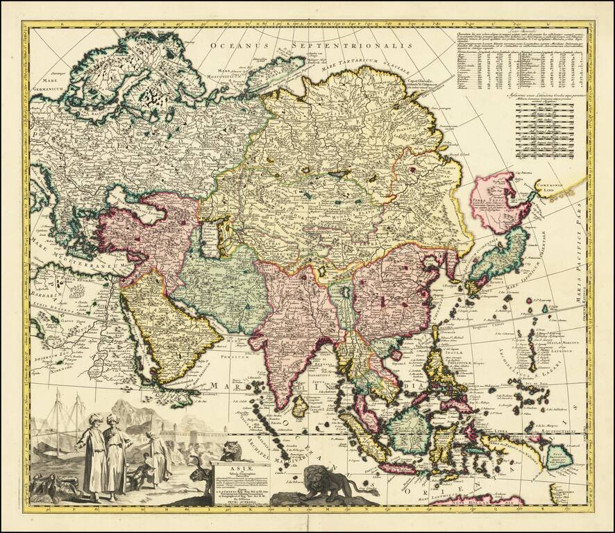
Scarce of map of Asia, published in Amsterdam. The map bears the additional names of Peter Schenk and Nicholas Visscher. The northeast coastline is shown with Witsen's information on Siberia. Hokkaido and Honshu (Terra Yedso) are joined together by a...
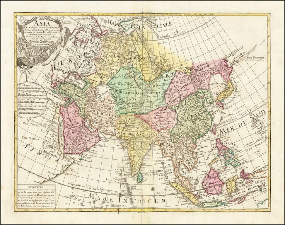
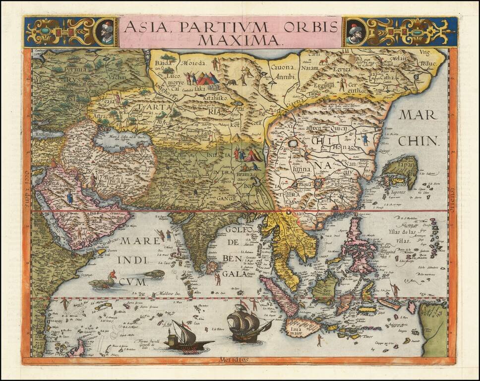
Striking Eighteenth-Century Map of Asia Fine example of Tobias Conrad Lotter's large format map of Asia, based on the cartography of the pre-eminent French cartographer of the eighteenth-century, Guillaume de L’Isle. The map embraces the whole of...
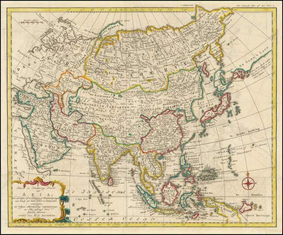
Scarce map of Asia, pubished in Amsterdam by Bachienne. The map includes a number of cartographic myths and interesting names, including Gama's Land and the Sea of Korea....
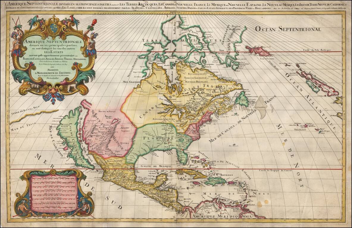
Jaillot’s Impressive Map of North America, with California as an Island Fine, dark impression of Jaillot's striking, large-format map of North America, showing California as an island. The map, printed in a wide-format, shows all that was then...
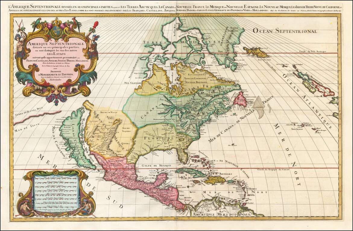
Jaillot’s Impressive Map of North America, with California as an Island Fine, dark impression of Jaillot's striking, large-format map of North America, showing California as an island. The map, printed in a wide-format, shows all that was then...
![A New & Accurate Map of Asia . . . [Shows Mythical De Gama's Land!]](/map/small/70385.jpg)
Decorative map of the continent of Asia, hand colored by countries. In the 1730s and 1740s, De Gama Land was a source of intellectual debate, not as to its existence, but its exact location, with such important explorers as De L'Isle, de la Croyere...

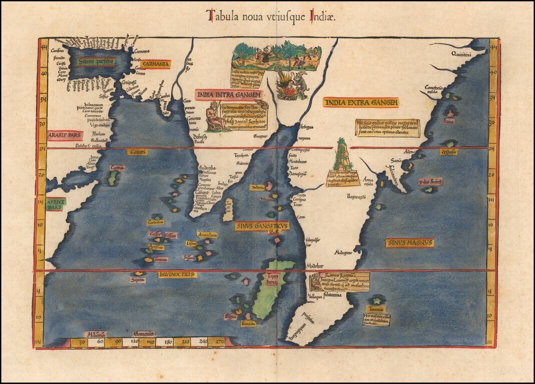
The Earliest Obtainable Map of Southeast Asia, India, etc. Important early map of the Indian Ocean and Southeast Asia, first published in the 1478 Rome edition of Ptolemy's Geography, Claudii Ptholomei Alexandrini. Cosmographia..., created under the...
![Undecima Asiae Tabula [India, Southeast Asia]](/map/small/29254.jpg)
First Two-Color Printed Map of Southeast Asia and Surrounding Areas From a Groundbreaking Edition of Ptolemy's Geographia Fine example of Bernardus Sylvanus’ map of Southeast Asia, China, India, and adjoining regions, from his Geographia published...

The Earliest Modern Map of India and Southeast Asia A striking example of Waldseemuller's modern map of the Indian Ocean, India, Southeast Asia and contiguous regions, from the 1513 edition of Waldseemuller's Geographia. Waldseemuller's modern map...
Nice full color example of the 1541 edition of Fries' map of India and Southeast Asia, focusing on Southeast Asia, India, and Sri Lanka and the Indian Ocean. Fries' map is a reduced size version of Waldeseemuller's 1513 map, the earliest modern map to...
![Tabula Asiae XII [Sri Lanka]](/map/small/59207.jpg)
Striking example of Gastaldi's important map of Sri Lanka, based upon Ptolemy. Giacomo Gastaldi's Atlas of 1548 has been called the most comprehensive atlas produced between Martin Waldseemüller's Geographiae of 1513, and the Abraham Ortelius...
The First Appearance of Formosa Island on a Printed Map. Finely colored example of Gerard De Jode's map of Asia, published in his Speculum Orbis Terrae, in 1593. The map has a fascinating depiction of the Philippine Islands. Singapore is "Sincapura"....

Gorgeous 16th-century map of the region centered on the Indian Ocean, from Linschoten's Itinerario. Linschoten's work was a significant advance in the mapping of India and the Middle East. As noted by Tibbetts, the surprising fact about the...
![[Rare English Edition!] Deliniantur in hac tabula, Orae maritimae Abexiae, freti Mecani: al. Maris Rubri: Arabiae Freti Mecani: al Maris Rubri: Arabiae, Ormi, Persiae, Supra Sindam usque . . . / The description of the coast of Abex, The Straights of Mec](/map/small/69450.jpg)
Rare 16th-century English map of the region centered on the Indian Ocean, which appeared in the rare English edition of Linschoten's Itinerario, Iohn Huighen van Linschoten. His discours of voyages . . . , published in London in 1598. Linschoten's...
![[Rare English Edition!] Delineatio Orarum Maritimarum, Terrae vulgo Indigetatae Terra do Natal, item Sofalae, Mozambicae, & Melindae . . . / The description or Caerd of the Coastes of the Countreys following called ~ Terra do Natal, all the Coast of S](/map/small/69464.jpg)
Rare English Edition -- Stunning Map of Eastern Africa Striking example of the rare English Edition of Linschoten's map of Eastern Africa, which appeared in the rare English edition of Linschoten's Itinerario, Iohn Huighen van Linschoten. His discours...