Map size in jpg-format: 8.75006MiB
Click to open in high resolution (open in new tab).

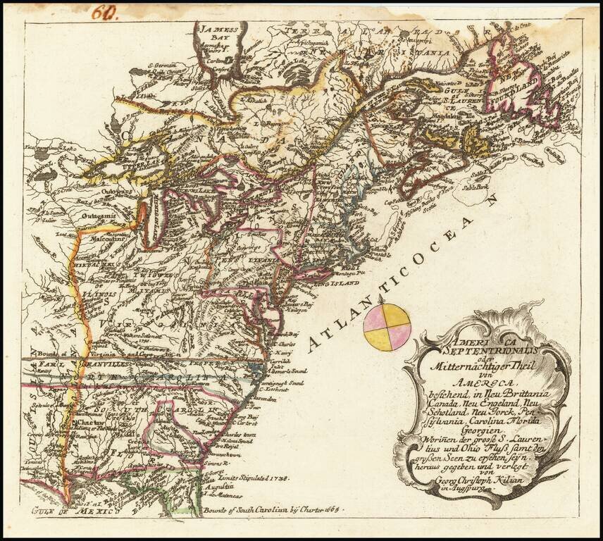
Rare map of the British Colonies at the conclusion of the French & Indian War, originally engraved by Georg Christoph Kilian and included in from Heiden's Americanische urquelle derer innerlichen kriege des bedrängten Teutschlands. . .
The map extends to just beyond the Mississippi River and locates a number of early points of interest, including forts, numerous Indian Tribes, rivers etc. Walker's Settlement 1750, the 1665 and 1738 Limits of the Carolina Colonies, Bounds of the Hudson Bay Company, etc. The map also shows the "Fort Taken by the French in 1754," a reference to George Washington's first military engagement.
The most unusual and interesting of these notes relates to the Walker Settlement. Dr. Thomas Walker ( 1715-1794) was a physician and explorer from Virginia who led an expedition to what is now the region beyond the Allegheny Mountains area of British North America in the mid-18th century. He was responsible for naming what is now known as the Cumberland Plateau and by extension the Cumberland River for the hero of the time, the Duke of Cumberland. His party were some of the first Englishmen to see this area. Previous white explorers were largely of Spanish and French origins. Walker explored Kentucky in 1750, 19 years before the arrival of Daniel Boone.
On July 12, 1749, the Loyal Land Company was founded with Walker as a leading member. After receiving a grant of 800,000 acres in what is now southeastern Kentucky, the company appointed Walker to lead an expedition to explore and survey the region in 1750. Walker was named head of the Loyal Land Company in 1752.
During the expedition, Walker gave names to many topographical features including the Cumberland Gap. His party built the first non-Indian house (a cabin) in Kentucky (today's Dr. Thomas Walker State Historic Site). Walker kept a daily journal of the trip.
If you are a student, write to us in telegram: @antiquemaps and indicate what material you need and for what work you need a map in high detail. We are ready to provide material on special terms. For students only!

![[Signed Political Satire Artwork] Vietnam ... Vietnam ... Vietnam ...](/map/small/68726.jpg)
