
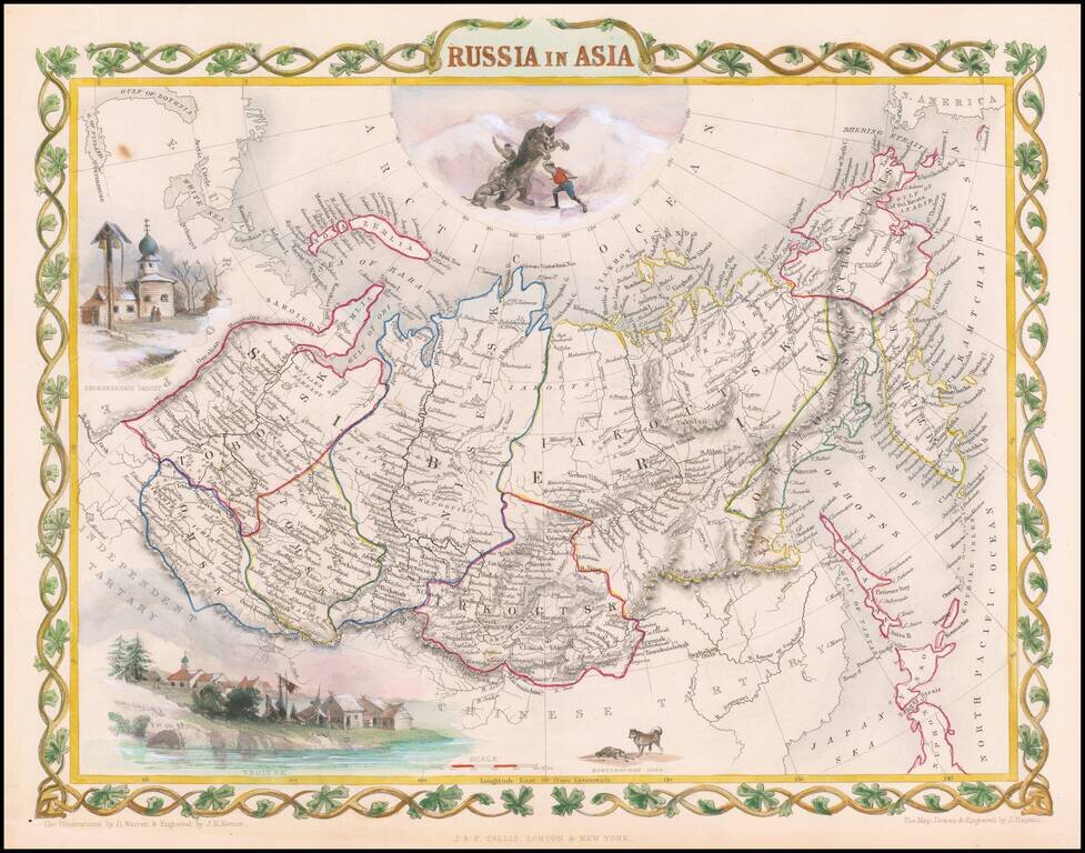
Decorative full color example of Tallis' decorative map of Russian Asia, with large vignettes of a polar hunting scene, Skorskarskoi Pagost, Troitsk and Kamchatkan Dogs. Engraved for R. Montgomery Martin's Illustrated Atlas. Tallis was one of the last...
Third state of Hondius' decorative map of the South Polar region, with the name Joannes Janssonius appearing for the first time. The present state predates the first appearance of New Zealand and Van Dieman's Land. The map includes significant...
![[South Polar Regions]](/map/small/43970.jpg)
Decorative example of Jansson's map of the South Polar region, including the earliest appearance of New Zealand and Van Dieman's Land. The supposed coastline of the unknown southern continent continues to appear. Includes notes regarding the...
![[Untitled Map of South Pole]](/map/small/69130.jpg)
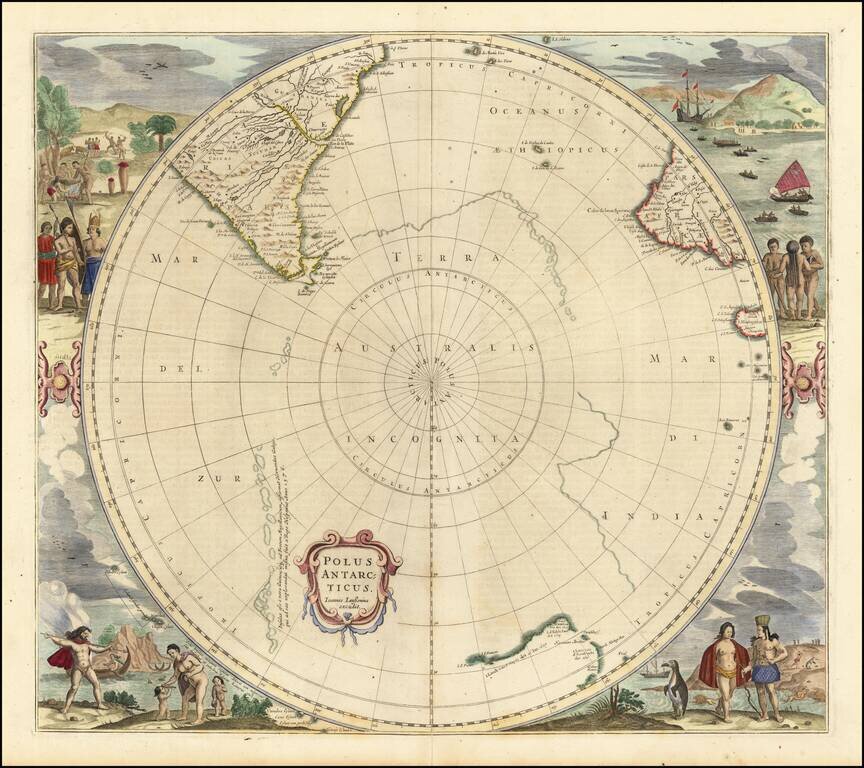
Old color example of this rare late edition of Hondius' decorative map of the South Polar region, including the earliest appearance of New Zealand and Van Dieman's Land on this map. The supposed coastline of the unknown southern continent continues to...

Scarce map of the South Polar regions, published in a late edition of the Jansson-Cloppenberg Atlas Minor. Includes an early depiction of Australia and New Zealand, with a note on islands seen by Magellan. Remnants of the mythical Terra Australis...
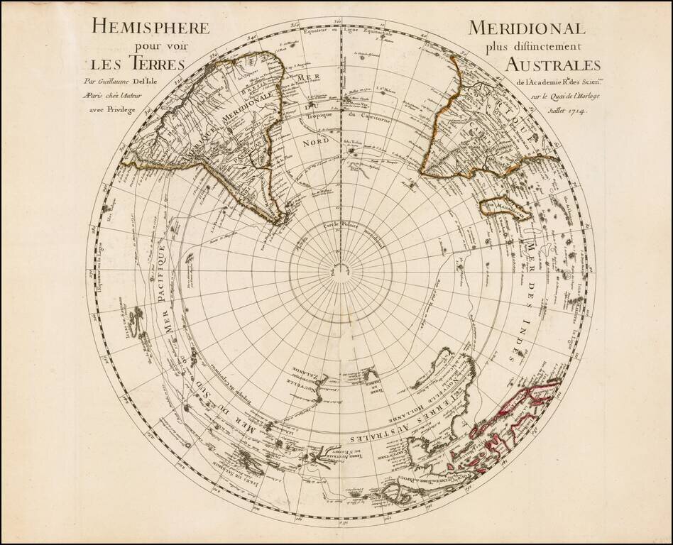
First edition of De L'Isle's important map of the Southern Hemisphere, first published in 1714. De L'Isle's map is an important early map of the South Polar regions, which would become the standard base map for French and Dutch map makers for much of...
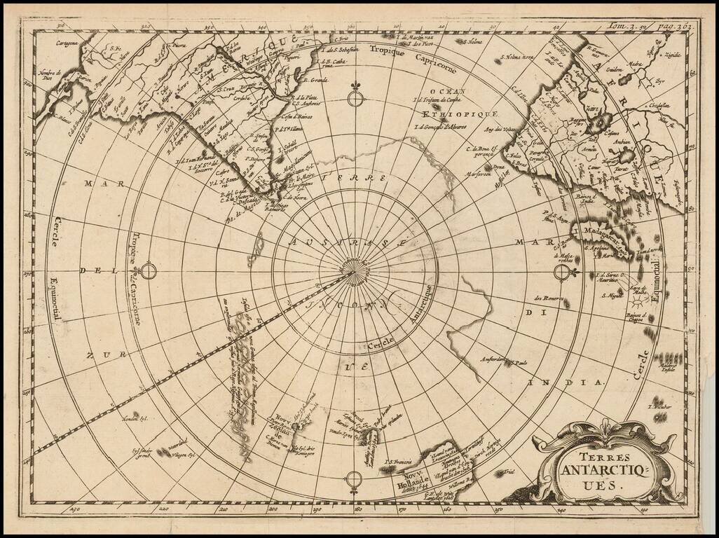
Rare map of the Southern Hemisphere, illustrating the known and imagined lands of the Antipodes. The map provides a fine accounting of the lands of the South Polar regions, some of which were fictional. The map includes outlines of Antarctic...
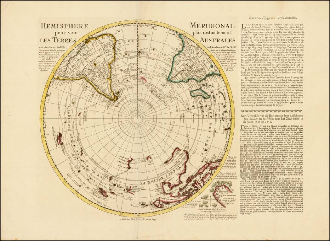
A Rare Ottens map of the Southern Hemisphere, with an additional text panels Southern Hemisphere This fascinating map captures the entire Southern Hemisphere from a polar projection. This rare variant example includes an additional text panel...

A Rare Pair of Ottens Maps of the Northern and Southern Hemisphere, made especially to commemorate Lozier Bouvet's 1738-9 voyage. Fine pair of maps of the northern and southern hemispheres, originally by Guillaume Delisle and here re-issued by...

Cook’s Map of the Southern Hemisphere, Highlighting Historic Exploration toward Antarctica--French Edition French edition of Cook’s highly-detailed, large-format map of the Southern Hemisphere, showing the tracks of major voyages of exploration in...
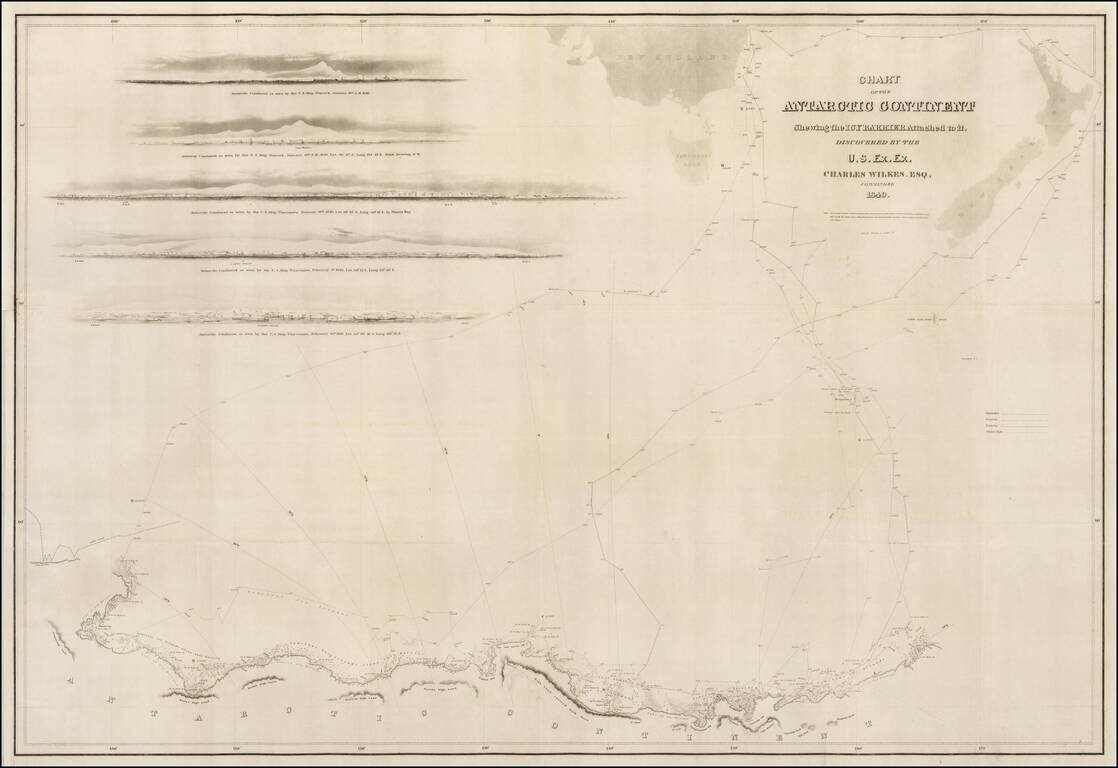
A good example of the Wilkes map of the Antarctic Regions, which accompanied the official account of Wilkes Expedition. The map includes the tracks of Wilkes' expedition, 5 profile views and an outline map of New Zealand and the Southern Tip of...
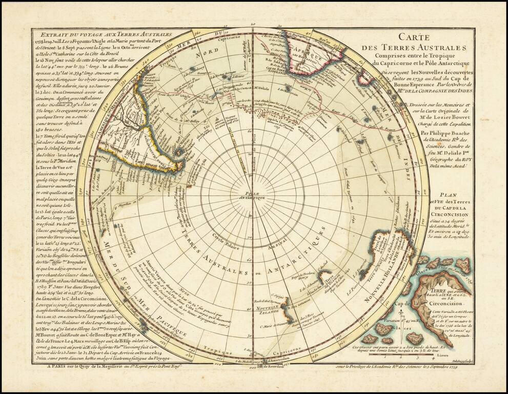
Rare First State / Overview of South Polar Exploration and Conjecture in the First Half of the 18th Century! Remarkable map of the Southern Hemisphere, the foundational map the work of noted French mapmaker Philippe Buache. This map is Buache's...
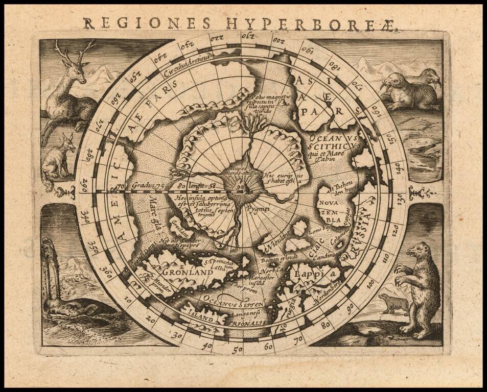
Fine example of Bertius' reduced size version of Gerhard Mercator's highly important and influential map of the North Pole, first published in 1595. Gerard Mercator was the first cartographer to create a polar projection of the earth. His map, the...
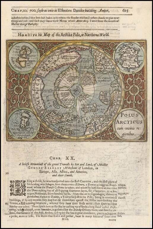
Excellent early map of the North Polar regions, based upon early maps by Mercator and Hondius. Shows the mythical land masses near the pole, the clearly navigable NW and NE passages, a massive California, as discovered by the Spanish, the Davis...
Nice example of this fine miniature map of the North Polar regions, being a reduced copy of the first separate map of the North Polar Regions. The map is extended to 60 degrees, to incorporate the recent explorations in search of the North West and...
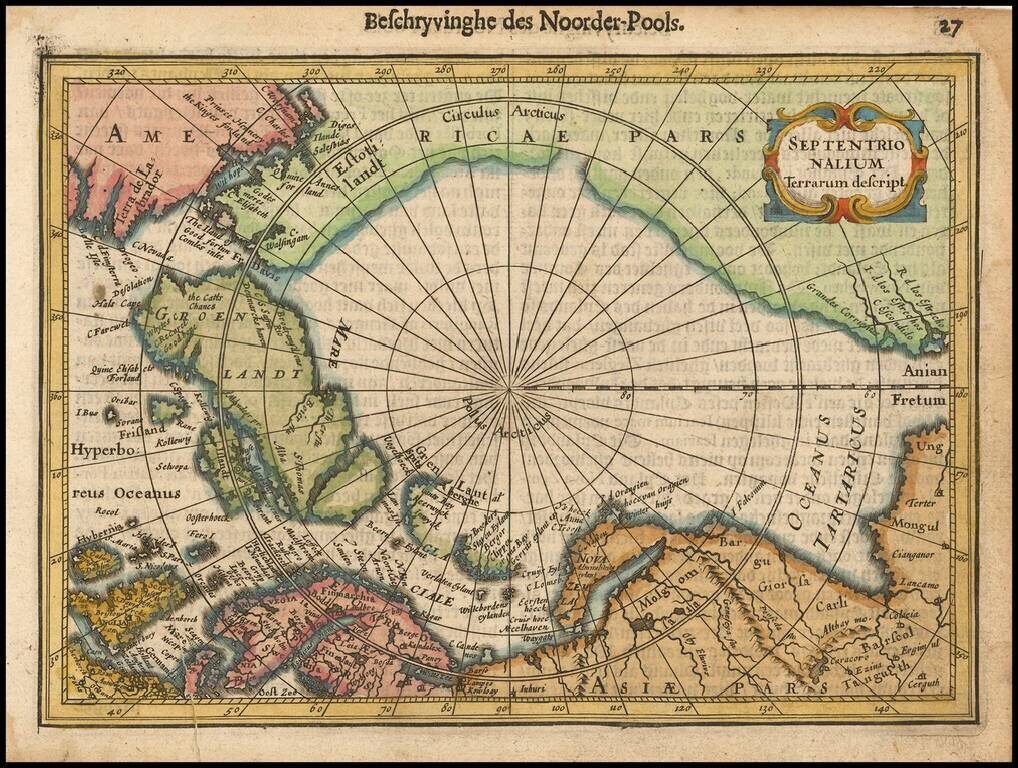
Striking example of Henricus Hondius' map of the North Polar Regions, first issued in 1636. With the advances in the knowledge of the Arctic, Mercator's map of 1595 had become obsolete by the 1630s. Hondius drew on the cartography of Henry Briggs for...