
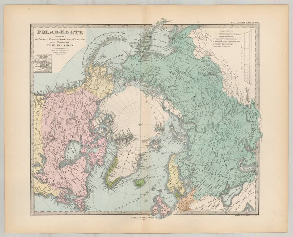
Striking map of the polar region, extending south to 50 degrees. Nice detail in Alaska and Canada, including forts, several routes and other interesting details.
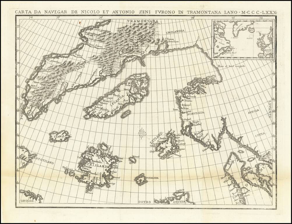
The Zeno Brothers Discoveries in the North Atlantic in the 14th Century Fine dark impression of this fine large format example of Nicolo Zeno's map of the North Atlantic, based upon the legend of a 14th Century Venetian family and their reported...

Henry Hudson's Final Sea Chart, One of the First Maps to Show Hudson Bay This remarkable chart illustrates the track of the fourth and final voyage of Henry Hudson in his hunt for a Northwest Passage. It was a landmark map in the exploration of the...
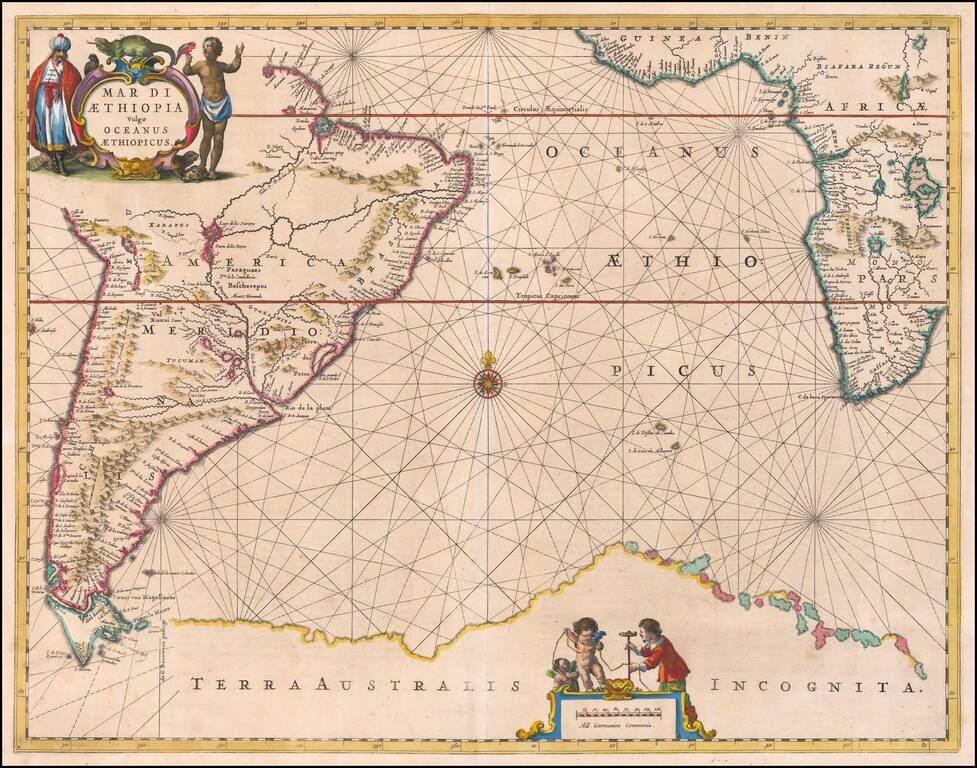
Striking example of Jansson's sea chart of the South Atlantic, showing the coastlines of South America, Southwestern Africa and the imagined Terra Australis. Tierra del Fuego is separated from the continent and a huge Terra Australis Incognita in the...
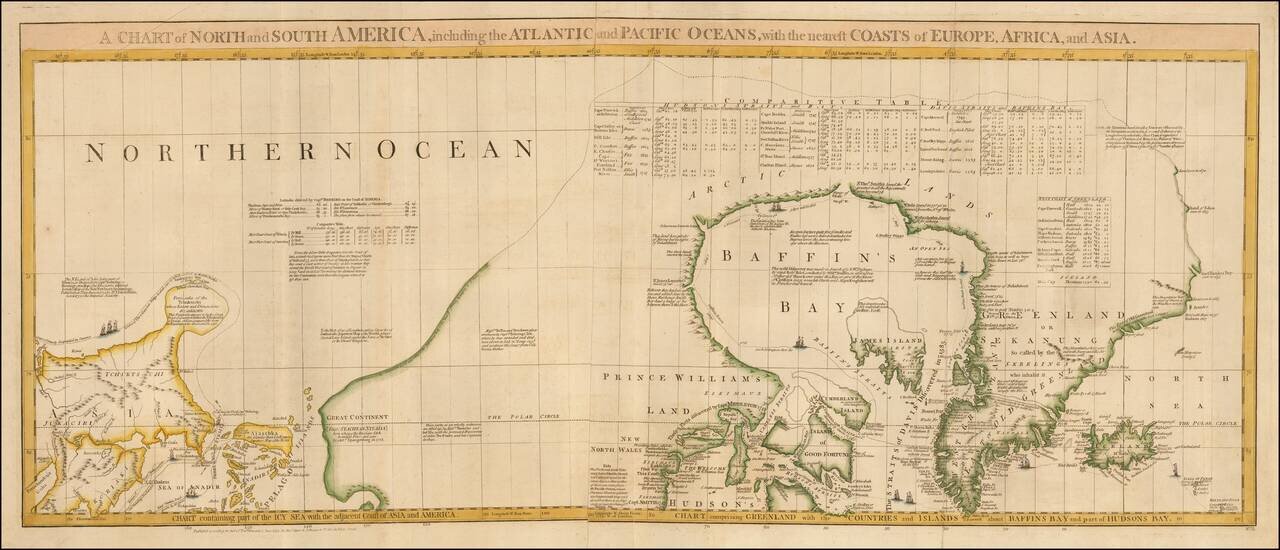
One of the Most Detailed and Important Map of the Americas made by a Scandalous Geographer This is a nice example of the northernmost sheets of 1775 edition of this important six sheet chart of North and South America, originally compiled by John...
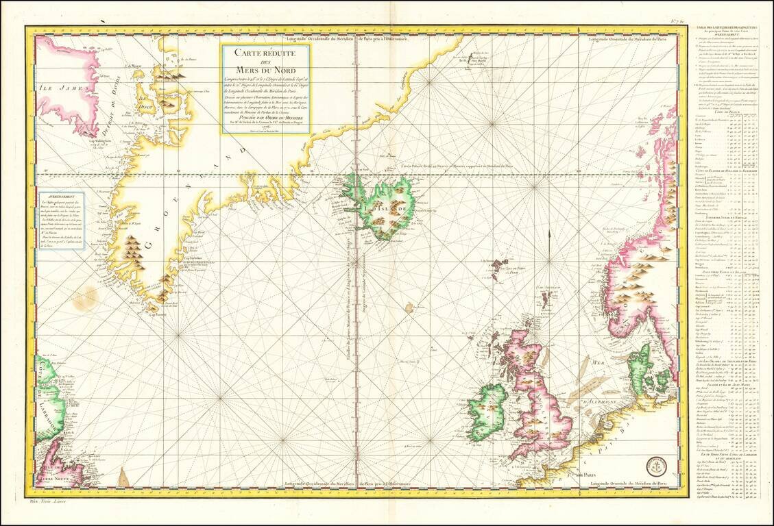
Late 18th Century Scientific Expedition In the North Atlantic Important mid-18th Century sea chart of the North Atlantic, published by the French Depot de la Marine. Centered on Iceland, the map extends from Labrador, Newfoundland, and Baffin Island...
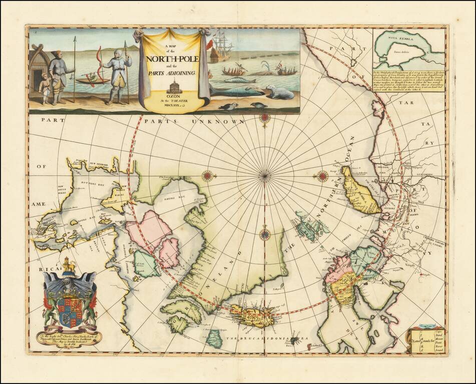
Remarkable Early English Map of the North Polar Regions Fine example of Moses Pitt's original map of the North Pole and surrounding lands. Moses Pitt initially set out to produce an expanded edition of Jansson's Atlas Maior with his partner Jacob Van...
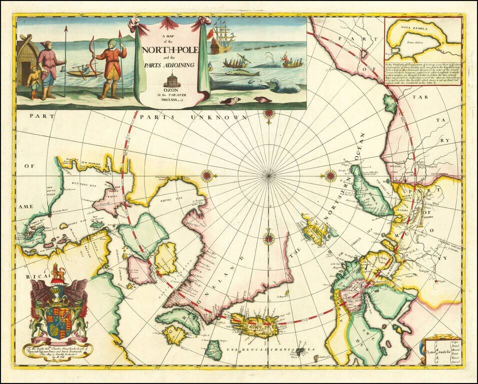
Remarkable Early English Map of the North Polar Regions Fine example of Moses Pitt's original map of the North Pole and surrounding lands. Moses Pitt initially set out to produce an expanded edition of Jansson's Atlas Maior with his partner Jacob Van...
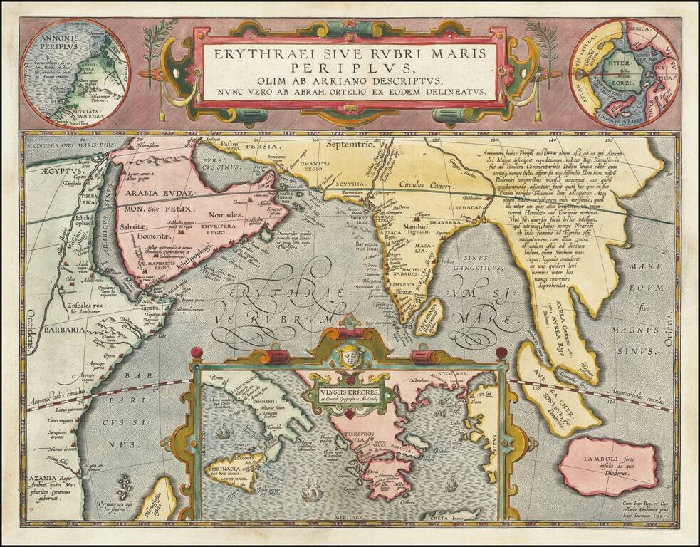
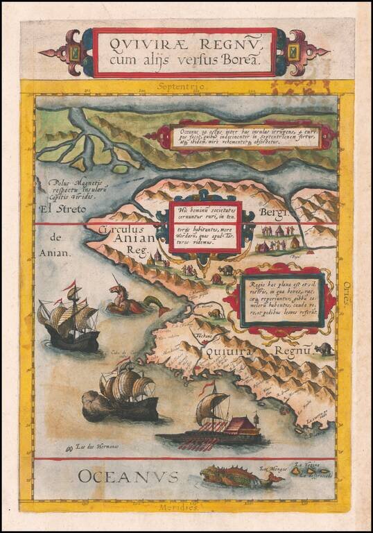
Fine Ortelius Map of the Indian Ocean Linking Mythical, Ancient, and Contemporary Exploration Striking historical map of the Indian Ocean and contiguous regions of the Middle East, India and Southeast Asia, published by Ortelius in his Parergon. This...
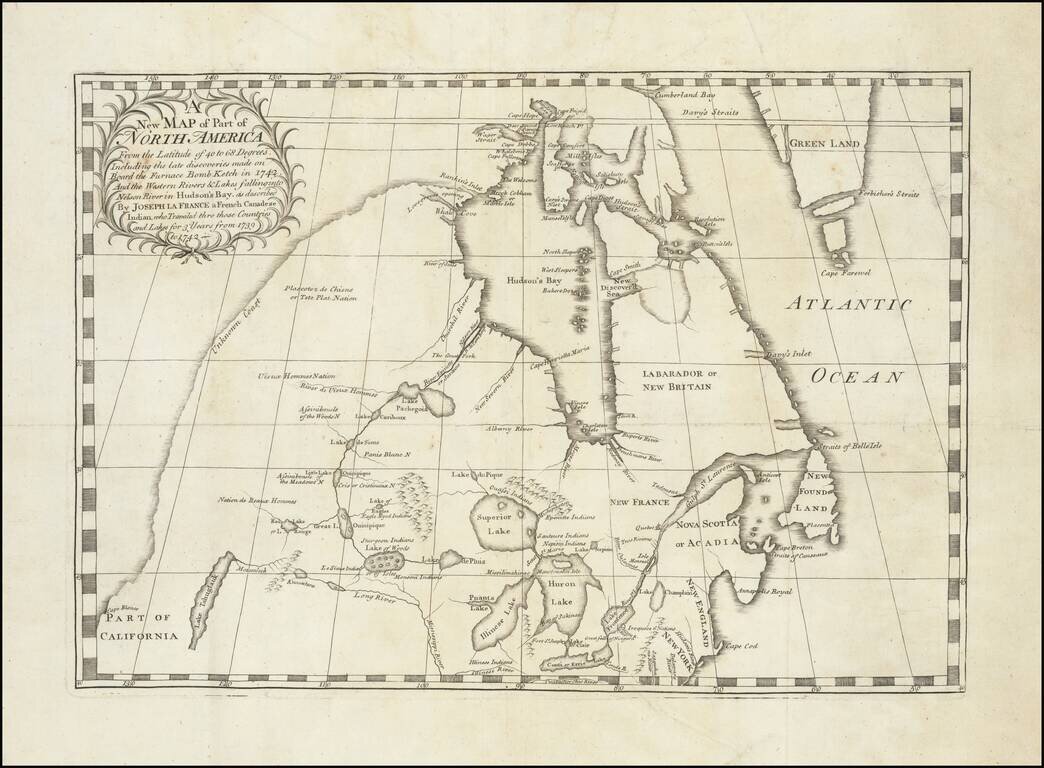
Important early map illustrating the controversy over the Northwest Passage. The map was part of the great Dobbs-Middleton debate concerning British exploration in search of a northwest passage. The present map extends from the Great Lakes, Upper...
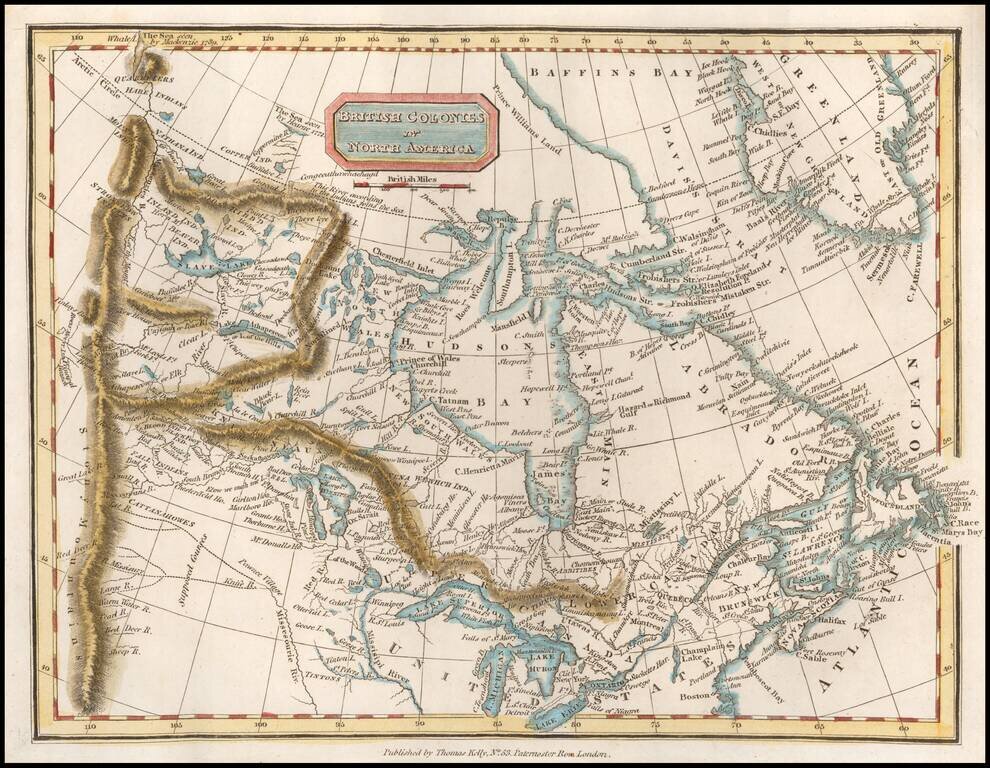
Scarce map of Canada, extending west to the Rocky Mountains and the MacKenzie River. Perhaps the most interesting feature is the depiction of the headwaters of the Missouri River. Here, the map incorporates the reports of Peter Fidler for the Hudson's...
The Benevento Copy. The Earliest Printed Map of the Northwest Coast of North America Fine old color example of this rare, important map depicting the west coast of North America, derived from Plancius's world map of 1592. De Jode's map is one of the...

Terrific map of the North Polar region, which shows the Northeast Passage, but no definite Northwest Passage. California is shown as an Island, along with the River systems of North America. Nice detail in the Polar regions, especially New Denmark and...
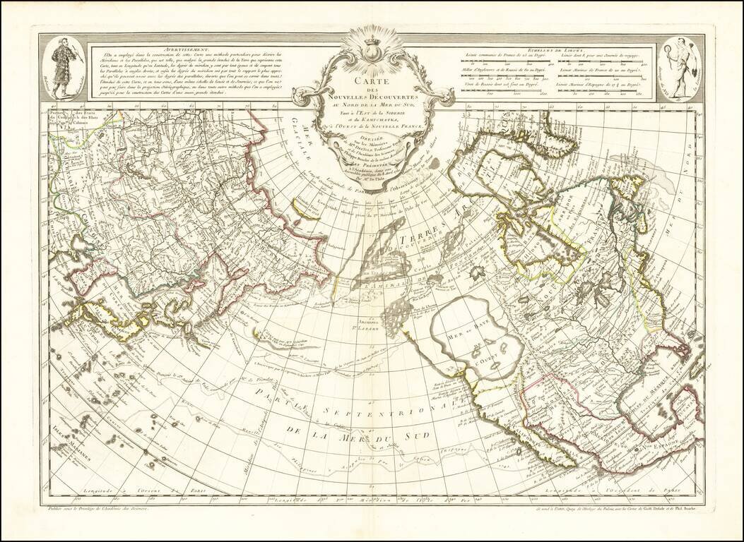
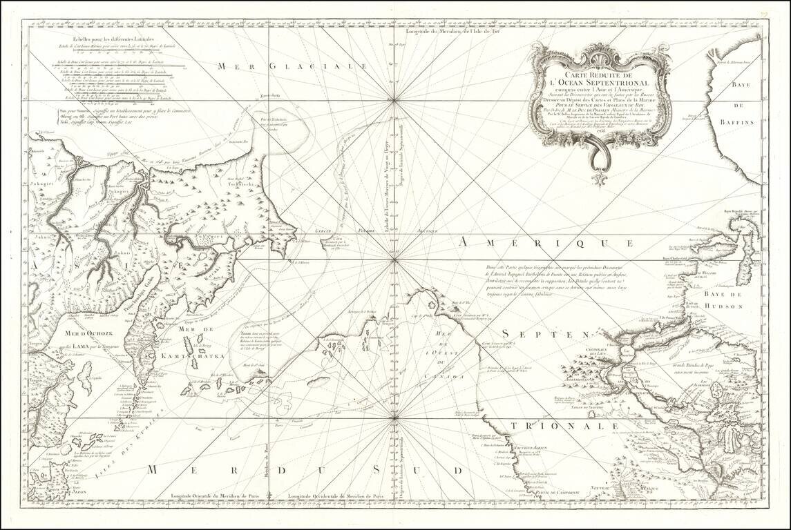
A Cartographic Landmark - The Most Complete Map of the North Pacific to Date and the Beginning of the Scientific Debate of the Sea of the West and Northwest Passage This is a fine example of a first edition of the landmark De L'Isle-Buache map of the...
An Important Early Navigational Chart Which Shows Alaska This is a foundational chart of Alaska, the Pacific Northwest, and the northeastern coast of Asia, published in Paris. The Port of San Francisco is named, three years before the supposed...
![A Map of the Icy Sea in which the several Communications with the Land Waters and other new Discoveries are exhibited [Sea of the West]](/map/small/0031dg.jpg)
An interesting map on a north hemispheric projection, showing the regions then actively explored by the Russian, French and English. Includes notes on Dutch, Portuguese and English discoveries near the North Pole. The projection is based upon Phillipe...