
![A Map of the Icy Sea in which the several Communications with the Land Waters and other new Discoveries are exhibited [Sea of the West]](/map/small/0054dg.jpg)
An interesting map on a north hemispheric projection, showing the regions then being actively explored by the Russians, French and English. The projection is based upon Phillipe Buache's work from the prior decade and illustrates one view of the...

Rare Dutch Edition of Didier Robert De Vaugondy's Comparative Cartographic Gem -- The Final De Vaugondy Map In The Greatest Cartographic Debate of the 18th Century Didier Robert De Vaugondy's Nouveau System Geographique . . . represents the final...
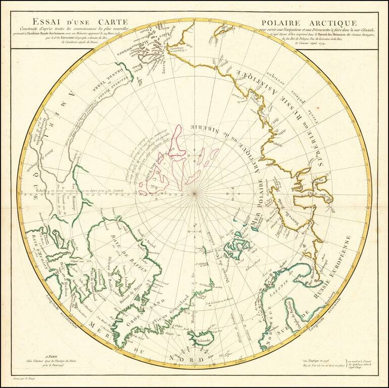
A Cartographic Landmark -- De Vaugondy's Presentation to the French Royal Academy on the Most Practicable Sailing Routes to the Pacific via the North Polar Regions Extremely rare polar map produced to illustrate a presentation made by Didier Robert...
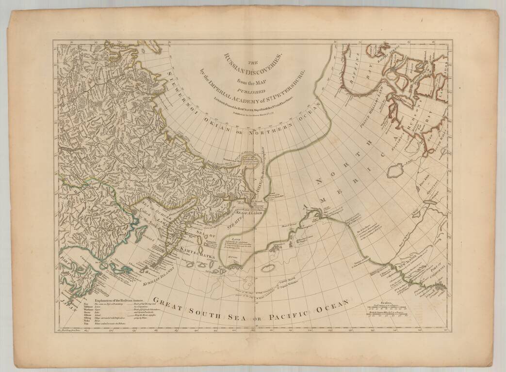
Fine English edition of Muller's map of the Northwest Coast of America and Northeast Coast of Asia, based upon reports from J.N. De L'Isle in St. Petersburg and others. Includes a massive conjectural land mass approximating the Alaskan Archipelago and...
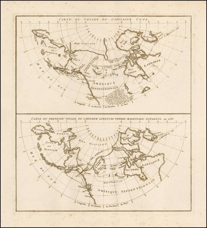
Rare pair of maps on a single sheet, showing the results of various real and apocryphal explorations in the Arctic Regions and the Northwest Coast of America, which appeared in the atlas volume of Jean Benjamin de LaBorde's Histoire Abrégée de la Mer...
![[Eastern Siberia and Alaska]. ‘Vostochnaya Chast Irtkutskoi Gubernii s prilezhashhimi ostrovami i zapadnom beregom Ameriki’ (‘The Eastern Part of the Irkutsk Province with the adjacent islands and the West Coast of America’).](/map/small/38895.jpg)
Fine example of this rare Russian map of the northwest coast of America and northeastern parts of Russia, published by Wilbrecht in his rare 1792 atlas entitled Ross'iiskoi Atlas iz soroka chetyrekh kart sostaiashch'ii I na sorok na dva...

First edition of Carey's map of Cook's Discoveries in the Pacific and Hearne's discoveries west of the Hudson, in search of the Arctic Sea. This is one of the earliest appearances of a Cook map to be published in America. Excellent conjectural NW...
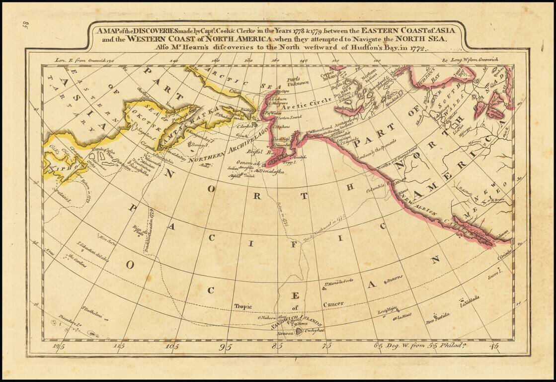
Outline color example of Carey's map of Cook's Discoveries in the Pacific and Hearn's discoveries west of the Hudson, in search of the Arctic Sea. This is one of the earliest appearances of a Cook map to be published in America. Excellent conjectural...
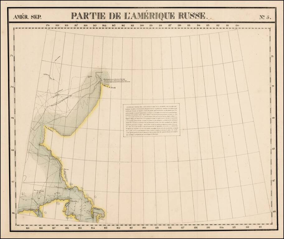
Large format map of the region, showing the Northern most known limits of Alaska. The northernmost named place is C. Glace de Cook. Cap Laburn is also shown, as is C. Mulgraves, and B. de Bonne Esperance. The primary feature on the map are the tracks...

Rare map showing the Northwest Passage, via the Bering Straits, with a fantastic early depiction of Alaska (then Russian America) and contiguous parts of Canada. Philip's map highlights the discoveries of Franklin and Richardson in the Arctic Sea...

Rare map of the Northwest Passage, Northern Canada, part of Alaska (America Russa) and Greenland. The map is quite unusual, being one of the few maps to focus on the known islands of the Northwest Passage, including several partially known...
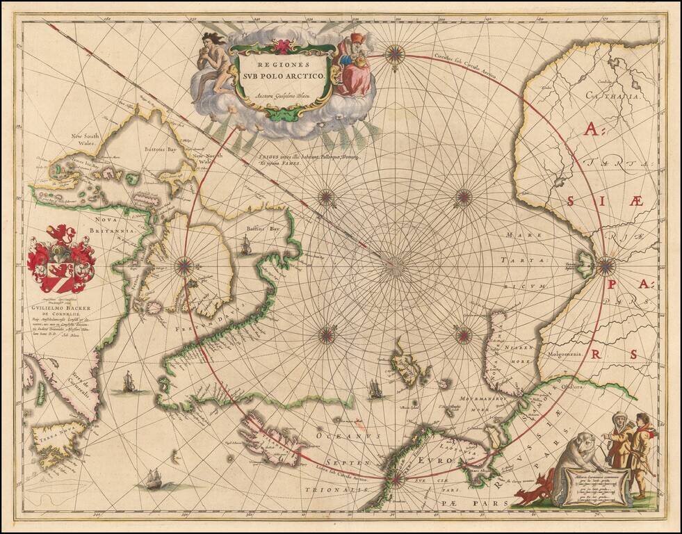
Nice example of the second edition of Blaeu's signature map of the North Polar Regions, with several wonderful cartouches and decorative coat of arms. Blaeu's decorative map of the North Pole, including Arctic North America, Scandinavia, and northern...
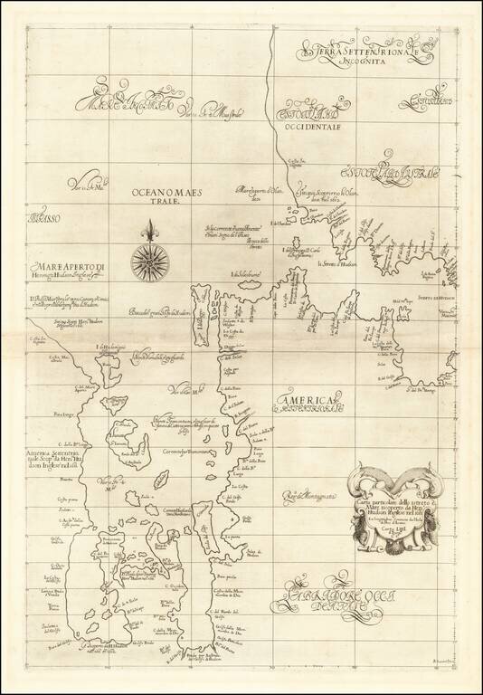
The First Sea Chart of Hudson Bay and Hudson Strait Fine example of the first edition of Robert Dudley's chart of Hudson Bay and Hudson Strait, the earliest sea chart of the region and the first printed map to focus on Hudson Bay. Dudley's chart is...
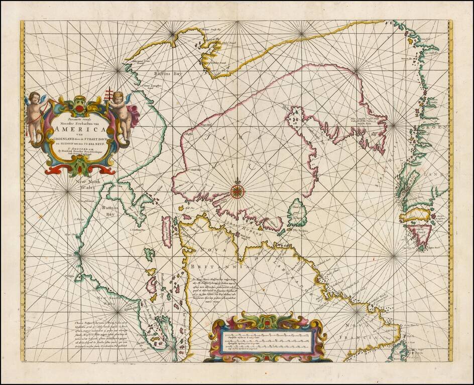
Fine example of Doncker's rare early map of the Northern part of America, including Hudson Bay, Davis Straits, Button Bay and the west coast of Greenland. Doncker's chart is one of the earliest obtainable charts to show this configuration and much of...
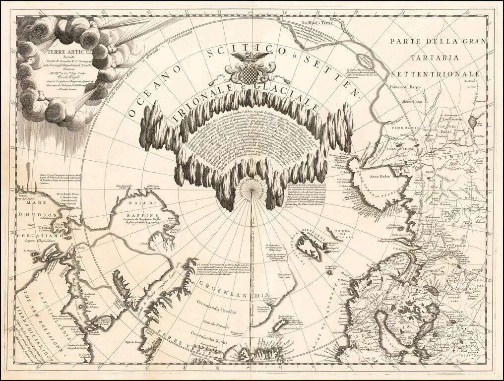
Fine example of Vincenzo Maria Coronelli's map of the North Polar Regions, published in Venice circa 1690. Coronelli's map provides a remarkable depiction of the Arctic Circle, North Pole, Greenland, and Baffin Bay, with parts of Canada, parts of...
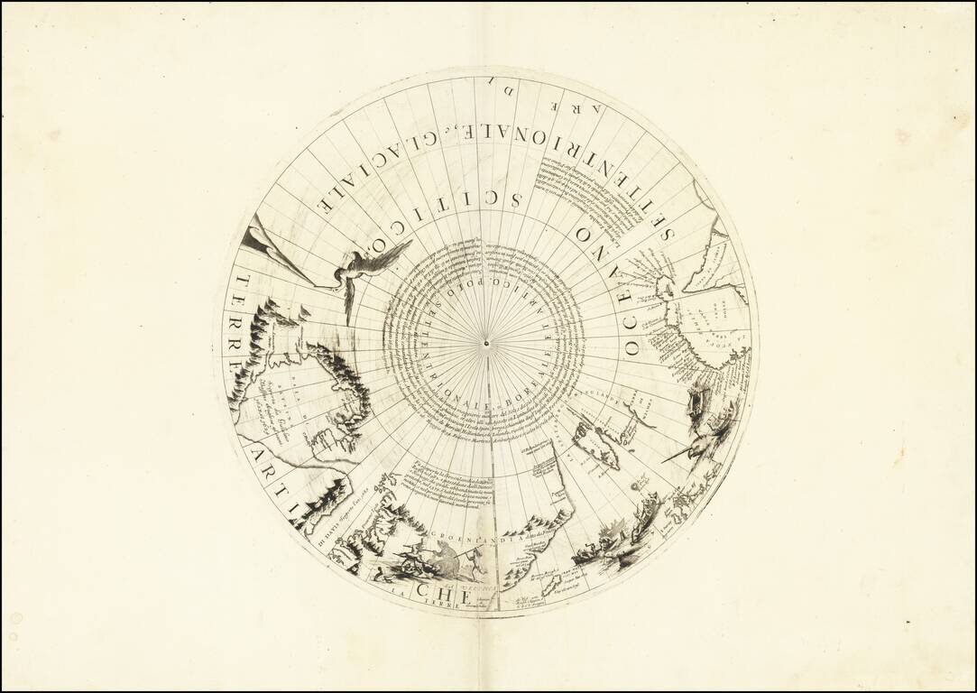
Rare north polar section of Coronelli's remarkable globe gores, first published in 1690. The present gore section is the upper calotte for Coronelli's large (110cm) globe showing the north pole and surrounding areas. The section includes extensive...