
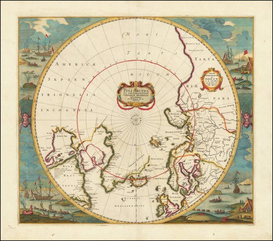
Old color example of Jansson's map of the North Polar regions, newly revised by Frederick De Wit. The map shows Baffin's Bay, Button's Bay and James Bay, Greenland, Iceland, Spitsberge (with incomplete coastline), Lappland, Russian and European Asia,...
![[North Polar Regions, Globe Calotte]](/map/small/67030.jpg)
Fine, Illustrated North Polar Globe Calotte Polar calotte that depicts coastlines and islands in far northern waters, as well as noting significant Arctic expeditions from the sixteenth and seventeenth centuries. The calotte—a cap that covers the...

English North Polar Rarity Rare English map of the North Polar regions, published by Jonas Moore. The map appeared in Moore's A New Geography. Many of the plates in the work were engraved by Herman Moll, who had moved to London in 1678 and had not...
Rare map of the Northern Hemisphere, illustrating the known and imagined lands of the North Polar regions. The map provides a fine accounting of the lands of the North Polar regions, much of which were fictional.
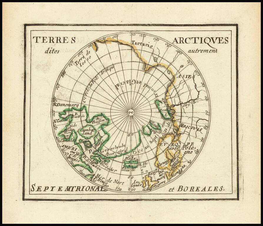
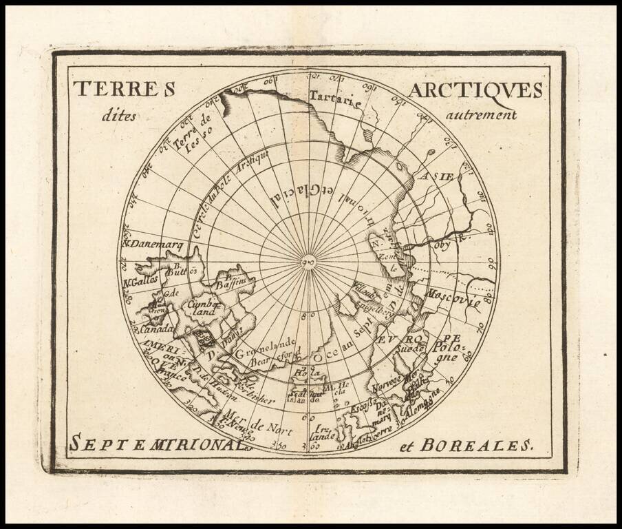
Du Val's Map of the Arctic Rare map of the north polar regions. The map provides a fine accounting of the lands of the Polar regions, which remained largely unexplored.
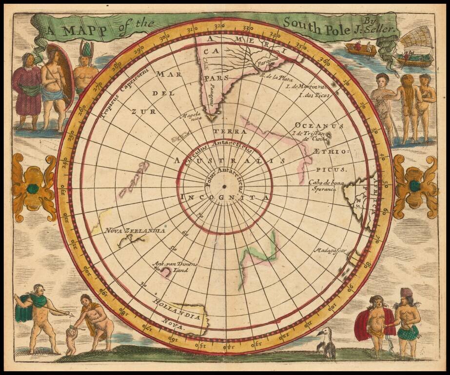
A 17th Century English South Polar Rarity Rare miniature map of the South Polar region, from Seller's Atlas Maritimus. Both the cartographic detail and embellishments are based upon the Hondius/Jansson map of the South Polar regions.
Interesting map of the South Polar Regions, including mythical coastlines and the known coastal regions in New Zealand, Australia, South America and Africa. From Mallet's monumental work.
![[South Polar Globe Gore] Fernando Magaglianes Poco Contento del Re di Portogallo suo Signore . . .](/map/small/70828.jpg)
A Celebration of Magellan's Circumnavigation for the King of Portugal Finely engraved polar gore, or calotte, created for one of Coronelli's largest globes. Coronelli is well known for making a concerted effort to delineate only verified discoveries...
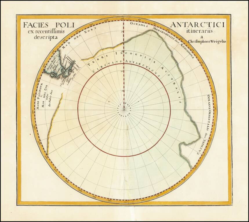
Interesting and nearly completely conjectural map of the South Pole from Davide Kohler's Descriptio Orbis Antiqui…published by Weigel in 1720. The map shows the prevailing belief in a massive southern hemisphere, which extended to just south of the...
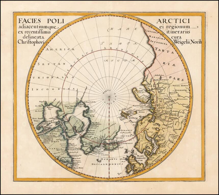
Interesting map of the North Pole from Davide Kohler's Descriptio Orbis Antiqui…published by Weigel in 1720. The map shows the prevailing belief in a massive northern hemisphere, extending to Alaska, Canada, the British Isles, Scandinavia and...
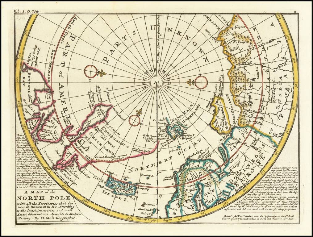
A fine example of Moll's map of the polar regions, known and unknown. The western part of North America is conspicuously absent, as is northeast Asia. A lengthy narrative note along the bottom describes the best contemporary knowledge. The body of...
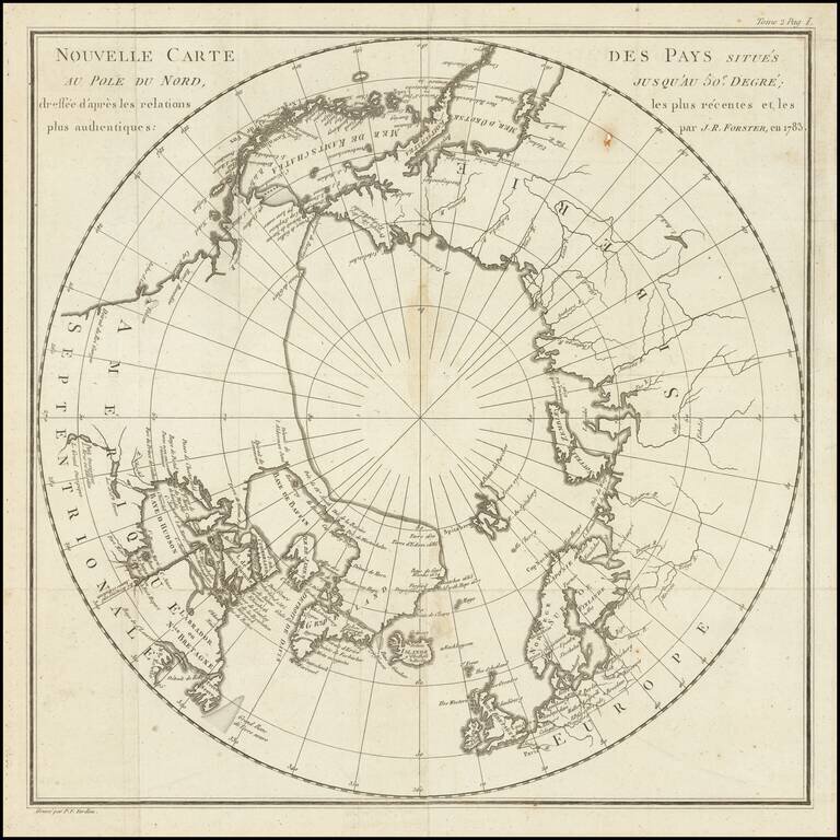
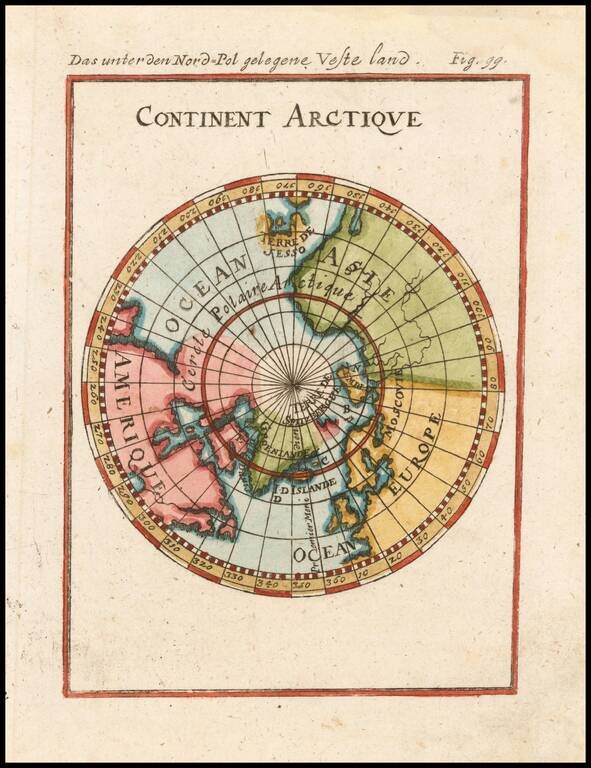
Fine map of the polar regions, which illustrated the French edition Johann Reinhold Forster's Geschichte der Entdeckungen und Schiffahrten im Norden, first published in 1784. The map translates as follows: New map of the countries situated fifty...
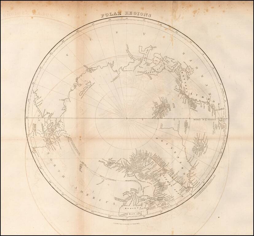
Scarce map of the Polar regions of the Arctic, published in 1822 in Edinburgh. This fascinating map of the North Pole shows a region still in the process of being discovered. There is little detail in western Canada beyond a few notes such as The Sea...

An Important British Admiralty Polar Chart Rare separately published map of the Polar regions, published on June 29, 1835 in London by the British Admiralty. The present example is updated to 1849, which seems to be the the edition ordered for...
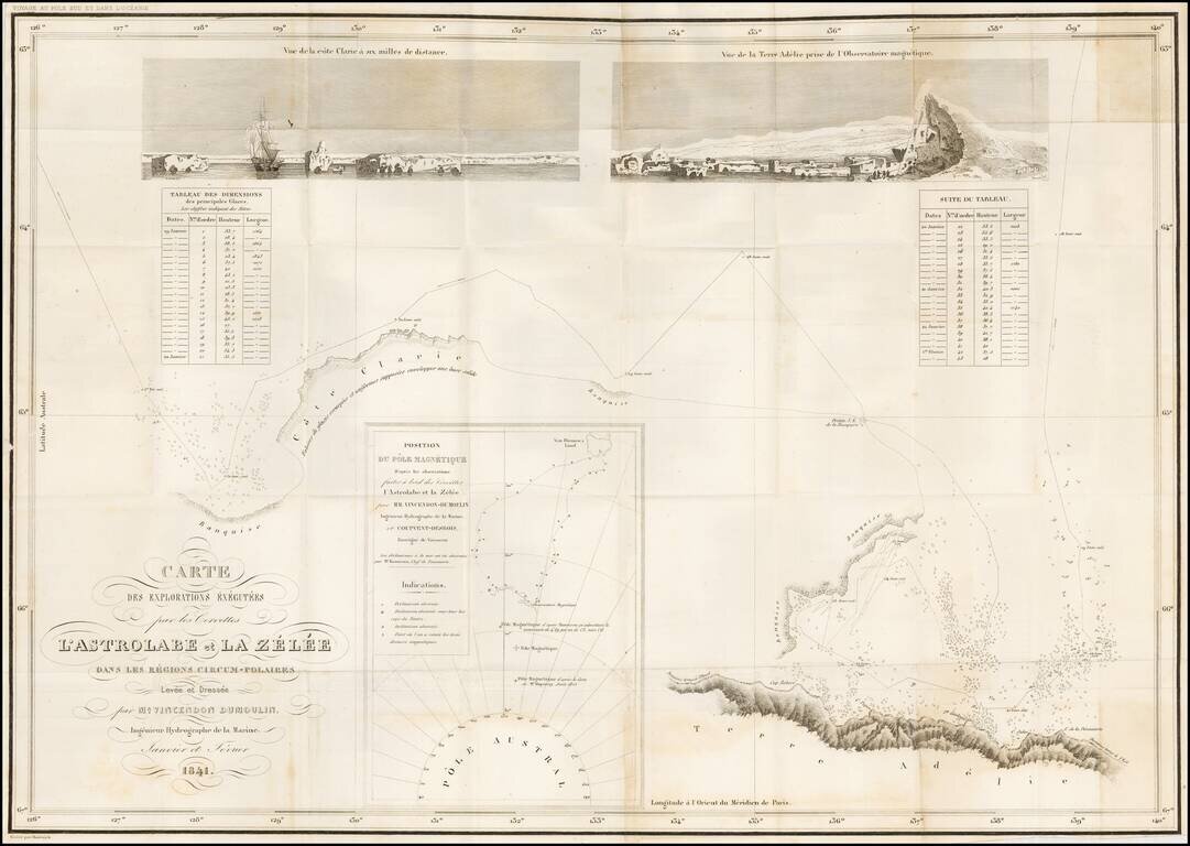
Reporting the Correct Location of the Southern Magnetic Pole -- Among the Very First Maps to Report Sighting of the Antarctic Landmass. Large engraved folding map of the Antarctic coast south of Van Diemen's Land. The map documents the leg of the...
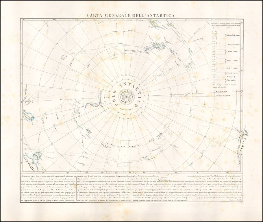
Rare map of the Antarctic regions, by Neapolitan mapmaker, Benedetto Marzolla. The map shows the tracks of South Polar Explorers, from Captain James Cook, in 1772, to Ross, in 1842. Voyages depicted are: Captain James Cook 1772-1775 Fabian Gottlieb...