
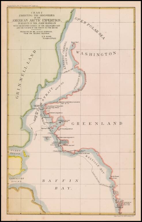
Map of the area of the Upper Part of Baffin Bay and the coasts of Greenland and Grinnell Land, illustrating the tracts of the Second Grinnell Expedition in 1854-1855. The Second Grinnell expedition of 1853–1855 was an American effort, financed by...
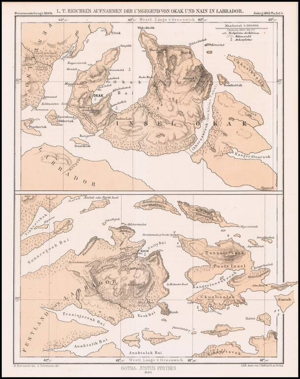
Detailed map of a portion of Labrador, published by Augustus Peterman. Includes Petermann's report on the region.
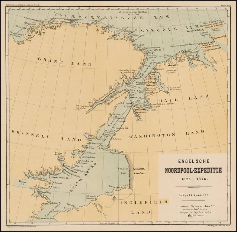
Detailed map illustrating the British Arctic Expedition of 1875-1876. The British Arctic Expedition of 1875-1876, led by Sir George Strong Nares, was sent by the British Admiralty to attempt to reach the North Pole via Smith Sound. Two ships, HMS...
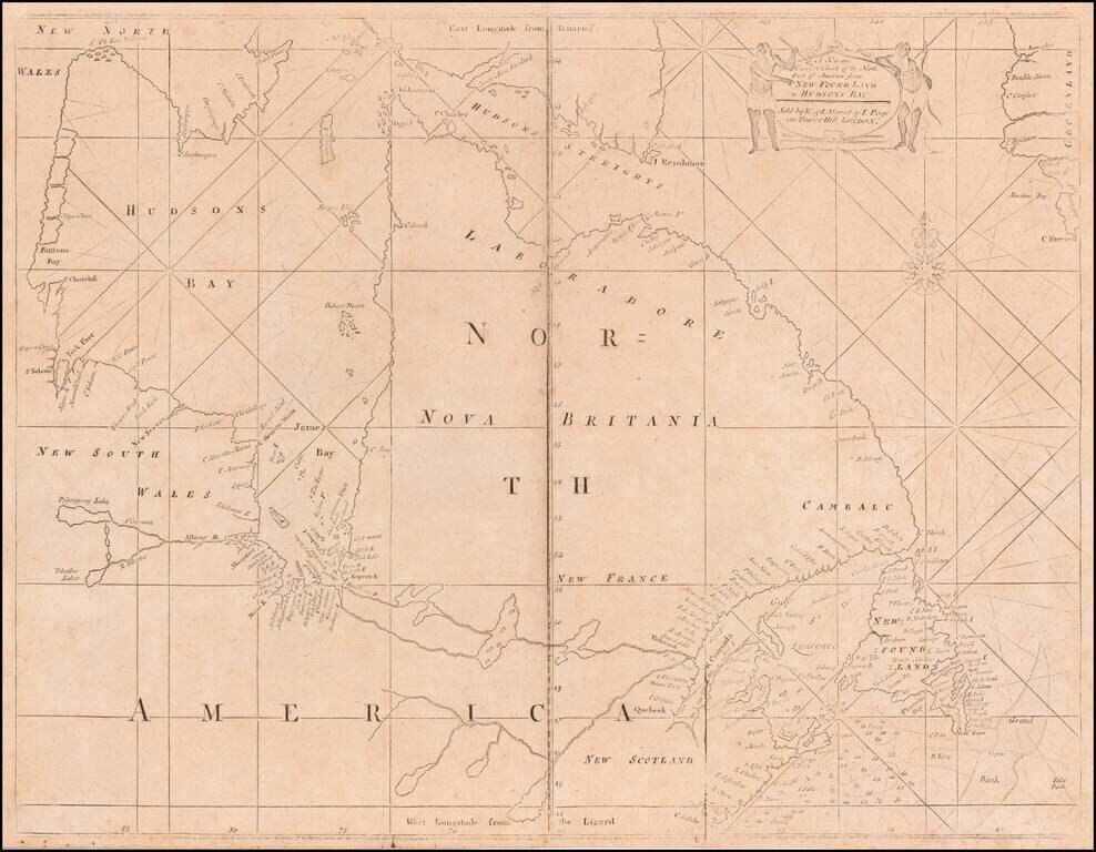
A Fine Mount & Page edition of John Thornton's important sea chart of Hudson's Bay and Eastern Canada. This fascinating sea chart embraces all of eastern Canada, from the southern part of Baffin Island down to include the Canadian Maritimes,...
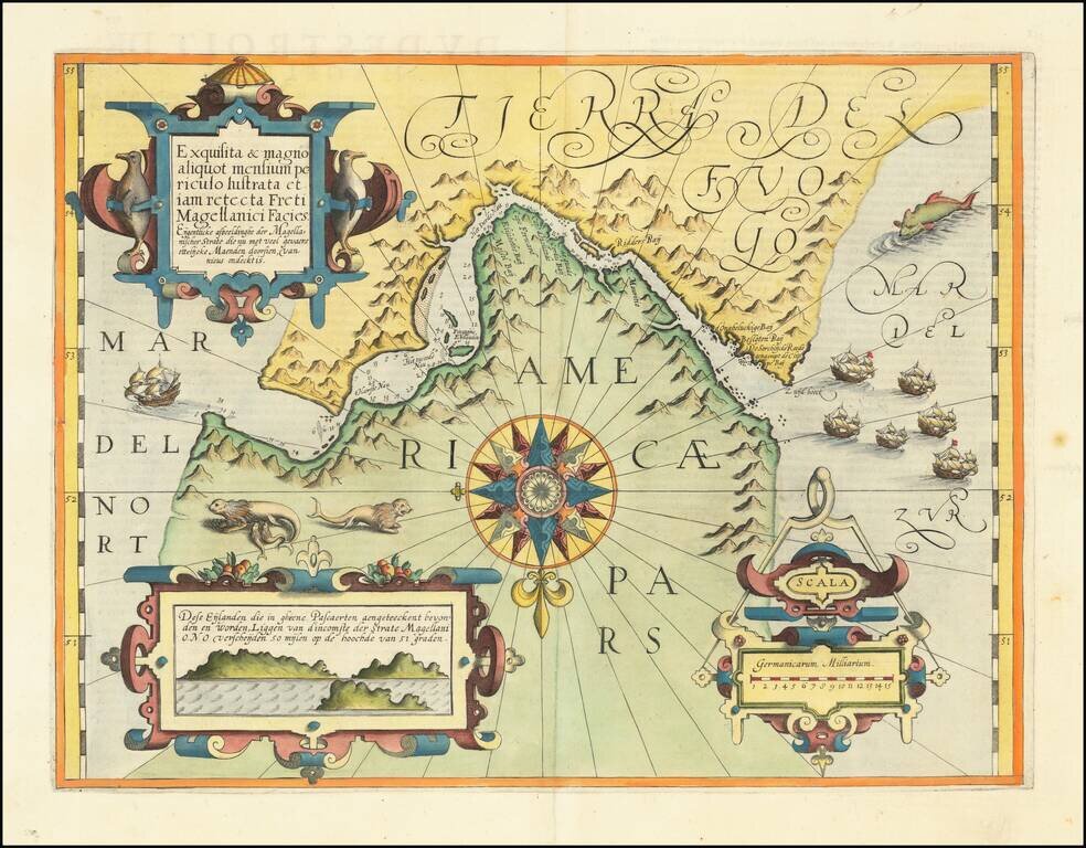
Nice example of this important early map of the Straits of Magellan, predating the discovery of the Straits of Le Maire. Mercator's map is the earliest map of the Straits of Magellan to appear in a commercial atlas. It is also a rare example of a...

Fine map illustrating the discovery of the Straits of Le Maire, as discovered in January 1616 by Le Maire and Schouten. This is De Bry's edition of the first printed map to detail the strait, showing the Magellan Strait and, further south, the route...
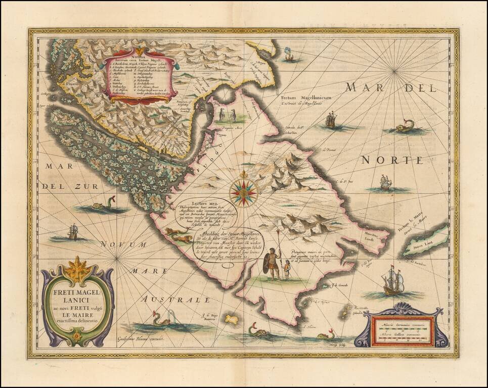
The Land of Giant Patagonians! Fine example of Willem Blaeu's map of the Straits of Magellan, Le Maire Strait, Fire Lands and the southern tip of Patagonia. The map is one of the earliest obtainable atlas maps of the Straits, preceded only by a map...
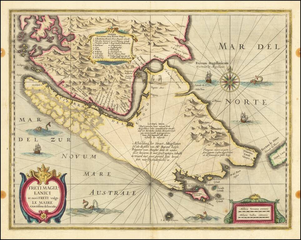
Nice example of the English edition of Hondius' map of the Straits of Magellan, Le Mair Strait, Fire Lands and the southern tip of Patagonia. The coastlines of Tierra del Fuego are incomplete. Fully engraved to show the mountainous terrain with no...

Blaeu’s Influential Map of Tierra del Fuego Showing the Important Strait of Le Maire Fine example of Willem Janszoon Blaeu's map of the Straits of Magellan and Tierra del Fuego (Magellanica)—the gateway to the Pacific during the seventeenth and...
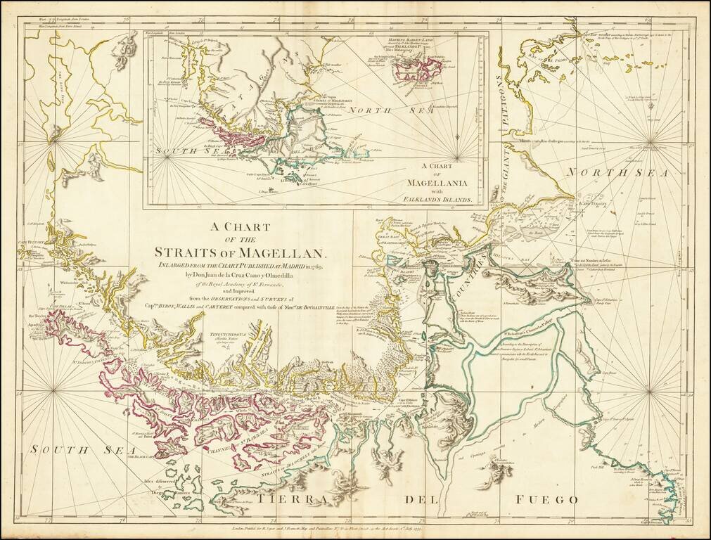
Nice example of this detailed map of the Straits of Magellan on continuous regions, prepared from the recently completed map of Juan de La Cruz Cano & Olmedilla and Hiolito Ricarte. Cruz Cano's eight-sheet map of South America, much like the...
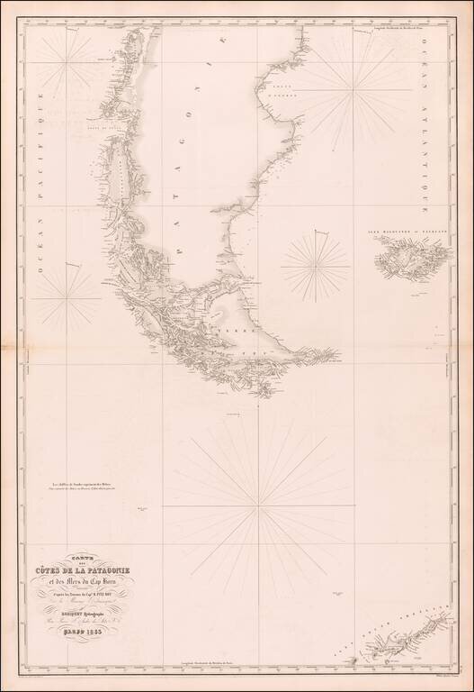
Rare separately published sea chart of the southern tip of South America, the Falkland Islands and the South Shetland Islands, published in Paris by Aime Robiquet. The chart lists Captain R. Fitz Roy of the British Admiralty as the source for the map...
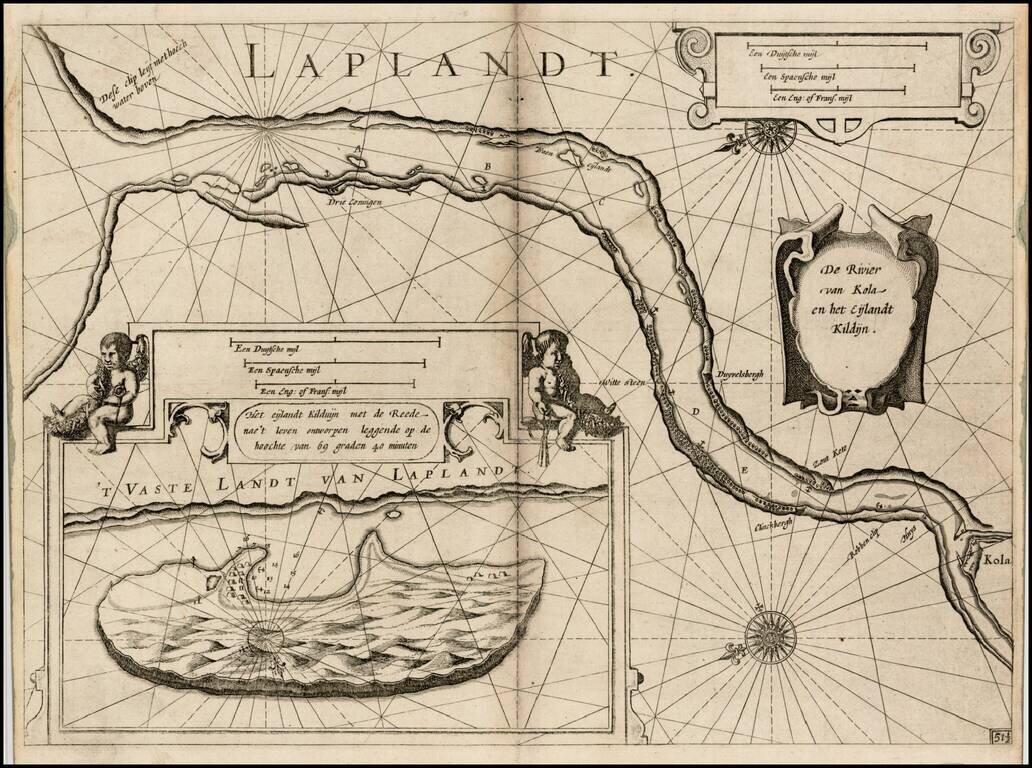
First edition of Blaeu's chart of part of Lapland, near Murmansk, from Blaeu's Zeespiegel, Inhoudende Een Karte Onderwijsinghe in de Konst de Zeevaert, en Eene beschrijvinghe der Seekusten van de Oostersche, Noordsche, en Westersche Schipvaert. The...

Detailed map of Nova Zembla and part of the Northeast passage. Includes a decorative title cartouche. One of the maps produced by Nicholas Bellin for L'Histoire Generale des Voyages.

Detailed map of the Nova Zemla region, focusing on the polar voyages in the region in the 1870s. The following explorer routes are noted: Johannsen 1869 Johannsen 1870 F.C. Mack 1871 Johannsen 1871 Tobiesen 1871 Isacksen 1871 Dorma 1871 Rosenthal...
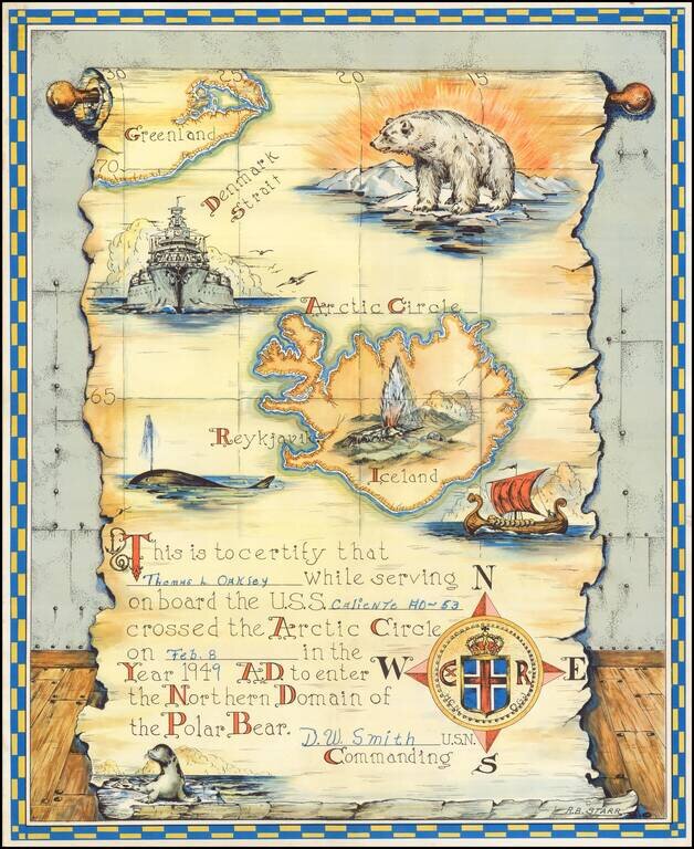
Interesting keepsake, which was given away by the U.S. Navy to sailors crossing into the Arctic Circle from at least 1943 to 1957, based upon our research. First time we have ever seen the map offered for sale.
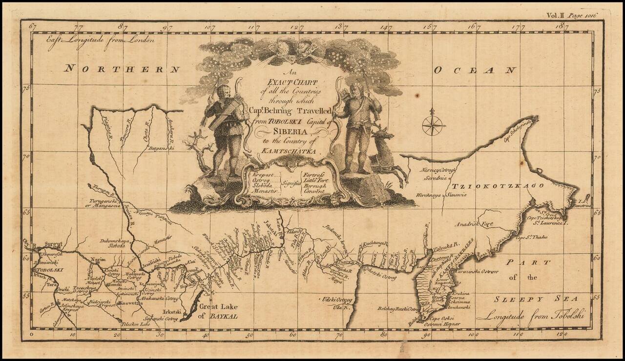
Nice example of the first English language map to show Vitus Behring's Route. In December 1724, Czar Peter the Great ordered the Danish-born Captain-Commander Vitus Bering (1681-1741) to lead the First Kamchatka Expedition (1725-30), in an effort to...