
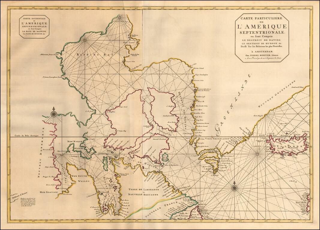
Pierre Mortier's large map of the Canadian Polar Regions, Greenland and Iceland, which appeared in his Suite de Neptune Francois. Among the more remarkable elements of the map is the depiction of "Destroit d'Anian," showing the Straits of Anian...
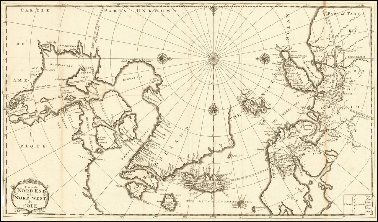
Fine Eighteenth-Century Map of the Arctic Elegant and finely-wrought map of “Northeast and Northwest of the Pole,” published by Amsterdam-based French scholar and mapmaker Jean Frédéric Bernard. The map encompasses the polar region from Tartary...
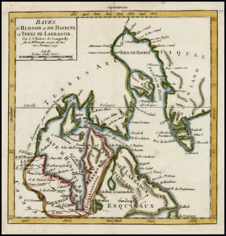
Detailed map of Hudson Bay, Baffin Bay Labrador and contiguous regions, from De Vaugondy's Atlas Portatif.

Scarce Leipzig edition of Bellin's excellent map of Hudson's Bay, Labrador, Hudson's Straits and neighboring regions originally issued in Bellin's Histoire General des Voyages. Includes numerous bays, islands, rivers, mountains and notes regarding...
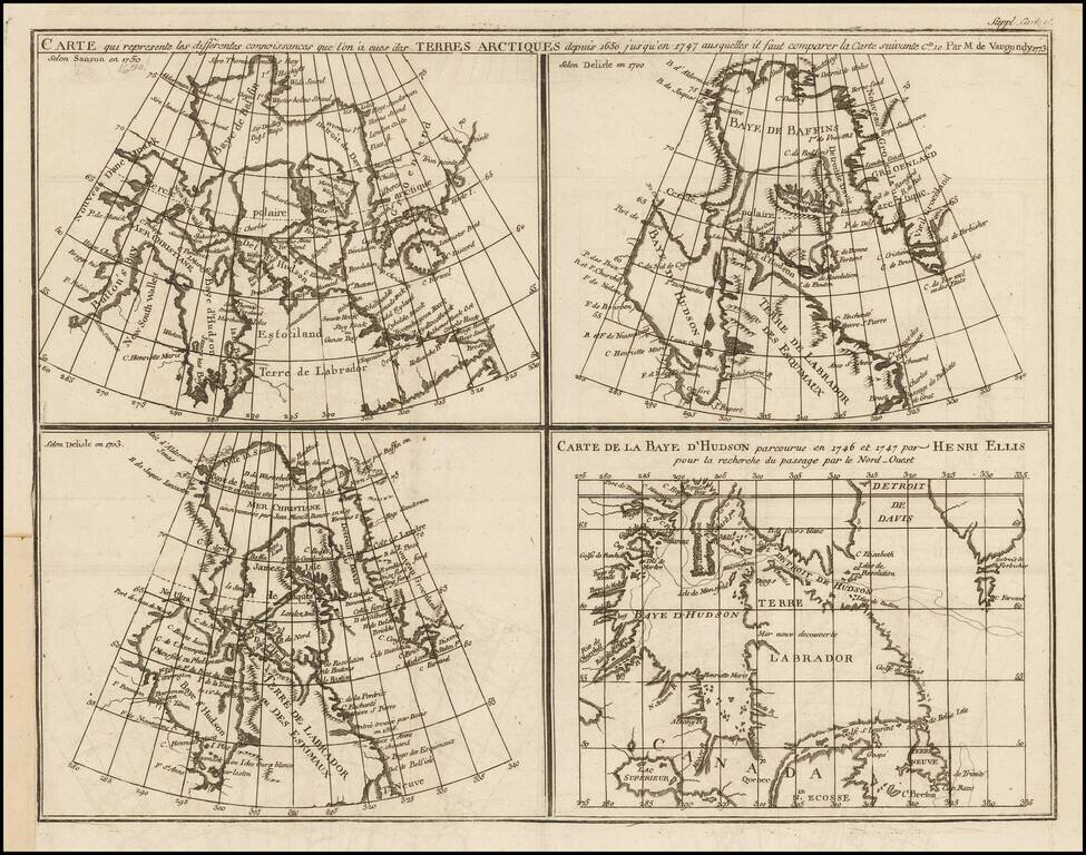
Marvelous set of four maps of the Hudson, Button and Baffin Bay regions, Davis Straits, and the Coast Labrador, as developed and explored between 1650 and 1750. This map was one of ten maps in Diderot's important 10 volume encyclopedia, one of the...
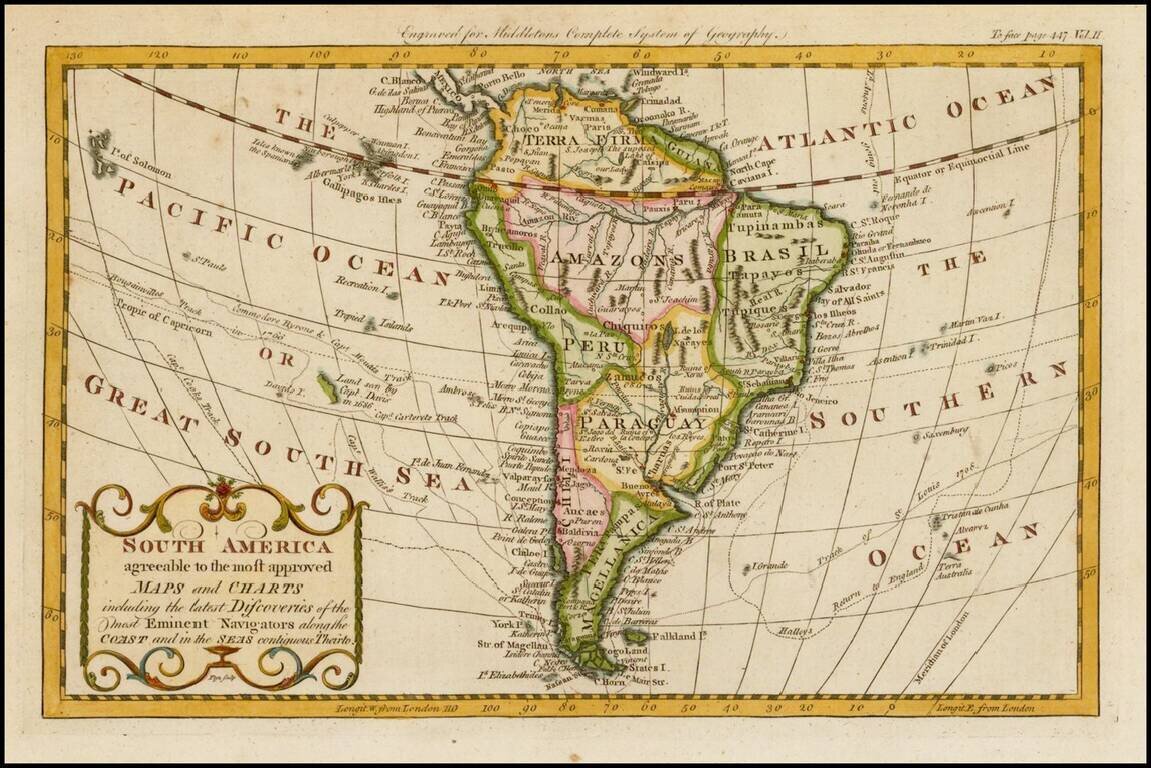
Detailed map of South America, published in London by Middleton. The map shows the exploration tracks of a number of major voyages of exploration, including: James Cook Sir Edmund Halley Philip Carteret Samuel Wallis John Byron Louis Antoine de...
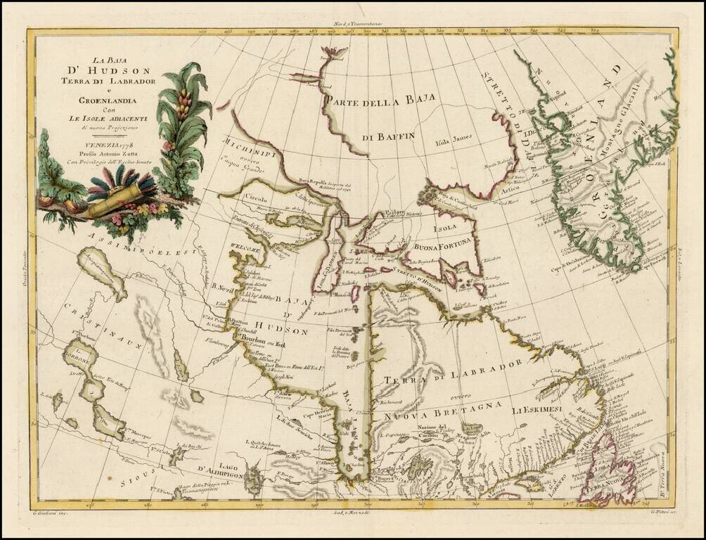
Striking map of Hudson Bay, Baffin Bay, part of Greenland, Labrador and Northern Canada. Marvelous detail on the islands and coastlines, known and unknown. Issued as part of Zatta's Atlante Novissimo, one of the last great decorative atlases.
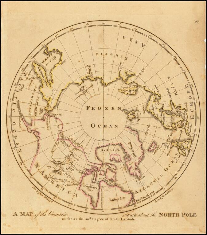
Early American map showing the extent of explorations in the North Pole, with emphasis on the efforts to find a Northwest passage and Hearne's and MacKenzies' routes.
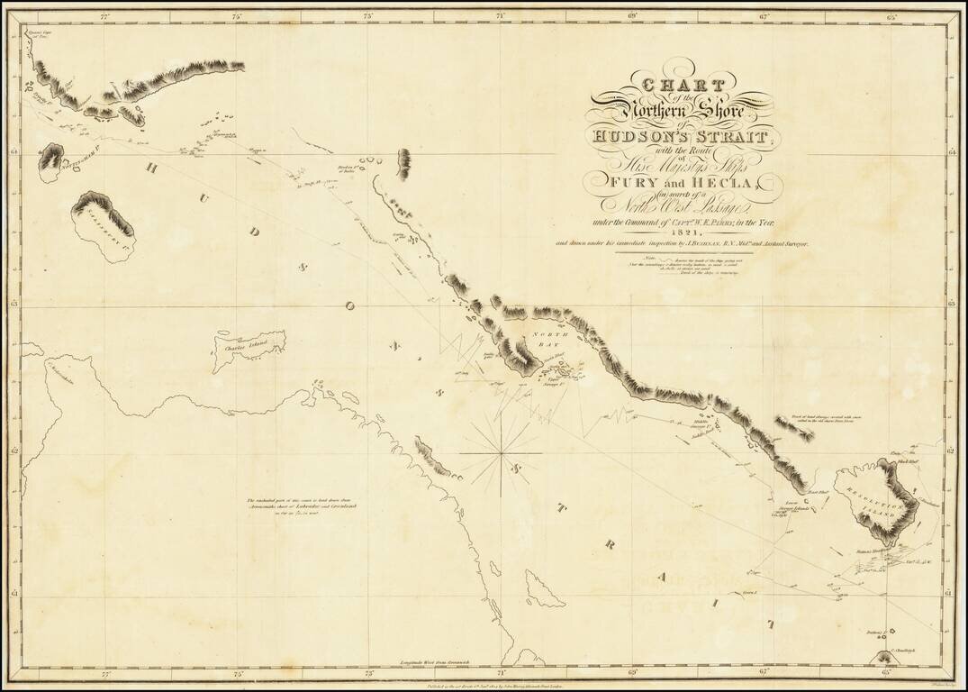
A nice example of Parry's map of Hudson's Strait, showing a portion of his expedtiion in search for the Northwest Passage. Shows Parry's tracts in marvelous detail, including a day by day account of his route and a number of annotations. After...
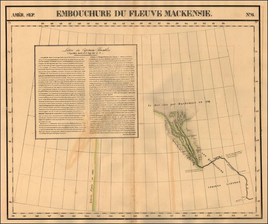
Regional map of part of the mouth of the MacKenzie River and the Arctic Sea. Shows towns, roads, rivers, mountains, and a host of other details. From Vandermaelen's remarkable 6 volume atlas, which if combined as globe gores forms an immense globe.
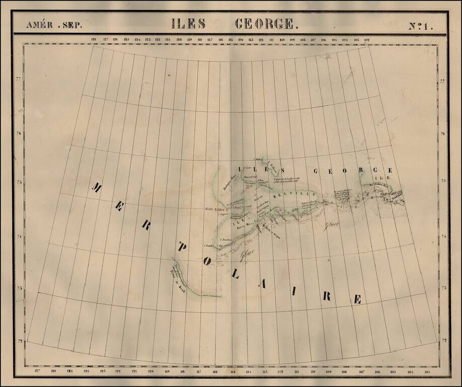
The Isles of George in the Arctic Sea. Shows towns, roads, rivers, mountains, and a host of other details. From Vandermaelen's remarkable 6 volume atlas, which if combined as globe gores forms an immense globe.
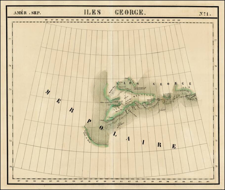
The Isles of George in the Arctic Sea. Shows towns, roads, rivers, mountains, and a host of other details. From Vandermaelen's remarkable 6 volume atlas, which if combined as globe gores forms an immense globe.
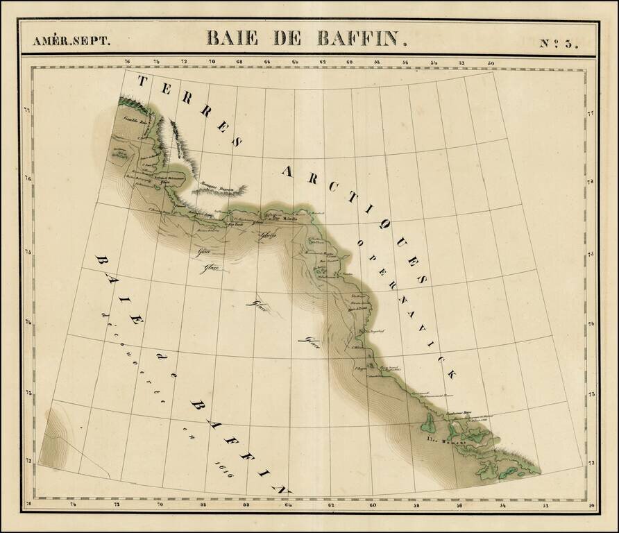
Large format map of the region bounded by Gamble Bay and Entrée de Baleine to Sandersons Hope and Iles Womens. Includes notes of David's voyage in 1587 and Baffin's voyage in 1616, Centered on Melville Baie. Shows the extensive ice flows in the...
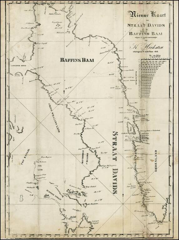
Rare map of the Baffin Bay and the David Straits, from Klaas Hoekstra's Dagverhaal van het verongelukken van het galjootschip Harlingen in Straat-Davids etc., in 1828. The last or nearly-last Dutch whaling voyage to the Arctic was an ill-fated venture...
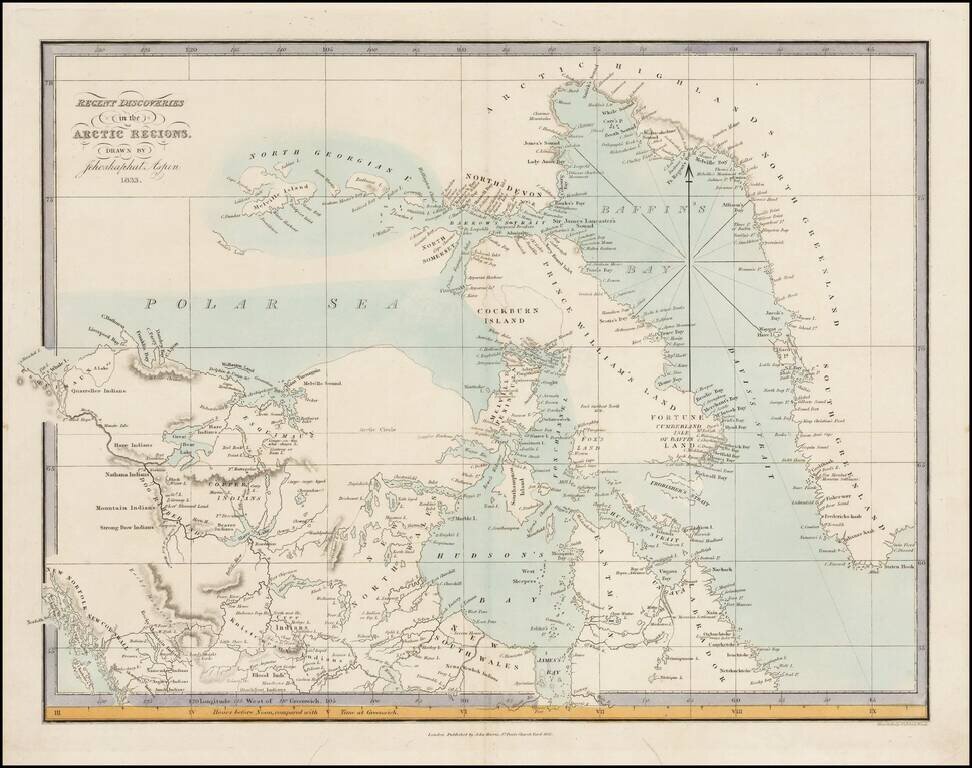
Very rare map of the Arctic Regions of North America, drawn by Jehoshaphat Aspin and published by John Harris in London. The map provides a marvelous snapshot of the known and partially explored regions of the Polar Seas, as of 1833. The map provides...

Nice example of Lizars map of Canada, Alaska and the Polar Regions. Excellent early map of Canada, Alaska and the Northwest part of America and contiguous regions covered by Lewis & Clark. The map provides a fine treatment of the search for the...