Map size in jpg-format: 2.22931MiB
Click to open in high resolution (open in new tab).
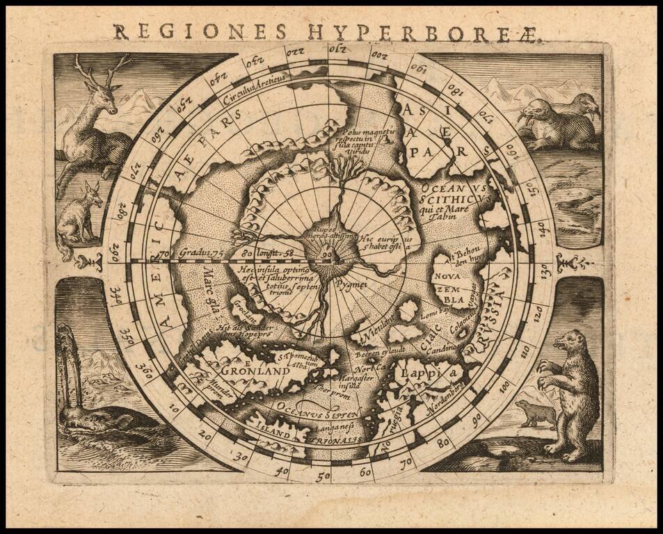
Fine example of Bertius' reduced size version of Gerhard Mercator's highly important and influential map of the North Pole, first published in 1595.
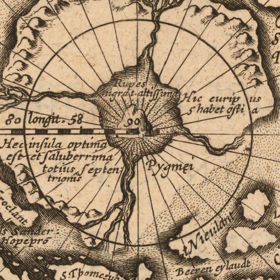
Gerard Mercator was the first cartographer to create a polar projection of the earth. His map, the first separate map devoted to the Arctic regions, is drawn from an inset on Mercator's world map of 1569. The map is extended to 60 degrees, to incorporate the recent explorations in search of the Northwest and Northeast Passages by Frobisher and Davis. California is identified as Spanish Territory and El Streto de Anian is clearly shown. The pole itself is made up of four surrounding islands, which myth had it, were separated by four strong flowing rivers. These carried the oceans of the world towards a giant whirlpool at the pole where there stood a large rock. An account of this myth in Mercator's own hand still exists.
Published one year after his death by his son Rumold, Gerard Mercator's classic map of the arctic is in hemispherical form, framed by four medallions and a handsome floral border. Three of the medallions contain inset maps of the Faeroe Isles, the Shetland Isles and the mythical island of Frisland.
Bertius' map shows Mercator's work in the second state, which was revised to show an unknown coastline on the central island at the lower right. The first state of Mercator's map can be distinguished from later editions by its inclusion of a definitive coastline in the lower left of the 4 islands surrounding the pole (Pygmei). Later editions omit part of the coastline.
If you are a student, write to us in telegram: @antiquemaps and indicate what material you need and for what work you need a map in high detail. We are ready to provide material on special terms. For students only!
![[Eastern Hemisphere Globe Gores] (Nova et integra universi Orbis descriptio)](/map/small/54480.jpg)

