

Scarce late state of Guillaume De L'Isle's map of the Western Hemisphere, updated to include the 3 voyages of Captain James Cook. Dezauche also shows the route of the voyages of Abel Tasman (1642), Quiros, Magellan (1520), Le Maire (1616), Mendana...

Willem Barentsz's Map of the Polar Regions, drawn from his observations during his third voyage of 1596-97 and engraved by Baptiste Van Deutecum. The Barentsz map of the polar regions is a major landmark in Arctic cartography, depicting the details...

Willem Barentsz's Map of the Polar Regions, drawn from his observations during his third voyage of 1596-97 and engraved by Baptiste Van Deutecum. The Barentsz map of the polar regions is a major landmark in Arctic cartography, depicting the details...

Extremely rare miniature map of the North Pole, from Seller's Atlas Maritimus. Both the cartographic detail and embellishments are based upon the Hondius/Jansson map of the North Polar Regions. Includes a coat of arms.
![[Spitzbergen & Wiches Lande]](/map/small/61990.jpg)
Mapping the early whaling voyages of the Muscovy Company Scarce early map of Spitzbergen, flanked by nine scenes of whaling, fishing, processing & bear hunting, and walruses (here called Seamorces), which first appeared in Purchas His Pilgrims...
![Cumnecdum Stella Haec extorts suiset Olympo… [Northern Celestial and Terrestrial Hemispheres]](/map/small/55745.jpg)
Striking map of the Northern Celestial Sky, with a projection of the Northern Hemisphere in the interior. The terrestrial projection shows California as an Island and a potential NW Passage and also a possible continuous land mass to Asia. The...

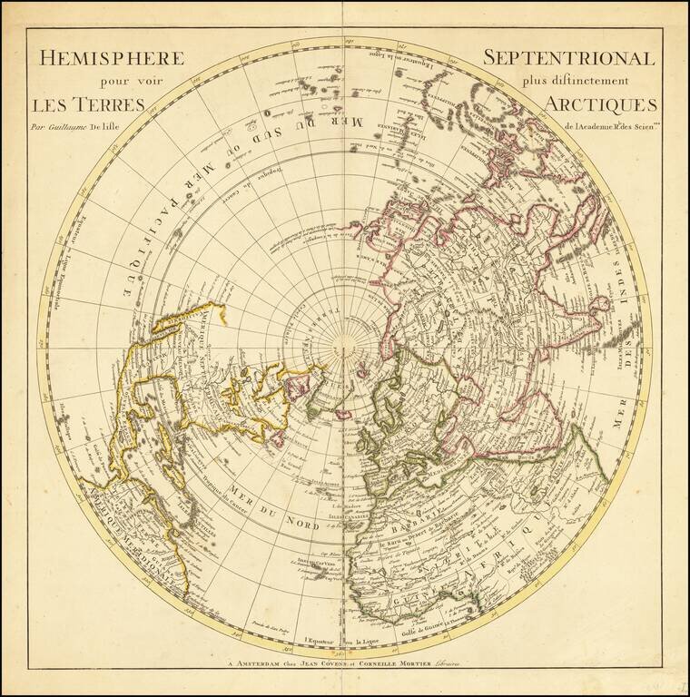
First Edition of De L’Isle’s Influential Map of the Northern Hemisphere Fine example of the first state of De L’Isle’s polar projection, focused on the Arctic. This map would become the prototype for a number of other eighteenth-century maps...
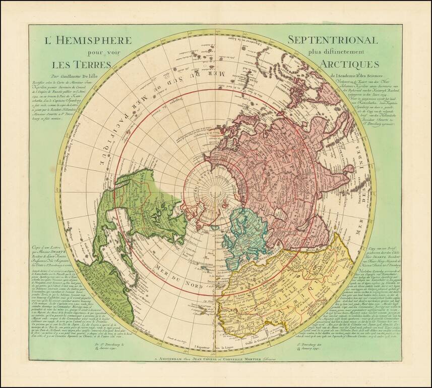
Fine Map of the Northern Hemisphere from Guillaume De L’Isle Covens and Mortier state of Guillaume De L'Isle's map of the Northern Hemisphere, originally published by De L'Isle in 1714. The map shows the entire Northern Hemisphere. The projection...
![[North Pole] A Globular Draught from the North Pole to the Latitude of 60 degrees.](/map/small/0005dg.jpg)
Scarce Map of the North Polar Regions, Published by Britain's leading scientific figures, including Edmund Halley, John Senex and John Harris. Fascinating polar projection, published by John Senex, with numerous rhumb lines and four compass roses....

Fine Map of the Northern Hemisphere Rare Henri de Leth edition of Guillaume De L'Isle's map of the Northern Hemisphere, originally published by De L'Isle in 1714. The map shows the entire Northern Hemisphere. The projection has the opposite effect of...
Fine Map of the Northern Hemisphere, With the Latest Russian Discoveries in the Northeast Asia Striking north polar projection which includes the latest Russian discoveries in the North Pacific. This is a rare 1741 edition of this important map,...
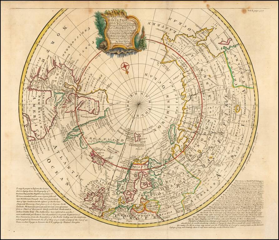
Second edition of Bowen's spectacular Arctic and sub-Arctic map, showing excellent detail around Hudson Bay, Greenland, Spitzbergen & NE Coast of Europe & Asia. The second edition has been revised to include the tracks of a number of early...
![[Untitled Map of the Northern Hemisphere]](/map/small/18651.jpg)
Rare early map of the Northern Hemisphere, one of the earliest maps engraved by Walch, who would go on to have a successful career of more than 30 years as a mapmaker in Augsburg. Nice post-Cook detail, a very early use of information from Cook's...
Interesting and highly detailed map of the Northern Hemisphere, published by John Thomson. Includes an unusual orientation such that all of Asia, Europe, Africa and North America are shown. Includes the tracks from Cook's voyages, along with dates...
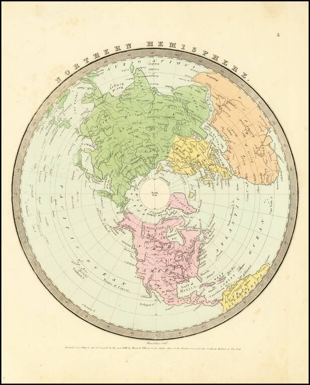
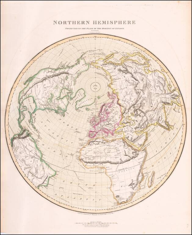
Interesting map of the Northern Hemisphere by David Burr, one of 4 hemispheric map projections in his New Universal Atlas. The map provides a nice depiction of the known extent of the North Polar regions and the coastlines of Northwestern America and...
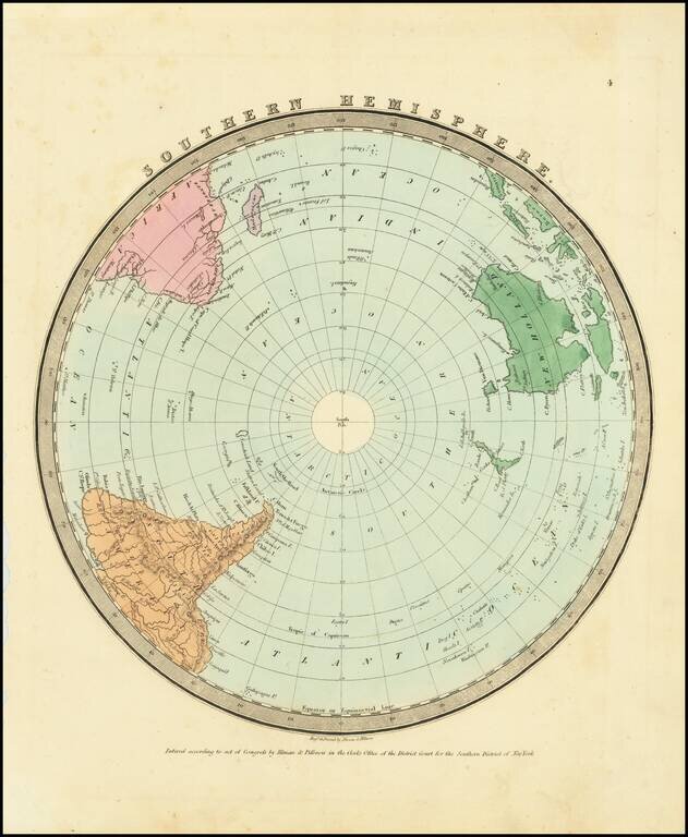
Interesting map of the Southern Hemisphere by David Burr, one of 4 hemispheric map projections in his New Universal Atlas. The map provides a nice depiction of the known extent of the South Polar regions.