Map size in jpg-format: 40.1916MiB
Click to open in high resolution (open in new tab).

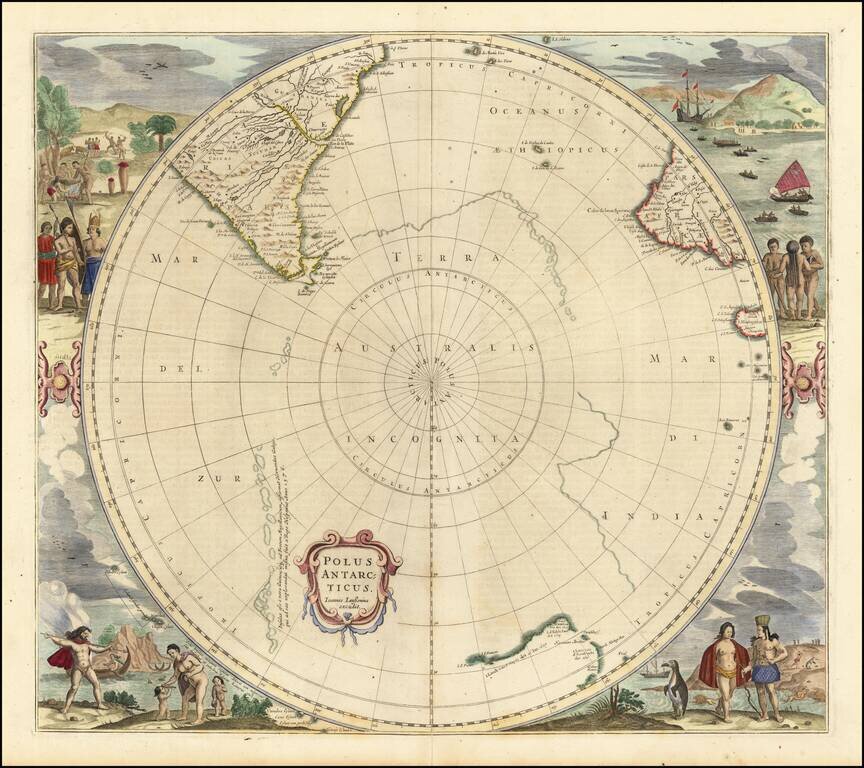
Third state of Hondius' decorative map of the South Polar region, with the name Joannes Janssonius appearing for the first time.
The present state predates the first appearance of New Zealand and Van Dieman's Land.
The map includes significant updates along the coast of South America and Cape Horn. The supposed coastline of the unknown southern continent continues to appear. Includes notes regarding the affirmation of the discovery of islands by Magellan and Hernando Galego.
If you are a student, write to us in telegram: @antiquemaps and indicate what material you need and for what work you need a map in high detail. We are ready to provide material on special terms. For students only!
![[Eastern Hemisphere Globe Gores] (Nova et integra universi Orbis descriptio)](/map/small/54480.jpg)

