

Scarce map of the South Pole, showing the most recent discoveries and some conjectural regions. Includes annotations with dates of discoveries from 1820 to about 1840 (Charles Wilkes), with some earlier notes regarding Cook's contact with the region...
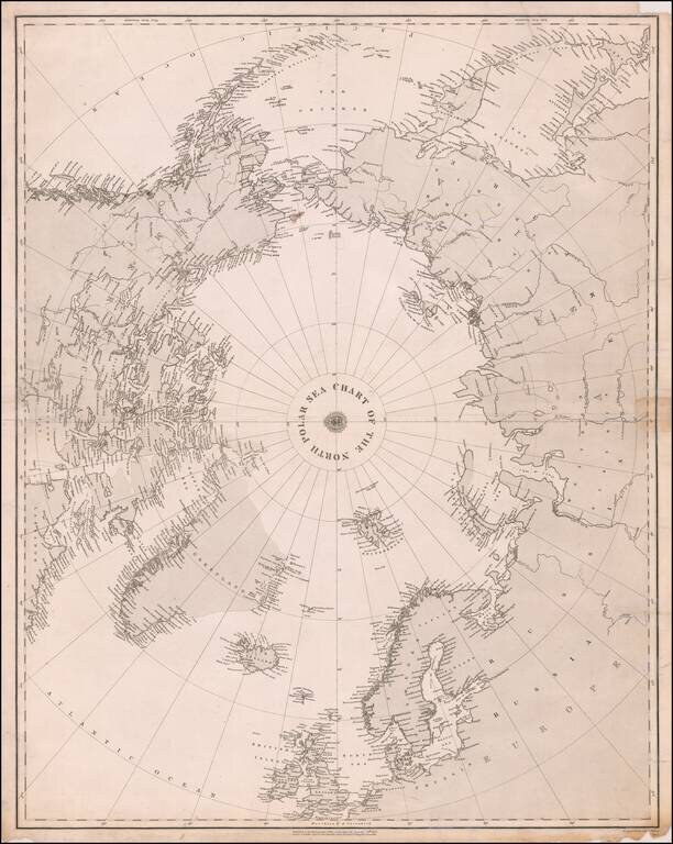
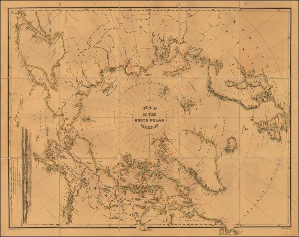
Rare separately published map of the Polar regions, published in December 1855 in London by the British Admiralty. Oriented with Greenwich meridian at the bottom, the map covers the Arctic Ocean and Arctic landmasses adjacent to it. On the verso are...
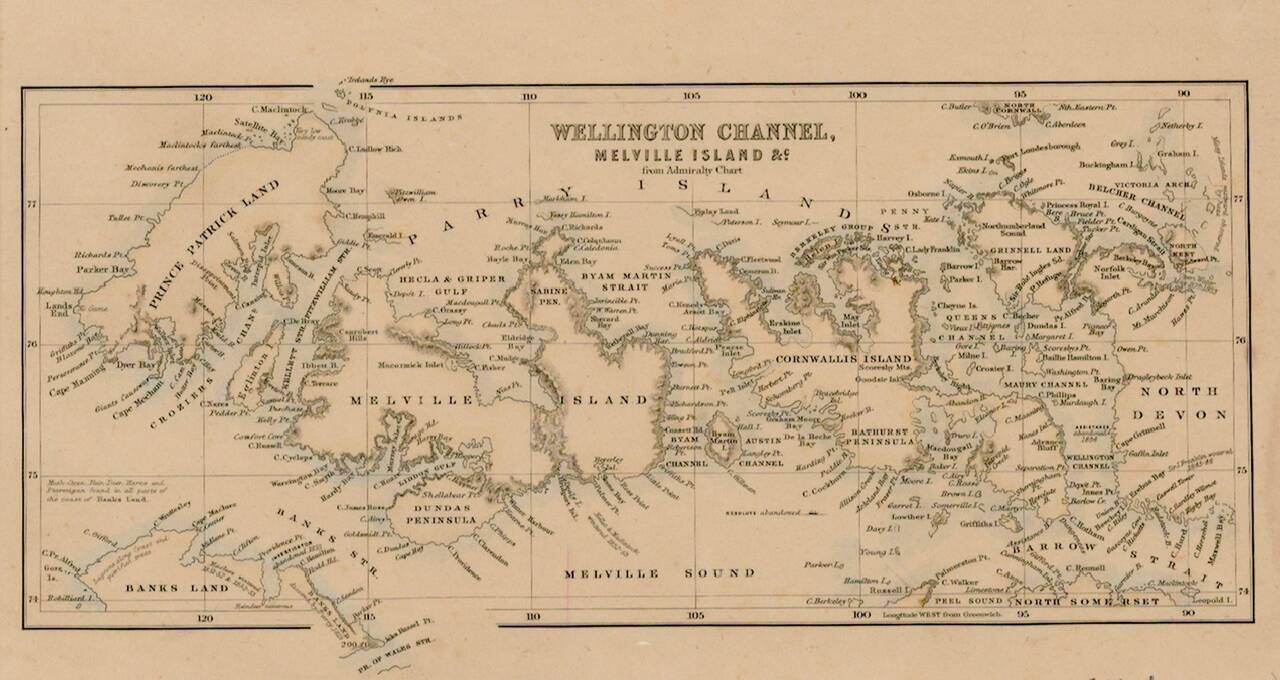
Interesting map of the Region being explored by the British in the second half of the 18th Century, with many up to date discoveries and place names.
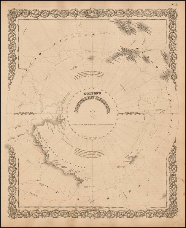
Detailed map of the South Polar Region, published by GW & CB Colton. The map shows in detail the land masses discovered to date, along with the Tracts of the Wilkes, Bellinghausen, Kemp, Ross and Cook Voyages, landfalls, etc.
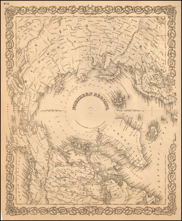
Detailed map of the regions around the North Pole. The Northwest and Northeast Passages are delineated and most of the coastlines of North America, Europe and Asia are shown with relative accuracy.

First Site of Stanford's Rare Map of the Polar Regions Fine example of Edward Stanford's map of the North Polar Regions, featuring the furthest most points reached by numerous exploring expeditions. Published on December 2, 1878, the map notes the...
Interesting map of the North Polar regions. The map provides a remarkable overview of Polar Exploration up to the mid-1870s. Approximately 70 explorers spanning four centuries are noted on the map, including the dates of voyages and coastlines...

Rare Map of the Polar Regions, Updated To Show Adolf Erik Nordenskold's Progress in 1878 Toward Completion of the First Northeast Passage. Fine example of Edward Stanford's map of the North Polar Regions, featuring the furthest most points reached by...
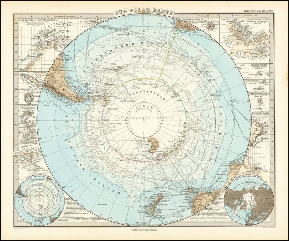
Very detailed map of the south polar regions, illustrating the great precision of Stieler's work. Remarkable amount of explorer details, including: Cook 1772-75 Bellinghausen 1819-21 Wedell 1822-23 Biscoe 1830-32 Kemp 1834 Ballen 1839...
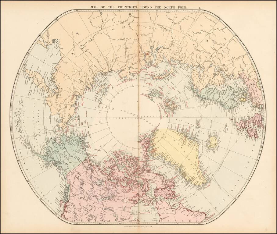
Fine early edition of Edward Stanford's map depicting the entire Arctic Region, featuring the furthest-most points reached by numerous exploring expeditions. This fascinating map embraces the entire Arctic regions of the World, within a unique ovoid...
Detailed accounting of the recent explorations in the South Polar Regions. The map identifies the explorations of: Cook 1772-75 Bellingshausen 1819-21 Wedell 1822-23 Biscoe 1830-32 Kemp 1834 d'Urville 1838-40 Balleny 1839 Wilkes 1839-40...

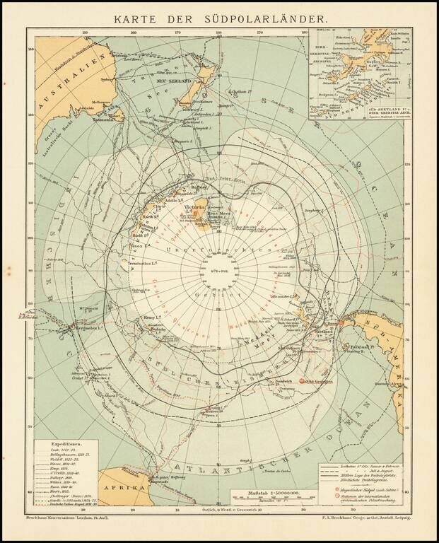
Finely executed map of the South Polar regions, published in Leipizig. The map is focused on the many explorations of the Antarctic regions up to several discoveries in 1902 and 1903. Very detailed map of Antarctica with insets and numerous tracks of...
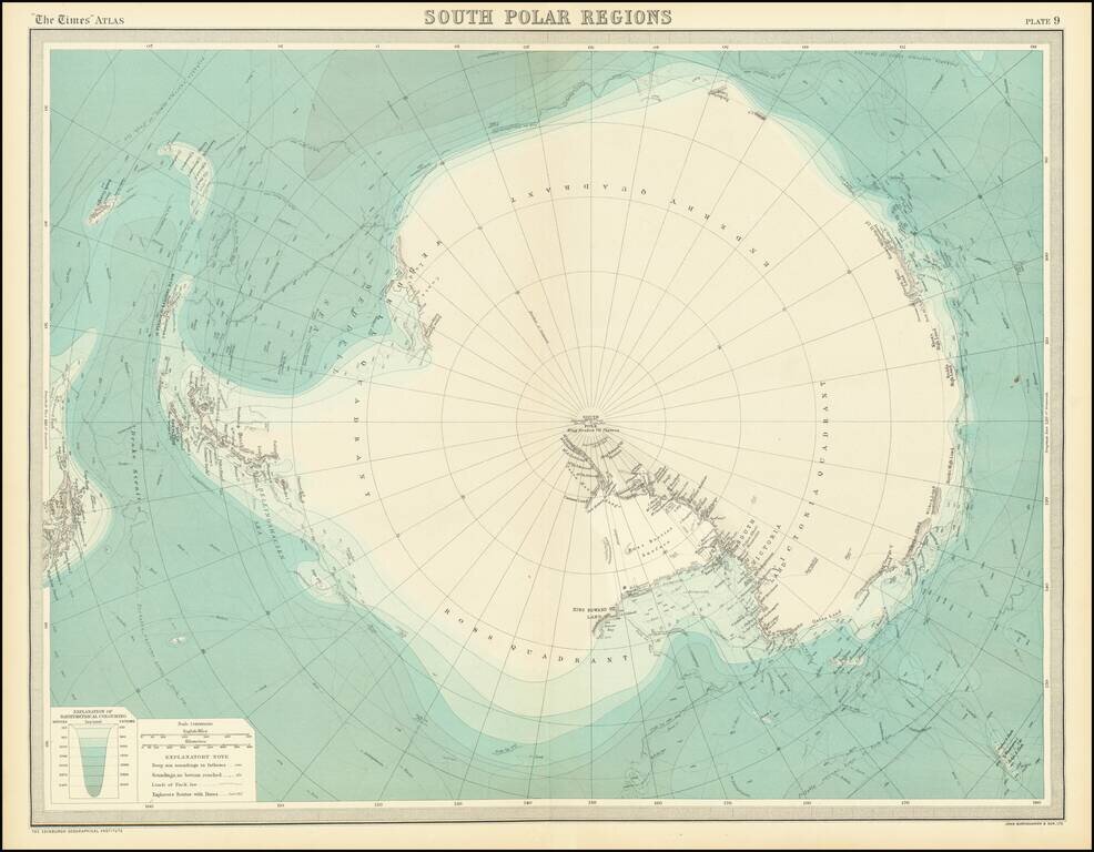
This is a fantastic map of Antarctica, published at a time when the outline of the continent was just starting to take shape. Parts of the exterior of the continent are shown in detail, though the interior of the vast continent is little described....
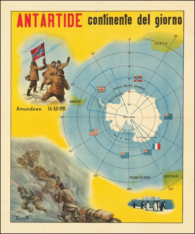
The Race for The South Pole Fine large, early twentieth-century Italian image illustrating the race for the South Pole and a map of Antarctica. The map depicts the race for the South Pole, where explorers from various nations sought to be the first...

Intereting publication and maps focused on the special methods of air navigation in the Polar regions. The maps cover the north and south Polar regions.
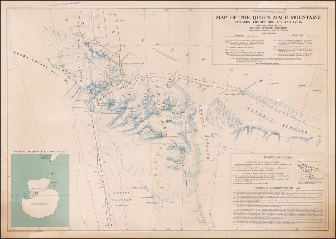
Owned By A Famous Italian Geography and Geologist The Queen Maud Mountains are a major group of mountains of the Transantarctic Mountains, lying between the Beardmore and Reedy Glaciers and including the area from the head of the Ross Ice Shelf to the...