Map size in jpg-format: 673383B
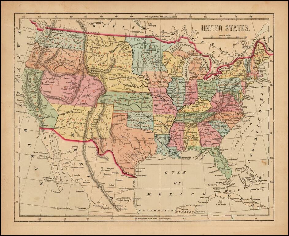
Scarce map of the United States, from Morse's General Atlas of the World.
The map captures the Transmississippi West, shortly after the Gadsden Purchase, with many of the large territorial configurations still in evidence, including a very early depiction of Washington Territory (extending to the Rocky Mountains), Oregon Territory (extending beyond the Rocky Mountains), Utah Territory (including Nevada and part of Colorado), New Mexico Territory (including Arizona and part of Colorado), Nebraska Territory (including Montana, Wyoming and part of the Dakotas), Kansas Territory (including much of Colorado), and Minnesota Territory (including the Dakotas). An early accurate depiction of Indian Territory is also given.
The atlas and map are quite scarce on the market.
If you are a student, write to us in telegram: @antiquemaps and indicate what material you need and for what work you need a map in high detail. We are ready to provide material on special terms. For students only!

![[Signed Political Satire Artwork] Vietnam ... Vietnam ... Vietnam ...](/map/small/68726.jpg)
